Peafield Plantation
Wood, Forest in Nottinghamshire Mansfield
England
Peafield Plantation
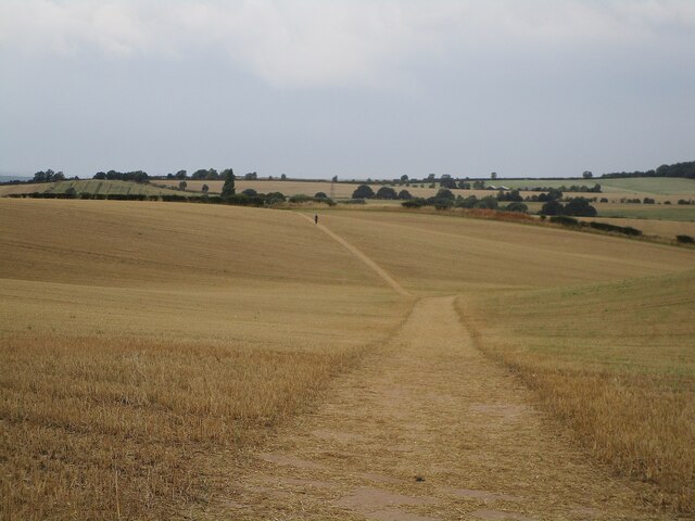
Peafield Plantation is a picturesque woodland located in the county of Nottinghamshire, England. Nestled within the heart of Sherwood Forest, this 200-acre plantation is a haven for nature enthusiasts and history buffs alike. The plantation is situated near the village of Edwinstowe, just a short distance from the famous Major Oak.
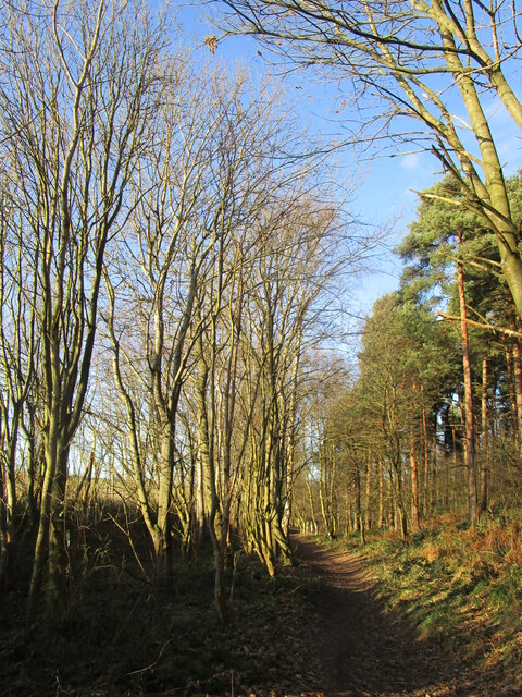
As one explores Peafield Plantation, they are greeted by a diverse range of flora and fauna. The woodland boasts a rich variety of trees, including oak, birch, and beech, creating a lush and vibrant ecosystem. This diversity attracts a plethora of wildlife, such as deer, foxes, and a range of bird species, making it a popular spot for birdwatching and wildlife photography.
Beyond its natural beauty, Peafield Plantation also holds historical significance. It is believed to have been part of the ancient royal hunting grounds, dating back to medieval times. The plantation's connection to Sherwood Forest adds to its allure, as it is intricately linked with the legendary tales of Robin Hood.
Visitors to Peafield Plantation can enjoy a network of well-maintained footpaths that wind through the woodland, providing ample opportunities for leisurely walks or invigorating hikes. The plantation also features designated picnic areas, allowing visitors to relax and soak in the tranquil surroundings.
Overall, Peafield Plantation is a captivating destination that seamlessly combines natural beauty with historical charm. Whether one is seeking solace in nature or an immersive experience in Robin Hood's fabled realm, this Nottinghamshire woodland is a must-visit location.
If you have any feedback on the listing, please let us know in the comments section below.
Peafield Plantation Images
Images are sourced within 2km of 53.17604/-1.1576744 or Grid Reference SK5664. Thanks to Geograph Open Source API. All images are credited.


Peafield Plantation is located at Grid Ref: SK5664 (Lat: 53.17604, Lng: -1.1576744)
Administrative County: Nottinghamshire
District: Mansfield
Police Authority: Nottinghamshire
What 3 Words
///helper.rainy.polygraph. Near Mansfield Woodhouse, Nottinghamshire
Nearby Locations
Related Wikis

Spion Kop, Nottinghamshire
Spion Kop is a small residential and former industrial area in Nottinghamshire, England, stretching for a few hundred yards on both sides of the main A60...

The Manor Academy
The Manor Academy is a co-educational secondary school with academy status in Mansfield Woodhouse, Nottinghamshire, overseen by and part of The Two Counties...

John Fretwell Sporting Complex
The John Fretwell Sporting Complex is a cricket ground located at Nettleworth near Market Warsop in Warsop parish, Nottinghamshire, England. The ground...
The Garibaldi School
The Garibaldi School (formerly Garibaldi College) is a co-educational secondary school and sixth form built in the 1960s. It is situated near to the edge...
Sherwood Forest Railway
The Sherwood Forest Railway (SFR) is a 15 in (381 mm) gauge light railway running through the old site of the Sherwood Forest Farm Park in Nottinghamshire...
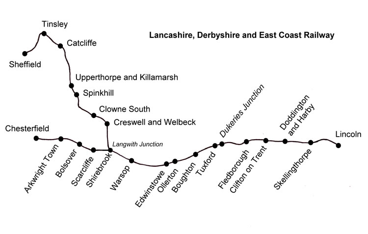
Warsop railway station
Warsop railway station is a former railway station in Market Warsop, Nottinghamshire, England. == History == The station was opened by the Lancashire,...
Clipstone F.C.
Clipstone Football Club is a football club based in Clipstone, Nottinghamshire, England. They are currently members of the United Counties League Division...

Forest Town, Nottinghamshire
Forest Town is a former mining village on the outskirts of Mansfield, Nottinghamshire, England. After continuous development it is no longer a separate...
Nearby Amenities
Located within 500m of 53.17604,-1.1576744Have you been to Peafield Plantation?
Leave your review of Peafield Plantation below (or comments, questions and feedback).