Bazett's Plantation

Wood, Forest in Berkshire

England

Bazett's Plantation

Bucklebury Farm footpath The public footpath crosses Bucklebury Farm Park's car park here.
Bucklebury Farm footpath Credit: Oscar Taylor

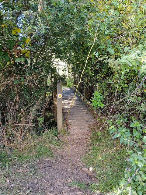
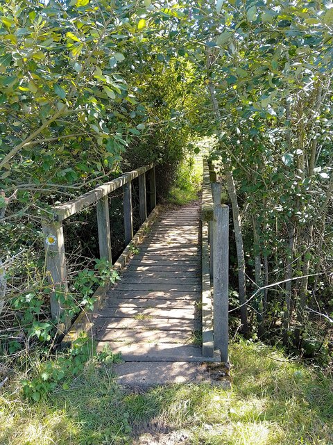
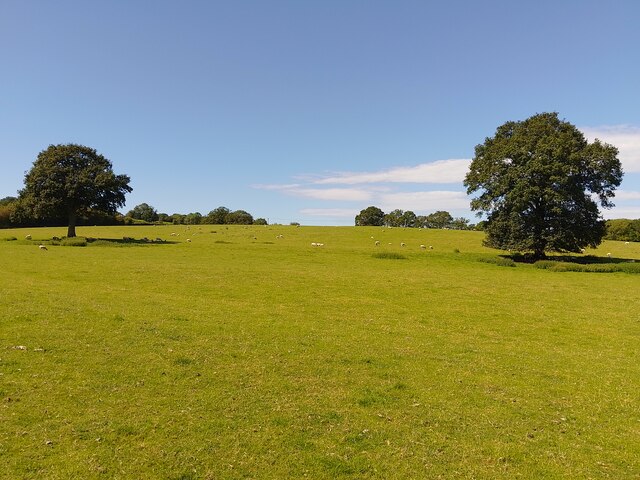
Bazett's Plantation is a picturesque woodland located in Berkshire, England. Situated within the larger area of Wood Forest, this plantation covers an area of approximately 100 acres. It is named after the Bazett family, who were the original landowners and established the plantation in the early 19th century.

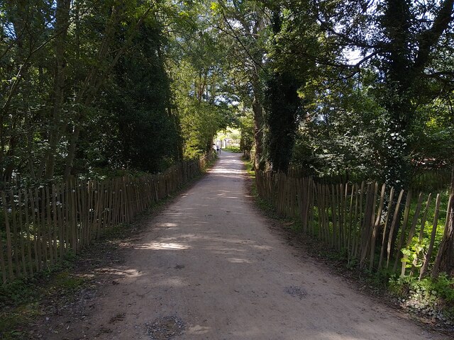
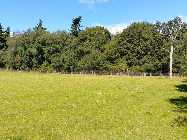
The plantation is known for its dense and diverse array of trees, including oak, beech, and pine. These trees create a lush and vibrant canopy, providing shade and shelter for a variety of wildlife. The woodland floor is carpeted with a rich tapestry of wildflowers, ferns, and mosses, creating a beautiful and tranquil environment.

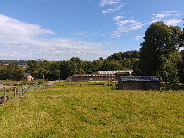
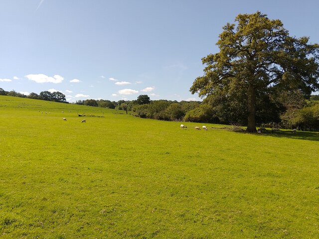
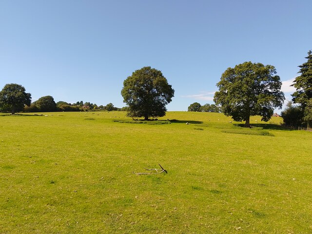
Visitors to Bazett's Plantation can explore its many winding paths and trails, which meander through the woodland and offer stunning views of the surrounding countryside. The plantation is a popular destination for outdoor enthusiasts, including hikers, cyclists, and birdwatchers. It offers numerous opportunities for wildlife spotting, with sightings of deer, foxes, and a wide range of bird species being common.

The plantation is also home to a small lake, which adds to its natural charm and provides a habitat for various aquatic plants and animals. The lake is a popular spot for fishing and boating, further enhancing the recreational opportunities available at Bazett's Plantation.

Overall, Bazett's Plantation is a haven of natural beauty, offering visitors a chance to escape the hustle and bustle of everyday life and immerse themselves in the tranquility of the Berkshire countryside.

If you have any feedback on the listing, please let us know in the comments section below.

Bazett's Plantation Images

Images are sourced within 2km of 51.410799/-1.2048794 or Grid Reference SU5568. Thanks to Geograph Open Source API. All images are credited.

Bucklebury Farm footpath The public footpath crosses Bucklebury Farm Park's car park here.
Bucklebury Farm footpath
The public footpath crosses Bucklebury Farm Park's car park here.
Bucklebury Farm footpath A public footpath crossing Bucklebury Farm. This is also the main path towards Bucklebury Farm Park for visitors.
Bucklebury Farm footpath
A public footpath crossing Bucklebury Farm. This is also the main path towards Bucklebury Farm Park for visitors.
Bucklebury Farm chickens Beside the public footpath.
Bucklebury Farm chickens
Beside the public footpath.
Bucklebury Farm footpath A public footpath crossing Bucklebury Farm. The route of the path is a little confusing across the attraction itself.

If approaching from the north, you cross the car park after crossing the field near Pease Hill, follow the pedestrian entrance to the park, then walk through the "exit" gate to the right (west) of the admissions building. You then climb or open and close three metal gates to fields, and walk on the left (east) side of the fence in this field until you reach two stiles. Cross these and then follow the fenceline until you reach a gate and exit to the restricted byway.

If approaching from the south, you go through the metal gate from the restricted byway, follow the fenceline to a pair of stiles, cross both and follow the fenceline down to a series of three gates. Open and close or climb over these three through fields until you reach the exit gate. Go through the gate and follow the pedestrian walk to the car park and continue to the metal gate crossing a field beside the entrance driveway.

Shoutout to the kind gentleman who helped me with the route on my walk!
Bucklebury Farm footpath
A public footpath crossing Bucklebury Farm. The route of the path is a little confusing across the attraction itself. If approaching from the north, you cross the car park after crossing the field near Pease Hill, follow the pedestrian entrance to the park, then walk through the "exit" gate to the right (west) of the admissions building. You then climb or open and close three metal gates to fields, and walk on the left (east) side of the fence in this field until you reach two stiles. Cross these and then follow the fenceline until you reach a gate and exit to the restricted byway. If approaching from the south, you go through the metal gate from the restricted byway, follow the fenceline to a pair of stiles, cross both and follow the fenceline down to a series of three gates. Open and close or climb over these three through fields until you reach the exit gate. Go through the gate and follow the pedestrian walk to the car park and continue to the metal gate crossing a field beside the entrance driveway. Shoutout to the kind gentleman who helped me with the route on my walk!
Bucklebury Farm and footpath A public footpath crossing Bucklebury Farm. The route of the path is a little confusing across the attraction itself.

If approaching from the north, you cross the car park after crossing the field near Pease Hill, follow the pedestrian entrance to the park, then walk through the "exit" gate to the right (west) of the admissions building. You then climb or open and close three metal gates to fields, and walk on the left (east) side of the fence in this field until you reach two stiles. Cross these and then follow the fenceline until you reach a gate and exit to the restricted byway.

If approaching from the south, you go through the metal gate from the restricted byway, follow the fenceline to a pair of stiles, cross both and follow the fenceline down to a series of three gates. Open and close or climb over these three through fields until you reach the exit gate. Go through the gate and follow the pedestrian walk to the car park and continue to the metal gate crossing a field beside the entrance driveway.

Shoutout to the kind gentleman who helped me with the route on my walk!
Bucklebury Farm and footpath
A public footpath crossing Bucklebury Farm. The route of the path is a little confusing across the attraction itself. If approaching from the north, you cross the car park after crossing the field near Pease Hill, follow the pedestrian entrance to the park, then walk through the "exit" gate to the right (west) of the admissions building. You then climb or open and close three metal gates to fields, and walk on the left (east) side of the fence in this field until you reach two stiles. Cross these and then follow the fenceline until you reach a gate and exit to the restricted byway. If approaching from the south, you go through the metal gate from the restricted byway, follow the fenceline to a pair of stiles, cross both and follow the fenceline down to a series of three gates. Open and close or climb over these three through fields until you reach the exit gate. Go through the gate and follow the pedestrian walk to the car park and continue to the metal gate crossing a field beside the entrance driveway. Shoutout to the kind gentleman who helped me with the route on my walk!
Bucklebury Farm footpath A public footpath crossing Bucklebury Farm. The route of the path is a little confusing across the attraction itself.

If approaching from the north, you cross the car park after crossing the field near Pease Hill, follow the pedestrian entrance to the park, then walk through the "exit" gate to the right (west) of the admissions building. You then climb or open and close three metal gates to fields, and walk on the left (east) side of the fence in this field until you reach two stiles. Cross these and then follow the fenceline until you reach a gate and exit to the restricted byway.

If approaching from the south, you go through the metal gate from the restricted byway, follow the fenceline to a pair of stiles, cross both and follow the fenceline down to a series of three gates. Open and close or climb over these three through fields until you reach the exit gate. Go through the gate and follow the pedestrian walk to the car park and continue to the metal gate crossing a field beside the entrance driveway.

Shoutout to the kind gentleman who helped me with the route on my walk!
Bucklebury Farm footpath
A public footpath crossing Bucklebury Farm. The route of the path is a little confusing across the attraction itself. If approaching from the north, you cross the car park after crossing the field near Pease Hill, follow the pedestrian entrance to the park, then walk through the "exit" gate to the right (west) of the admissions building. You then climb or open and close three metal gates to fields, and walk on the left (east) side of the fence in this field until you reach two stiles. Cross these and then follow the fenceline until you reach a gate and exit to the restricted byway. If approaching from the south, you go through the metal gate from the restricted byway, follow the fenceline to a pair of stiles, cross both and follow the fenceline down to a series of three gates. Open and close or climb over these three through fields until you reach the exit gate. Go through the gate and follow the pedestrian walk to the car park and continue to the metal gate crossing a field beside the entrance driveway. Shoutout to the kind gentleman who helped me with the route on my walk!
Bucklebury landscape A field of sheep near to Redhill Copse.
Bucklebury landscape
A field of sheep near to Redhill Copse.
Bucklebury footpath A public footpath crossing a field near to Redhill Copse.
Bucklebury footpath
A public footpath crossing a field near to Redhill Copse.
Bucklebury footpath A public footpath around a field, near to Bucklebury.
Bucklebury footpath
A public footpath around a field, near to Bucklebury.
Bucklebury field
Bucklebury field
Bucklebury footpath A public footpath around the edge of a field.
Bucklebury footpath
A public footpath around the edge of a field.
Bucklebury footpath A public footpath crossing a field near to Bucklebury.
Bucklebury footpath
A public footpath crossing a field near to Bucklebury.
Bucklebury footpath A public footpath crossing a field near to Bucklebury.
Bucklebury footpath
A public footpath crossing a field near to Bucklebury.
Bucklebury footbridge A footbridge over a ditch on a public footpath near to Bucklebury. It is rather overgrown: you need to duck underneath the vegetation.
Bucklebury footbridge
A footbridge over a ditch on a public footpath near to Bucklebury. It is rather overgrown: you need to duck underneath the vegetation.
Bucklebury landscape A large field with lots of sheep.
Bucklebury landscape
A large field with lots of sheep.
Game bird fencing, Redhill Copse Near to Bucklebury.
Game bird fencing, Redhill Copse
Near to Bucklebury.
Bucklebury landscape A large field with lots of sheep.
Bucklebury landscape
A large field with lots of sheep.
Show me another place!

Bazett's Plantation is located at Grid Ref: SU5568 (Lat: 51.410799, Lng: -1.2048794)

Unitary Authority: West Berkshire

Police Authority: Thames Valley

What 3 Words

///twists.dummy.cave. Near Thatcham, Berkshire

Related Wikis

Midgham

Midgham is a village and civil parish occupying slopes and the flood plain on the north side of the River Kennet, which in summer months draws much of...

Midgham Green

Midgham Green is a hamlet in the civil parish of Midgham in the English county of Berkshire. The settlement lies near to the A4 road and is located approximately...

Bucklebury Common

Bucklebury Common is an elevated common consisting of woodland with a few relatively small clearings in the English county of Berkshire, within the civil...

Colthrop

Colthrop is a suburb of the town of Thatcham in the English county of Berkshire, England. == Geography == Colthrop is part of the civil parish of Thatcham...

Bucklebury Manor

Bucklebury Manor is a Grade II listed manor house in the civil parish of Bucklebury in the English county of Berkshire. Since 2012, it has been the home...

Chapel Row

Chapel Row is a hamlet in West Berkshire, England, and part of the civil parish of Bucklebury. In 2019 it had an estimated population of 627. == History... ==

Heale's Lock

Heale's Lock is a lock on the Kennet and Avon Canal, between Thatcham and Woolhampton, Berkshire, England. Heale's Lock was built between 1718 and 1723...

Midgham Lock

Midgham Lock is a lock on the Kennet and Avon Canal, between Thatcham and Woolhampton, Berkshire, England. Midgham Lock was built between 1718 and 1723...

Have you been to Bazett's Plantation?

Leave your review of Bazett's Plantation below (or comments, questions and feedback).