Bendbow Spinney

Wood, Forest in Leicestershire

England

Bendbow Spinney

The Shoemaker in New Parks, Leicester The Shoemakers is a public house on Cokayne Road, in the New Parks area of Leicester. It opened in January 1958.
The Shoemaker in New Parks, Leicester Credit: Mat Fascione

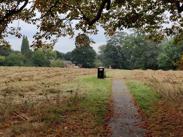
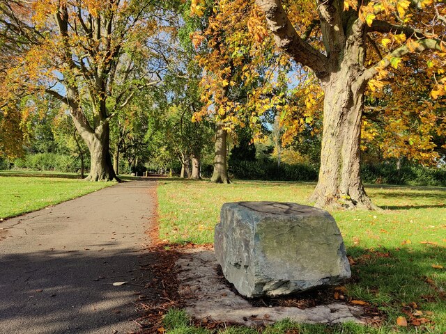
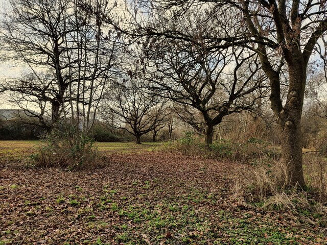
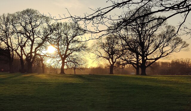
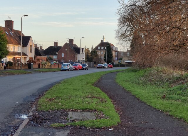
Bendbow Spinney is a picturesque wood located in the heart of Leicestershire, England. Spanning over a vast area, it is commonly referred to as a forest due to its dense vegetation and diverse range of tree species. The spinney is situated on the outskirts of a small village, surrounded by rolling hills and meandering streams, offering visitors a tranquil escape from the bustling city life.

As one ventures into Bendbow Spinney, they are greeted by a captivating display of nature's beauty. Towering oak, beech, and ash trees provide a canopy of shade, while sunlight filters through the leaves, casting enchanting patterns on the forest floor. The woodland is also home to a variety of wildlife, including squirrels, rabbits, and an array of bird species, making it a haven for nature enthusiasts and photographers.

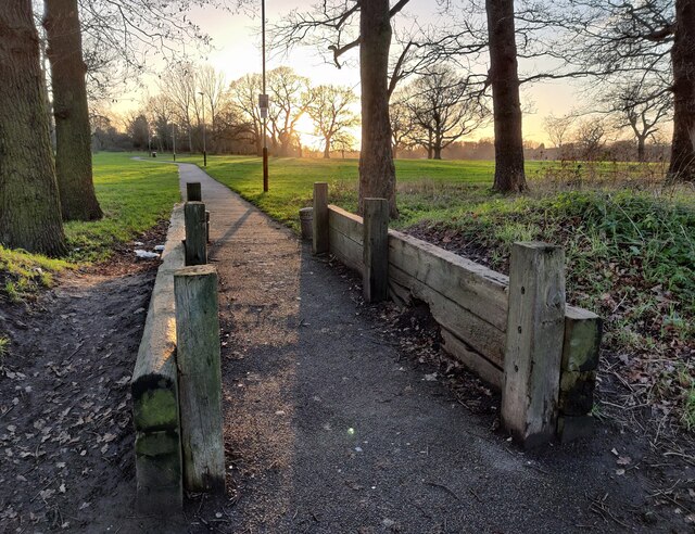
The wood features a network of well-maintained footpaths, enabling visitors to explore its hidden gems. These pathways wind through the spinney, leading to open clearings where one can find wildflowers in bloom during the spring and summer months. Additionally, benches strategically placed along the trails offer the perfect spot for visitors to rest and immerse themselves in the peaceful surroundings.

Bendbow Spinney is well-loved by the local community, who often organize events such as guided walks and nature workshops to encourage the appreciation and conservation of the woodland. It serves as an ideal location for families to enjoy picnics, children to play, and dog walkers to take their furry companions for a stroll.

Overall, Bendbow Spinney is a natural gem in Leicestershire, providing a serene and idyllic setting for individuals to reconnect with nature and enjoy the beauty of the English countryside.

If you have any feedback on the listing, please let us know in the comments section below.

Bendbow Spinney Images

Images are sourced within 2km of 52.623798/-1.1868082 or Grid Reference SK5503. Thanks to Geograph Open Source API. All images are credited.

The Shoemaker in New Parks, Leicester The Shoemakers is a public house on Cokayne Road, in the New Parks area of Leicester. It opened in January 1958.
The Shoemaker in New Parks, Leicester
The Shoemakers is a public house on Cokayne Road, in the New Parks area of Leicester. It opened in January 1958.
Swans at the Upper Lake (Reservoir), Braunstone Park This flood storage reservoir was constructed in the early 1970's to reduce the risk of flooding from the Braunstone Brook. It is located on the southern edge of Braunstone Park.
Swans at the Upper Lake (Reservoir), Braunstone Park
This flood storage reservoir was constructed in the early 1970's to reduce the risk of flooding from the Braunstone Brook. It is located on the southern edge of Braunstone Park.
St. Peter's Church at Braunstone A church dating back to the 12th century, restored in the 19th century.
St. Peter's Church at Braunstone
A church dating back to the 12th century, restored in the 19th century.
Path through Church Field in Braunstone An area of open public space next to St Peters Church in Braunstone.
Path through Church Field in Braunstone
An area of open public space next to St Peters Church in Braunstone.
Bidford Convenience Store Along Braunstone Lane in the Braunstone suburb of Leicester.
Bidford Convenience Store
Along Braunstone Lane in the Braunstone suburb of Leicester.
Path through Braunstone Park
Woodland on Cort Crescent
Reed bed at the Mossdale Meadows
Kirby Frith Nature Area Next to Cherry Hills Road in the Kirby Frith area of Leicester.
Kirby Frith Nature Area
Next to Cherry Hills Road in the Kirby Frith area of Leicester.
Winter sunset over Braunstone Park
Gooding Avenue in Braunstone
Path at Braunstone Park This path is next to Gooding Avenue.
Path at Braunstone Park
This path is next to Gooding Avenue.
Jaguar showroom, Narborough Road, Leicester Part of the Sturgess group. Website lists 0 new vehicles in stock. Global 'chip' shortage?
Jaguar showroom, Narborough Road, Leicester
Part of the Sturgess group. Website lists 0 new vehicles in stock. Global 'chip' shortage?
Convenience store, Ayston Road, Leicester Premier stores "are locally owned by independent retailers", under franchise from the Booker Group, which is a subsidiary of Tescos.
Convenience store, Ayston Road, Leicester
Premier stores "are locally owned by independent retailers", under franchise from the Booker Group, which is a subsidiary of Tescos.
Roundabout, Hallam Crescent East, Leicester This part of Braunstone was developed after the first world war
Roundabout, Hallam Crescent East, Leicester
This part of Braunstone was developed after the first world war
Skatepark, Braunstone Park, Leicester Doesn't look very exciting. But what would I know?
Skatepark, Braunstone Park, Leicester
Doesn't look very exciting. But what would I know?
Braunstone Avenue, Leicester Passing under the Leicester-Burton on Trent line.
Braunstone Avenue, Leicester
Passing under the Leicester-Burton on Trent line.
Show me another place!

Bendbow Spinney is located at Grid Ref: SK5503 (Lat: 52.623798, Lng: -1.1868082)

Unitary Authority: Leicester

Police Authority: Leicestershire

What 3 Words

///ankle.trunk.mixed. Near Glenfield, Leicestershire

Related Wikis

Emmanuel Christian School, Leicester

Emmanuel Christian School, Leicester is a small, independent, co-educational Christian school for pupils aged 4–16. Opening in August 2003, it was the...

Winstanley House

Winstanley House in Leicestershire previously called Braunstone Hall, is a building of historical significance and is Grade II listed on the English Heritage...

The Winstanley School

The Winstanley School is a coeducational secondary school located in Braunstone in the English county of Leicestershire.The school specialises in sports...

Thorpe Astley

Thorpe Astley is a suburban settlement on the southwestern edge of the city of Leicester, England. It is part of the civil parish of Braunstone Town, although...

Nearby Amenities

Located within 500m of 52.623798,-1.1868082
Traffic Calming: chicane
Lat/Long: 52.6268532/-1.1824797
Traffic Calming: chicane
Lat/Long: 52.623603/-1.1816955
Mini Roundabout
Direction: clockwise
Lat/Long: 52.6224934/-1.1879847
Turning Circle
Lat/Long: 52.6212831/-1.1843257
Traffic Signals
Crossing Ref: pelican
Lat/Long: 52.6226806/-1.1881951
Noexit: yes
Lat/Long: 52.6213463/-1.1820917
Turning Circle
Lat/Long: 52.622597/-1.1821941
Shop: convenience
Lat/Long: 52.6238224/-1.1831497
Fast Food
The Raven Fryer
Cuisine: fish_and_chips
Lat/Long: 52.6240616/-1.1832028
Barrier: cycle_barrier
Lat/Long: 52.6250066/-1.1832997
Turning Circle
Lat/Long: 52.6234517/-1.1850679
Turning Circle
Lat/Long: 52.6224114/-1.1840348
Community Centre
Cort Crescent Community Centre
Lat/Long: 52.6262716/-1.1827481
Traffic Calming: chicane
Lat/Long: 52.626352/-1.1824574
Post Box
Ref: LE3 917
Lat/Long: 52.6276504/-1.1842411
Barrier: cycle_barrier
Lat/Long: 52.6274343/-1.183797
SureStart Children's Centre
Building: public
Lat/Long: 52.6276418/-1.183284
Braunstone Community Association
Building: public
Lat/Long: 52.6274854/-1.1845541
Barrier: bollard
Bicycle: yes
Foot: yes
Horse: yes
Motorcycle: yes
Lat/Long: 52.6273141/-1.1861821
Barrier: bollard
Bicycle: yes
Foot: yes
Horse: yes
Motorcycle: yes
Lat/Long: 52.6272455/-1.1866785
New Cantrell Store
Shop: convenience
Source: survey
Lat/Long: 52.6257235/-1.1920797
Mini Roundabout
Lat/Long: 52.6247113/-1.193423
Bus Stop
Meadwell Raod / Braunstone Lane
Bus: yes
Public Transport: platform
Lat/Long: 52.6246638/-1.1930402
Bidford Road
Naptan AtcoCode: 260003263
Naptan Bearing: SE
Naptan BusStopType: CUS
Naptan CommonName: Bidford Road
Naptan Indicator: outside
Naptan Landmark: 54 Evelyn Road
Naptan NaptanCode: leidpwpw
Naptan Notes: Non-Hourly - County
Naptan PlusbusZoneRef: LESTER
Naptan Street: Evelyn Road
Naptan Verified: no
Source: naptan_import
Lat/Long: 52.6194913/-1.1848991
Darien Way
Naptan AtcoCode: 260003281A
Naptan Bearing: S
Naptan BusStopType: CUS
Naptan CommonName: Darien Way
Naptan Indicator: near
Naptan Landmark: Darien Way
Naptan NaptanCode: leimajtm
Naptan Notes: Hourly - County
Naptan PlusbusZoneRef: LESTER
Naptan Street: The Littlefare
Naptan Verified: no
Source: naptan_import
Lat/Long: 52.6214647/-1.1895084
Barrier: cycle_barrier
Lat/Long: 52.6206378/-1.1879687
Barrier: cycle_barrier
Lat/Long: 52.6205397/-1.1879235
Barrier: bollard
Bicycle: yes
Foot: yes
Lat/Long: 52.6206863/-1.1879488
Barrier: bollard
Bicycle: yes
Foot: yes
Lat/Long: 52.6205177/-1.1877707
Barrier: cycle_barrier
Lat/Long: 52.6223114/-1.1887169
Barrier: cycle_barrier
Lat/Long: 52.6226145/-1.1883264
Bus Stop
Pilkington Road
Bus: yes
Naptan AtcoCode: 269070160
Naptan NaptanCode: lecdmjpw
Public Transport: platform
Lat/Long: 52.6223195/-1.1867008
Bus Stop
Woodshawe Rise
Bus: yes
Public Transport: platform
Lat/Long: 52.6219983/-1.1814952
Turning Circle
Lat/Long: 52.6214587/-1.1899886
Bus Stop
opp Pilkington Road
Bus: yes
Public Transport: platform
Lat/Long: 52.6222437/-1.1869264
Bus Stop
Linacres Road
Bus: yes
Public Transport: platform
Lat/Long: 52.6217788/-1.1829774
Access: yes
Barrier: kerb
Bicycle: dismount
Foot: yes
Horse: no
Motor Vehicle: no
Wheelchair: no
Lat/Long: 52.6250178/-1.1821601
Generator Method: photovoltaic
Generator Output Electricity: yes
Generator Source: solar
Generator Type: solar_photovoltaic_panel
Location: rii
Power: generator
Lat/Long: 52.6255169/-1.1918049
Generator Method: photovoltaic
Generator Output Electricity: yes
Generator Source: solar
Generator Type: solar_photovoltaic_panel
Location: rii
Power: generator
Lat/Long: 52.6246816/-1.1910405
Generator Method: photovoltaic
Generator Output Electricity: yes
Generator Source: solar
Generator Type: solar_photovoltaic_panel
Location: rii
Power: generator
Lat/Long: 52.6245872/-1.1911236
Generator Method: photovoltaic
Generator Output Electricity: yes
Generator Source: solar
Generator Type: solar_photovoltaic_panel
Location: rii
Power: generator
Lat/Long: 52.6244553/-1.1913087
Generator Method: photovoltaic
Generator Output Electricity: yes
Generator Source: solar
Generator Type: solar_photovoltaic_panel
Location: rii
Power: generator
Lat/Long: 52.624413/-1.1910834
Generator Method: photovoltaic
Generator Output Electricity: yes
Generator Source: solar
Generator Type: solar_photovoltaic_panel
Location: rii
Power: generator
Lat/Long: 52.6243886/-1.1909627
Generator Method: photovoltaic
Generator Output Electricity: yes
Generator Source: solar
Generator Type: solar_photovoltaic_panel
Location: rii
Power: generator
Lat/Long: 52.6243283/-1.190834
Generator Method: photovoltaic
Generator Output Electricity: yes
Generator Source: solar
Generator Type: solar_photovoltaic_panel
Location: rii
Power: generator
Lat/Long: 52.6243071/-1.1907723
Generator Method: photovoltaic
Generator Output Electricity: yes
Generator Source: solar
Generator Type: solar_photovoltaic_panel
Location: rii
Power: generator
Lat/Long: 52.6242339/-1.190614
Generator Method: photovoltaic
Generator Output Electricity: yes
Generator Source: solar
Generator Type: solar_photovoltaic_panel
Location: rii
Power: generator
Lat/Long: 52.6242192/-1.1905497
Generator Method: photovoltaic
Generator Output Electricity: yes
Generator Source: solar
Generator Type: solar_photovoltaic_panel
Location: rii
Power: generator
Lat/Long: 52.6241508/-1.1904263
Generator Method: photovoltaic
Generator Output Electricity: yes
Generator Source: solar
Generator Type: solar_photovoltaic_panel
Location: rii
Power: generator
Lat/Long: 52.6241492/-1.1903699
Generator Method: photovoltaic
Generator Output Electricity: yes
Generator Source: solar
Generator Type: solar_photovoltaic_panel
Location: rii
Power: generator
Lat/Long: 52.6240418/-1.1901312
Generator Method: photovoltaic
Generator Output Electricity: yes
Generator Source: solar
Generator Type: solar_photovoltaic_panel
Location: rii
Power: generator
Lat/Long: 52.6240939/-1.1900213
Generator Method: photovoltaic
Generator Output Electricity: yes
Generator Source: solar
Generator Type: solar_photovoltaic_panel
Location: rii
Power: generator
Lat/Long: 52.6242127/-1.1899113
Generator Method: photovoltaic
Generator Output Electricity: yes
Generator Source: solar
Generator Type: solar_photovoltaic_panel
Location: rii
Power: generator
Lat/Long: 52.6242534/-1.1898415
Generator Method: photovoltaic
Generator Output Electricity: yes
Generator Source: solar
Generator Type: solar_photovoltaic_panel
Location: rii
Power: generator
Lat/Long: 52.6243055/-1.1898201
Generator Method: photovoltaic
Generator Output Electricity: yes
Generator Source: solar
Generator Type: solar_photovoltaic_panel
Location: rii
Power: generator
Lat/Long: 52.6240808/-1.194058
Generator Method: photovoltaic
Generator Output Electricity: yes
Generator Source: solar
Generator Type: solar_photovoltaic_panel
Location: rii
Power: generator
Lat/Long: 52.6241101/-1.1941224
Generator Method: photovoltaic
Generator Output Electricity: yes
Generator Source: solar
Generator Type: solar_photovoltaic_panel
Location: roof
Power: generator
Lat/Long: 52.622132/-1.1911357
Generator Method: photovoltaic
Generator Output Electricity: yes
Generator Source: solar
Generator Type: solar_photovoltaic_panel
Location: roof
Power: generator
Lat/Long: 52.6207811/-1.1863355
Fast Food
Lee's House
Addr City: Braunstone Town
Addr Country: GB
Addr Housenumber: 8
Addr Postcode: LE3 3DS
Addr Street: Sunway
Fhrs Authority: Blaby
Fhrs Id: 1202183
Fhrs Local Authority Id: 48545
Lat/Long: 52.6237048/-1.1931968
Sunway News
Addr City: Braunstone Town
Addr Country: GB
Addr Housenumber: 6
Addr Postcode: LE3 3DS
Addr Street: Sunway
Fhrs Authority: Blaby
Fhrs Id: 1201577
Fhrs Local Authority Id: 2008
Shop: newsagent
Lat/Long: 52.6237993/-1.1931163
Cafe
Sunway Cafe
Addr City: Braunstone Town
Addr Country: GB
Addr Housenumber: 9
Addr Postcode: LE3 3DS
Addr Street: Sunway
Fhrs Authority: Blaby
Fhrs Id: 1215656
Fhrs Local Authority Id: 20/0097/CP
Lat/Long: 52.6237374/-1.1937279
Londis
Addr City: Braunstone Town
Addr Country: GB
Addr Housenumber: 7
Addr Postcode: LE3 3DS
Addr Street: Sunway
Brand: Londis
Brand Wikidata: Q21008564
Brand Wikipedia: en:Londis (United Kingdom)
Fhrs Authority: Blaby
Fhrs Id: 1201578
Fhrs Local Authority Id: 2009
Shop: convenience
Lat/Long: 52.6238449/-1.1935777
Bidford News
Addr City: Braunstone Town
Addr Country: GB
Addr Housenumber: 266
Addr Postcode: LE3 3AT
Addr Street: Braunstone Lane
Fhrs Authority: Blaby
Fhrs Id: 1202146
Fhrs Local Authority Id: 48392
Shop: newsagent
Lat/Long: 52.620007/-1.18316
New Dawn New Day
Office: association
Lat/Long: 52.6257599/-1.1919921
Bench
Backrest: no
Material: metal
Lat/Long: 52.625917/-1.18083
Bench
Backrest: no
Material: metal
Lat/Long: 52.6245038/-1.180814
Bench
Backrest: no
Material: wood
Lat/Long: 52.6244634/-1.1808131
The data included in this document is from www.openstreetmap.org. The data is made available under ODbL.

Have you been to Bendbow Spinney?

Leave your review of Bendbow Spinney below (or comments, questions and feedback).