Ashby

Settlement in Lincolnshire

England

Ashby

New housing, Old Coal Yard, Ashby
New housing, Old Coal Yard, Ashby Credit: Jonathan Thacker

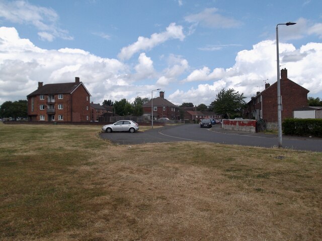
Ashby is a small village located in the East Lindsey district of Lincolnshire, England. It is situated about 7 miles northeast of Horncastle and 10 miles southeast of Louth. With a population of around 400 residents, Ashby boasts a close-knit community that embraces the tranquility and charm of rural life.

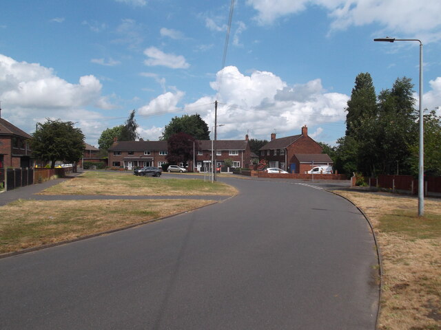
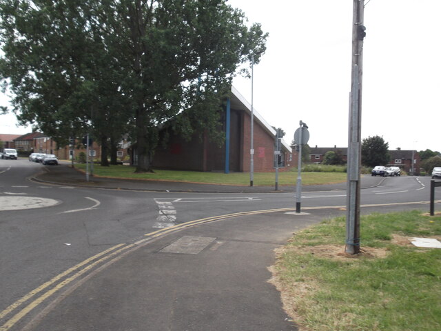
The village is characterized by its picturesque countryside surroundings, featuring rolling hills, lush green fields, and idyllic landscapes. Traditional stone and red-brick houses line the streets, giving Ashby a timeless and quintessential English village feel.

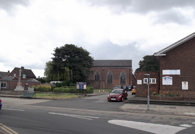
Despite its small size, Ashby offers a range of amenities to cater to the needs of its residents. These include a village hall, a local pub, and a church. The village hall serves as a hub for various community events and activities, fostering a sense of unity and togetherness.

Nature enthusiasts will appreciate the abundance of walking and cycling trails that wind through the village and its surrounding areas. Ashby also benefits from its proximity to the Lincolnshire Wolds, an Area of Outstanding Natural Beauty, where visitors can explore scenic countryside and enjoy breathtaking views.

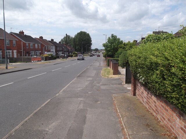
In terms of transportation, Ashby is well-connected to neighboring towns and cities. The A158 road runs through the village, providing easy access to Horncastle and Lincoln, while the nearby Market Rasen railway station offers convenient train connections to destinations across the country.

Overall, Ashby offers a peaceful and picturesque setting, making it an attractive place to live for those seeking a quiet rural lifestyle surrounded by natural beauty.

If you have any feedback on the listing, please let us know in the comments section below.
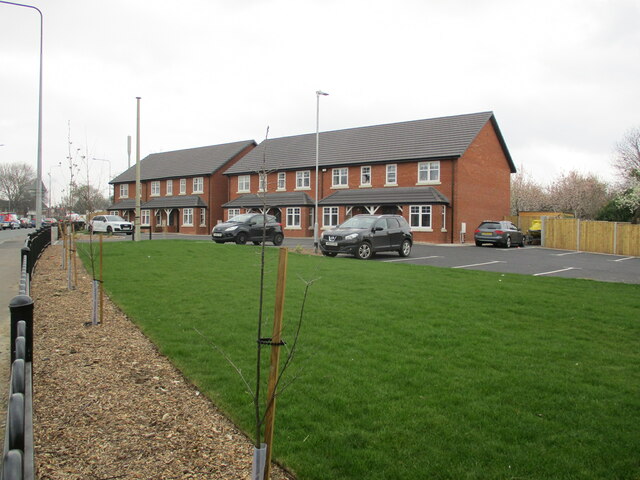
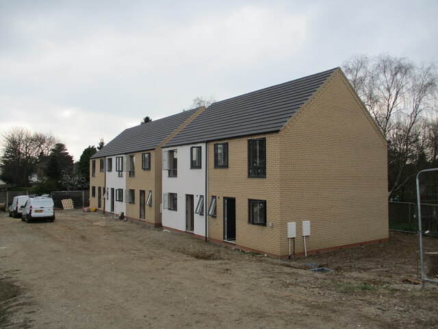
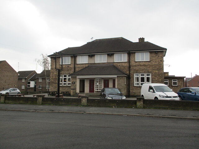
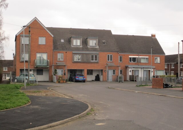
Ashby Images

Images are sourced within 2km of 53.564174/-0.653922 or Grid Reference SE8908. Thanks to Geograph Open Source API. All images are credited.

New housing, Old Coal Yard, Ashby
New housing on an as yet unbuilt and unnamed road, Ashby
The Queen Bess, Ashby
Housing on the site of the former St. Catherine's church, Ashby
Footpath to Grange Lane South, Ashby
Salvation Army, Ashby
The Crown Hotel, Ashby High Street Bears a datestone 1909.
The Crown Hotel, Ashby High Street
Bears a datestone 1909.
The Malt Shovel, Ashby High Street
Path by Bottesford Beck
St Peter ad Vincula, Bottesford
Holme Hall Avenue, Bottesford
Bellingham Road
Bellingham Road
Bellingham Road
Bellingham Road
St Paul's Church, Ashby
Burringham Road, Ashby
Church of the Holy Spirit, Ashby
High Street, Yaddlethorpe
Show me another place!

Ashby is located at Grid Ref: SE8908 (Lat: 53.564174, Lng: -0.653922)

Division: Parts of Lindsey

Unitary Authority: North Lincolnshire

Police Authority: Humberside

What 3 Words

///after.actual.cared. Near Scunthorpe, Lincolnshire

Nearby Locations

Ashby

Related Wikis

Joyce Mason School of Dance

The Joyce Mason School of Dance is an independent dance school based on Ashby High Street in Scunthorpe, North Lincolnshire, England. == Curriculum... ==
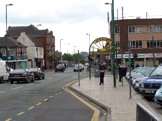
Ashby, Lincolnshire

Ashby is a suburb of Scunthorpe in Lincolnshire, England. The population of the suburb is included in the Brumby ward of the North Lincolnshire Unitary...

St Bede's Catholic Voluntary Academy

St Bede's Catholic Voluntary Academy (formerly St Bede's Catholic School) is a mixed Roman Catholic secondary school located in Scunthorpe, North Lincolnshire...

Melior Community Academy

Melior Community Academy is a coeducational secondary school with academy status, located in Scunthorpe, North Lincolnshire, England. The school is sponsored...

Frederick Gough School

Frederick Gough School is a community secondary school in Scunthorpe, England, for approximately 1,300 pupils aged from 11 to 16. == History == === Grammar... ===

Yaddlethorpe

Yaddlethorpe is a district in the south of Scunthorpe, North Lincolnshire, England. It is close to the M180 and next to Bottesford, divided by the A159...

John Leggott College

John Leggott College is a sixth form college on West Common Lane, in Old Brumby, Scunthorpe, North Lincolnshire, England. == History == === Technical... ===

Queen Bess, Scunthorpe

The Queen Bess is a grade-II-listed (historic) public house in Scunthorpe, Lincolnshire, England. It opened in 1959 and is one of the few remaining examples...

Nearby Amenities

Located within 500m of 53.564174,-0.653922
Ashby
Place: suburb
Source: Bing
Wikidata: Q4804690
Lat/Long: 53.5642206/-0.6544905
Traffic Signals
Lat/Long: 53.5667849/-0.6540547
Traffic Signals
Lat/Long: 53.5667914/-0.6566467
Traffic Signals
Lat/Long: 53.5631901/-0.6566051
Bus Stop
Angerstein Road
Alt Name: Messingham Road
Naptan AltCommonName: Messingham Road
Naptan AltIndicator: adj
Naptan AltStreet: Angerstein Road
Naptan AtcoCode: 227000010343
Naptan Bearing: E
Naptan CommonName: Angerstein Road
Naptan Indicator: o/s 2
Naptan NaptanCode: scupwaw
Naptan Street: Angerstein Road
Naptan Verified: no
Source: naptan_import
Lat/Long: 53.5632112/-0.6575092
Bus Stop
Angerstein Road
Alt Name: Messingham Road
Naptan AltCommonName: Messingham Road
Naptan AltIndicator: opp
Naptan AltStreet: Angerstein Road
Naptan AtcoCode: 227000010344
Naptan Bearing: W
Naptan CommonName: Angerstein Road
Naptan Indicator: adj 1
Naptan Landmark: Messingham Road
Naptan NaptanCode: scuwdaw
Naptan Street: Angerstein Road
Naptan Verified: no
Source: naptan_import
Lat/Long: 53.5631381/-0.6574058
Bus Stop
Angerstein Road
Bench: no
Naptan AtcoCode: 227000010345
Naptan Bearing: E
Naptan CommonName: Angerstein Road
Naptan Indicator: o/s 48
Naptan NaptanCode: scuwgaw
Naptan Street: Angerstein Road
Naptan Verified: no
Shelter: no
Source: naptan_import
Lat/Long: 53.563175/-0.6606963
Bus Stop
Angerstein Road
Bench: no
Naptan AtcoCode: 227000010346
Naptan Bearing: W
Naptan CommonName: Angerstein Road
Naptan Indicator: o/s 41
Naptan NaptanCode: scuwjaw
Naptan Street: Angerstein Road
Naptan Verified: no
Source: naptan_import
Lat/Long: 53.5630975/-0.6602004
Bus Stop
Ashby Turn
Alt Name: Local Link
Naptan AltCommonName: Local Link
Naptan AltIndicator: opp
Naptan AltStreet: Ashby High Street
Naptan AtcoCode: 227000010351
Naptan Bearing: E
Naptan CommonName: Ashby Turn
Naptan Indicator: adj link
Naptan NaptanCode: scuajda
Naptan Street: Ashby High Street
Naptan Verified: no
Source: naptan_import
Lat/Long: 53.5668344/-0.6527586
Bus Stop
Carvers Fish Shop
Alt Name: Belmont Street;Belmont Street;Victoria Road
Naptan AltCommonName: Belmont Street;Victoria Road
Naptan AltIndicator: opp;adj
Naptan AltStreet: Ashby High Street;Ashby High Street
Naptan AtcoCode: 227000010353
Naptan Bearing: W
Naptan CommonName: Carvers Fish Shop
Naptan Indicator: o/s
Naptan NaptanCode: scuapda
Naptan Street: Ashby High Street
Naptan Verified: no
Source: naptan_import
Lat/Long: 53.5667287/-0.6513576
Bus Stop
Broadway
Naptan AtcoCode: 227000010354
Naptan Bearing: W
Naptan CommonName: Broadway
Naptan Indicator: o/s Shops
Naptan NaptanCode: scuatda
Naptan Street: Ashby High Street
Naptan Verified: no
Shelter: yes
Source: naptan_import
Lat/Long: 53.5666844/-0.6482332
Bus Stop
Broadway
Naptan AtcoCode: 227000010357
Naptan Bearing: E
Naptan CommonName: Broadway
Naptan Indicator: opp shops
Naptan NaptanCode: scudgda
Naptan Street: Ashby High Street
Naptan Verified: no
Source: naptan_import
Lat/Long: 53.5668322/-0.6493761
Bus Stop
Ashby Turn
Alt Name: Local Link
Naptan AltCommonName: Local Link
Naptan AltIndicator: o/s 387
Naptan AltStreet: Ashby Road
Naptan AtcoCode: 227000010363
Naptan Bearing: N
Naptan CommonName: Ashby Turn
Naptan Indicator: o/s 387
Naptan NaptanCode: scugada
Naptan Street: Ashby Road
Naptan Verified: no
Source: naptan_import
Lat/Long: 53.5672542/-0.6541194
Bus Stop
Churchfield Road
Naptan AtcoCode: 227000010390
Naptan Bearing: N
Naptan CommonName: Churchfield Road
Naptan Indicator: opp
Naptan NaptanCode: scuwmda
Naptan Street: Bottesford Road
Naptan Verified: no
Source: naptan_import
Lat/Long: 53.5647638/-0.6469204
Bus Stop
Churchfield Road
Naptan AtcoCode: 227000010391
Naptan Bearing: S
Naptan CommonName: Churchfield Road
Naptan Indicator: adj
Naptan NaptanCode: scuwpda
Naptan Street: Bottesford Road
Naptan Verified: no
Source: naptan_import
Lat/Long: 53.5644196/-0.6466897
Bus Stop
Rochdale Road
Alt Name: RAOB Club
Naptan AltCommonName: RAOB Club
Naptan AltIndicator: adj
Naptan AltStreet: Bottesford Road
Naptan AtcoCode: 227000010393
Naptan Bearing: N
Naptan CommonName: Rochdale Road
Naptan Indicator: adj
Naptan NaptanCode: scuagdg
Naptan Street: Bottesford Road
Naptan Verified: no
Source: naptan_import
Lat/Long: 53.5630448/-0.6467336
Bus Stop
Ashby Turn
Alt Name: Local Link;Local Link;Old Rectory Gardens
Naptan AltCommonName: Local Link;Old Rectory Gardens
Naptan AltIndicator: nr;adj
Naptan AltStreet: Burringham Road;Burringham Road
Naptan AtcoCode: 227000010406
Naptan Bearing: W
Naptan CommonName: Ashby Turn
Naptan Indicator: opp
Naptan NaptanCode: scugadg
Naptan Street: Burringham Road
Naptan Verified: no
Source: naptan_import
Lat/Long: 53.5667413/-0.6556759
Bus Stop
Ancaster Court
Alt Name: Messingham Road
Naptan AltCommonName: Messingham Road
Naptan AltIndicator: o/s 117
Naptan AltStreet: Messingham Road
Naptan AtcoCode: 227000010543
Naptan Bearing: N
Naptan CommonName: Ancaster Court
Naptan Indicator: opp
Naptan NaptanCode: scujmdp
Naptan Street: Messingham Road
Naptan Verified: no
Source: naptan_import
Lat/Long: 53.5617003/-0.6566511
Bus Stop
Ancaster Court
Alt Name: Messingham Road
Naptan AltCommonName: Messingham Road
Naptan AltIndicator: o/s 142
Naptan AltStreet: Messingham Road
Naptan AtcoCode: 227000010544
Naptan Bearing: S
Naptan CommonName: Ancaster Court
Naptan Indicator: adj
Naptan Landmark: 142
Naptan NaptanCode: scujpdp
Naptan Street: Messingham Road
Naptan Verified: no
Source: naptan_import
Lat/Long: 53.5613658/-0.6564805
Bus Stop
Messingham Road
Naptan AtcoCode: 227000010545
Naptan Bearing: N
Naptan CommonName: Messingham Road
Naptan Indicator: o/s 7
Naptan NaptanCode: scujtdp
Naptan Street: Messingham Road
Naptan Verified: no
Source: naptan_import
Lat/Long: 53.5659802/-0.656742
Bus Stop
Messingham Road
Naptan AtcoCode: 227000010546
Naptan Bearing: S
Naptan CommonName: Messingham Road
Naptan Indicator: o/s 38
Naptan NaptanCode: scujwdp
Naptan Street: Messingham Road
Naptan Verified: no
Source: naptan_import
Lat/Long: 53.5656459/-0.6565865
Bus Stop
Angerstein Road
Alt Name: Rochdale Road
Naptan AltCommonName: Rochdale Road
Naptan AltIndicator: adj
Naptan AltStreet: Messingham Road
Naptan AtcoCode: 227000010547
Naptan Bearing: N
Naptan CommonName: Angerstein Road
Naptan Indicator: adj
Naptan NaptanCode: scumadp
Naptan Street: Messingham Road
Naptan Verified: no
Source: naptan_import
Lat/Long: 53.5637864/-0.6567058
Bus Stop
Angerstein Road
Alt Name: Rochdale Road
Naptan AltCommonName: Rochdale Road
Naptan AltIndicator: adj
Naptan AltStreet: Messingham Road
Naptan AtcoCode: 227000010548
Naptan Bearing: S
Naptan CommonName: Angerstein Road
Naptan Indicator: opp
Naptan NaptanCode: scumgdp
Naptan Street: Messingham Road
Naptan Verified: no
Source: naptan_import
Lat/Long: 53.5642069/-0.6565264
Bus Stop
Ashby Star
Alt Name: Rochdale Road
Naptan AltCommonName: Rochdale Road
Naptan AltIndicator: adj pub
Naptan AltLandmark: Pub
Naptan AltStreet: Rochdale Road
Naptan AtcoCode: 227000010579
Naptan Bearing: E
Naptan CommonName: Ashby Star
Naptan Indicator: adj
Naptan NaptanCode: scugjdt
Naptan Street: Rochdale Road
Naptan Verified: no
Source: naptan_import
Lat/Long: 53.5633154/-0.6500015
Bus Stop
Ashby Star
Naptan AtcoCode: 227000010580
Naptan Bearing: W
Naptan CommonName: Ashby Star
Naptan Indicator: opp
Naptan NaptanCode: scugmdt
Naptan Street: Rochdale Road
Naptan Verified: no
Source: naptan_import
Lat/Long: 53.5632117/-0.6503672
Bus Stop
Rochdale Road
Naptan AtcoCode: 227000010581
Naptan Bearing: E
Naptan CommonName: Rochdale Road
Naptan Indicator: opp 18
Naptan NaptanCode: scugpdt
Naptan Street: Rochdale Road
Naptan Verified: no
Source: naptan_import
Lat/Long: 53.5632868/-0.6546379
Bus Stop
Rochdale Road
Naptan AtcoCode: 227000010582
Naptan Bearing: W
Naptan CommonName: Rochdale Road
Naptan Indicator: o/s 10
Naptan NaptanCode: scugtdt
Naptan Street: Rochdale Road
Naptan Verified: no
Source: naptan_import
Lat/Long: 53.5631759/-0.6551699
Bus Stop
Monks Road
Naptan AtcoCode: 227000010873
Naptan Bearing: E
Naptan CommonName: Monks Road
Naptan Indicator: adj
Naptan NaptanCode: scuawgt
Naptan Street: Burringham Road
Naptan Verified: no
Source: naptan_import
Lat/Long: 53.566803/-0.6587696
Bus Stop
Willoughby Road
Naptan AtcoCode: 227000010971
Naptan Bearing: N
Naptan CommonName: Willoughby Road
Naptan Indicator: adj
Naptan NaptanCode: scugwja
Naptan Street: Messingham Road
Naptan Verified: no
Source: naptan_import
Lat/Long: 53.5602351/-0.6566522
Bus Stop
Priory Road
Naptan AtcoCode: 227000011025
Naptan Bearing: N
Naptan CommonName: Priory Road
Naptan Indicator: o/s 11
Naptan NaptanCode: scupmjg
Naptan Street: Priory Road
Naptan Verified: no
Source: naptan_import
Lat/Long: 53.5677147/-0.6567021
Bus Stop
Priory Road
Naptan AtcoCode: 227000011026
Naptan Bearing: S
Naptan CommonName: Priory Road
Naptan Indicator: o/s 16
Naptan NaptanCode: scuptjg
Naptan Street: Priory Road
Naptan Verified: no
Source: naptan_import
Lat/Long: 53.5677941/-0.6565637
Bus Stop
Monks Road
Naptan AtcoCode: 227000011058
Naptan Bearing: W
Naptan CommonName: Monks Road
Naptan Indicator: opp
Naptan NaptanCode: scumdjm
Naptan Street: Burringham Road
Naptan Verified: no
Source: naptan_import
Lat/Long: 53.5667556/-0.6585446
Pub
Mill Road Working Mens Club
Lat/Long: 53.567535/-0.6493389
Pharmacy
Lat/Long: 53.5659389/-0.6541159
Barrier: lift_gate
Lat/Long: 53.567308/-0.6491387
Leisure: playground
Lat/Long: 53.5607974/-0.6512476
Age UK
Brand: Age UK
Brand Wikidata: Q4691850
Brand Wikipedia: en:Age UK
Shop: charity
Lat/Long: 53.5665597/-0.6491191
Alan Betts
Addr City: Scunthorpe
Addr Housenumber: 4
Addr Postcode: DN16 2SN
Addr Street: Broadway
Fhrs Id: 418968
Shop: butcher
Source Addr: FHRS Open Data
Lat/Long: 53.5665166/-0.6480245
Balloons Galore
Shop: gift
Lat/Long: 53.5669111/-0.6482907
Card Factory
Brand: Card Factory
Brand Wikidata: Q5038192
Brand Wikipedia: en:Card Factory
Shop: gift
Lat/Long: 53.5665341/-0.6484891
Cafe
Coffee at 43
Cuisine: coffee_shop
Lat/Long: 53.5669235/-0.6490214
Cooplands
Addr City: Scunthorpe
Addr Housenumber: 222
Addr Postcode: DN16 2SJ
Addr Street: Ashby High Street
Brand: Cooplands
Brand Wikidata: Q5167971
Brand Wikipedia: en:Cooplands
Fhrs Id: 213938
Shop: bakery
Source Addr: FHRS Open Data
Lat/Long: 53.566689/-0.6493055
Coral
Brand: Coral
Brand Wikidata: Q54621344
Brand Wikipedia: en:Coral (bookmaker)
Shop: bookmaker
Lat/Long: 53.5665274/-0.6481854
Curtis
Addr City: Scunthorpe
Addr Housenumber: 33
Addr Postcode: DN16 2SS
Addr Street: Broadway
Fhrs Id: 214131
Shop: bakery
Source Addr: FHRS Open Data
Lat/Long: 53.5669197/-0.6486144
Fast Food
Greggs
Addr City: Scunthorpe
Addr Housenumber: 20
Addr Postcode: DN16 2SN
Addr Street: Broadway
Brand: Greggs
Brand Wikidata: Q3403981
Brand Wikipedia: en:Greggs
Contact Website: https://www.greggs.co.uk/shop-finder?shop-code=1281
Cuisine: sandwich;bakery
Fhrs Id: 213689
Shop: bakery
Source Addr: FHRS Open Data
Takeaway: yes
Lat/Long: 53.5665449/-0.6487678
Heron Foods
Addr City: Scunthorpe
Addr Country: GB
Addr Housenumber: 22
Addr Postcode: DN16 2SN
Addr Street: Broadway
Brand: Heron Foods
Brand Wikidata: Q5743472
Brand Wikipedia: en:Heron Foods
Contact Website: https://heronfoods.com/store/ashby/
Fhrs Id: 214471
Shop: supermarket
Lat/Long: 53.5665449/-0.6488812
Home Bargains
Brand: Home Bargains
Brand Wikidata: Q5888229
Brand Wikipedia: en:Home Bargains
Contact Website: https://storelocator.homebargains.co.uk/store/A111/Ashby+High+Street,+Scunthorpe+
Shop: variety_store
Lat/Long: 53.5665382/-0.6486001
Hunters
Office: estate_agent
Lat/Long: 53.5669197/-0.6486849
Iceland
Brand: Iceland
Brand Wikidata: Q721810
Brand Wikipedia: en:Iceland (supermarket)
Contact Website: https://www.iceland.co.uk/store-finder/store?StoreID=341&StoreName=ASHBY
Shop: frozen_food
Lat/Long: 53.566914/-0.648539
Keep Yourself Right
Shop: yes
Lat/Long: 53.5669216/-0.6489316
Check Date: 2019-10-21
Disused Shop: bookmaker
Old Name: Ladbrokes
Lat/Long: 53.5665247/-0.6480903
Bank
Lloyds Bank
Brand: Lloyds Bank
Brand Wikidata: Q1152847
Brand Wikipedia: en:Lloyds Bank
Lat/Long: 53.5666881/-0.6495363
Martin's
Brand: Martin's
Brand Wikidata: Q116779207
Brand Wikipedia: en:McColl's
Contact Website: https://www.mccolls.co.uk/storelocator/scunthorpe-ashby-high-st/
Shop: newsagent
Lat/Long: 53.566557/-0.6490556
More Booze
Addr City: Scunthorpe
Addr Housenumber: 10
Addr Postcode: DN16 2SN
Addr Street: Broadway
Fhrs Id: 1024110
Shop: alcohol
Source Addr: FHRS Open Data
Lat/Long: 53.5665287/-0.6482852
Betfred
Brand: Betfred
Brand Wikidata: Q4897425
Brand Wikipedia: en:Betfred
Shop: bookmaker
Lat/Long: 53.5665301/-0.6483917
Check Date: 2015-12-29
Disused Shop: yes
Lat/Long: 53.5669035/-0.6481288
Shop: yes
Lat/Long: 53.5669187/-0.648757
Renshaw & Sons
Shop: shoe_repair
Lat/Long: 53.5669197/-0.6488419
Fast Food
Papa John's
Addr City: Scunthorpe
Addr Housenumber: 24
Addr Postcode: DN16 2SN
Addr Street: Broadway
Brand: Papa John's
Brand Wikidata: Q2759586
Brand Wikipedia: en:Papa John's Pizza
Cuisine: pizza
Fhrs Id: 949870
Source Addr: FHRS Open Data
Takeaway: yes
Website: https://www.papajohns.co.uk/stores/scunthorpe
Lat/Long: 53.5665515/-0.6489786
Fast Food
Shaun's
Addr City: Scunthorpe
Addr Housenumber: 32
Addr Postcode: DN16 2SN
Addr Street: Broadway
Cuisine: fish_and_chips
Fhrs Id: 705473
Source Addr: FHRS Open Data
Lat/Long: 53.5665637/-0.6491961
Spar
Addr City: Scunthorpe
Addr Housenumber: 224
Addr Postcode: DN16 2SJ
Addr Street: Ashby High Street
Brand: Spar
Brand Wikidata: Q610492
Brand Wikipedia: en:SPAR (retailer)
Fhrs Id: 214570
Shop: convenience
Source Addr: FHRS Open Data
Lat/Long: 53.56669/-0.6494145
Phone Bar
Shop: yes
Lat/Long: 53.5666862/-0.6495924
Poundland
Addr City: Scunthorpe
Addr Country: GB
Addr Housenumber: 2
Addr Postcode: DN16 2SN
Addr Street: Broadway
Brand: Poundland
Brand Wikidata: Q1434528
Shop: variety_store
Lat/Long: 53.5665104/-0.6478718
Defibrillator
Defibrillator Location: outside, to the right of the door
Emergency: defibrillator
Opening Hours: 24/7
Wheelchair: yes
Lat/Long: 53.5666798/-0.6535348
Telephone
Booth: KX100
Covered: booth
Fee: yes
Lit: yes
Operator: BT
Payment Coins: yes
Lat/Long: 53.5668708/-0.6537649
Generator Method: photovoltaic
Generator Output Electricity: yes
Generator Source: solar
Generator Type: solar_photovoltaic_panel
Location: roof
Power: generator
Lat/Long: 53.5676729/-0.6548875
Generator Method: photovoltaic
Generator Output Electricity: yes
Generator Source: solar
Generator Type: solar_photovoltaic_panel
Location: roof
Power: generator
Lat/Long: 53.5676984/-0.6579566
Generator Method: photovoltaic
Generator Output Electricity: yes
Generator Source: solar
Generator Type: solar_photovoltaic_panel
Location: roof
Power: generator
Lat/Long: 53.5676976/-0.6583126
Generator Method: photovoltaic
Generator Output Electricity: yes
Generator Source: solar
Generator Type: solar_photovoltaic_panel
Location: roof
Power: generator
Lat/Long: 53.5674455/-0.6583335
Generator Method: photovoltaic
Generator Output Electricity: yes
Generator Source: solar
Generator Type: solar_photovoltaic_panel
Location: roof
Power: generator
Lat/Long: 53.56654/-0.6585681
Generator Method: photovoltaic
Generator Output Electricity: yes
Generator Source: solar
Generator Type: solar_photovoltaic_panel
Location: roof
Power: generator
Lat/Long: 53.5651223/-0.6600782
Generator Method: photovoltaic
Generator Output Electricity: yes
Generator Source: solar
Generator Type: solar_photovoltaic_panel
Location: roof
Power: generator
Lat/Long: 53.5629828/-0.658485
Generator Method: photovoltaic
Generator Output Electricity: yes
Generator Source: solar
Generator Type: solar_photovoltaic_panel
Location: roof
Power: generator
Lat/Long: 53.5624938/-0.6607273
Defibrillator
Emergency: defibrillator
Lat/Long: 53.566606/-0.6492575
Generator Method: photovoltaic
Generator Output Electricity: yes
Generator Source: solar
Generator Type: solar_photovoltaic_panel
Location: roof
Power: generator
Lat/Long: 53.5643949/-0.6563001
Generator Method: photovoltaic
Generator Output Electricity: yes
Generator Source: solar
Generator Type: solar_photovoltaic_panel
Location: roof
Power: generator
Lat/Long: 53.564402/-0.6561875
Generator Method: photovoltaic
Generator Output Electricity: yes
Generator Source: solar
Generator Type: solar_photovoltaic_panel
Location: roof
Power: generator
Lat/Long: 53.5630762/-0.65582
Generator Method: photovoltaic
Generator Output Electricity: yes
Generator Source: solar
Generator Type: solar_photovoltaic_panel
Location: roof
Power: generator
Lat/Long: 53.5630539/-0.6548759
Generator Method: photovoltaic
Generator Output Electricity: yes
Generator Source: solar
Generator Type: solar_photovoltaic_panel
Location: roof
Power: generator
Lat/Long: 53.5623992/-0.6547686
Generator Method: photovoltaic
Generator Output Electricity: yes
Generator Source: solar
Generator Type: solar_photovoltaic_panel
Location: roof
Power: generator
Lat/Long: 53.5631097/-0.6538137
Generator Method: photovoltaic
Generator Output Electricity: yes
Generator Source: solar
Generator Type: solar_photovoltaic_panel
Location: roof
Power: generator
Lat/Long: 53.5649433/-0.6498843
Generator Method: photovoltaic
Generator Output Electricity: yes
Generator Source: solar
Generator Type: solar_photovoltaic_panel
Location: roof
Power: generator
Lat/Long: 53.5600698/-0.651239
Generator Method: photovoltaic
Generator Output Electricity: yes
Generator Source: solar
Generator Type: solar_photovoltaic_panel
Location: roof
Power: generator
Lat/Long: 53.5600292/-0.651589
Generator Method: photovoltaic
Generator Output Electricity: yes
Generator Source: solar
Generator Type: solar_photovoltaic_panel
Location: roof
Power: generator
Lat/Long: 53.5600188/-0.6519994
Generator Method: photovoltaic
Generator Output Electricity: yes
Generator Source: solar
Generator Type: solar_photovoltaic_panel
Location: roof
Power: generator
Lat/Long: 53.5601614/-0.6535269
Generator Method: photovoltaic
Generator Output Electricity: yes
Generator Source: solar
Generator Type: solar_photovoltaic_panel
Location: roof
Power: generator
Lat/Long: 53.5598452/-0.6542954
Generator Method: photovoltaic
Generator Output Electricity: yes
Generator Source: solar
Generator Type: solar_photovoltaic_panel
Location: roof
Power: generator
Lat/Long: 53.559846/-0.6543598
Generator Method: photovoltaic
Generator Output Electricity: yes
Generator Source: solar
Generator Type: solar_photovoltaic_panel
Location: roof
Power: generator
Lat/Long: 53.5605438/-0.6576897
Generator Method: photovoltaic
Generator Output Electricity: yes
Generator Source: solar
Generator Type: solar_photovoltaic_panel
Location: roof
Power: generator
Lat/Long: 53.5605438/-0.6576146
Generator Method: photovoltaic
Generator Output Electricity: yes
Generator Source: solar
Generator Type: solar_photovoltaic_panel
Location: roof
Power: generator
Lat/Long: 53.5602769/-0.6548063
Generator Method: photovoltaic
Generator Output Electricity: yes
Generator Source: solar
Generator Type: solar_photovoltaic_panel
Location: roof
Power: generator
Lat/Long: 53.5606123/-0.654286
Generator Method: photovoltaic
Generator Output Electricity: yes
Generator Source: solar
Generator Type: solar_photovoltaic_panel
Location: roof
Power: generator
Lat/Long: 53.5603335/-0.6519927
Generator Method: photovoltaic
Generator Output Electricity: yes
Generator Source: solar
Generator Type: solar_photovoltaic_panel
Location: roof
Power: generator
Lat/Long: 53.5604665/-0.6507227
Generator Method: photovoltaic
Generator Output Electricity: yes
Generator Source: solar
Generator Type: solar_photovoltaic_panel
Location: roof
Power: generator
Lat/Long: 53.560488/-0.6506409
Generator Method: photovoltaic
Generator Output Electricity: yes
Generator Source: solar
Generator Type: solar_photovoltaic_panel
Location: roof
Power: generator
Lat/Long: 53.5606609/-0.6497584
Generator Method: photovoltaic
Generator Output Electricity: yes
Generator Source: solar
Generator Type: solar_photovoltaic_panel
Location: roof
Power: generator
Lat/Long: 53.56068/-0.6496739
Generator Method: photovoltaic
Generator Output Electricity: yes
Generator Source: solar
Generator Type: solar_photovoltaic_panel
Location: roof
Power: generator
Lat/Long: 53.5613618/-0.6492126
Generator Method: photovoltaic
Generator Output Electricity: yes
Generator Source: solar
Generator Type: solar_photovoltaic_panel
Location: roof
Power: generator
Lat/Long: 53.560915/-0.6559517
Generator Method: photovoltaic
Generator Output Electricity: yes
Generator Source: solar
Generator Type: solar_photovoltaic_panel
Location: roof
Power: generator
Lat/Long: 53.5609213/-0.6563137
Generator Method: photovoltaic
Generator Output Electricity: yes
Generator Source: solar
Generator Type: solar_photovoltaic_panel
Location: roof
Power: generator
Lat/Long: 53.5609198/-0.6562333
Generator Method: photovoltaic
Generator Output Electricity: yes
Generator Source: solar
Generator Type: solar_photovoltaic_panel
Location: roof
Power: generator
Lat/Long: 53.5619808/-0.6563245
Generator Method: photovoltaic
Generator Output Electricity: yes
Generator Source: solar
Generator Type: solar_photovoltaic_panel
Location: roof
Power: generator
Lat/Long: 53.5619808/-0.656248
Generator Method: photovoltaic
Generator Output Electricity: yes
Generator Source: solar
Generator Type: solar_photovoltaic_panel
Location: roof
Power: generator
Lat/Long: 53.5618111/-0.653362
Generator Method: photovoltaic
Generator Output Electricity: yes
Generator Source: solar
Generator Type: solar_photovoltaic_panel
Location: roof
Power: generator
Lat/Long: 53.5617824/-0.6533191
Generator Method: photovoltaic
Generator Output Electricity: yes
Generator Source: solar
Generator Type: solar_photovoltaic_panel
Location: roof
Power: generator
Lat/Long: 53.5618087/-0.6532735
Generator Method: photovoltaic
Generator Output Electricity: yes
Generator Source: solar
Generator Type: solar_photovoltaic_panel
Location: roof
Power: generator
Lat/Long: 53.5618772/-0.6506999
Generator Method: photovoltaic
Generator Output Electricity: yes
Generator Source: solar
Generator Type: solar_photovoltaic_panel
Location: roof
Power: generator
Lat/Long: 53.5619967/-0.6501876
Generator Method: photovoltaic
Generator Output Electricity: yes
Generator Source: solar
Generator Type: solar_photovoltaic_panel
Location: roof
Power: generator
Lat/Long: 53.5619792/-0.649741
Generator Method: photovoltaic
Generator Output Electricity: yes
Generator Source: solar
Generator Type: solar_photovoltaic_panel
Location: roof
Power: generator
Lat/Long: 53.5619752/-0.6493923
Generator Method: photovoltaic
Generator Output Electricity: yes
Generator Source: solar
Generator Type: solar_photovoltaic_panel
Location: roof
Power: generator
Lat/Long: 53.561976/-0.6488666
Generator Method: photovoltaic
Generator Output Electricity: yes
Generator Source: solar
Generator Type: solar_photovoltaic_panel
Location: roof
Power: generator
Lat/Long: 53.5619879/-0.6486882
Generator Method: photovoltaic
Generator Output Electricity: yes
Generator Source: solar
Generator Type: solar_photovoltaic_panel
Location: roof
Power: generator
Lat/Long: 53.5619895/-0.6485997
Generator Method: photovoltaic
Generator Output Electricity: yes
Generator Source: solar
Generator Type: solar_photovoltaic_panel
Location: roof
Power: generator
Lat/Long: 53.5619887/-0.6484307
Place Of Worship
The Fairburn Residence
Addr City: Scunthorpe
Addr Housenumber: 41
Addr Street: Belmont Street
Fixme: I can find no online records from reliable sources that a Voodoo place of worship exists at Belmont Street, Scunthorpe. Potentially does not exist.
Religion: voodoo
Service Times: 24/7
Lat/Long: 53.5683501/-0.6512155
Crossing
Lat/Long: 53.5646452/-0.6534194
Generator Method: photovoltaic
Generator Output Electricity: yes
Generator Source: solar
Generator Type: solar_photovoltaic_panel
Location: roof
Power: generator
Lat/Long: 53.5679406/-0.6574202
Generator Method: photovoltaic
Generator Output Electricity: yes
Generator Source: solar
Generator Type: solar_photovoltaic_panel
Location: roof
Power: generator
Lat/Long: 53.5679378/-0.6574966
Generator Method: photovoltaic
Generator Output Electricity: yes
Generator Source: solar
Generator Type: solar_photovoltaic_panel
Location: roof
Power: generator
Lat/Long: 53.5677132/-0.6574269
Generator Method: photovoltaic
Generator Output Electricity: yes
Generator Source: solar
Generator Type: solar_photovoltaic_panel
Location: roof
Power: generator
Lat/Long: 53.567718/-0.6574953
Tesco Express
Addr City: Scunthorpe
Addr Housenumber: 311
Addr Postcode: DN16 2RY
Addr Street: Ashby High Street
Addr Suburb: Ashby
Brand: Tesco Express
Brand Wikidata: Q98456772
Contact Website: https://www.tesco.com/store-locator/scunthorpe/311-ashby-high-st
Fhrs Id: 213925
Shop: convenience
Lat/Long: 53.5668968/-0.6532708
Post Office
Ashby Post Office
Addr City: Scunthorpe
Addr Country: GB
Addr Housenumber: 224-226
Addr Postcode: DN16 2SJ
Addr Street: Ashby High Street
Addr Village: Ashby
Brand: Post Office
Brand Wikidata: Q1783168
Check Date: 2022-05-27
Check Date Opening Hours: 2022-05-27
Opening Hours: Mo-Fr 09:00-17:30; Sa 09:00-12:30
Ref Pol Id: 13189
Website: https://www.postoffice.co.uk/branch-finder/3363112/ashby
Lat/Long: 53.56656/-0.64937
Crossing
Lat/Long: 53.565466/-0.6536263
Crossing
Lat/Long: 53.5648011/-0.6537225
Crossing
Lat/Long: 53.5647126/-0.6535777
Crossing
Crossing: zebra
Crossing Markings: yes
Traffic Calming: table
Lat/Long: 53.5660714/-0.6535231
Crossing
Lat/Long: 53.5658615/-0.6532541
Crossing
Lat/Long: 53.5663118/-0.6540272
Crossing
Lat/Long: 53.5655091/-0.6537495
Crossing
Lat/Long: 53.5661956/-0.6538917
Crossing
Lat/Long: 53.5662752/-0.6541022
Crossing
Lat/Long: 53.5652265/-0.6536622
The data included in this document is from www.openstreetmap.org. The data is made available under ODbL.

Have you been to Ashby?

Leave your review of Ashby below (or comments, questions and feedback).