Ashbury

Settlement in Devon West Devon

England

Ashbury

Lane at Shallowford The lane from Crowden to Northlew crossing a tributary of the West Lew (see <a href="https://www.geograph.org.uk/photo/4006436">SX4999 : Stream at Shallowford</a>), at what must have previously been a ford.
Lane at Shallowford Credit: Derek Harper

Ashbury is a small village located in the county of Devon, England. Situated on the northern edge of Dartmoor National Park, it is surrounded by picturesque landscapes and offers a peaceful and idyllic setting for its residents and visitors. The village is part of the West Devon local government district and falls within the civil parish of Okehampton Hamlets.

Ashbury is known for its charming, traditional English countryside atmosphere, with its quaint thatched cottages, rolling green hills, and meandering streams. The village is home to a close-knit community, and residents often participate in various community events and activities.

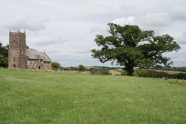
One of the notable landmarks in Ashbury is the St. Mary's Church, a beautiful medieval church that dates back to the 13th century. The church features stunning architectural details and provides a glimpse into the village's rich history. Additionally, there are several walking and hiking trails in the area, allowing nature enthusiasts to explore the surrounding natural beauty.

The village does not have many amenities, but a short drive away is the town of Okehampton, where residents can find a wider range of services, shops, and restaurants. Okehampton also offers access to transportation links, including a train station, making it convenient for those commuting to other parts of Devon or even further afield.

Overall, Ashbury, Devon is a charming and peaceful village that offers a tranquil escape from the hustle and bustle of city life. It is a place where residents can enjoy the beauty of nature, embrace community spirit, and discover the rich history of the region.

If you have any feedback on the listing, please let us know in the comments section below.
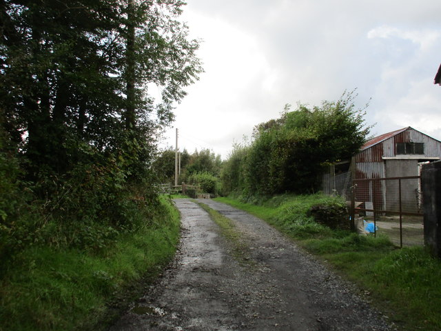
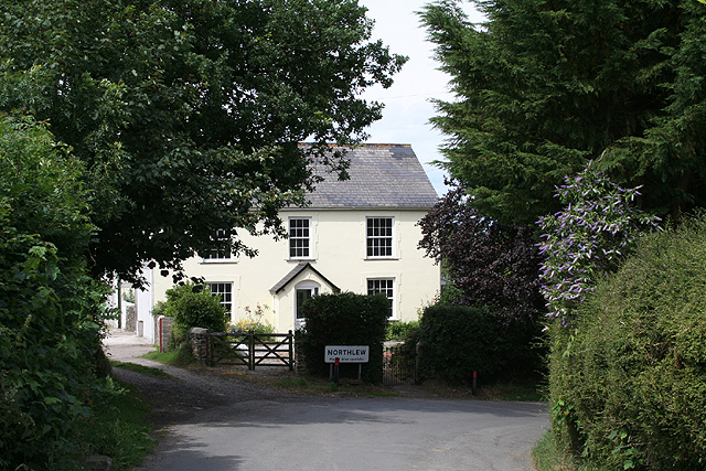
Ashbury Images

Images are sourced within 2km of 50.761873/-4.115513 or Grid Reference SX5097. Thanks to Geograph Open Source API. All images are credited.

Lane at Shallowford The lane from Crowden to Northlew crossing a tributary of the West Lew (see <a href="https://www.geograph.org.uk/photo/4006436">SX4999 : Stream at Shallowford</a>), at what must have previously been a ford.
Lane at Shallowford
The lane from Crowden to Northlew crossing a tributary of the West Lew (see SX4999 : Stream at Shallowford), at what must have previously been a ford.
Stream at Shallowford Looking up the stream from the crossing at <a href="https://www.geograph.org.uk/photo/4006326">SX4999 : Lane at Shallowford</a>.
Stream at Shallowford
Looking up the stream from the crossing at SX4999 : Lane at Shallowford.
Track to Lower East Kimber Farm
Footpath to Crowden
Footpath to Crowden
Bridleway to East Kimber
Led home Looking north from the hamlet of Bogtown along the lane towards Northlew.
Led home
Looking north from the hamlet of Bogtown along the lane towards Northlew.
Streamside trees near Northlew A field and trees beside a small tributary of the River Lew, seen from the lane to Kimber.
Streamside trees near Northlew
A field and trees beside a small tributary of the River Lew, seen from the lane to Kimber.
View to Costloes Cottages The two houses to the right of barns are among the cottages at Costloes. The farm beyond is Norley, in <a href="https://www.geograph.org.uk/gridref/SS4900">SS4900</a>. View from the start of Northlew Footpath 3 on the lane between Kimber and Northlew.
View to Costloes Cottages
The two houses to the right of barns are among the cottages at Costloes. The farm beyond is Norley, in SS4900. View from the start of Northlew Footpath 3 on the lane between Kimber and Northlew.
Beaworthy: The Mill House and Wigdon Corn Mill House conversions from a watermill. Looking south. Wigdon Mill stands on a ridge between two valleys and water was fed here by two leats, one from each valley. This was a typical west country watermill with two waterwheels in line. A surviving example is the watermill at Dunster in Somerset
Beaworthy: The Mill House and Wigdon Corn Mill
House conversions from a watermill. Looking south. Wigdon Mill stands on a ridge between two valleys and water was fed here by two leats, one from each valley. This was a typical west country watermill with two waterwheels in line. A surviving example is the watermill at Dunster in Somerset
Beaworthy: towards Stoney Stoney is the farm on the hill, near Bogtown. Looking north west by the entrance to Melbury on the road to Ashbury. The Countryside Stewardship Scheme operates at Melbury, an initiative by MAFF
Beaworthy: towards Stoney
Stoney is the farm on the hill, near Bogtown. Looking north west by the entrance to Melbury on the road to Ashbury. The Countryside Stewardship Scheme operates at Melbury, an initiative by MAFF
Ashbury: St Mary’s church Looking east-north-east
Ashbury: St Mary’s church
Looking east-north-east
Ashbury: Ten Acre Plantation Forestry Commission woodland; looking south-south-east
Ashbury: Ten Acre Plantation
Forestry Commission woodland; looking south-south-east
Ashbury: towards Wadland Barton The land drops away beyond the field with sheep, hiding a valley this side of the barton. Looking south east
Ashbury: towards Wadland Barton
The land drops away beyond the field with sheep, hiding a valley this side of the barton. Looking south east
Northlew: Bolland Approaching the village from the south
Northlew: Bolland
Approaching the village from the south
Northlew: village square Looking east-north-east
Northlew: village square
Looking east-north-east
Inwardleigh: near Homing Down Cross Looking south east towards Dartmoor
Inwardleigh: near Homing Down Cross
Looking south east towards Dartmoor
Northlew: public bridleway to Scobchester Looking west
Northlew: public bridleway to Scobchester
Looking west
Northlew: Higher Gorhuish Looking east-north-east to farm buildings: stone, brick, cob and corrugated iron all feature here
Northlew: Higher Gorhuish
Looking east-north-east to farm buildings: stone, brick, cob and corrugated iron all feature here
Show me another place!

Ashbury is located at Grid Ref: SX5097 (Lat: 50.761873, Lng: -4.115513)

Administrative County: Devon

District: West Devon

Police Authority: Devon and Cornwall

What 3 Words

///jolly.bookshop.ahead. Near Hatherleigh, Devon

Related Wikis

Ashbury, Devon

Ashbury is a village and former civil parish, now in the parish of Northlew, in the West Devon district, in the county of Devon, England. It is 5 miles...

Northlew

Northlew is a village and civil parish in the West Devon district of the county of Devon, England. To the west of the village, but within the parish, are...

Ashbury railway station

Ashbury railway station was located on the Okehampton to Bude Line 3¾ miles east of Halwill Junction, and served the hamlet of Ashbury and the village...

Broadbury Castle

Broadbury Castle (grid reference SX48379580) is an archaeological earthwork close to Beaworthy in Devon, England. It comprises a single bank and ditch...

Related Videos

Emily Explores our village

Always good to adventure with a grandchild. Such fun.
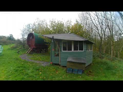
lovas lakókocsi

this is a gypsy caravan ,you can rent at Hide awaycamping, Devon, England.

Trike & Bike explore around Northlew

summarising a glorious evening bike ride around a lovely part of Devon. Victor and Ed experience the different cycling styles of a ...

Northlew Lambretta Rally 2024

Back to the 60's as these nostalgic scooters and their riders visit Northlew village square and The Green Dragon pub.

Nearby Amenities

Located within 500m of 50.761873,-4.115513
Ashbury
Place: hamlet
Lat/Long: 50.7617275/-4.1186863
St Mary's Church
Historic Amenity: place_of_worship
Note: No Longer in Regular Use
Lat/Long: 50.7619523/-4.1170412
Man Made: tower
Lat/Long: 50.7619747/-4.1171502
The data included in this document is from www.openstreetmap.org. The data is made available under ODbL.

Have you been to Ashbury?

Leave your review of Ashbury below (or comments, questions and feedback).