Dudley

Settlement in Northumberland

England

Dudley

Front Street (B1505), Annitsford
Front Street (B1505), Annitsford Credit: habiloid

Dudley is a small village located in the county of Northumberland, in the northeastern region of England. Situated approximately 3 miles northwest of the town of Cramlington, Dudley is nestled in a rural setting surrounded by picturesque countryside.

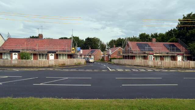
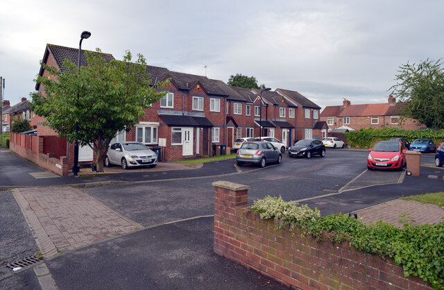
The village has a population of around 300 residents, making it a close-knit and tight community. Dudley is known for its charm and tranquility, with its traditional stone houses and well-maintained gardens adding to its appeal. The village is a popular choice for those seeking a peaceful and idyllic lifestyle away from the hustle and bustle of larger towns and cities.

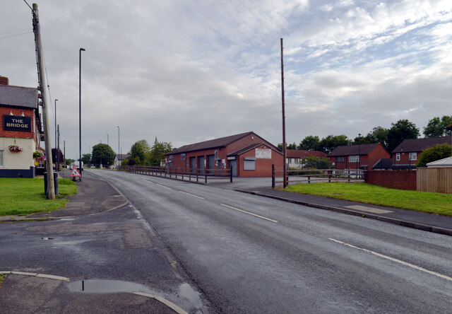
Despite its small size, Dudley offers a range of amenities and facilities for its residents. These include a local pub, a village hall, a primary school, and a post office. The village also benefits from good transport links, with regular bus services connecting Dudley to neighboring towns and villages.

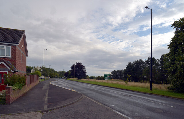
Surrounded by natural beauty, Dudley is an excellent base for outdoor enthusiasts. The village is located near several nature reserves and walking trails, providing ample opportunities for hiking, cycling, and birdwatching. Additionally, the nearby Northumberland coast and its stunning beaches are within easy reach, offering residents the chance to enjoy seaside activities and panoramic views.

In summary, Dudley is a charming and peaceful village situated in the heart of Northumberland. With its rural setting, close-knit community, and access to beautiful natural landscapes, it offers a desirable and tranquil lifestyle for its residents.

If you have any feedback on the listing, please let us know in the comments section below.
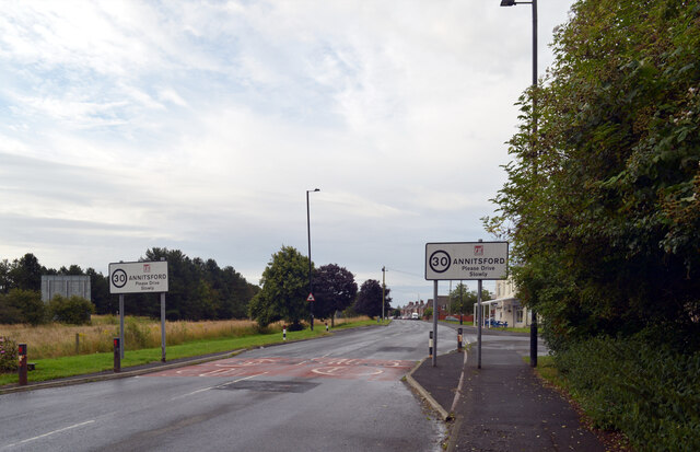
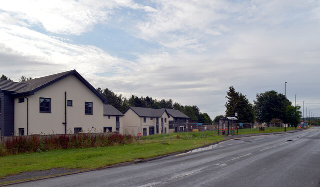
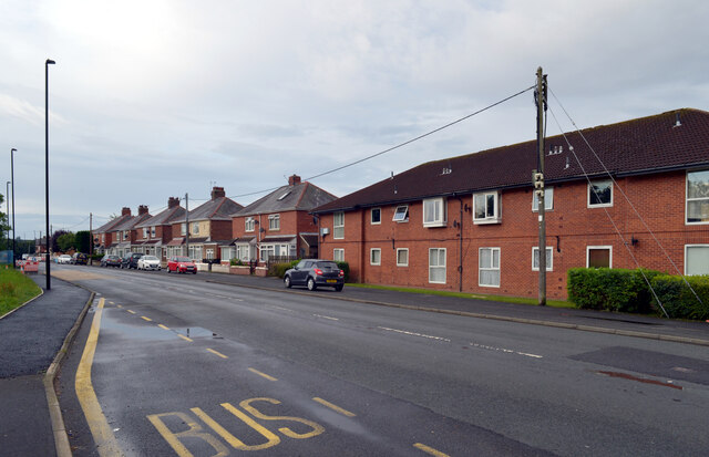
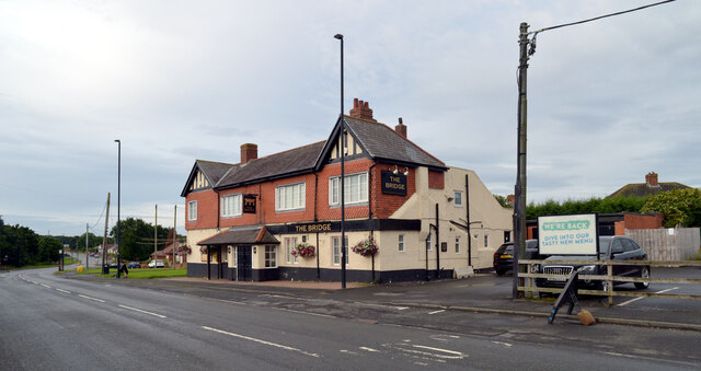
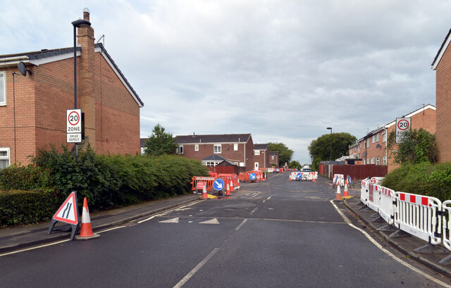
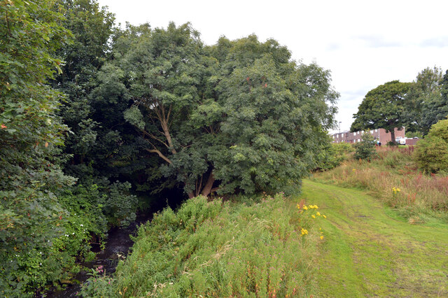
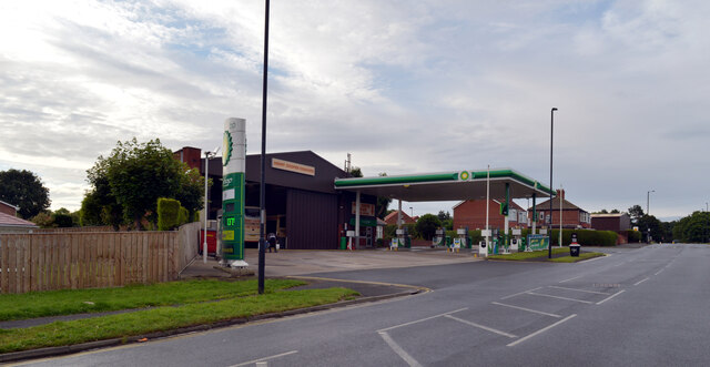
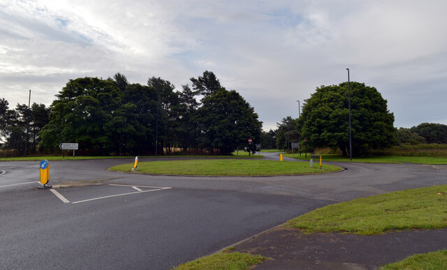
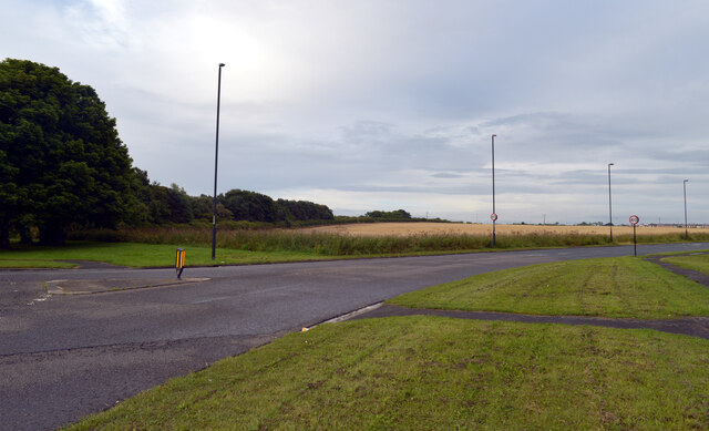
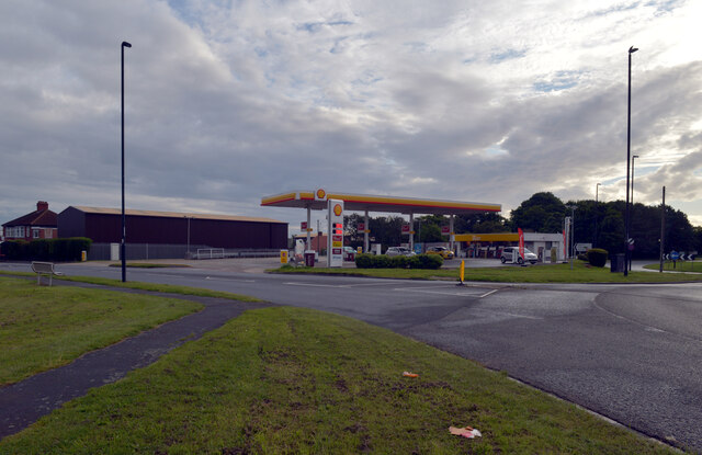
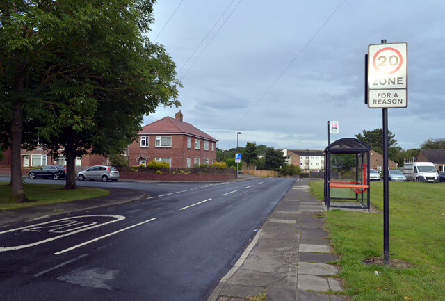
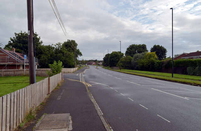
Dudley Images

Images are sourced within 2km of 55.053529/-1.591411 or Grid Reference NZ2673. Thanks to Geograph Open Source API. All images are credited.

Front Street (B1505), Annitsford
New houses, Front Street (B1505), Annitsford
Front Street (B1505), Annitsford
The Bridge, Front Street (B1505), Annitsford
Harrison Court, Annitsford
Seaton Burn seen from Front Street, Annitsford
Petrol station, Front Street (B1505), Annitsford
Roundabout at the junction of Front Street (B1505) and the B1321, Annitsford
The B1321, Annitsford Leaving the roundabout at its junction with Front Street (B1505).
The B1321, Annitsford
Leaving the roundabout at its junction with Front Street (B1505).
Petrol station, Front Street (B1505), Annitsford
Fern Drive, Annitsford
Front Street (B1505), Annitsford
Bridge Cottages seen from Front Street (B1505), Annitsford
Front Street (B1505), Annitsford The Bridge pub and Bridge Garage are on this part of Front Street; houses on The Spinney can be seen behind the garage.
Front Street (B1505), Annitsford
The Bridge pub and Bridge Garage are on this part of Front Street; houses on The Spinney can be seen behind the garage.
Front Street (B1505), Annitsford The large road sign beyond the grass is on the A189.
Front Street (B1505), Annitsford
The large road sign beyond the grass is on the A189.
Hanover Court seen from Front Street (B1505), Annitsford
The A189, Annitsford The A189 is an important A-road in southeast Northumberland, running for almost 21 miles from Gateshead to Ashington.

North of urban Tyne and Wear, the A189 is often referred to as simply “the Spine Road”. It is an example of a road which was constructed to promote regeneration of a whole area by improving road access to Tyneside and the A1 and A19 trunk roads. Construction of the Spine Road was undertaken in stages in the late 1960s and 1970s to facilitate regeneration of the historic coalfield area of South East Northumberland, which by this time was suffering from pit closures and loss of employment.

<span class="nowrap"><a title="https://www.sabre-roads.org.uk/wiki/index.php?title=A189" rel="nofollow ugc noopener" href="https://www.sabre-roads.org.uk/wiki/index.php?title=A189">Link</a><img style="margin-left:2px;" alt="External link" title="External link - shift click to open in new window" src="https://s1.geograph.org.uk/img/external.png" width="10" height="10"/></span> SABRE
<span class="nowrap"><a title="https://www.ciht.org.uk/media/8078/the_a189_spine_road.pdf" rel="nofollow ugc noopener" href="https://www.ciht.org.uk/media/8078/the_a189_spine_road.pdf">Link</a><img style="margin-left:2px;" alt="External link" title="External link - shift click to open in new window" src="https://s1.geograph.org.uk/img/external.png" width="10" height="10"/></span> CIHT
The A189, Annitsford
The A189 is an important A-road in southeast Northumberland, running for almost 21 miles from Gateshead to Ashington. North of urban Tyne and Wear, the A189 is often referred to as simply “the Spine Road”. It is an example of a road which was constructed to promote regeneration of a whole area by improving road access to Tyneside and the A1 and A19 trunk roads. Construction of the Spine Road was undertaken in stages in the late 1960s and 1970s to facilitate regeneration of the historic coalfield area of South East Northumberland, which by this time was suffering from pit closures and loss of employment. LinkExternal link SABRE LinkExternal link CIHT
Show me another place!

Dudley is located at Grid Ref: NZ2673 (Lat: 55.053529, Lng: -1.591411)

Unitary Authority: North Tyneside

Police Authority: Northumbria

What 3 Words

///divide.object.canny. Near Wideopen, Northumberland

Nearby Locations

Fordley Dudley

Related Wikis

Annitsford railway station

The first station in the area opened in 1860 as Dudley and served Dudley Colliery and the village of Dudley in North Tyneside, England. It was located...

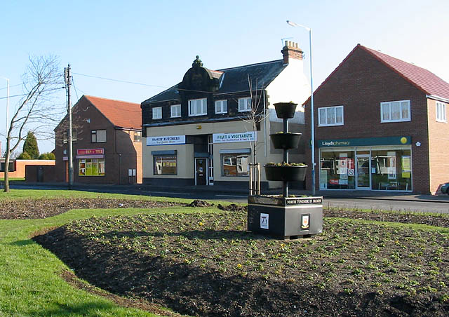
Dudley, Tyne and Wear

Dudley is a large village in North Tyneside, in the county of Tyne and Wear, England. A former mining village and formerly part of Northumberland, it was...

Annitsford

Annitsford is a semi-rural village located in North Tyneside (formerly South East Northumberland), on the border between Tyne and Wear and Northumberland...

Burradon, Tyne and Wear

Burradon is a village in Tyne and Wear, England, to the north of Newcastle upon Tyne. It is adjacent to Camperdown and the two villages are closely linked...
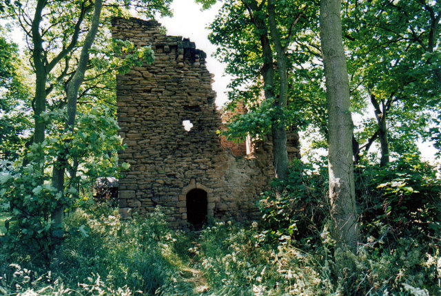
Burradon Tower

Burradon Tower is a ruinous tower house at Burradon, North Tyneside, England which is both a Scheduled Ancient Monument and a Grade II listed building...

Camperdown, Tyne and Wear

Camperdown is a village in the metropolitan borough of North Tyneside, Tyne and Wear in North East England. Camperdown is just south of Burradon, and the...

North Gosforth Academy

North Gosforth Academy is a co-educational secondary school located in Seaton Burn, Tyne and Wear, England. It has a specialism in business and enterprise...

Wideopen

Wideopen, also occasionally misspelled as Wide Open, is a village in the North Tyneside metropolitan borough of Tyne and Wear, England, around 5 miles...

Nearby Amenities

Located within 500m of 55.053529,-1.591411
Annitsford
Historic Railway: station
Railway: site
Wikidata: Q4769544
Wikipedia: en:Annitsford railway station
Lat/Long: 55.0562109/-1.5970271
Traffic Calming: choker
Lat/Long: 55.0514665/-1.5910641
Mini Roundabout
Direction: clockwise
Lat/Long: 55.0558477/-1.5948243
Post Box
Postal Code: NE23 7HR
Ref: NE23 477
Lat/Long: 55.0564202/-1.5933758
Post Box
Postal Code: NE23 7BP
Ref: NE23 36
Lat/Long: 55.0543817/-1.5868659
Noexit: yes
Lat/Long: 55.0549194/-1.5905578
Noexit: yes
Lat/Long: 55.0551841/-1.597456
Post Box
Operator: Royal Mail
Operator Wikidata: Q638098
Post Box Type: wall
Postal Code: NE23 7LJ
Ref: NE23 355
Lat/Long: 55.0519698/-1.5915612
Bus Stop
WEETSLADE ROAD-ETHEL TERRACE-N/B
Local Ref: NW
Naptan AtcoCode: 410000003023
Naptan Bearing: NW
Naptan CommonName: WEETSLADE ROAD-ETHEL TERRACE-N/B
Naptan Indicator: NW
Naptan Landmark: OUTSIDE ETHEL TERRACE
Naptan NaptanCode: twradjdg
Naptan Street: WEETSLADE ROAD
Naptan Verified: no
Source: naptan_import
Lat/Long: 55.0502595/-1.590145
Bus Stop
Weetslade Road
Bus: yes
Departures Board: timetable
Local Ref: NW
Naptan AtcoCode: 410000003024
Naptan Bearing: NW
Naptan CommonName: WEETSLADE ROAD-WEETSLADE CRESCENT-N/B
Naptan Indicator: NW
Naptan Landmark: JUNCTION WEETSLADE CRESCENT
Naptan NaptanCode: twradjdj
Naptan Street: WEETSLADE ROAD
Naptan Verified: no
Public Transport: platform
Source: naptan_import
Lat/Long: 55.0522325/-1.5916275
Bus Stop
DUDLEY
Local Ref: NW
Naptan AtcoCode: 410000003025
Naptan Bearing: NW
Naptan CommonName: DUDLEY
Naptan Indicator: NW
Naptan Landmark: OPPOSITE DUDLEY FIRST SCHOOL
Naptan NaptanCode: twradjdm
Naptan Street: WEETSLADE ROAD
Naptan Verified: no
Source: naptan_import
Lat/Long: 55.0551263/-1.5943532
Bus Stop
DUDLEY
Local Ref: S
Naptan AtcoCode: 410000003034
Naptan Bearing: S
Naptan CommonName: DUDLEY
Naptan Indicator: S
Naptan Landmark: OPPOSITE RECREATION GROUND
Naptan NaptanCode: twradjgm
Naptan Street: WEETSLADE ROAD
Naptan Verified: no
Source: naptan_import
Lat/Long: 55.0546206/-1.5936069
Bus Stop
WEETSLADE ROAD-WEETSLADE CRESCENT-S/B
Bench: yes
Bin: no
Bus: yes
Local Ref: SE
Naptan AtcoCode: 410000003035
Naptan Bearing: SE
Naptan CommonName: WEETSLADE ROAD-WEETSLADE CRESCENT-S/B
Naptan Indicator: SE
Naptan Landmark: OPPOSITE JUNCTION WEETSLADE CRESCENT
Naptan NaptanCode: twradjgp
Naptan Street: WEETSLADE ROAD
Naptan Verified: no
Public Transport: platform
Shelter: yes
Source: naptan_import
Lat/Long: 55.0518809/-1.5912711
Bus Stop
WEETSLADE ROAD-CLARKES TERRACE-S/B
Bench: yes
Bus: yes
Local Ref: NE
Naptan AtcoCode: 410000003036
Naptan Bearing: NE
Naptan CommonName: WEETSLADE ROAD-CLARKES TERRACE-S/B
Naptan Indicator: NE
Naptan Landmark: OUTSIDE 24 CLARKES TERRACE
Naptan NaptanCode: twradjgt
Naptan Street: WEETSLADE ROAD
Naptan Verified: no
Public Transport: platform
Shelter: yes
Source: naptan_import
Lat/Long: 55.0498268/-1.5895519
Bus Stop
Dudley
Bench: yes
Bin: yes
Bus: yes
Departures Board: timetable
Local Ref: SE
Naptan AtcoCode: 410000003041
Naptan Bearing: SE
Naptan CommonName: DUDLEY
Naptan Indicator: SE
Naptan Landmark: OUTSIDE WATSON COURT-DUDLEY CLUB
Naptan NaptanCode: twradjmj
Naptan Street: WEETSLADE ROAD
Naptan Verified: no
Public Transport: platform
Shelter: yes
Source: naptan_import
Lat/Long: 55.0563233/-1.5950122
Bus Stop
Dudley
Bench: yes
Bin: no
Bus: yes
Departures Board: timetable
Local Ref: E
Naptan AtcoCode: 410000003042
Naptan Bearing: E
Naptan CommonName: DUDLEY
Naptan Indicator: E
Naptan Landmark: JUNCTION MARKET STREET-FERN DRIVE
Naptan NaptanCode: twradjmp
Naptan Street: FERN DRIVE
Naptan Verified: no
Public Transport: platform
Shelter: yes
Source: naptan_import
Lat/Long: 55.0575281/-1.5924033
Bus Stop
FERN DRIVE-LIBRARY-E/B
Bench: yes
Bus: yes
Local Ref: E
Naptan AtcoCode: 410000003043
Naptan Bearing: E
Naptan CommonName: FERN DRIVE-LIBRARY-E/B
Naptan Indicator: E
Naptan Landmark: OUTSIDE LIBRARY
Naptan NaptanCode: twradjmt
Naptan Street: FERN DRIVE
Naptan Verified: no
Public Transport: platform
Shelter: yes
Source: naptan_import
Lat/Long: 55.056163/-1.5872981
Bus Stop
FERN DRIVE-NUMBER 92-W/B
Local Ref: SW
Naptan AtcoCode: 410000003046
Naptan Bearing: SW
Naptan CommonName: FERN DRIVE-NUMBER 92-W/B
Naptan Indicator: SW
Naptan Landmark: OUTSIDE 92 FERN DRIVE
Naptan NaptanCode: twradjpd
Naptan Street: FERN DRIVE
Naptan Verified: no
Source: naptan_import
Lat/Long: 55.0560394/-1.5879569
Bus Stop
Dudley
Bench: yes
Bus: yes
Departures Board: timetable
Local Ref: W
Naptan AtcoCode: 410000003047
Naptan Bearing: W
Naptan CommonName: DUDLEY
Naptan Indicator: W
Naptan Landmark: JUNCTION FERN DRIVE-MARKET STREET
Naptan NaptanCode: twradjpg
Naptan Street: FERN DRIVE
Naptan Verified: no
Public Transport: platform
Shelter: yes
Source: naptan_import
Lat/Long: 55.0574737/-1.5922473
Bus Stop
Dudley
Bench: yes
Bus: yes
Departures Board: timetable
Local Ref: NW
Naptan AtcoCode: 410000003048
Naptan CommonName: DUDLEY
Naptan Indicator: NW
Naptan Landmark: OPPOSITE DUDLEY CLUB
Naptan NaptanCode: twradjpj
Naptan Street: WEETSLADE ROAD
Naptan Verified: no
Public Transport: platform
Shelter: yes
Source: naptan_import
Lat/Long: 55.0563453/-1.5954082
Bus Stop
B1321-WEETSLADE ROAD-E/B
Bench: no
Bus: yes
Local Ref: E
Naptan AtcoCode: 410000003117
Naptan Bearing: E
Naptan CommonName: B1321-WEETSLADE ROAD-E/B
Naptan Indicator: E
Naptan Landmark: OUTSIDE BROOKSIDE
Naptan NaptanCode: twradmtp
Naptan Street: B1321
Naptan Verified: no
Public Transport: platform
Shelter: no
Source: naptan_import
Lat/Long: 55.0542734/-1.5919198
Bus Stop
B1321-MARCH ROAD-E/B
Local Ref: E
Naptan AtcoCode: 410000003118
Naptan Bearing: E
Naptan CommonName: B1321-MARCH ROAD-E/B
Naptan Indicator: E
Naptan Landmark: OUTSIDE WRIGHT DRIVE
Naptan NaptanCode: twradmtw
Naptan Street: B1321
Naptan Verified: no
Source: naptan_import
Lat/Long: 55.0539247/-1.587102
Bus Stop
B1321-MARCH ROAD-W/B
Local Ref: W
Naptan AtcoCode: 410000003121
Naptan Bearing: W
Naptan CommonName: B1321-MARCH ROAD-W/B
Naptan Indicator: W
Naptan Landmark: OPPOSITE WRIGHTS DRIVE
Naptan NaptanCode: twradmwa
Naptan Street: B1321
Naptan Verified: no
Source: naptan_import
Lat/Long: 55.0538176/-1.5873222
Bus Stop
B1321 Weetslade Road
Bench: no
Bus: yes
Departures Board: timetable
Local Ref: NW
Naptan AtcoCode: 410000003122
Naptan Bearing: NW
Naptan CommonName: B1321-WEETSLADE ROAD-W/B
Naptan Indicator: NW
Naptan Landmark: OPPOSITE BROOKSIDE
Naptan NaptanCode: twradmwd
Naptan Street: B1321
Naptan Verified: no
Public Transport: platform
Shelter: no
Source: naptan_import
Lat/Long: 55.0542206/-1.5922334
Bus Stop
Fern Drive
Bench: yes
Bin: yes
Bus: yes
Departures Board: timetable
Local Ref: W
Naptan AtcoCode: 410000003975
Naptan Bearing: W
Naptan Indicator: W-Bound
Naptan Landmark: Opposite Library
Naptan NaptanCode: twradpgw
Naptan Street: Fern Drive
Naptan Verified: no
Public Transport: platform
Shelter: yes
Source: naptan_import
Lat/Long: 55.0561778/-1.5863743
Bus Stop
MARCH ROAD-N/B
Local Ref: N
Naptan AtcoCode: 410000003976
Naptan Bearing: N
Naptan CommonName: MARCH ROAD-N/B
Naptan Indicator: N
Naptan Landmark: BESIDE THE SEATON BURN
Naptan NaptanCode: twradpja
Naptan Street: MARCH DRIVE
Naptan Verified: no
Source: naptan_import
Lat/Long: 55.0558107/-1.5867538
Noexit: yes
Lat/Long: 55.0560833/-1.5957202
Noexit: yes
Lat/Long: 55.0568168/-1.5941433
Noexit: yes
Lat/Long: 55.0565643/-1.5943779
Noexit: yes
Lat/Long: 55.0545904/-1.5928264
Noexit: yes
Lat/Long: 55.0556939/-1.5916052
Noexit: yes
Lat/Long: 55.0547194/-1.5934821
Noexit: yes
Lat/Long: 55.057517/-1.5946146
Noexit: yes
Lat/Long: 55.0564486/-1.5943233
Barrier: bollard
Bicycle: yes
Foot: yes
Lat/Long: 55.0574838/-1.5933274
Barrier: bollard
Bicycle: yes
Foot: yes
Lat/Long: 55.0570334/-1.5928396
Noexit: yes
Lat/Long: 55.0575819/-1.5935197
Noexit: yes
Lat/Long: 55.0556261/-1.5920704
Noexit: yes
Lat/Long: 55.0542864/-1.5852681
Pub
The Dudley Hotel
Wikidata: Q79683807
Lat/Long: 55.0556054/-1.594902
Taxi
Lat/Long: 55.0554962/-1.5956086
Library
John Wille Sams Centre
Lat/Long: 55.054927/-1.5949522
Post Office
Dudley Post Office
Addr City: Dudley
Addr Postcode: NE23 7AB
Addr Street: West View
Opening Hours: Mo-Fr 07:00-22:00; Sa,Su 08:00-22:00
Ref Pol Id: 125373
Source: survey
Lat/Long: 55.057196/-1.5922052
Lifestyle Express
Addr City: Dudley
Addr Housenumber: 83
Addr Postcode: NE23 7AG
Addr Street: Fern Drive
Brand: Lifestyle Express
Brand Wikidata: Q61994869
Fhrs Id: 75072
Shop: convenience
Lat/Long: 55.0562566/-1.5871759
Philips News
Shop: convenience
Lat/Long: 55.0564377/-1.5936958
Doctors
John Wille Sams Centre
Postal Code: NE23 7HS
Lat/Long: 55.0548667/-1.5951948
RM Tool Hire
Shop: doityourself
Lat/Long: 55.0555987/-1.5953138
Doctors
John Wille Sams Centre
Sport: multi
Lat/Long: 55.054808/-1.5954676
Fast Food
Top Wok
Addr City: Dudley
Addr County: Northumberland
Addr Housenumber: 35
Addr Postcode: NE23 7HS
Addr Street: Market Street
Cuisine: chinese
Fhrs Id: 1469589
Lat/Long: 55.0556288/-1.5950969
Noexit: yes
Lat/Long: 55.0506966/-1.5908892
Noexit: yes
Lat/Long: 55.0492481/-1.590239
Turning Circle
Lat/Long: 55.051394/-1.5931567
Turning Circle
Lat/Long: 55.0530969/-1.5941613
Dudley
Name Lt: Dadlis
Place: village
Wikidata: Q28008450
Lat/Long: 55.0541243/-1.5949864
Fordley
Place: village
Lat/Long: 55.0565331/-1.5857638
Noexit: yes
Lat/Long: 55.0552876/-1.5978833
Noexit: yes
Lat/Long: 55.0553828/-1.5970715
Crossing
Crossing: uncontrolled
Lat/Long: 55.0540291/-1.5900515
Noexit: yes
Lat/Long: 55.0542286/-1.5902529
Noexit: yes
Lat/Long: 55.0557714/-1.5911434
Atm
Brand: Post Office
Opening Hours: 24/7
Wheelchair: yes
Lat/Long: 55.0571736/-1.5925274
Noexit: yes
Lat/Long: 55.0558143/-1.5882932
Power: pole
Source: Bing
Lat/Long: 55.0522303/-1.5839586
Power: pole
Source: Bing
Lat/Long: 55.0509846/-1.5879921
Power: pole
Source: Bing
Lat/Long: 55.0518272/-1.5852556
Power: pole
Source: Bing
Lat/Long: 55.0528631/-1.5840812
Power: pole
Source: Bing
Lat/Long: 55.0535235/-1.584209
Noexit: yes
Lat/Long: 55.0549074/-1.5907186
Noexit: yes
Lat/Long: 55.0553548/-1.5943171
Traffic Calming: choker
Lat/Long: 55.0575607/-1.5906359
Generator Method: photovoltaic
Generator Output Electricity: yes
Generator Source: solar
Generator Type: solar_photovoltaic_panel
Location: roof
Power: generator
Lat/Long: 55.0491014/-1.5904167
Generator Method: photovoltaic
Generator Output Electricity: yes
Generator Source: solar
Generator Type: solar_photovoltaic_panel
Location: roof
Power: generator
Lat/Long: 55.0544959/-1.5838063
Generator Method: photovoltaic
Generator Output Electricity: yes
Generator Source: solar
Generator Type: solar_photovoltaic_panel
Location: roof
Power: generator
Lat/Long: 55.055284/-1.5877545
Generator Method: photovoltaic
Generator Output Electricity: yes
Generator Source: solar
Generator Type: solar_photovoltaic_panel
Location: roof
Power: generator
Lat/Long: 55.0552963/-1.5861451
Generator Method: photovoltaic
Generator Output Electricity: yes
Generator Source: solar
Generator Type: solar_photovoltaic_panel
Location: roof
Power: generator
Lat/Long: 55.0552718/-1.5860432
Generator Method: photovoltaic
Generator Output Electricity: yes
Generator Source: solar
Generator Type: solar_photovoltaic_panel
Location: roof
Power: generator
Lat/Long: 55.0555314/-1.5859172
Generator Method: photovoltaic
Generator Output Electricity: yes
Generator Source: solar
Generator Type: solar_photovoltaic_panel
Location: roof
Power: generator
Lat/Long: 55.0555437/-1.586003
Generator Method: photovoltaic
Generator Output Electricity: yes
Generator Source: solar
Generator Type: solar_photovoltaic_panel
Location: roof
Power: generator
Lat/Long: 55.0555898/-1.5864134
Generator Method: photovoltaic
Generator Output Electricity: yes
Generator Source: solar
Generator Type: solar_photovoltaic_panel
Location: roof
Power: generator
Lat/Long: 55.0550613/-1.5861881
Generator Method: photovoltaic
Generator Output Electricity: yes
Generator Source: solar
Generator Type: solar_photovoltaic_panel
Location: roof
Power: generator
Lat/Long: 55.0550305/-1.5861049
Generator Method: photovoltaic
Generator Output Electricity: yes
Generator Source: solar
Generator Type: solar_photovoltaic_panel
Location: roof
Power: generator
Lat/Long: 55.0543822/-1.5910294
Generator Method: photovoltaic
Generator Output Electricity: yes
Generator Source: solar
Generator Type: solar_photovoltaic_panel
Location: roof
Power: generator
Lat/Long: 55.0544222/-1.5913164
Generator Method: photovoltaic
Generator Output Electricity: yes
Generator Source: solar
Generator Type: solar_photovoltaic_panel
Location: roof
Power: generator
Lat/Long: 55.0544237/-1.5914666
Generator Method: photovoltaic
Generator Output Electricity: yes
Generator Source: solar
Generator Type: solar_photovoltaic_panel
Location: roof
Power: generator
Lat/Long: 55.0551319/-1.5897178
Generator Method: photovoltaic
Generator Output Electricity: yes
Generator Source: solar
Generator Type: solar_photovoltaic_panel
Location: roof
Power: generator
Lat/Long: 55.0558924/-1.588138
Generator Method: photovoltaic
Generator Output Electricity: yes
Generator Source: solar
Generator Type: solar_photovoltaic_panel
Location: roof
Power: generator
Lat/Long: 55.0559109/-1.587784
Generator Method: photovoltaic
Generator Output Electricity: yes
Generator Source: solar
Generator Type: solar_photovoltaic_panel
Location: roof
Power: generator
Lat/Long: 55.0559308/-1.587623
Generator Method: photovoltaic
Generator Output Electricity: yes
Generator Source: solar
Generator Type: solar_photovoltaic_panel
Location: roof
Power: generator
Lat/Long: 55.0559354/-1.5875318
Generator Method: photovoltaic
Generator Output Electricity: yes
Generator Source: solar
Generator Type: solar_photovoltaic_panel
Location: roof
Power: generator
Lat/Long: 55.0559431/-1.5873843
Generator Method: photovoltaic
Generator Output Electricity: yes
Generator Source: solar
Generator Type: solar_photovoltaic_panel
Location: roof
Power: generator
Lat/Long: 55.0559477/-1.5873012
Generator Method: photovoltaic
Generator Output Electricity: yes
Generator Source: solar
Generator Type: solar_photovoltaic_panel
Location: roof
Power: generator
Lat/Long: 55.055957/-1.5871081
Generator Method: photovoltaic
Generator Output Electricity: yes
Generator Source: solar
Generator Type: solar_photovoltaic_panel
Location: roof
Power: generator
Lat/Long: 55.0559493/-1.587033
Generator Method: photovoltaic
Generator Output Electricity: yes
Generator Source: solar
Generator Type: solar_photovoltaic_panel
Location: roof
Power: generator
Lat/Long: 55.0562811/-1.5868828
Generator Method: photovoltaic
Generator Output Electricity: yes
Generator Source: solar
Generator Type: solar_photovoltaic_panel
Location: roof
Power: generator
Lat/Long: 55.0571122/-1.5873629
Generator Method: photovoltaic
Generator Output Electricity: yes
Generator Source: solar
Generator Type: solar_photovoltaic_panel
Location: roof
Power: generator
Lat/Long: 55.0560929/-1.5902007
Generator Method: photovoltaic
Generator Output Electricity: yes
Generator Source: solar
Generator Type: solar_photovoltaic_panel
Location: roof
Power: generator
Lat/Long: 55.0562642/-1.5907076
Generator Method: photovoltaic
Generator Output Electricity: yes
Generator Source: solar
Generator Type: solar_photovoltaic_panel
Location: roof
Power: generator
Lat/Long: 55.0557434/-1.5902811
Generator Method: photovoltaic
Generator Output Electricity: yes
Generator Source: solar
Generator Type: solar_photovoltaic_panel
Location: roof
Power: generator
Lat/Long: 55.0556989/-1.5903187
Generator Method: photovoltaic
Generator Output Electricity: yes
Generator Source: solar
Generator Type: solar_photovoltaic_panel
Location: roof
Power: generator
Lat/Long: 55.0562151/-1.5910348
Generator Method: photovoltaic
Generator Output Electricity: yes
Generator Source: solar
Generator Type: solar_photovoltaic_panel
Location: roof
Power: generator
Lat/Long: 55.0565638/-1.5907532
Generator Method: photovoltaic
Generator Output Electricity: yes
Generator Source: solar
Generator Type: solar_photovoltaic_panel
Location: roof
Power: generator
Lat/Long: 55.056553/-1.5909329
Generator Method: photovoltaic
Generator Output Electricity: yes
Generator Source: solar
Generator Type: solar_photovoltaic_panel
Location: roof
Power: generator
Lat/Long: 55.0565223/-1.5910616
Generator Method: photovoltaic
Generator Output Electricity: yes
Generator Source: solar
Generator Type: solar_photovoltaic_panel
Location: roof
Power: generator
Lat/Long: 55.0564731/-1.5914506
Generator Method: photovoltaic
Generator Output Electricity: yes
Generator Source: solar
Generator Type: solar_photovoltaic_panel
Location: roof
Power: generator
Lat/Long: 55.0574733/-1.5902489
Generator Method: photovoltaic
Generator Output Electricity: yes
Generator Source: solar
Generator Type: solar_photovoltaic_panel
Location: roof
Power: generator
Lat/Long: 55.0579003/-1.5920085
Generator Method: photovoltaic
Generator Output Electricity: yes
Generator Source: solar
Generator Type: solar_photovoltaic_panel
Location: roof
Power: generator
Lat/Long: 55.0578973/-1.5920514
Generator Method: photovoltaic
Generator Output Electricity: yes
Generator Source: solar
Generator Type: solar_photovoltaic_panel
Location: roof
Power: generator
Lat/Long: 55.05763/-1.5920299
Generator Method: photovoltaic
Generator Output Electricity: yes
Generator Source: solar
Generator Type: solar_photovoltaic_panel
Location: roof
Power: generator
Lat/Long: 55.0572966/-1.5920728
Generator Method: photovoltaic
Generator Output Electricity: yes
Generator Source: solar
Generator Type: solar_photovoltaic_panel
Location: roof
Power: generator
Lat/Long: 55.0558786/-1.5935615
Generator Method: photovoltaic
Generator Output Electricity: yes
Generator Source: solar
Generator Type: solar_photovoltaic_panel
Location: roof
Power: generator
Lat/Long: 55.055579/-1.5933978
Generator Method: photovoltaic
Generator Output Electricity: yes
Generator Source: solar
Generator Type: solar_photovoltaic_panel
Location: roof
Power: generator
Lat/Long: 55.0557081/-1.5924725
Generator Method: photovoltaic
Generator Output Electricity: yes
Generator Source: solar
Generator Type: solar_photovoltaic_panel
Location: roof
Power: generator
Lat/Long: 55.055198/-1.5929499
Generator Method: photovoltaic
Generator Output Electricity: yes
Generator Source: solar
Generator Type: solar_photovoltaic_panel
Location: roof
Power: generator
Lat/Long: 55.0558079/-1.5917322
Generator Method: photovoltaic
Generator Output Electricity: yes
Generator Source: solar
Generator Type: solar_photovoltaic_panel
Location: roof
Power: generator
Lat/Long: 55.0572747/-1.5935936
Generator Method: photovoltaic
Generator Output Electricity: yes
Generator Source: solar
Generator Type: solar_photovoltaic_panel
Location: roof
Power: generator
Lat/Long: 55.0572701/-1.593678
Generator Method: photovoltaic
Generator Output Electricity: yes
Generator Source: solar
Generator Type: solar_photovoltaic_panel
Location: roof
Power: generator
Lat/Long: 55.0571789/-1.5938417
Generator Method: photovoltaic
Generator Output Electricity: yes
Generator Source: solar
Generator Type: solar_photovoltaic_panel
Location: roof
Power: generator
Lat/Long: 55.0571635/-1.5939128
Generator Method: photovoltaic
Generator Output Electricity: yes
Generator Source: solar
Generator Type: solar_photovoltaic_panel
Location: roof
Power: generator
Lat/Long: 55.0558533/-1.5960096
Generator Method: photovoltaic
Generator Output Electricity: yes
Generator Source: solar
Generator Type: solar_photovoltaic_panel
Location: roof
Power: generator
Lat/Long: 55.0558703/-1.5959291
Generator Method: photovoltaic
Generator Output Electricity: yes
Generator Source: solar
Generator Type: solar_photovoltaic_panel
Location: roof
Power: generator
Lat/Long: 55.0559732/-1.595433
Generator Method: photovoltaic
Generator Output Electricity: yes
Generator Source: solar
Generator Type: solar_photovoltaic_panel
Location: roof
Power: generator
Lat/Long: 55.0559501/-1.595508
Generator Method: photovoltaic
Generator Output Electricity: yes
Generator Source: solar
Generator Type: solar_photovoltaic_panel
Location: roof
Power: generator
Lat/Long: 55.0561714/-1.5955187
Generator Method: photovoltaic
Generator Output Electricity: yes
Generator Source: solar
Generator Type: solar_photovoltaic_panel
Location: roof
Power: generator
Lat/Long: 55.0562605/-1.5957092
Generator Method: photovoltaic
Generator Output Electricity: yes
Generator Source: solar
Generator Type: solar_photovoltaic_panel
Location: roof
Power: generator
Lat/Long: 55.0570977/-1.5948107
Generator Method: photovoltaic
Generator Output Electricity: yes
Generator Source: solar
Generator Type: solar_photovoltaic_panel
Location: roof
Power: generator
Lat/Long: 55.0571189/-1.5946444
Generator Method: photovoltaic
Generator Output Electricity: yes
Generator Source: solar
Generator Type: solar_photovoltaic_panel
Location: roof
Power: generator
Lat/Long: 55.0572875/-1.594875
Generator Method: photovoltaic
Generator Output Electricity: yes
Generator Source: solar
Generator Type: solar_photovoltaic_panel
Location: roof
Power: generator
Lat/Long: 55.0574242/-1.5948737
Noexit: yes
Lat/Long: 55.055984/-1.5933622
Give Way
Direction: forward
Lat/Long: 55.0542973/-1.5929988
Noexit: yes
Lat/Long: 55.0553159/-1.5926525
Post Box
Drive Through: no
Operator: Royal Mail
Operator Wikidata: Q638098
Post Box Type: pillar
Royal Cypher: EIIR
Royal Cypher Wikidata: Q33102113
Lat/Long: 55.0569455/-1.5924973
Generator Method: photovoltaic
Generator Output Electricity: yes
Generator Source: solar
Generator Type: solar_photovoltaic_panel
Location: roof
Power: generator
Lat/Long: 55.0576748/-1.5924825
Generator Method: photovoltaic
Generator Output Electricity: yes
Generator Source: solar
Generator Type: solar_photovoltaic_panel
Location: roof
Power: generator
Lat/Long: 55.0579245/-1.5925361
Generator Method: photovoltaic
Generator Output Electricity: yes
Generator Source: solar
Generator Type: solar_photovoltaic_panel
Location: roof
Power: generator
Lat/Long: 55.0578822/-1.5925227
Generator Method: photovoltaic
Generator Output Electricity: yes
Generator Source: solar
Generator Type: solar_photovoltaic_panel
Location: roof
Power: generator
Lat/Long: 55.0578354/-1.5925173
Recycling
Recycling Type: container
Lat/Long: 55.0561967/-1.587134
Direction: both
Traffic Calming: choker
Lat/Long: 55.0569544/-1.5889081
Noexit: yes
Lat/Long: 55.0522851/-1.5919469
Communication Mobile Phone: yes
Man Made: mast
Tower Type: communication
Lat/Long: 55.0539841/-1.593046
Direction: both
Traffic Calming: choker
Lat/Long: 55.0562147/-1.5857422
Noexit: yes
Lat/Long: 55.0563893/-1.5914804
Generator Method: photovoltaic
Generator Output Electricity: yes
Generator Source: solar
Generator Type: solar_photovoltaic_panel
Location: roof
Power: generator
Lat/Long: 55.0554995/-1.5920869
Noexit: yes
Lat/Long: 55.0547451/-1.5918255
Give Way
Direction: forward
Lat/Long: 55.0518978/-1.591421
Give Way
Direction: backward
Lat/Long: 55.0532988/-1.5922662
Give Way
Direction: backward
Lat/Long: 55.049376/-1.5892894
Generator Method: photovoltaic
Generator Output Electricity: yes
Generator Source: solar
Generator Type: solar_photovoltaic_panel
Location: roof
Power: generator
Lat/Long: 55.0518494/-1.5928922
Generator Method: photovoltaic
Generator Output Electricity: yes
Generator Source: solar
Generator Type: solar_photovoltaic_panel
Location: roof
Power: generator
Lat/Long: 55.051829/-1.592693
Generator Method: photovoltaic
Generator Output Electricity: yes
Generator Source: solar
Generator Type: solar_photovoltaic_panel
Location: roof
Power: generator
Lat/Long: 55.0513066/-1.5928969
Give Way
Direction: backward
Lat/Long: 55.0567432/-1.5862773
Give Way
Direction: forward
Lat/Long: 55.0571836/-1.5880689
Give Way
Direction: backward
Lat/Long: 55.0571172/-1.5889173
Give Way
Direction: backward
Lat/Long: 55.057507/-1.5926635
Give Way
Direction: backward
Lat/Long: 55.0543162/-1.5867976
Give Way
Direction: forward
Lat/Long: 55.0551885/-1.5868109
Give Way
Direction: forward
Lat/Long: 55.0568667/-1.5926036
Give Way
Direction: forward
Lat/Long: 55.0577074/-1.5895037
Give Way
Direction: backward
Lat/Long: 55.0575224/-1.5917977
Noexit: yes
Lat/Long: 55.0573491/-1.5897466
Give Way
Direction: backward
Lat/Long: 55.0561326/-1.5867829
Give Way
Direction: forward
Lat/Long: 55.0562496/-1.5863089
Artwork Type: statue
Tourism: artwork
Lat/Long: 55.0565994/-1.5929049
Generator Method: photovoltaic
Generator Output Electricity: yes
Generator Source: solar
Generator Type: solar_photovoltaic_panel
Location: roof
Power: generator
Lat/Long: 55.057641/-1.5945089
Give Way
Direction: forward
Lat/Long: 55.0554929/-1.5866581
Give Way
Direction: forward
Lat/Long: 55.0561935/-1.5939502
Give Way
Direction: forward
Lat/Long: 55.0568041/-1.5938537
Crossing
Crossing: traffic_signals
Crossing Markings: dashes
Crossing Ref: pelican
Kerb: lowered
Tactile Paving: yes
Lat/Long: 55.0555924/-1.5946684
Noexit: yes
Lat/Long: 55.056952/-1.5948831
Generator Method: photovoltaic
Generator Output Electricity: yes
Generator Source: solar
Generator Type: solar_photovoltaic_panel
Location: roof
Power: generator
Lat/Long: 55.0569382/-1.5941387
Generator Method: photovoltaic
Generator Output Electricity: yes
Generator Source: solar
Generator Type: solar_photovoltaic_panel
Location: roof
Power: generator
Lat/Long: 55.0576111/-1.5921571
Door: yes
Exit: emergency
Lat/Long: 55.0572053/-1.5922942
Entrance: main
Lat/Long: 55.0571362/-1.5925658
The data included in this document is from www.openstreetmap.org. The data is made available under ODbL.

Have you been to Dudley?

Leave your review of Dudley below (or comments, questions and feedback).