Oakmeadow Spinney

Wood, Forest in Leicestershire

England

Oakmeadow Spinney

Somerset Drive
Somerset Drive Credit: Dave Thompson

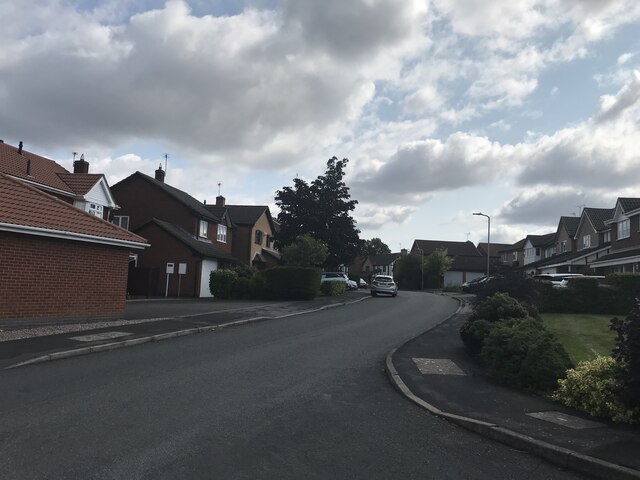
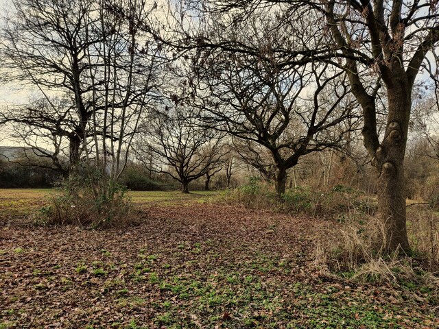
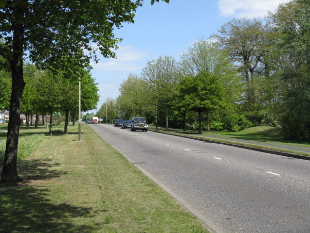
Oakmeadow Spinney is a charming woodland located in Leicestershire, England. Spanning over several acres, this picturesque spinney is a haven for nature enthusiasts and those seeking a serene escape from the hustle and bustle of daily life.

The spinney is predominantly composed of oak trees, which lend the area its name. These majestic trees provide a dense canopy that filters sunlight, creating a cool and tranquil atmosphere within the spinney. The forest floor is covered with a lush carpet of moss, ferns, and wildflowers, adding to the area's natural beauty.

Within Oakmeadow Spinney, visitors can find a variety of plant and animal species. The woodland is home to an array of bird species, including woodpeckers, thrushes, and owls, making it a popular spot for birdwatching. Squirrels can be spotted darting among the branches, while rabbits and foxes occasionally roam the forest floor.

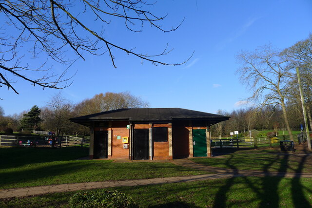
Nature trails wind through the spinney, allowing visitors to explore its hidden corners and discover its diverse flora and fauna. Picnic areas are scattered throughout the woodland, providing a perfect spot to relax and enjoy the peaceful surroundings.

Oakmeadow Spinney is not only a beautiful natural retreat but also an important ecosystem that supports local biodiversity. The spinney is actively managed by conservation organizations to ensure the preservation of its natural features and to protect its delicate balance.

Whether one seeks solitude, a place to connect with nature, or a peaceful walk, Oakmeadow Spinney offers a tranquil and enchanting experience for visitors of all ages.

If you have any feedback on the listing, please let us know in the comments section below.

Oakmeadow Spinney Images

Images are sourced within 2km of 52.638823/-1.2031989 or Grid Reference SK5404. Thanks to Geograph Open Source API. All images are credited.

Somerset Drive
Somerset Drive
Junction with Kirby Road
St Aidan New Parks This modern Church of England church is on St Oswalds Road New Parks and is the parish church for Kirby Frith, Braunstone Frith and New Parks.
St Aidan New Parks
This modern Church of England church is on St Oswalds Road New Parks and is the parish church for Kirby Frith, Braunstone Frith and New Parks.
St Aidan New Parks sign This modern Church of England church is on St Oswalds Road New Parks and is the parish church for Kirby Frith, Braunstine Frith and New Parks.
St Aidan New Parks sign
This modern Church of England church is on St Oswalds Road New Parks and is the parish church for Kirby Frith, Braunstine Frith and New Parks.
Kirby Frith Nature Area Next to Cherry Hills Road in the Kirby Frith area of Leicester.
Kirby Frith Nature Area
Next to Cherry Hills Road in the Kirby Frith area of Leicester.
Kirby Muxloe Castle and Moat <span class="nowrap"><a title="https://historicengland.org.uk/listing/the-list/list-entry/1013323?section=official-listing" rel="nofollow ugc noopener" href="https://historicengland.org.uk/listing/the-list/list-entry/1013323?section=official-listing">Link</a><img style="margin-left:2px;" alt="External link" title="External link - shift click to open in new window" src="https://s1.geograph.org.uk/img/external.png" width="10" height="10"/></span>
Kirby Muxloe Castle and Moat
Public convenience, Western Park, Leicester Closed
Public convenience, Western Park, Leicester
Closed
Bandstand, Western Park, Leicester "An early-20th century octagonal bandstand that forms a focal point to views up the hill within Western Park. The bandstand is not part of the original design of Western Park, which was opened in 1899 as a municipal public park following the acquisition of the land by the Leicester Corporation, ..." [Local Heritage Asset Register, Leicester City Council]
Bandstand, Western Park, Leicester
"An early-20th century octagonal bandstand that forms a focal point to views up the hill within Western Park. The bandstand is not part of the original design of Western Park, which was opened in 1899 as a municipal public park following the acquisition of the land by the Leicester Corporation, ..." [Local Heritage Asset Register, Leicester City Council]
Western Park (part of), Leicester The park was bought for £30,000 in 1897, and at 178 acres is the largest in Leicester.
Western Park (part of), Leicester
The park was bought for £30,000 in 1897, and at 178 acres is the largest in Leicester.
The Burton on Trent-Leicester line  Freight only, but with plans to re-open to passenger traffic. <span class="nowrap"><a title="https://en.wikipedia.org/wiki/Leicester%E2%80%93Burton_upon_Trent_line" rel="nofollow ugc noopener" href="https://en.wikipedia.org/wiki/Leicester%E2%80%93Burton_upon_Trent_line">Link</a><img style="margin-left:2px;" alt="External link" title="External link - shift click to open in new window" src="https://s1.geograph.org.uk/img/external.png" width="10" height="10"/></span>
The Burton on Trent-Leicester line
Freight only, but with plans to re-open to passenger traffic. LinkExternal link
Kirby Muxloe Castle The west tower remains viewed from the courtyard
Kirby Muxloe Castle
The west tower remains viewed from the courtyard
Braunstone Lane, Braunstone Town, Leicester
Londis shop, Sun Way, Braunstone, Leicester Run as franchises; owned by Tescos
Londis shop, Sun Way, Braunstone, Leicester
Run as franchises; owned by Tescos
Table Table restaurant, Hinkley Road, Leicester Fronting a Premier Inn (both owned by the Whitbread Group), and close to the M1.
Table Table restaurant, Hinkley Road, Leicester
Fronting a Premier Inn (both owned by the Whitbread Group), and close to the M1.
The M1 passing the west side of Leicester Seen from the Hinkley Road (A47) bridge
The M1 passing the west side of Leicester
Seen from the Hinkley Road (A47) bridge
Midland Railway's Leicester to Coalville line One of the oldest lines in England. Currently freight only, but with hopes of restoring passenger services.
Midland Railway's Leicester to Coalville line
One of the oldest lines in England. Currently freight only, but with hopes of restoring passenger services.
Samworth Brothers Supply Chain, Oak Meadow, Leicester - 1 Part of the massive distribution centre for this family-run food production company <span class="nowrap"><a title="https://www.samworthbrothers.co.uk/" rel="nofollow ugc noopener" href="https://www.samworthbrothers.co.uk/">Link</a><img style="margin-left:2px;" alt="External link" title="External link - shift click to open in new window" src="https://s1.geograph.org.uk/img/external.png" width="10" height="10"/></span>
Samworth Brothers Supply Chain, Oak Meadow, Leicester - 1
Part of the massive distribution centre for this family-run food production company LinkExternal link
Samworth Brothers Supply Chain, Oak Meadow, Leicester - 2 Entrance to the massive distribution centre for this family-run food production company <span class="nowrap"><a title="https://www.samworthbrothers.co.uk/" rel="nofollow ugc noopener" href="https://www.samworthbrothers.co.uk/">Link</a><img style="margin-left:2px;" alt="External link" title="External link - shift click to open in new window" src="https://s1.geograph.org.uk/img/external.png" width="10" height="10"/></span>
Samworth Brothers Supply Chain, Oak Meadow, Leicester - 2
Entrance to the massive distribution centre for this family-run food production company LinkExternal link
Show me another place!

Oakmeadow Spinney is located at Grid Ref: SK5404 (Lat: 52.638823, Lng: -1.2031989)

Unitary Authority: Leicester

Police Authority: Leicestershire

What 3 Words

///jabs.sketch.fades. Near Glenfield, Leicestershire

Related Wikis

Kirby Frith Nature Reserve

Kirby Frith is a 2.1-hectare (5.2-acre) Local Nature Reserve on the western outskirts of Leicester. It is owned and managed by Leicester City Council...

Glenfield, Leicestershire

Glenfield is a large village and former civil parish, now in the parish of Glenfields, in the Blaby district of Leicestershire, England. At the 2011 Census...

A563 road

The A563 is the designation for the ring road of Leicester, England. It forms a near-complete circuit except for a gap of around 2.2 miles (3.5 km) in...

New College Leicester

New College Leicester (formed in 1999/2000 in a merger between New Parks Community College, Alderman Newton's School, and Wycliffe Community College) is...

Kirby Muxloe Castle

Kirby Muxloe Castle, also known historically as Kirby Castle, is a ruined, fortified manor house in Kirby Muxloe, Leicestershire, England. William, Lord...

Kirby Muxloe F.C.

Kirby Muxloe Football Club is a football club based in Kirby Muxloe, Leicestershire, England. They are currently members of the United Counties League...

Western Park, Leicester

Western Park is a park and surrounding suburb located in West End of Leicester. It is also a ward of the City of Leicester whose population at the 2011...

Western Park Open Air School

The Western Park Open Air School, situated in Western Park, was the first open air school in Leicester, for children with respiratory problems. It opened...

Nearby Amenities

Located within 500m of 52.638823,-1.2031989
Doctors
Oakmeadow Surgery
Addr City: Leicester
Addr Street: Tatlow Road
Healthcare: doctor
Lat/Long: 52.6403434/-1.1990395
Kirby Frith
Place: suburb
Lat/Long: 52.6362384/-1.198593
Barrier: cycle_barrier
Bicycle: yes
Foot: yes
Horse: no
Motor Vehicle: no
Lat/Long: 52.6418661/-1.1994774
Barrier: stile
Material: wood
Source: survey
Step Count: 0
Stile: stepover
Lat/Long: 52.6355307/-1.2018077
Generator Method: photovoltaic
Generator Output Electricity: yes
Generator Source: solar
Generator Type: solar_photovoltaic_panel
Location: rii
Power: generator
Lat/Long: 52.6402203/-1.1965326
Generator Method: photovoltaic
Generator Output Electricity: yes
Generator Source: solar
Generator Type: solar_photovoltaic_panel
Location: rii
Power: generator
Lat/Long: 52.6402626/-1.1968196
Generator Method: photovoltaic
Generator Output Electricity: yes
Generator Source: solar
Generator Type: solar_photovoltaic_panel
Location: rii
Power: generator
Lat/Long: 52.6404905/-1.196656
Generator Method: photovoltaic
Generator Output Electricity: yes
Generator Source: solar
Generator Type: solar_photovoltaic_panel
Location: rii
Power: generator
Lat/Long: 52.6400591/-1.1972729
Generator Method: photovoltaic
Generator Output Electricity: yes
Generator Source: solar
Generator Type: solar_photovoltaic_panel
Location: rii
Power: generator
Lat/Long: 52.6406711/-1.1978496
Generator Method: photovoltaic
Generator Output Electricity: yes
Generator Source: solar
Generator Type: solar_photovoltaic_panel
Location: rii
Power: generator
Lat/Long: 52.6412685/-1.1983699
Generator Method: photovoltaic
Generator Output Electricity: yes
Generator Source: solar
Generator Type: solar_photovoltaic_panel
Location: rii
Power: generator
Lat/Long: 52.6412961/-1.1984263
Generator Method: photovoltaic
Generator Output Electricity: yes
Generator Source: solar
Generator Type: solar_photovoltaic_panel
Location: rii
Power: generator
Lat/Long: 52.6413189/-1.1985201
Generator Method: photovoltaic
Generator Output Electricity: yes
Generator Source: solar
Generator Type: solar_photovoltaic_panel
Location: rii
Power: generator
Lat/Long: 52.6413563/-1.1986006
Generator Method: photovoltaic
Generator Output Electricity: yes
Generator Source: solar
Generator Type: solar_photovoltaic_panel
Location: rii
Power: generator
Lat/Long: 52.6405409/-1.2009341
Generator Method: photovoltaic
Generator Output Electricity: yes
Generator Source: solar
Generator Type: solar_photovoltaic_panel
Location: rii
Power: generator
Lat/Long: 52.6411236/-1.2011085
Generator Method: photovoltaic
Generator Output Electricity: yes
Generator Source: solar
Generator Type: solar_photovoltaic_panel
Location: rii
Power: generator
Lat/Long: 52.6421783/-1.1996976
Generator Method: photovoltaic
Generator Output Electricity: yes
Generator Source: solar
Generator Type: solar_photovoltaic_panel
Location: rii
Power: generator
Lat/Long: 52.6422548/-1.1986569
Generator Method: photovoltaic
Generator Output Electricity: yes
Generator Source: solar
Generator Type: solar_photovoltaic_panel
Location: rii
Power: generator
Lat/Long: 52.6420513/-1.2021224
Generator Method: photovoltaic
Generator Output Electricity: yes
Generator Source: solar
Generator Type: solar_photovoltaic_panel
Location: rii
Power: generator
Lat/Long: 52.6420692/-1.202404
Generator Method: photovoltaic
Generator Output Electricity: yes
Generator Source: solar
Generator Type: solar_photovoltaic_panel
Location: rii
Power: generator
Lat/Long: 52.6421001/-1.20264
Generator Method: photovoltaic
Generator Output Electricity: yes
Generator Source: solar
Generator Type: solar_photovoltaic_panel
Location: rii
Power: generator
Lat/Long: 52.6421034/-1.2029807
Generator Method: photovoltaic
Generator Output Electricity: yes
Generator Source: solar
Generator Type: solar_photovoltaic_panel
Location: rii
Power: generator
Lat/Long: 52.6428472/-1.2041045
Generator Method: photovoltaic
Generator Output Electricity: yes
Generator Source: solar
Generator Type: solar_photovoltaic_panel
Location: rii
Power: generator
Lat/Long: 52.643132/-1.2030048
Generator Method: photovoltaic
Generator Output Electricity: yes
Generator Source: solar
Generator Type: solar_photovoltaic_panel
Location: rii
Power: generator
Lat/Long: 52.6428667/-1.2047402
Generator Method: photovoltaic
Generator Output Electricity: yes
Generator Source: solar
Generator Type: solar_photovoltaic_panel
Location: rii
Power: generator
Lat/Long: 52.6425526/-1.2042869
Generator Method: photovoltaic
Generator Output Electricity: yes
Generator Source: solar
Generator Type: solar_photovoltaic_panel
Location: rii
Power: generator
Lat/Long: 52.636558/-1.1986087
Generator Method: photovoltaic
Generator Output Electricity: yes
Generator Source: solar
Generator Type: solar_photovoltaic_panel
Location: rii
Power: generator
Lat/Long: 52.6365889/-1.198547
Generator Method: photovoltaic
Generator Output Electricity: yes
Generator Source: solar
Generator Type: solar_photovoltaic_panel
Location: rii
Power: generator
Lat/Long: 52.636628/-1.1984477
Generator Method: photovoltaic
Generator Output Electricity: yes
Generator Source: solar
Generator Type: solar_photovoltaic_panel
Location: rii
Power: generator
Lat/Long: 52.636392/-1.1982251
Generator Method: photovoltaic
Generator Output Electricity: yes
Generator Source: solar
Generator Type: solar_photovoltaic_panel
Location: rii
Power: generator
Lat/Long: 52.6363724/-1.1982895
Generator Method: photovoltaic
Generator Output Electricity: yes
Generator Source: solar
Generator Type: solar_photovoltaic_panel
Location: rii
Power: generator
Lat/Long: 52.6360518/-1.1985577
Generator Method: photovoltaic
Generator Output Electricity: yes
Generator Source: solar
Generator Type: solar_photovoltaic_panel
Location: rii
Power: generator
Lat/Long: 52.6360029/-1.1985979
Generator Method: photovoltaic
Generator Output Electricity: yes
Generator Source: solar
Generator Type: solar_photovoltaic_panel
Location: rii
Power: generator
Lat/Long: 52.6358711/-1.1988447
Generator Method: photovoltaic
Generator Output Electricity: yes
Generator Source: solar
Generator Type: solar_photovoltaic_panel
Location: rii
Power: generator
Lat/Long: 52.6365857/-1.1993865
Generator Method: photovoltaic
Generator Output Electricity: yes
Generator Source: solar
Generator Type: solar_photovoltaic_panel
Location: rii
Power: generator
Lat/Long: 52.6365531/-1.1994616
Generator Method: photovoltaic
Generator Output Electricity: yes
Generator Source: solar
Generator Type: solar_photovoltaic_panel
Location: rii
Power: generator
Lat/Long: 52.6364896/-1.1996038
Generator Method: photovoltaic
Generator Output Electricity: yes
Generator Source: solar
Generator Type: solar_photovoltaic_panel
Location: rii
Power: generator
Lat/Long: 52.6364538/-1.1996654
Generator Method: photovoltaic
Generator Output Electricity: yes
Generator Source: solar
Generator Type: solar_photovoltaic_panel
Location: rii
Power: generator
Lat/Long: 52.6368331/-1.1988125
Generator Method: photovoltaic
Generator Output Electricity: yes
Generator Source: solar
Generator Type: solar_photovoltaic_panel
Location: rii
Power: generator
Lat/Long: 52.6369389/-1.2012211
Generator Method: photovoltaic
Generator Output Electricity: yes
Generator Source: solar
Generator Type: solar_photovoltaic_panel
Location: rii
Power: generator
Lat/Long: 52.6369926/-1.2031496
Generator Method: photovoltaic
Generator Output Electricity: yes
Generator Source: solar
Generator Type: solar_photovoltaic_panel
Location: rii
Power: generator
Lat/Long: 52.6368917/-1.2035707
Generator Method: photovoltaic
Generator Output Electricity: yes
Generator Source: solar
Generator Type: solar_photovoltaic_panel
Location: rii
Power: generator
Lat/Long: 52.6364961/-1.2021545
Generator Method: photovoltaic
Generator Output Electricity: yes
Generator Source: solar
Generator Type: solar_photovoltaic_panel
Location: rii
Power: generator
Lat/Long: 52.6352753/-1.2007088
Generator Method: photovoltaic
Generator Output Electricity: yes
Generator Source: solar
Generator Type: solar_photovoltaic_panel
Location: rii
Power: generator
Lat/Long: 52.6353665/-1.2005533
Generator Method: photovoltaic
Generator Output Electricity: yes
Generator Source: solar
Generator Type: solar_photovoltaic_panel
Location: roof
Power: generator
Lat/Long: 52.6427608/-1.2002499
The data included in this document is from www.openstreetmap.org. The data is made available under ODbL.

Have you been to Oakmeadow Spinney?

Leave your review of Oakmeadow Spinney below (or comments, questions and feedback).