Ewer's Copse

Wood, Forest in Oxfordshire South Oxfordshire

England

Ewer's Copse

End of the platform, Culham Station Looking northwards along the railway towards Oxford. On the right you can see one of the old WW2 aircraft hangars on the old Culham Airfield site. Now a business estate, a fair number of the original wartime buildings are still being used.
End of the platform, Culham Station Credit: Des Blenkinsopp

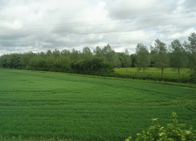
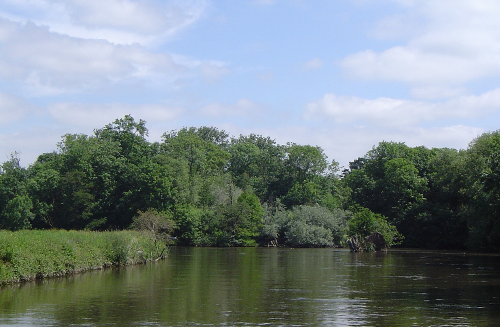
Ewer's Copse is a small wood located in Oxfordshire, England. Situated in the heart of the county, it covers an area of approximately 20 acres. The copse is known for its dense and diverse forest, encompassing various species of trees such as oak, beech, and ash.

The wood is home to a rich array of wildlife, with numerous species of birds, mammals, and insects inhabiting the area. Visitors to Ewer's Copse can expect to see woodland birds such as woodpeckers, tits, and thrushes, as well as small mammals like rabbits and squirrels.

The copse is accessible through a network of footpaths and trails, allowing visitors to explore the wood and appreciate its natural beauty. The paths wind through the trees, providing a peaceful and tranquil environment for walkers, joggers, and nature enthusiasts.

Ewer's Copse has a long history, and evidence of human activity in the area dates back centuries. The wood was traditionally managed for timber production, and remnants of old forestry practices can still be seen in the form of coppiced trees and fallen logs.

Today, the copse is a protected site, managed by local authorities to ensure the preservation of its unique ecosystem. It serves as an important green space for the local community, offering a place for relaxation, recreation, and appreciation of nature. Ewer's Copse is a hidden gem in Oxfordshire, inviting visitors to immerse themselves in the beauty of its woodland surroundings.

If you have any feedback on the listing, please let us know in the comments section below.

Ewer's Copse Images

Images are sourced within 2km of 51.667872/-1.2241455 or Grid Reference SU5396. Thanks to Geograph Open Source API. All images are credited.

End of the platform, Culham Station Looking northwards along the railway towards Oxford. On the right you can see one of the old WW2 aircraft hangars on the old Culham Airfield site. Now a business estate, a fair number of the original wartime buildings are still being used.
End of the platform, Culham Station
Looking northwards along the railway towards Oxford. On the right you can see one of the old WW2 aircraft hangars on the old Culham Airfield site. Now a business estate, a fair number of the original wartime buildings are still being used.
St Michael’s Church, Clifton Hampden Showing the church on the steep bank above the River Thames
St Michael’s Church, Clifton Hampden
Showing the church on the steep bank above the River Thames
St Michael’s Church, Clifton Hampden St Michael’s Church and the steep bank down to the River Thames
St Michael’s Church, Clifton Hampden
St Michael’s Church and the steep bank down to the River Thames
St Michael’s Church and River Thames, Clifton Hampden A view from the road bridge across the River Thames
St Michael’s Church and River Thames, Clifton Hampden
A view from the road bridge across the River Thames
River Thames at Clifton Hampden View along river showing the different height of the banks on either side of the river
River Thames at Clifton Hampden
View along river showing the different height of the banks on either side of the river
Clifton Hampden Bridge A view of the bridge from the north
Clifton Hampden Bridge
A view of the bridge from the north
St Michael’s Church, Clifton Hampden A view across the River Thames showing the river cliff on the northern bank
St Michael’s Church, Clifton Hampden
A view across the River Thames showing the river cliff on the northern bank
Clifton Hampden Manor House A view across the River Thames showing the height of the river cliff on which the Manor House sits
Clifton Hampden Manor House
A view across the River Thames showing the height of the river cliff on which the Manor House sits
Old All Saints, Nuneham Courtenay
Carfax Conduit The Carfax Conduit was a water conduit that supplied the city of Oxford with water from 1610 until 1797, when the structure was replaced with a smaller cistern that continued to supply water to the city until 1869. The original structure was given to the Earl Harcourt, who re-erected it on this site.
Carfax Conduit
The Carfax Conduit was a water conduit that supplied the city of Oxford with water from 1610 until 1797, when the structure was replaced with a smaller cistern that continued to supply water to the city until 1869. The original structure was given to the Earl Harcourt, who re-erected it on this site.
Crop field and woodland South of Radley.
Crop field and woodland
South of Radley.
River Thames near Abingdon
Cereal crop near Culham Station
Murco Garage near Clifton Hampden
Overgrown hedgerow on A415
Thames Path flooded
Thames Path flooded
Pumney Farm
Pumney Farm
Boathouse on the River Thames
Show me another place!

Ewer's Copse is located at Grid Ref: SU5396 (Lat: 51.667872, Lng: -1.2241455)

Administrative County: Oxfordshire

District: South Oxfordshire

Police Authority: Thames Valley

What 3 Words

///soulful.mergers.clays. Near Radley, Oxfordshire

Nearby Locations

Ewer's Copse Furze Brake

Related Wikis

Lock Wood Island

Lock Wood Island is an island in the River Thames in England just downstream of Nuneham House on the reach above Abingdon Lock. The island sits on a sharp...

Carfax Conduit

The Carfax Conduit was a water conduit that supplied the city of Oxford with water from 1610 until 1869. The conduit ran in an underground lead pipe from...

Joint European Torus

The Joint European Torus (JET) was a magnetically confined plasma physics experiment, located at Culham Centre for Fusion Energy in Oxfordshire, UK. Based...

Culham Centre for Fusion Energy

The Culham Centre for Fusion Energy (CCFE) is the UK's national laboratory for fusion research. It is located at the Culham Science Centre, near Culham...

Small Tight Aspect Ratio Tokamak

The Small Tight Aspect Ratio Tokamak, or START was a nuclear fusion experiment that used magnetic confinement to hold plasma. START was the first full...

RNAS Culham (HMS Hornbill)

Royal Naval Air Station Culham (RNAS Culham, also known as HMS Hornbill) was a former Royal Navy, Fleet Air Arm station near Culham, Oxfordshire. It opened...

Mega Ampere Spherical Tokamak

Mega Ampere Spherical Tokamak (MAST) was a nuclear fusion experiment, testing a spherical tokamak nuclear fusion reactor, and commissioned by EURATOM/UKAEA...

Nuneham Viaduct

Nuneham Viaduct, also known as Nuneham Railway Bridge and the Black Bridge is near the town of Abingdon-on-Thames in Oxfordshire, England. It is a two...

Nearby Amenities

Located within 500m of 51.667872,-1.2241455
Power: tower
Lat/Long: 51.669613/-1.2234436
Power: tower
Lat/Long: 51.6679149/-1.2266059
The data included in this document is from www.openstreetmap.org. The data is made available under ODbL.

Have you been to Ewer's Copse?

Leave your review of Ewer's Copse below (or comments, questions and feedback).