Silford Copse

Wood, Forest in Hampshire Winchester

England

Silford Copse

"The Railway" at Botley A pub in the Greene King Brewery estate on Station Hill opposite the entrance to Botley station.
"The Railway" at Botley Credit: Des Blenkinsopp

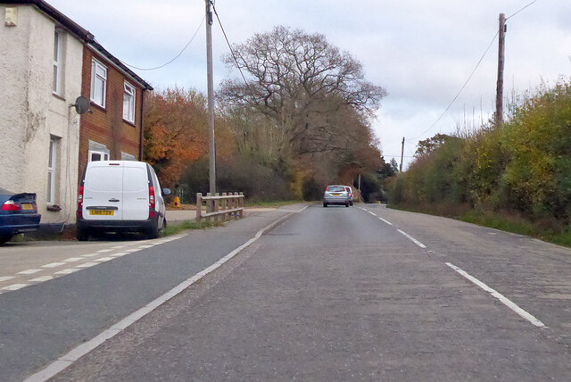
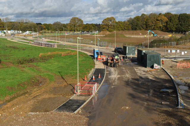
Silford Copse is a picturesque woodland located in the county of Hampshire, England. Covering an area of approximately 100 acres, it is a popular destination for nature enthusiasts and those seeking tranquility amidst the beauty of nature. The copse is situated near the town of Silford, just a short drive from the bustling city of Winchester.

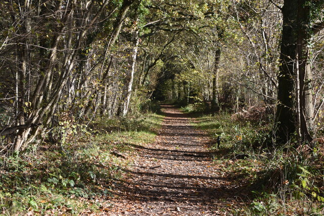
The woodland is predominantly made up of broadleaf trees, including oak, beech, and ash, which create a dense and lush canopy overhead. These trees provide a haven for a diverse range of wildlife, making Silford Copse a haven for birdwatchers and wildlife photographers. Visitors may be lucky enough to spot species such as woodpeckers, owls, and various songbirds.

The forest floor of Silford Copse is carpeted with a rich tapestry of wildflowers, ferns, and mosses, creating a vibrant and ever-changing landscape throughout the seasons. In spring, the copse is transformed into a riot of colors as bluebells, primroses, and wild garlic adorn the forest floor.

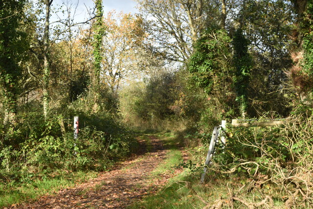
Several well-maintained footpaths meander through Silford Copse, allowing visitors to explore its natural wonders at their own pace. These paths lead to secluded clearings, where benches have been strategically placed, providing the perfect spot for reflection and relaxation. There is also a small stream that runs through the copse, adding to its charm and providing a serene backdrop for a peaceful walk.

Silford Copse offers a true escape from the hustle and bustle of everyday life, inviting visitors to immerse themselves in the beauty of nature and experience a sense of tranquility in its serene surroundings.

If you have any feedback on the listing, please let us know in the comments section below.

Silford Copse Images

Images are sourced within 2km of 50.910633/-1.2422319 or Grid Reference SU5312. Thanks to Geograph Open Source API. All images are credited.

"The Railway" at Botley A pub in the Greene King Brewery estate on Station Hill opposite the entrance to Botley station.
"The Railway" at Botley
A pub in the Greene King Brewery estate on Station Hill opposite the entrance to Botley station.
Station Hill, Botley Part of a small business estate along Hillsons Road off to the left.
The station is beyond the trees in the background.
Station Hill, Botley
Part of a small business estate along Hillsons Road off to the left. The station is beyond the trees in the background.
A334 towards Wickham
A334 towards Wickham Leaving Botley, crossing the River Hamble.
A334 towards Wickham
Leaving Botley, crossing the River Hamble.
Newly built houses in Brunel Way, Whiteley The houses are complete and occupied, but the road surface is still in need of some attention.
Newly built houses in Brunel Way, Whiteley
The houses are complete and occupied, but the road surface is still in need of some attention.
New housing nearing completion on Bluebell Way, Whiteley
Tree-lined footpath, Whiteley
New road under construction, Whiteley Taken from a temporary footbridge enabling the footpath to pass over the area controlled by the developers.
New road under construction, Whiteley
Taken from a temporary footbridge enabling the footpath to pass over the area controlled by the developers.
New road under construction, Whiteley Taken from a temporary footbridge enabling the footpath to pass over the area controlled by the developers.
New road under construction, Whiteley
Taken from a temporary footbridge enabling the footpath to pass over the area controlled by the developers.
Drainage work on Whiteley Way The contractors are working on a balancing pond and drainage beside this newly-constructed section of Whiteley Way. The present extent of new housing is visible in the distance. Photo taken from a temporary footbridge enabling the footpath to pass over the area controlled by the developers.
Drainage work on Whiteley Way
The contractors are working on a balancing pond and drainage beside this newly-constructed section of Whiteley Way. The present extent of new housing is visible in the distance. Photo taken from a temporary footbridge enabling the footpath to pass over the area controlled by the developers.
Track branching away from footpath, Whiteley
Botley: on Platform 2 This is the line from Fareham to Eastleigh (ahead). The original station buildings - with the exception of the boarded-up signal box - have been demolished and Botley is now an unstaffed halt. The late Ben Brooksbank's <a href="https://www.geograph.org.uk/photo/1859055">SU5213 : Botley Station</a> shows it as it was in 1963.
Botley: on Platform 2
This is the line from Fareham to Eastleigh (ahead). The original station buildings - with the exception of the boarded-up signal box - have been demolished and Botley is now an unstaffed halt. The late Ben Brooksbank's SU5213 : Botley Station shows it as it was in 1963.
Approaching Botley Station The Railway Inn is on the right of the A334, opposite the station (which is masked by trees and part of an industrial estate).
Approaching Botley Station
The Railway Inn is on the right of the A334, opposite the station (which is masked by trees and part of an industrial estate).
Botley: at the corner of Church Lane and Mill Hill High Street is to the left and Winchester Street ahead. The house on the corner is one of many fine Grade II listed 18th-century houses in Botley. The bricks of the single-storey wing on the right are laid in Chinese bond - on their sides, rather than laid flat, they appear larger than bricks laid normally.
Botley: at the corner of Church Lane and Mill Hill
High Street is to the left and Winchester Street ahead. The house on the corner is one of many fine Grade II listed 18th-century houses in Botley. The bricks of the single-storey wing on the right are laid in Chinese bond - on their sides, rather than laid flat, they appear larger than bricks laid normally.
Botley: former maltings, Church Lane Now residential.
Botley: former maltings, Church Lane
Now residential.
Botley: north along Church Lane Looking past  Grade II listed Ivy Cottage towards the former maltings on an April evening.
Botley: north along Church Lane
Looking past Grade II listed Ivy Cottage towards the former maltings on an April evening.
Botley: Cobbetts Cottage, Church Lane This Grade II listed 18th-century house is the only remaining part of the estate of William Cobbett, pamphleteer, journalist and author of "Rural Rides". The south wall is slate-hung.
Botley: Cobbetts Cottage, Church Lane
This Grade II listed 18th-century house is the only remaining part of the estate of William Cobbett, pamphleteer, journalist and author of "Rural Rides". The south wall is slate-hung.
Show me another place!

Silford Copse is located at Grid Ref: SU5312 (Lat: 50.910633, Lng: -1.2422319)

Administrative County: Hampshire

District: Winchester

Police Authority: Hampshire

What 3 Words

///collected.command.claps. Near Botley, Hampshire

Nearby Locations

Hole Copse Silford Copse

Related Wikis

The Curdridge Country Show

The Curdridge Country Show is an annual country fair in Curdridge, Hampshire, England. The event is held mid-July on a Saturday, and attracts up to 7000...

Curdridge

Curdridge is a village and civil parish within the City of Winchester district of Hampshire, England. The parish also contains the similarly named village...

Botley railway station

Botley railway station serves Botley and the surrounding areas in the English county of Hampshire. The station is on the railway line between Eastleigh...

Curbridge, Hampshire

Curbridge is a village and former civil parish, now in the parish of Curdridge, in the Winchester district, in the county of Hampshire, England. In 1951...

Strawberry Trail

The Strawberry Trail is a 15-mile footpath through Hampshire, England The trail is part linear and part circular. The linear section connects Botley to...

Botley, Hampshire

Botley is a historic village in Hampshire, England. The village was once described as "the most delightful village in the world" by 18th century journalist...

Shedfield

Shedfield is a village and civil parish in the City of Winchester district of Hampshire, England. In the 2001 UK Census, Shedfield had a population of...

Edward Sparshott

Edward Sparshott (3 March 1788 – 9 November 1873) was an English officer of the Royal Navy, serving during the Napoleonic Wars. As midshipman on HMS Centaur...

Nearby Amenities

Located within 500m of 50.910633,-1.2422319
Power: tower
Ref: 49
Source: interpolation
Lat/Long: 50.9111503/-1.2486221
Power: tower
Ref: 48
Source: interpolation
Lat/Long: 50.9096907/-1.2460378
Power: tower
Ref: 47
Source: interpolation
Lat/Long: 50.9074451/-1.2426399
Noexit: yes
Lat/Long: 50.9106845/-1.2433029
The data included in this document is from www.openstreetmap.org. The data is made available under ODbL.

Have you been to Silford Copse?

Leave your review of Silford Copse below (or comments, questions and feedback).