Moor Copse
Wood, Forest in Hampshire Winchester
England
Moor Copse

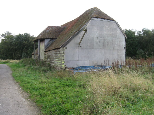
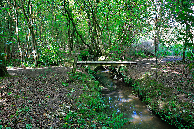
Moor Copse is a beautiful woodland located in Hampshire, England. Covering an area of approximately 400 acres, it is a designated Site of Special Scientific Interest (SSSI) due to its rich biodiversity and unique habitat.
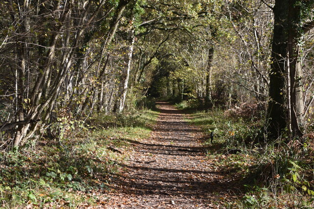
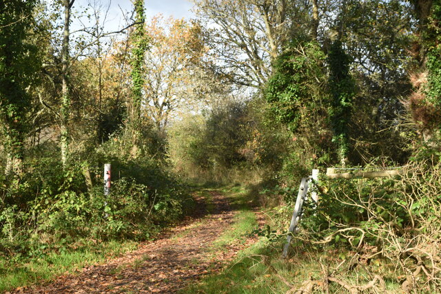
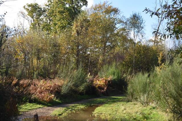
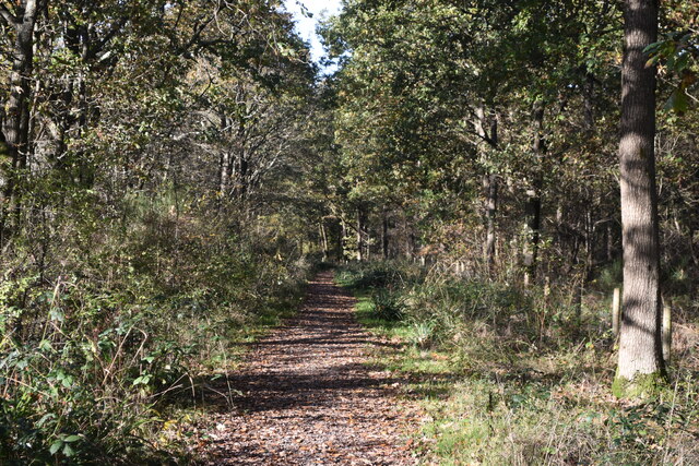
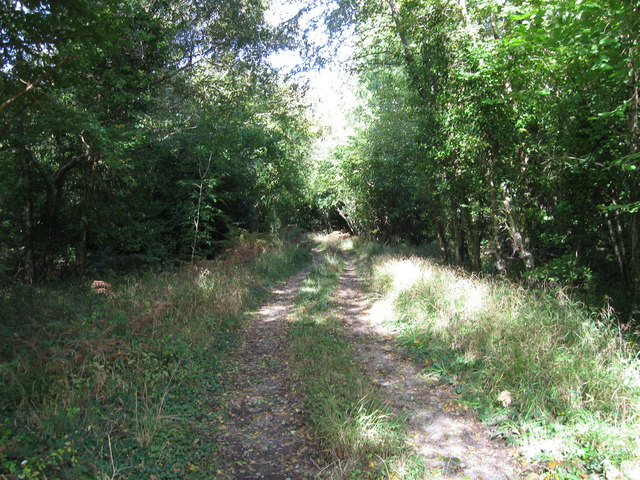
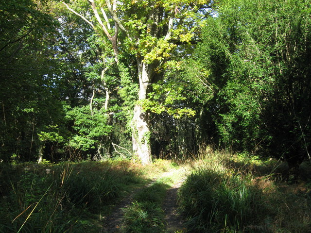
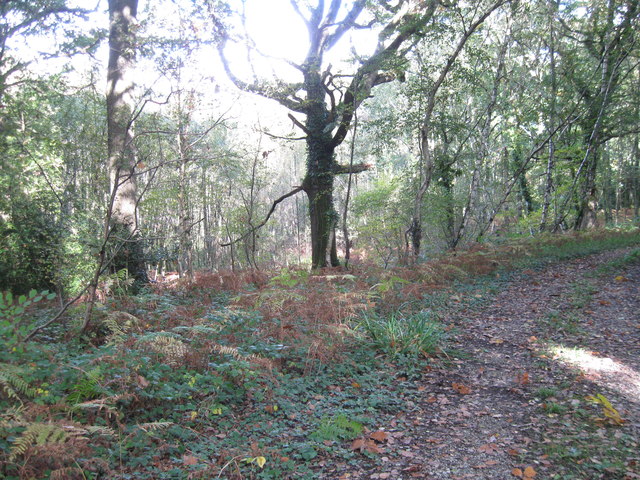
The woodland is predominantly composed of ancient oak and ash trees, which have been standing for centuries and provide a majestic backdrop for visitors. The diverse range of flora and fauna found within Moor Copse is truly remarkable. It is home to over 300 species of flowering plants, including bluebells, primroses, and wood anemones, which create a stunning carpet of colors during the spring months.
The forest also serves as a haven for wildlife. Visitors may be lucky enough to spot a range of bird species, including the rare nightingale. Other animals that call Moor Copse their home include badgers, foxes, and various species of bats. The woodland is also home to several ponds, which attract an array of amphibians and insects.
The area is a popular destination for nature enthusiasts and offers a network of well-maintained footpaths, allowing visitors to explore the woodland at their own leisure. The peaceful atmosphere and serene surroundings make it an ideal location for those seeking tranquility and a break from the hustle and bustle of everyday life.
Moor Copse is managed by the Berkshire, Buckinghamshire, and Oxfordshire Wildlife Trust (BBOWT), who work tirelessly to preserve and protect the natural beauty of the area. They organize various educational and recreational activities throughout the year, including guided walks and wildlife surveys, to engage and educate visitors about the importance of conservation.
Overall, Moor Copse is a hidden gem in Hampshire, offering a unique and enchanting woodland experience for all nature lovers.
If you have any feedback on the listing, please let us know in the comments section below.
Moor Copse Images
Images are sourced within 2km of 50.893549/-1.242509 or Grid Reference SU5310. Thanks to Geograph Open Source API. All images are credited.


Moor Copse is located at Grid Ref: SU5310 (Lat: 50.893549, Lng: -1.242509)
Administrative County: Hampshire
District: Winchester
Police Authority: Hampshire
What 3 Words
///against.greet.firebird. Near Botley, Hampshire
Nearby Locations
Related Wikis
Botley Wood and Everett's and Mushes Copses
Botley Wood and Everett's and Mushes Copses is a 352.7-hectare (872-acre) biological Site of Special Scientific Interest north of Fareham in Hampshire...

Curbridge, Hampshire
Curbridge is a village and former civil parish, now in the parish of Curdridge, in the Winchester district, in the county of Hampshire, England. In 1951...
College of Air Traffic Control
The College of Air Traffic Control or CATC is the main British non-military training establishment for air traffic control (ATC). It also trains people...

Burridge
Burridge is a small village in the Borough of Fareham, south of Hampshire, England. It lies approximately 14 miles south of Winchester on the A3051 between...
Whiteley
Whiteley is a community of (planned) 6,500 homes in the county of Hampshire, England, near Fareham. The development straddles the boundary between two...
Swanwick, Hampshire
Swanwick () is a village in Hampshire, England, east of the River Hamble and north of the M27 motorway. The village is located within the borough of...

Swanwick railway station
Swanwick railway station is a railway station in Fareham, Hampshire, England. Despite its name, it is actually located in Park Gate, one mile south of...
Upper Hamble Estuary and Woods
Upper Hamble Estuary and Woods is a 151.2-hectare (374-acre) biological Site of Special Scientific Interest east of Southampton in Hampshire. It is part...
Nearby Amenities
Located within 500m of 50.893549,-1.242509Have you been to Moor Copse?
Leave your review of Moor Copse below (or comments, questions and feedback).