Low Pasture Wood
Wood, Forest in Yorkshire Ryedale
England
Low Pasture Wood
Low Pasture Wood is a picturesque woodland located in the region of Yorkshire, England. This woodland covers an area of approximately 50 acres and is characterized by its diverse flora and fauna, making it a popular destination for nature enthusiasts.
The wood is primarily composed of a mixture of broadleaf and coniferous trees, creating a vibrant and rich canopy. Among the tree species found in Low Pasture Wood are oak, beech, birch, and pine, providing a varied and visually appealing landscape. The forest floor is covered with a carpet of ferns, mosses, and wildflowers, adding to the enchanting atmosphere of the woodland.
Low Pasture Wood is home to a wide range of wildlife, including various bird species such as woodpeckers, owls, and thrushes. Small mammals like rabbits, squirrels, and voles can also be spotted throughout the wood. Additionally, the woodland serves as a habitat for numerous insects, including butterflies, bees, and beetles.
Visitors to Low Pasture Wood can enjoy a tranquil and immersive experience in nature. The wood offers several walking trails, allowing individuals to explore its scenic beauty at their own pace. These trails wind through the trees, offering glimpses of the surrounding countryside and providing opportunities for birdwatching and nature photography.
Overall, Low Pasture Wood in Yorkshire is a captivating woodland that offers a haven for wildlife and a serene retreat for visitors seeking solace in nature.
If you have any feedback on the listing, please let us know in the comments section below.
Low Pasture Wood Images
Images are sourced within 2km of 54.308882/-1.1929061 or Grid Reference SE5290. Thanks to Geograph Open Source API. All images are credited.
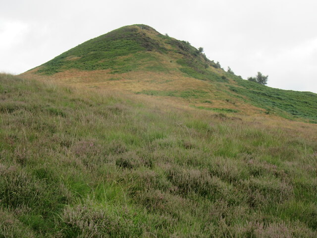


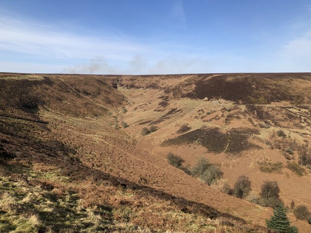
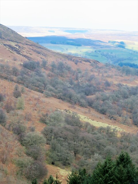
![View over Thorodale Beyond the wall the ground plunges steeply down into the well wooded valley of Thorodale where the hillsides echoed with the sound of gunfire from pheasant shooting [no Geograph contributors were harmed]. Mount Pleasant Farm is visible near the centre of the photo, whilst the northern prow of Hawnby Hill is prominent to the right.](https://s2.geograph.org.uk/geophotos/07/07/24/7072494_177776f2.jpg)


Low Pasture Wood is located at Grid Ref: SE5290 (Lat: 54.308882, Lng: -1.1929061)
Division: North Riding
Administrative County: North Yorkshire
District: Ryedale
Police Authority: North Yorkshire
What 3 Words
///noticing.epidemics.destroyer. Near Bilsdale, North Yorkshire
Related Wikis

Hawnby
Hawnby is a small crossroads village and civil parish in Ryedale in the North York Moors National Park, North Yorkshire, England. The village is about...

Laskill
Laskill is a small hamlet in Bilsdale, 5 miles (8 km) north-west of Helmsley, North Yorkshire, England, on the road from Helmsley to Stokesley and is located...

Bilsdale
Bilsdale is a dale in the western part of the North York Moors in North Yorkshire, England. The head of the dale is at Hasty Bank, and the dale extends...

Holy Trinity Church, Boltby
Holy Trinity Church, Boltby is a parish church in the Church of England: 81 in Boltby. == History == The first chapel was founded in 1409 and was rebuilt...

Boltby
Boltby is a village and civil parish in the Hambleton District of North Yorkshire, England. It is on the edge of the North York Moors National Park at...

Kepwick
Kepwick is a village and civil parish in the Hambleton district of North Yorkshire, England, on the North York Moors and near the A19. The population according...

Cowesby
Cowesby is a village and civil parish in the Hambleton District of North Yorkshire, England. Part of the village including The Cowesby Hall Estate is within...
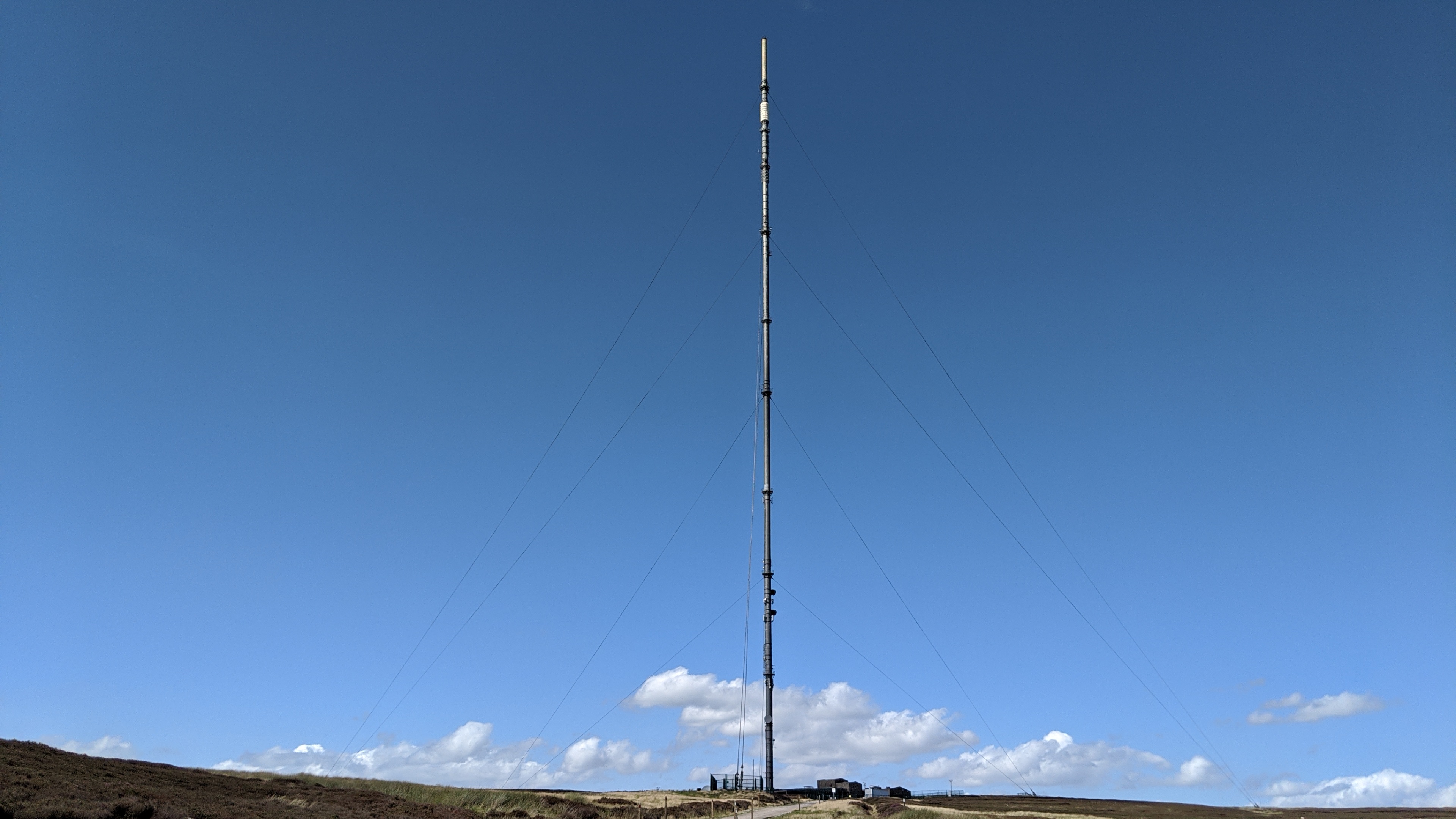
Bilsdale transmitting station
The Bilsdale transmitting station is a broadcasting and telecommunications facility, located at Bilsdale West Moor above Bilsdale, close to Helmsley, North...
Nearby Amenities
Located within 500m of 54.308882,-1.1929061Have you been to Low Pasture Wood?
Leave your review of Low Pasture Wood below (or comments, questions and feedback).