Cave Plantation

Wood, Forest in Yorkshire

England

Cave Plantation

Fordoles Trig Point Flush Bracket S1852
Fordoles Trig Point Flush Bracket S1852 Credit: thejackrustles

Cave Plantation, located in Yorkshire, is a picturesque woodland area known for its natural beauty and rich history. Spanning over a vast area, this forested land offers a tranquil escape for nature enthusiasts and history buffs alike.

The plantation is primarily composed of native trees such as oak, beech, and birch, creating a diverse and vibrant ecosystem. The dense foliage provides a habitat for a variety of wildlife, including deer, foxes, and numerous bird species, making it a popular spot for wildlife observation and birdwatching.

Steeped in history, Cave Plantation is home to ancient cave systems that date back thousands of years. These caves hold archaeological significance, with evidence of human habitation found within. Visitors can explore these caves, marveling at the intricate rock formations and gaining insight into the lives of our ancestors.

In addition to its natural beauty and historical significance, Cave Plantation offers a range of recreational activities for visitors. Hiking and walking trails wind through the forest, providing an opportunity to immerse oneself in the tranquil surroundings. The plantation also offers designated picnic areas, allowing visitors to enjoy a leisurely outdoor meal amidst the greenery.

Cave Plantation is easily accessible, with well-maintained roads and ample parking facilities. It attracts visitors throughout the year, with each season offering its own unique charm. Whether it's the vibrant colors of autumn foliage or the fresh blooms of spring, this woodland paradise never fails to captivate the senses.

Overall, Cave Plantation in Yorkshire is a treasure trove of natural beauty, history, and recreational opportunities. It provides a welcome escape from the hustle and bustle of daily life, offering a serene retreat for those seeking solace in nature.

If you have any feedback on the listing, please let us know in the comments section below.

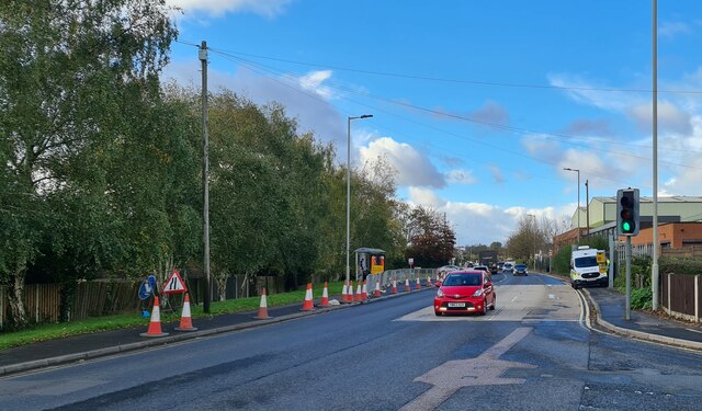
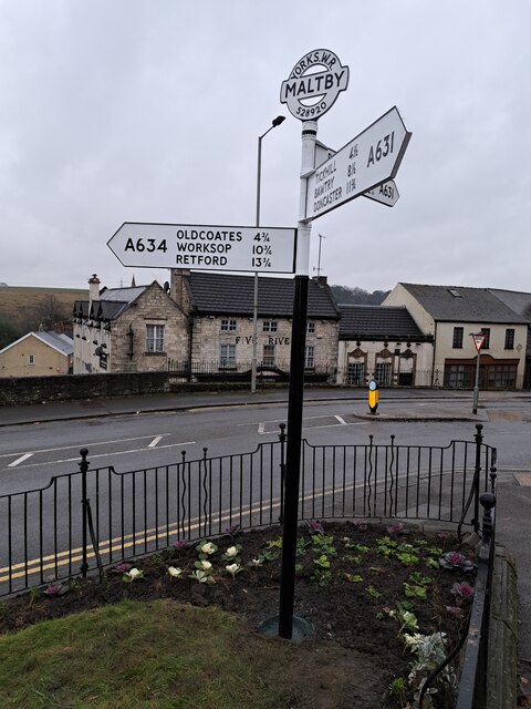
Cave Plantation Images

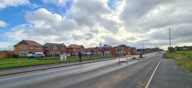
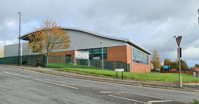
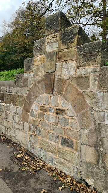
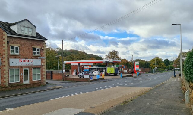
Images are sourced within 2km of 53.423239/-1.2147067 or Grid Reference SK5292. Thanks to Geograph Open Source API. All images are credited.

Fordoles Trig Point Flush Bracket S1852
Hellaby Hall Hellaby Hall in Hellaby, South Yorkshire
Hellaby Hall
Hellaby Hall in Hellaby, South Yorkshire
Grange Lane approaching Maltby
New estate off Grange Lane, Maltby
Salisbury Road, Maltby Old soldiers live here by the looks of the flags and door number plate
Salisbury Road, Maltby
Old soldiers live here by the looks of the flags and door number plate
Former Anglican Church of The Venerable Bede According to the Maltby Neighbourhood Plan 2017- 2028

"This former church (now used for storage by a local company) is of interesting and pleasant design. Built in 1959, its architect was George Pace, now regarded as the foremost ecclesiastical architect of the 20th century in the north of England."
Former Anglican Church of The Venerable Bede
According to the Maltby Neighbourhood Plan 2017- 2028 "This former church (now used for storage by a local company) is of interesting and pleasant design. Built in 1959, its architect was George Pace, now regarded as the foremost ecclesiastical architect of the 20th century in the north of England."
Dale Hill Road, Maltby
Braithwell Road, Maltby
Maltby Leisure Centre
Memorial to R R who died in 1886 Probably the position of a horse trough or public drinking fountain, but who was R R? 

It seems to be on the site of a natural spring.
Memorial to R R who died in 1886
Probably the position of a horse trough or public drinking fountain, but who was R R? It seems to be on the site of a natural spring.
Essar Filling station, Rotherham Road, Maltby Signs of the times, Rubies Dog Grooming Lounge and a Nisalocal shop in the garage.
Essar Filling station, Rotherham Road, Maltby
Signs of the times, Rubies Dog Grooming Lounge and a Nisalocal shop in the garage.
Crystal Hot Hand Car Wash Sign of the times, fuel sales gone to supermarkets and other bigger turnover retailers, car washing no longer the owner's Sunday chore.
Crystal Hot Hand Car Wash
Sign of the times, fuel sales gone to supermarkets and other bigger turnover retailers, car washing no longer the owner's Sunday chore.
Servicing the traffic camera
Shops on Laburnum Parade
Looking towards Hellaby With Rotherham in the distance
Looking towards Hellaby
With Rotherham in the distance
Fordoles Head Lane The trig point must have had a better view when new.
Fordoles Head Lane
The trig point must have had a better view when new.
Direction Sign – Signpost in Maltby Located at the west tip of a railed off grassed enclosure also containing cross YSRO_MAL, east of the junction of the A631 Rotherham Road and A634 Blyth Road. Maltby parish.

3 arms and annulus and bar finial. The Rotherham and Sheffield arm was broken off some time before October 2008 but has been replaced. The whole fingerpost has been missing since at least September 2016, but has been restored and was put back in place on 7 December 2023.

Milestone Society National ID: YW_SK5292
Direction Sign – Signpost in Maltby
Located at the west tip of a railed off grassed enclosure also containing cross YSRO_MAL, east of the junction of the A631 Rotherham Road and A634 Blyth Road. Maltby parish. 3 arms and annulus and bar finial. The Rotherham and Sheffield arm was broken off some time before October 2008 but has been replaced. The whole fingerpost has been missing since at least September 2016, but has been restored and was put back in place on 7 December 2023. Milestone Society National ID: YW_SK5292
Hellaby Hall Country House of c1700, it was derelict for many years and in danger of being demolished until rescued and transformed into a country house hotel.
Hellaby Hall
Country House of c1700, it was derelict for many years and in danger of being demolished until rescued and transformed into a country house hotel.
Show me another place!

Cave Plantation is located at Grid Ref: SK5292 (Lat: 53.423239, Lng: -1.2147067)

Division: West Riding

Unitary Authority: Rotherham

Police Authority: South Yorkshire

What 3 Words

///lyrics.reception.blueberry. Near Maltby, South Yorkshire

Related Wikis

Maltby Academy

Maltby Academy is an academy school in the former mining town of Maltby in South Yorkshire, England. == Admissions == The school has a sixth form. The...

Maltby, South Yorkshire

Maltby is a former mining town and civil parish in the Metropolitan Borough of Rotherham, South Yorkshire, England. It was historically in the West Riding...
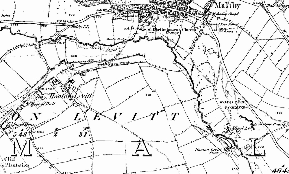
Hooton Levitt

Hooton Levitt (sometimes spelled Hooton Levett) is a village and civil parish in the Metropolitan Borough of Rotherham in South Yorkshire, England; one...

Maltby Main F.C.

Maltby Main Football Club is a football club based in Maltby, Rotherham, South Yorkshire. They are currently members of the Northern Counties East League...

Nearby Amenities

Located within 500m of 53.423239,-1.2147067
Turning Circle
Lat/Long: 53.4231286/-1.2197903
Turning Circle
Lat/Long: 53.4240834/-1.2189906
Turning Circle
Lat/Long: 53.4224518/-1.2217949
Fuel
Created By: Potlatch 0.4c
Operator: Total
Lat/Long: 53.4216263/-1.2124892
Post Box
Brand: Royal Mail
Brand Wikidata: Q638098
Collection Times: Mo-Fr 09:00; Sa 07:00
Location: 53.42500 -1.21495
Operator: Royal Mail
Operator Wikidata: Q638098
Ref: S66 264
Royal Cypher: EIIR
Royal Cypher Wikidata: Q33102113
Lat/Long: 53.4250126/-1.2149613
Bus Stop
Rotherham Road/Cliff Hill
Bus: yes
Naptan AtcoCode: 370030336
Naptan Bearing: E
Naptan CommonName: Rotherham Road/Cliff Hill
Naptan Indicator: 30336
Naptan Landmark: Toll Bar Pub
Naptan PlusbusZoneRef: ROTHCEN
Naptan Street: Rotherham Road
Naptan Verified: no
Public Transport: platform
Source: naptan_import
Lat/Long: 53.4216714/-1.2202002
Bus Stop
Rotherham Road/Blyth Road
Bus: yes
Naptan AtcoCode: 370030523
Naptan Bearing: E
Naptan CommonName: Rotherham Road/Blyth Road
Naptan Indicator: 30523
Naptan Landmark: Maltby Comprehensive School
Naptan PlusbusZoneRef: ROTHCEN
Naptan Street: Rotherham Road
Naptan Verified: no
Public Transport: platform
Source: naptan_import
Lat/Long: 53.422349/-1.2078755
Bus Stop
Rotherham Road/Carr Lane
Bus: yes
Naptan AtcoCode: 370030531
Naptan Bearing: N
Naptan CommonName: Rotherham Road/Carr Lane
Naptan Indicator: 30531
Naptan Landmark: Total Petrol Station
Naptan PlusbusZoneRef: ROTHCEN
Naptan Street: Rotherham Road
Naptan Verified: no
Public Transport: platform
Source: naptan_import
Lat/Long: 53.4215004/-1.214918
Bus Stop
Rotherham Road/Parkhill Farm
Alt Name: Rotherham Road/Parkhill Farm
Bus: yes
Naptan AltCommonName: Rotherham Road/Parkhill Farm
Naptan AtcoCode: 370035017
Naptan Bearing: N
Naptan CommonName: Rotherham Road/Parkhill Farm
Naptan Indicator: 35017
Naptan Landmark: Parkhill Farm
Naptan PlusbusZoneRef: ROTHCEN
Naptan Street: Rotherham Road
Naptan Verified: no
Public Transport: platform
Source: naptan_import
Lat/Long: 53.4214806/-1.2168327
Bus Stop
Rotherham Road/Rolleston Avenue
Bus: yes
Naptan AtcoCode: 370035020
Naptan Bearing: NE
Naptan CommonName: Rotherham Road/Rolleston Avenue
Naptan Indicator: 35020
Naptan Landmark: P.W. PENNINGTON GARAGE
Naptan PlusbusZoneRef: ROTHCEN
Naptan Street: Rotherham Road
Naptan Verified: no
Public Transport: platform
Source: naptan_import
Lat/Long: 53.4218138/-1.2126128
Bus Stop
Rotherham Road/Milton Street
Alt Name: Rotherham Road/Milton Street
Bus: yes
Naptan AltCommonName: Rotherham Road/Milton Street
Naptan AtcoCode: 370035035
Naptan Bearing: W
Naptan CommonName: Rotherham Road/Milton Street
Naptan Indicator: 35035
Naptan Landmark: 35035
Naptan PlusbusZoneRef: ROTHCEN
Naptan Street: Rotherham Road
Naptan Verified: no
Public Transport: platform
Source: naptan_import
Lat/Long: 53.4221853/-1.2086441
Bus Stop
Rotherham Road/All Hallows Drive
Alt Name: Rotherham Road/All Hallows Drive
Bus: yes
Naptan AltCommonName: Rotherham Road/All Hallows Drive
Naptan AtcoCode: 370035445
Naptan Bearing: SW
Naptan CommonName: Rotherham Road/All Hallows Drive
Naptan Indicator: 35445
Naptan Landmark: THE GRANGE/P.W.PENNINGTONS
Naptan PlusbusZoneRef: ROTHCEN
Naptan Street: Rotherham Road
Naptan Verified: no
Public Transport: platform
Source: naptan_import
Lat/Long: 53.4215443/-1.2133237
Source: OS_OpenData_StreetView
Lat/Long: 53.4229215/-1.2110262
Source: OS_OpenData_StreetView
Lat/Long: 53.4229972/-1.210963
Source: OS_OpenData_StreetView
Lat/Long: 53.4229098/-1.212227
Source: OS_OpenData_StreetView
Lat/Long: 53.4230138/-1.2124876
Source: OS_OpenData_StreetView
Lat/Long: 53.4231446/-1.2115603
Source: OS_OpenData_StreetView
Lat/Long: 53.42316/-1.2107664
Source: OS_OpenData_StreetView
Lat/Long: 53.4229413/-1.2118041
Source: OS_OpenData_StreetView
Lat/Long: 53.4230095/-1.2119855
Source: OS_OpenData_StreetView
Lat/Long: 53.422875/-1.2113289
Source: OS_OpenData_StreetView
Lat/Long: 53.422936/-1.2124891
Source: OS_OpenData_StreetView
Lat/Long: 53.4229707/-1.211485
Source: OS_OpenData_StreetView
Lat/Long: 53.4226935/-1.2107855
Source: OS_OpenData_StreetView
Lat/Long: 53.4229102/-1.211985
Source: OS_OpenData_StreetView
Lat/Long: 53.4227914/-1.2112927
Source: OS_OpenData_StreetView
Lat/Long: 53.4229268/-1.2108284
Source: OS_OpenData_StreetView
Lat/Long: 53.4230169/-1.212922
Source: OS_OpenData_StreetView
Lat/Long: 53.4227664/-1.2114553
Source: OS_OpenData_StreetView
Lat/Long: 53.4231152/-1.2117518
Source: OS_OpenData_StreetView
Lat/Long: 53.4230091/-1.2122274
Source: OS_OpenData_StreetView
Lat/Long: 53.4229596/-1.2116845
Source: OS_OpenData_StreetView
Lat/Long: 53.422726/-1.2130157
Source: OS_OpenData_StreetView
Lat/Long: 53.4230118/-1.2108636
Source: OS_OpenData_StreetView
Lat/Long: 53.4229122/-1.2109278
Source: OS_OpenData_StreetView
Lat/Long: 53.4228596/-1.2114957
Source: OS_OpenData_StreetView
Lat/Long: 53.4229391/-1.2129236
Source: OS_OpenData_StreetView
Lat/Long: 53.4230337/-1.2110747
Source: OS_OpenData_StreetView
Lat/Long: 53.4231924/-1.2129966
Source: OS_OpenData_StreetView
Lat/Long: 53.4228203/-1.2117518
Rotherham Road/Milton Street
Bus: yes
Public Transport: stop_position
Lat/Long: 53.4222299/-1.2086533
Rotherham Road/Carr Lane
Bus: yes
Public Transport: stop_position
Lat/Long: 53.4214396/-1.2149177
Rotherham Road/All Hallows Drive
Bus: yes
Public Transport: stop_position
Lat/Long: 53.4215953/-1.2133427
Social Facility
Layden Court
Social Facility: nursing_home
Social Facility For: senior
Wheelchair: yes
Lat/Long: 53.420927/-1.2119808
Barrier: bollard
Lat/Long: 53.4203391/-1.2167525
Generator Method: photovoltaic
Generator Output Electricity: yes
Generator Source: solar
Generator Type: solar_photovoltaic_panel
Location: roof
Power: generator
Lat/Long: 53.4250442/-1.2161538
Generator Method: photovoltaic
Generator Output Electricity: yes
Generator Source: solar
Generator Type: solar_photovoltaic_panel
Location: roof
Power: generator
Lat/Long: 53.4217868/-1.2133589
Generator Method: photovoltaic
Generator Output Electricity: yes
Generator Source: solar
Generator Type: solar_photovoltaic_panel
Location: roof
Power: generator
Lat/Long: 53.4224917/-1.2162101
Generator Method: photovoltaic
Generator Output Electricity: yes
Generator Source: solar
Generator Type: solar_photovoltaic_panel
Location: roof
Power: generator
Lat/Long: 53.4222663/-1.2156335
Generator Method: photovoltaic
Generator Output Electricity: yes
Generator Source: solar
Generator Type: solar_photovoltaic_panel
Location: roof
Power: generator
Lat/Long: 53.4212306/-1.2161887
Generator Method: photovoltaic
Generator Output Electricity: yes
Generator Source: solar
Generator Type: solar_photovoltaic_panel
Location: roof
Power: generator
Lat/Long: 53.4212402/-1.2164462
Generator Method: photovoltaic
Generator Output Electricity: yes
Generator Source: solar
Generator Type: solar_photovoltaic_panel
Location: roof
Power: generator
Lat/Long: 53.4212513/-1.2167117
Generator Method: photovoltaic
Generator Output Electricity: yes
Generator Source: solar
Generator Type: solar_photovoltaic_panel
Location: roof
Power: generator
Lat/Long: 53.4213313/-1.2182191
Generator Method: photovoltaic
Generator Output Electricity: yes
Generator Source: solar
Generator Type: solar_photovoltaic_panel
Location: roof
Power: generator
Lat/Long: 53.4213329/-1.2183559
Generator Method: photovoltaic
Generator Output Electricity: yes
Generator Source: solar
Generator Type: solar_photovoltaic_panel
Location: roof
Power: generator
Lat/Long: 53.4225764/-1.2217596
Generator Method: photovoltaic
Generator Output Electricity: yes
Generator Source: solar
Generator Type: solar_photovoltaic_panel
Location: roof
Power: generator
Lat/Long: 53.4221464/-1.2186724
Generator Method: photovoltaic
Generator Output Electricity: yes
Generator Source: solar
Generator Type: solar_photovoltaic_panel
Location: roof
Power: generator
Lat/Long: 53.4217932/-1.2199035
Generator Method: photovoltaic
Generator Output Electricity: yes
Generator Source: solar
Generator Type: solar_photovoltaic_panel
Location: roof
Power: generator
Lat/Long: 53.4219307/-1.2217087
Generator Method: photovoltaic
Generator Output Electricity: yes
Generator Source: solar
Generator Type: solar_photovoltaic_panel
Location: roof
Power: generator
Lat/Long: 53.4219099/-1.2217569
Generator Method: photovoltaic
Generator Output Electricity: yes
Generator Source: solar
Generator Type: solar_photovoltaic_panel
Location: roof
Power: generator
Lat/Long: 53.4222615/-1.2215075
Generator Method: photovoltaic
Generator Output Electricity: yes
Generator Source: solar
Generator Type: solar_photovoltaic_panel
Location: roof
Power: generator
Lat/Long: 53.4222807/-1.2218159
Generator Method: photovoltaic
Generator Output Electricity: yes
Generator Source: solar
Generator Type: solar_photovoltaic_panel
Location: roof
Power: generator
Lat/Long: 53.4255045/-1.2212285
Generator Method: photovoltaic
Generator Output Electricity: yes
Generator Source: solar
Generator Type: solar_photovoltaic_panel
Location: roof
Power: generator
Lat/Long: 53.4248652/-1.2211293
Generator Method: photovoltaic
Generator Output Electricity: yes
Generator Source: solar
Generator Type: solar_photovoltaic_panel
Location: roof
Power: generator
Lat/Long: 53.4247837/-1.2210435
Generator Method: photovoltaic
Generator Output Electricity: yes
Generator Source: solar
Generator Type: solar_photovoltaic_panel
Location: roof
Power: generator
Lat/Long: 53.4235498/-1.2197292
Generator Method: photovoltaic
Generator Output Electricity: yes
Generator Source: solar
Generator Type: solar_photovoltaic_panel
Location: roof
Power: generator
Lat/Long: 53.4234906/-1.2195253
Generator Method: photovoltaic
Generator Output Electricity: yes
Generator Source: solar
Generator Type: solar_photovoltaic_panel
Location: roof
Power: generator
Lat/Long: 53.4234523/-1.2194073
Generator Method: photovoltaic
Generator Output Electricity: yes
Generator Source: solar
Generator Type: solar_photovoltaic_panel
Location: roof
Power: generator
Lat/Long: 53.4236936/-1.2190023
Generator Method: photovoltaic
Generator Output Electricity: yes
Generator Source: solar
Generator Type: solar_photovoltaic_panel
Location: roof
Power: generator
Lat/Long: 53.4244049/-1.2204641
Generator Method: photovoltaic
Generator Output Electricity: yes
Generator Source: solar
Generator Type: solar_photovoltaic_panel
Location: roof
Power: generator
Lat/Long: 53.4245599/-1.2207028
Generator Method: photovoltaic
Generator Output Electricity: yes
Generator Source: solar
Generator Type: solar_photovoltaic_panel
Location: roof
Power: generator
Lat/Long: 53.4232445/-1.222221
Generator Method: photovoltaic
Generator Output Electricity: yes
Generator Source: solar
Generator Type: solar_photovoltaic_panel
Location: roof
Power: generator
Lat/Long: 53.4234747/-1.2218052
Generator Method: photovoltaic
Generator Output Electricity: yes
Generator Source: solar
Generator Type: solar_photovoltaic_panel
Location: roof
Power: generator
Lat/Long: 53.425618/-1.2199411
Generator Method: photovoltaic
Generator Output Electricity: yes
Generator Source: solar
Generator Type: solar_photovoltaic_panel
Location: roof
Power: generator
Lat/Long: 53.4267894/-1.2181896
Generator Method: photovoltaic
Generator Output Electricity: yes
Generator Source: solar
Generator Type: solar_photovoltaic_panel
Location: roof
Power: generator
Lat/Long: 53.4265801/-1.2182888
Generator Method: photovoltaic
Generator Output Electricity: yes
Generator Source: solar
Generator Type: solar_photovoltaic_panel
Location: roof
Power: generator
Lat/Long: 53.4263915/-1.2178892
Generator Method: photovoltaic
Generator Output Electricity: yes
Generator Source: solar
Generator Type: solar_photovoltaic_panel
Location: roof
Power: generator
Lat/Long: 53.4264954/-1.2175351
Generator Method: photovoltaic
Generator Output Electricity: yes
Generator Source: solar
Generator Type: solar_photovoltaic_panel
Location: roof
Power: generator
Lat/Long: 53.4270563/-1.2167841
Generator Method: photovoltaic
Generator Output Electricity: yes
Generator Source: solar
Generator Type: solar_photovoltaic_panel
Location: roof
Power: generator
Lat/Long: 53.4272689/-1.2178597
Generator Method: photovoltaic
Generator Output Electricity: yes
Generator Source: solar
Generator Type: solar_photovoltaic_panel
Location: roof
Power: generator
Lat/Long: 53.4272002/-1.2176022
Generator Method: photovoltaic
Generator Output Electricity: yes
Generator Source: solar
Generator Type: solar_photovoltaic_panel
Location: roof
Power: generator
Lat/Long: 53.4272641/-1.2142682
Generator Method: photovoltaic
Generator Output Electricity: yes
Generator Source: solar
Generator Type: solar_photovoltaic_panel
Location: roof
Power: generator
Lat/Long: 53.4274335/-1.2147081
Generator Method: photovoltaic
Generator Output Electricity: yes
Generator Source: solar
Generator Type: solar_photovoltaic_panel
Location: roof
Power: generator
Lat/Long: 53.4275534/-1.21308
Generator Method: photovoltaic
Generator Output Electricity: yes
Generator Source: solar
Generator Type: solar_photovoltaic_panel
Location: roof
Power: generator
Lat/Long: 53.4270436/-1.2113017
Generator Method: photovoltaic
Generator Output Electricity: yes
Generator Source: solar
Generator Type: solar_photovoltaic_panel
Location: roof
Power: generator
Lat/Long: 53.4270004/-1.2106901
Rotherham Road/Cliff Hill
Bus: yes
Public Transport: stop_position
Lat/Long: 53.4216199/-1.2202077
Rotherham Road/Parkhill Farm
Bus: yes
Public Transport: stop_position
Lat/Long: 53.4215198/-1.2168372
Rotherham Road/Rolleston Avenue
Bus: yes
Public Transport: stop_position
Lat/Long: 53.4217635/-1.2125829
Rotherham Road/Blyth Road
Bus: yes
Public Transport: stop_position
Lat/Long: 53.4222764/-1.2078706
Crossing
Lat/Long: 53.4247815/-1.2084228
Direction: 75
Man Made: surveillance
Surveillance: public
Surveillance Type: ALPR
Surveillance Zone: traffic
Lat/Long: 53.4218931/-1.2117629
Direction: 235
Man Made: surveillance
Surveillance: public
Surveillance Type: ALPR
Surveillance Zone: traffic
Lat/Long: 53.4217615/-1.2128595
Addr Country: GB
Addr Housenumber: 140
Addr Street: Rotherham Road
Lat/Long: 53.4215008/-1.2203486
Addr Country: GB
Addr Housenumber: 189
Addr Street: Rotherham Road
Lat/Long: 53.4216493/-1.2147832
Addr Country: GB
Addr Housenumber: 219
Addr Street: Rotherham Road
Lat/Long: 53.4219147/-1.2127433
Addr Country: GB
Addr Housenumber: 211
Addr Street: Rotherham Road
Lat/Long: 53.4217916/-1.2134784
Addr Country: GB
Addr Housenumber: 270
Addr Street: Rotherham Road
Lat/Long: 53.4220346/-1.2086409
Defibrillator
Access: yes
Defibrillator Location: By the side of the road outside number 28 Joan Lane.
Emergency: defibrillator
Indoor: no
Lat/Long: 53.4188929/-1.2132487
The data included in this document is from www.openstreetmap.org. The data is made available under ODbL.

Have you been to Cave Plantation?

Leave your review of Cave Plantation below (or comments, questions and feedback).