Rookery Copse

Wood, Forest in Hampshire Winchester

England

Rookery Copse

B3354 Winchester Road, Boorley Green Towards Winchester.
B3354 Winchester Road, Boorley Green Credit: Robin Webster

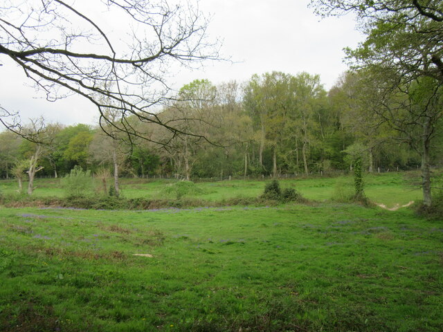
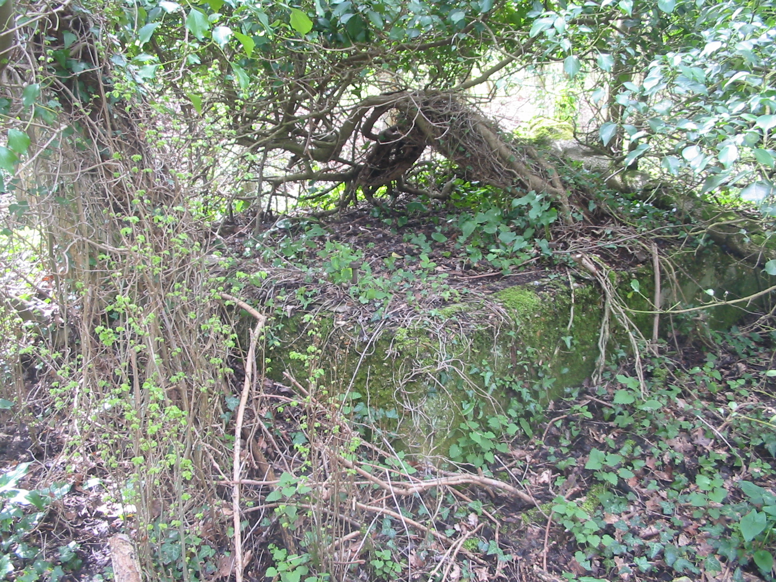
Rookery Copse is a picturesque woodland located in Hampshire, England. Covering an area of approximately 20 acres, it is a charming and tranquil destination for nature enthusiasts and hikers alike. The copse is situated in the beautiful countryside, surrounded by rolling hills and lush green fields.

The woodland is predominantly composed of oak and beech trees, creating a dense canopy that provides shade and shelter for various species of flora and fauna. The forest floor is carpeted with a rich tapestry of wildflowers, including bluebells, primroses, and wood anemones, which add a burst of color to the landscape during springtime.

As visitors wander through Rookery Copse, they may encounter an array of wildlife. The copse is home to a diverse range of bird species, including woodpeckers, thrushes, and owls, which can be heard singing and calling throughout the day. Squirrels can often be spotted darting between the trees, whilst badgers and foxes may occasionally make an appearance during the quieter hours.

Several well-maintained footpaths wind their way through Rookery Copse, allowing visitors to explore its natural beauty at their own pace. The paths are generally flat and easy to navigate, making it accessible for people of all ages and fitness levels. Along the way, benches are strategically placed, providing opportunities for visitors to rest and take in the tranquil surroundings.

Rookery Copse offers a welcome escape from the hustle and bustle of everyday life, providing a serene setting where visitors can immerse themselves in the wonders of nature. Whether it's a leisurely stroll, birdwatching, or simply finding solace in the peaceful ambiance, Rookery Copse is a hidden gem waiting to be discovered in the heart of Hampshire.

If you have any feedback on the listing, please let us know in the comments section below.

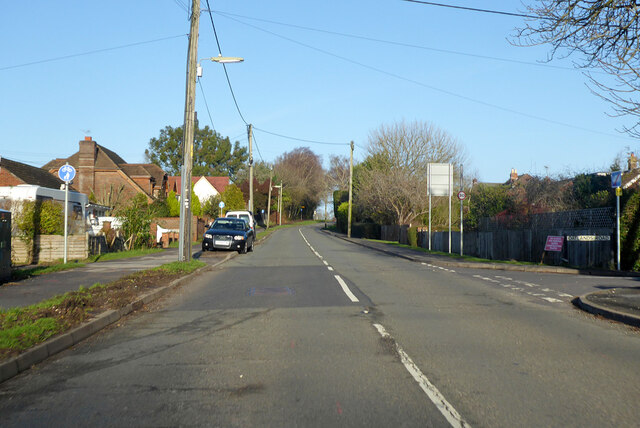
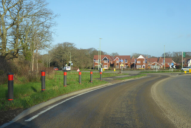
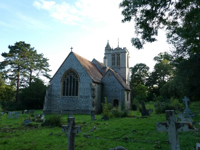
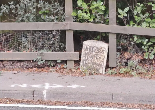
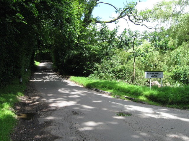
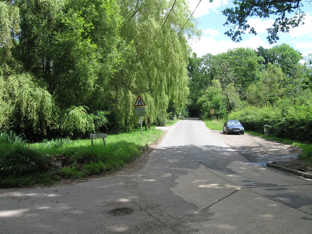
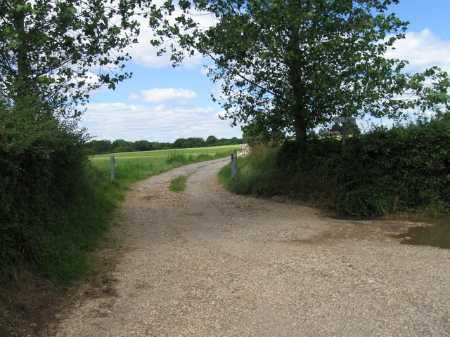
Rookery Copse Images

Images are sourced within 2km of 50.935002/-1.2603081 or Grid Reference SU5215. Thanks to Geograph Open Source API. All images are credited.

B3354 Winchester Road, Boorley Green Towards Winchester.
B3354 Winchester Road, Boorley Green
Towards Winchester.
Roundabout on B3354 Winchester Road Inserted in the straight a few years ago to serve a housing development of a golf course site.
Roundabout on B3354 Winchester Road
Inserted in the straight a few years ago to serve a housing development of a golf course site.
Greenwood This woodland is called Greenwood.
Greenwood
This woodland is called Greenwood.
St Peter, Curdridge: revisited It is nearly 13 years since my last visit <a title="https://www.geograph.org.uk/search.php?i=187100420" href="https://www.geograph.org.uk/search.php?i=187100420">Link</a>
St Peter, Curdridge: revisited
It is nearly 13 years since my last visit Link
St Peter, Curdridge: CWGC grave (a) For John Churcher's service record see <span class="nowrap"><a title="https://www.cwgc.org/find-records/find-war-dead/casualty-details/2758216/john-churcher/" rel="nofollow ugc noopener" href="https://www.cwgc.org/find-records/find-war-dead/casualty-details/2758216/john-churcher/">Link</a><img style="margin-left:2px;" alt="External link" title="External link - shift click to open in new window" src="https://s1.geograph.org.uk/img/external.png" width="10" height="10"/></span>
St Peter, Curdridge: CWGC grave (a)
For John Churcher's service record see LinkExternal link
St Peter, Curdridge: CWGC grave (b) For Young's service record see <span class="nowrap"><a title="https://www.cwgc.org/find-records/find-war-dead/casualty-details/2758219/b-r-young/" rel="nofollow ugc noopener" href="https://www.cwgc.org/find-records/find-war-dead/casualty-details/2758219/b-r-young/">Link</a><img style="margin-left:2px;" alt="External link" title="External link - shift click to open in new window" src="https://s1.geograph.org.uk/img/external.png" width="10" height="10"/></span>
St Peter, Curdridge: CWGC grave (b)
For Young's service record see LinkExternal link
St Peter, Curdridge: CWGC grave (c) For Hubert Keele's service record see <span class="nowrap"><a title="https://www.cwgc.org/find-records/find-war-dead/casualty-details/2758218/hubert-keele/" rel="nofollow ugc noopener" href="https://www.cwgc.org/find-records/find-war-dead/casualty-details/2758218/hubert-keele/">Link</a><img style="margin-left:2px;" alt="External link" title="External link - shift click to open in new window" src="https://s1.geograph.org.uk/img/external.png" width="10" height="10"/></span>
St Peter, Curdridge: CWGC grave (c)
For Hubert Keele's service record see LinkExternal link
St Peter, Curdridge: seat in the churchyard
Old Milestone by the B3035, Curdridge Metal plate attached to stone post by the B3035, in parish of Curdridge (Winchester District), opposite Woolams Cottage, by the road, on East side of road. Erected by the London & Southampton through Bishops Waltham turnpike trust in the 19th century. 

Inscription reads:-
MILES
69 TO
LONDON
8 TO
SOUTHTON 

Winchester HER & Winchester UAD listed.
Winchester HER No.: MWC1652 <span class="nowrap"><a title="https://www.heritagegateway.org.uk/Gateway/Results_Single.aspx?uid=MWC1652&resourceID=1013" rel="nofollow ugc noopener" href="https://www.heritagegateway.org.uk/Gateway/Results_Single.aspx?uid=MWC1652&resourceID=1013">Link</a><img style="margin-left:2px;" alt="External link" title="External link - shift click to open in new window" src="https://s1.geograph.org.uk/img/external.png" width="10" height="10"/></span>

Milestone Society National ID: HA_ALBO22
Old Milestone by the B3035, Curdridge
Metal plate attached to stone post by the B3035, in parish of Curdridge (Winchester District), opposite Woolams Cottage, by the road, on East side of road. Erected by the London & Southampton through Bishops Waltham turnpike trust in the 19th century. Inscription reads:- MILES 69 TO LONDON 8 TO SOUTHTON Winchester HER & Winchester UAD listed. Winchester HER No.: MWC1652 LinkExternal link Milestone Society National ID: HA_ALBO22
Footpath
Footpath
Herd of Jersey Cows
Herd of Jersey Cows
Railway underpass
Railway underpass
Newhouse Farm
Newhouse Farm
Finger post
Finger post
Scrapyard
Scrapyard
Netherhill lane
Netherhill lane
Wangfield Lane
Wangfield Lane
Entrance to Hill Farm
Show me another place!

Rookery Copse is located at Grid Ref: SU5215 (Lat: 50.935002, Lng: -1.2603081)

Administrative County: Hampshire

District: Winchester

Police Authority: Hampshire

What 3 Words

///finer.shred.nervy. Near Botley, Hampshire

Related Wikis

Durley Mill

Durley Mill is a hamlet between Botley and Bishops Waltham in Hampshire, England. It once had a small intermediate halt on the Bishops Waltham branch...

Durley Halt railway station

Durley Halt railway station was the only intermediate stop on the 3+3⁄4 mile Bishops Waltham branch line that connected Bishops Waltham to Botley. Opened...

Durley

Durley is a village and civil parish in the City of Winchester district of Hampshire, England. It is located approximately 7½ miles (12.1 km) northeast...

Long Common

Long Common is a village in the civil parish of Botley in the Eastleigh district of Hampshire, England. It lies approximately 5.6 miles (9.0 km) north...

Curdridge

Curdridge is a village and civil parish within the City of Winchester district of Hampshire, England. The parish also contains the similarly named village...

The Curdridge Country Show

The Curdridge Country Show is an annual country fair in Curdridge, Hampshire, England. The event is held mid-July on a Saturday, and attracts up to 7000...

Botley railway station

Botley railway station serves Botley and the surrounding areas in the English county of Hampshire. The station is on the railway line between Eastleigh...

Botley, Hampshire

Botley is a historic village in Hampshire, England. The village was once described as "the most delightful village in the world" by 18th century journalist...

Nearby Amenities

Located within 500m of 50.935002,-1.2603081
Barrier: stile
Lat/Long: 50.931429/-1.2560954
Barrier: stile
Lat/Long: 50.93081/-1.2623625
Barrier: stile
Lat/Long: 50.9317071/-1.2603395
Post Box
Post Box Type: lamp
Ref: SO32 420
Royal Cypher: EIIR
Royal Cypher Wikidata: Q33102113
Lat/Long: 50.935281/-1.2622722
Material: wood
Power: pole
Source: bing
Lat/Long: 50.9317841/-1.2647047
Material: wood
Power: pole
Source: bing
Lat/Long: 50.9324969/-1.2633025
Material: wood
Power: pole
Source: bing
Lat/Long: 50.9328888/-1.2618815
Material: wood
Power: pole
Source: bing
Lat/Long: 50.9335305/-1.259847
Material: wood
Power: pole
Source: bing
Lat/Long: 50.9340631/-1.2579836
Material: wood
Power: pole
Source: bing
Lat/Long: 50.9347798/-1.2559658
Material: wood
Power: pole
Source: bing
Lat/Long: 50.9349315/-1.2535255
Material: wood
Power: pole
Source: bing
Lat/Long: 50.9351572/-1.2545156
Material: wood
Power: pole
Source: bing
Lat/Long: 50.9356865/-1.2534797
Heathens log bench
Note: Often used by weary cyclists or walkers for a short rest and refreshments while passing through the area. Pheasants can often be heard in the adjoining fields in the summer months.
Lat/Long: 50.9377213/-1.2659894
Hill Farm Airstrip
Aeroway: aerodrome
Source: LAAS 2017 Airfield Guide
Lat/Long: 50.9343439/-1.2658966
The data included in this document is from www.openstreetmap.org. The data is made available under ODbL.

Have you been to Rookery Copse?

Leave your review of Rookery Copse below (or comments, questions and feedback).