Burnhill Wood

Wood, Forest in Derbyshire Bolsover

England

Burnhill Wood

Hickingwood Lane in Clowne
Hickingwood Lane in Clowne Credit: Stephen Ostler

Burnhill Wood is a picturesque forest located in Derbyshire, England. Covering an area of approximately 50 acres, it is a popular destination for nature enthusiasts and outdoor enthusiasts alike.

The wood is characterized by its diverse range of tree species, including oak, birch, and beech. The dense canopy formed by these trees creates a tranquil and peaceful atmosphere, making it an ideal spot for walking, hiking, and birdwatching. The forest floor is also adorned with a variety of wildflowers and ferns, adding to its natural beauty.

Burnhill Wood is home to a rich array of wildlife, with many species of birds, mammals, and insects inhabiting the area. Visitors may be lucky enough to spot woodpeckers, deer, and butterflies as they explore the forest. The wood is also known for its abundance of fungi, with numerous species of mushrooms and toadstools scattered throughout.

In addition to its natural beauty, Burnhill Wood has a rich cultural history. It was once part of the estate of a nearby manor house and has been used for various purposes over the years, including timber production and recreational activities. Today, it is managed by the local authorities and is open to the public year-round.

Overall, Burnhill Wood offers a tranquil escape from the hustle and bustle of everyday life. Its diverse range of flora and fauna, combined with its rich cultural history, make it a must-visit destination for nature lovers and history enthusiasts alike.

If you have any feedback on the listing, please let us know in the comments section below.

Burnhill Wood Images

Images are sourced within 2km of 53.280228/-1.2287735 or Grid Reference SK5176. Thanks to Geograph Open Source API. All images are credited.

Hickingwood Lane in Clowne
Houses in Creswell Road, Clowne
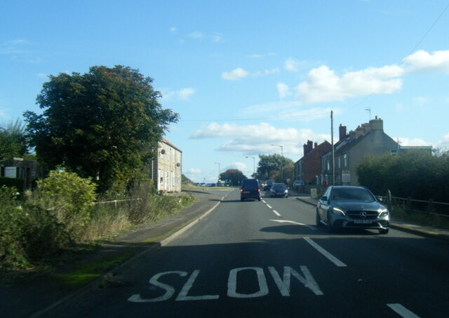
A619 at Springfield Farm entrance
A619 at Whitwell Common
A619 Clinthill Lane at lay-by
Hazelmere Road near Creswell
Bus Stop by Peter More Hill Looking towards Whitwell
Bus Stop by Peter More Hill
Looking towards Whitwell
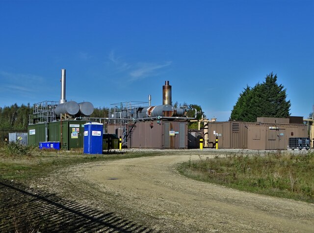
Legacy of Coal Mining at Whitwell In this area of North East Derbyshire the underground world is riddled with old coal mine workings that still emit methane which needs to be vented and dealt with by processing stations like this one.
Legacy of Coal Mining at Whitwell
In this area of North East Derbyshire the underground world is riddled with old coal mine workings that still emit methane which needs to be vented and dealt with by processing stations like this one.
Elmton and Creswell Junction signal box On what is now known as "The Robin Hood Line"
Elmton and Creswell Junction signal box
On what is now known as "The Robin Hood Line"
View north from Creswell Station
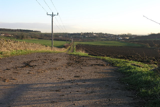
View towards Highwood Lane Taken on the Archaeological Way
View towards Highwood Lane
Taken on the Archaeological Way
View East from Gapsick Lane
Footpath sign near Clowne Footpath towards Whitwell across recently harvested fields.
Footpath sign near Clowne
Footpath towards Whitwell across recently harvested fields.
Footpath towards Gorse Covert
Duke Street, Whitwell Off Welbeck Street. Leading to Mill Crescent.
Duke Street, Whitwell
Off Welbeck Street. Leading to Mill Crescent.
Coronation Street, Whitwell Off Welbeck Street.
Coronation Street, Whitwell
Off Welbeck Street.
Eastern side of Hangar Hill, Whitwell Seen from Welbeck Street, which continues west (left) as Hangar Hill into the centre of the village.
Eastern side of Hangar Hill, Whitwell
Seen from Welbeck Street, which continues west (left) as Hangar Hill into the centre of the village.
Old Green Close, Whitwell A recently built cul de sac off Hangar Hill.
Old Green Close, Whitwell
A recently built cul de sac off Hangar Hill.
Show me another place!

Burnhill Wood is located at Grid Ref: SK5176 (Lat: 53.280228, Lng: -1.2287735)

Administrative County: Derbyshire

District: Bolsover

Police Authority: Derbyshire

What 3 Words

///cookie.indicates.expose. Near Whitwell, Derbyshire

Related Wikis

Bakestone Moor

Bakestone Moor is an area of settlement in Derbyshire, England. It is located on the west side of Whitwell.

Whitwell Common

Whitwell Common is a village, in Bolsover District, Derbyshire, lying just North-West of Whitwell, straddling the A619, which runs between Chesterfield...

St Lawrence's Church, Whitwell

St Lawrence's Church, Whitwell is a Grade I listed parish church in the Church of England in Whitwell, Derbyshire. == History == The church dates from...

Markland Grips Viaduct

Markland Grips Viaduct is a former railway viaduct south east of Clowne, Derbyshire, England. == Context == The viaduct carried the LD&ECR's double-track...

Nearby Amenities

Located within 500m of 53.280228,-1.2287735
Barrier: stile
Lat/Long: 53.2817641/-1.2283487
Barrier: stile
Lat/Long: 53.2779082/-1.2263266
Barrier: stile
Lat/Long: 53.2777991/-1.2288574
Barrier: stile
Lat/Long: 53.2764178/-1.2325485
Power: pole
Lat/Long: 53.2774469/-1.2335124
Power: pole
Lat/Long: 53.2773762/-1.2319664
Power: pole
Lat/Long: 53.2781576/-1.2335041
Power: pole
Lat/Long: 53.277894/-1.2319738
Power: pole
Lat/Long: 53.2783687/-1.2352998
Power: pole
Lat/Long: 53.277322/-1.2288498
Power: pole
Lat/Long: 53.2773005/-1.230418
Power: pole
Lat/Long: 53.2771938/-1.2288421
Power: pole
Lat/Long: 53.2773932/-1.2288467
Power: pole
Lat/Long: 53.2776238/-1.2304078
Power: pole
Lat/Long: 53.2772552/-1.2288468
Power: tower
Lat/Long: 53.2761742/-1.2272719
Power: pole
Lat/Long: 53.2767464/-1.2249716
Power: pole
Lat/Long: 53.2768611/-1.2250369
Power: pole
Lat/Long: 53.2770629/-1.2248551
Power: pole
Lat/Long: 53.2775036/-1.225929
Power: pole
Lat/Long: 53.277818/-1.2287775
Power: pole
Lat/Long: 53.277861/-1.2276055
Power: pole
Lat/Long: 53.2778899/-1.230008
Power: pole
Lat/Long: 53.2780588/-1.2323375
Power: pole
Lat/Long: 53.2783178/-1.2246453
Power: pole
Lat/Long: 53.2791423/-1.2233529
Power: pole
Lat/Long: 53.279815/-1.2223432
Power: pole
Lat/Long: 53.2805144/-1.2214663
Passing Place
Lat/Long: 53.2807595/-1.2272886
Power: pole
Lat/Long: 53.2816856/-1.2285587
Power: pole
Lat/Long: 53.2819718/-1.2276904
Power: pole
Lat/Long: 53.2823642/-1.2264515
Power: pole
Lat/Long: 53.2827444/-1.2252381
Power: pole
Lat/Long: 53.2831337/-1.2240171
Power: pole
Lat/Long: 53.2839055/-1.2330352
Power: pole
Lat/Long: 53.2840675/-1.2320073
Power: pole
Lat/Long: 53.2844357/-1.2298487
Passing Place
Lat/Long: 53.281172/-1.2278177
Man Made: tower
Tower Type: communication
Lat/Long: 53.2772416/-1.2275049
The data included in this document is from www.openstreetmap.org. The data is made available under ODbL.

Have you been to Burnhill Wood?

Leave your review of Burnhill Wood below (or comments, questions and feedback).