Northwood Copse

Wood, Forest in Hampshire Basingstoke and Deane

England

Northwood Copse

An eco-home, Ecchinswell An odd design, by Baufritz, according to the banner.
An eco-home, Ecchinswell Credit: Robin Webster

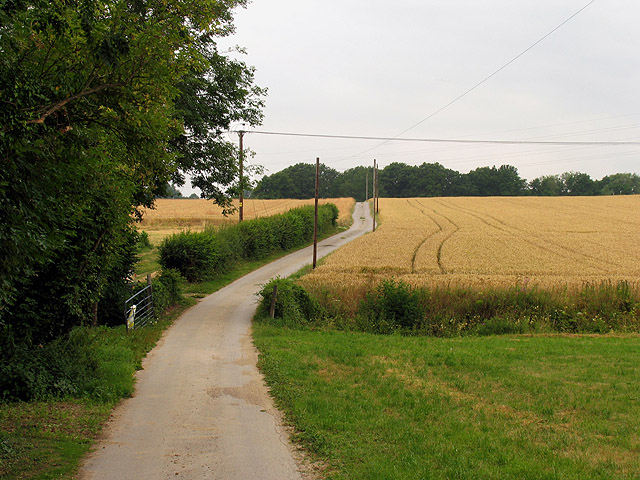
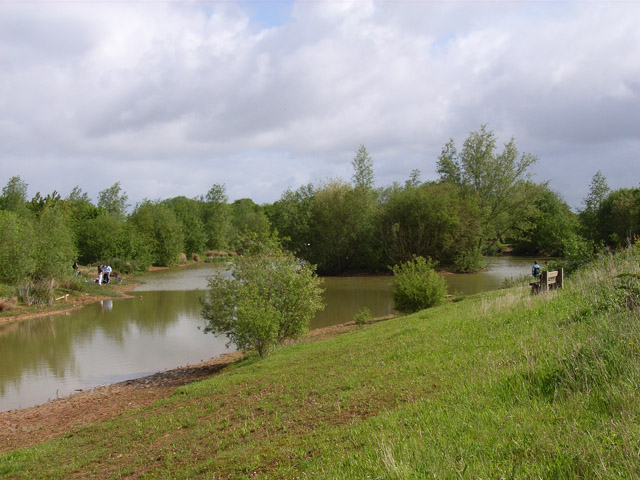
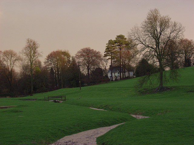
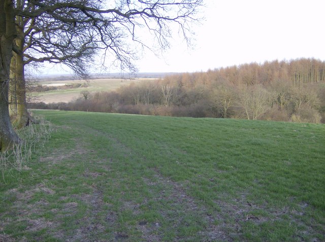
Northwood Copse is a picturesque woodland located in the county of Hampshire, England. Covering an area of approximately 100 acres, it is a popular destination for nature enthusiasts and outdoor lovers. The copse is situated near the village of Northwood, offering a tranquil escape from the hustle and bustle of nearby urban areas.

The woodland is characterized by a diverse range of tree species, including oak, beech, birch, and hazel, creating a rich and vibrant ecosystem. The dense canopy provides a cool and shaded environment during summer months, making it an ideal spot for picnics and leisurely walks.

Northwood Copse is home to a variety of wildlife, including deer, foxes, badgers, and a plethora of bird species. Birdwatchers can spot woodpeckers, owls, and warblers among the trees, while the undergrowth provides a habitat for small mammals and insects. The copse is also known for its bluebell carpet during spring, attracting visitors who come to admire the stunning floral display.

The woodland is crisscrossed by a network of well-maintained footpaths, allowing visitors to explore its beauty at their own pace. There are several picnic areas and benches strategically placed throughout the copse, offering visitors the chance to relax and enjoy the peaceful surroundings.

Northwood Copse is easily accessible by car, with ample parking facilities available nearby. It is open to the public throughout the year, free of charge. Whether you are seeking a quiet retreat or an opportunity to connect with nature, Northwood Copse is a delightful destination that showcases the natural beauty of Hampshire's woodlands.

If you have any feedback on the listing, please let us know in the comments section below.

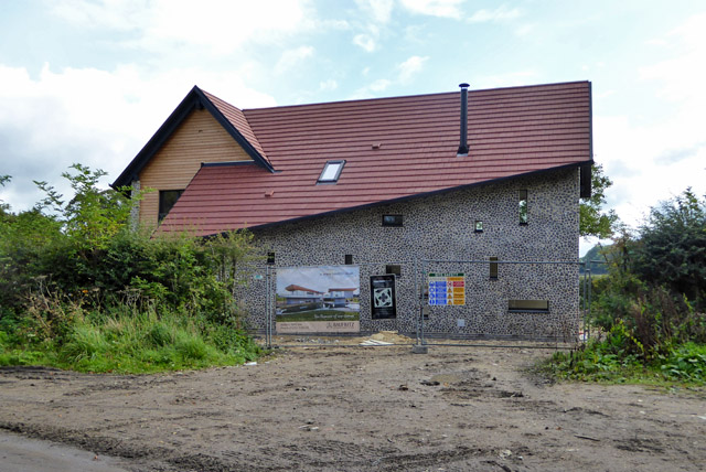
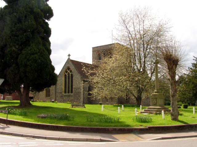
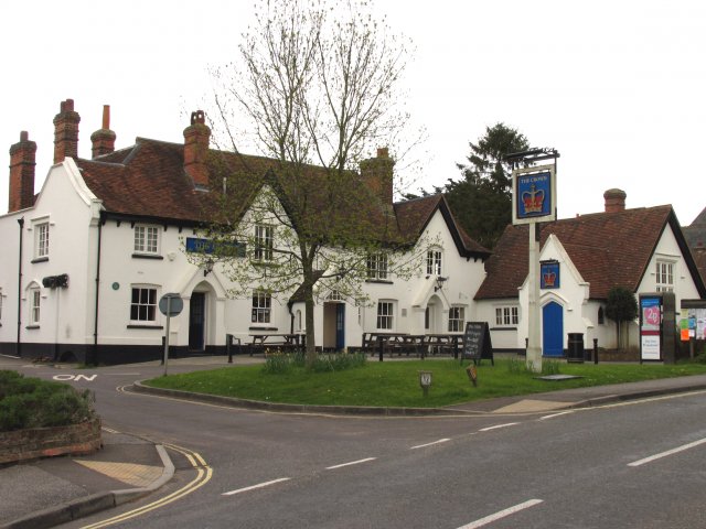
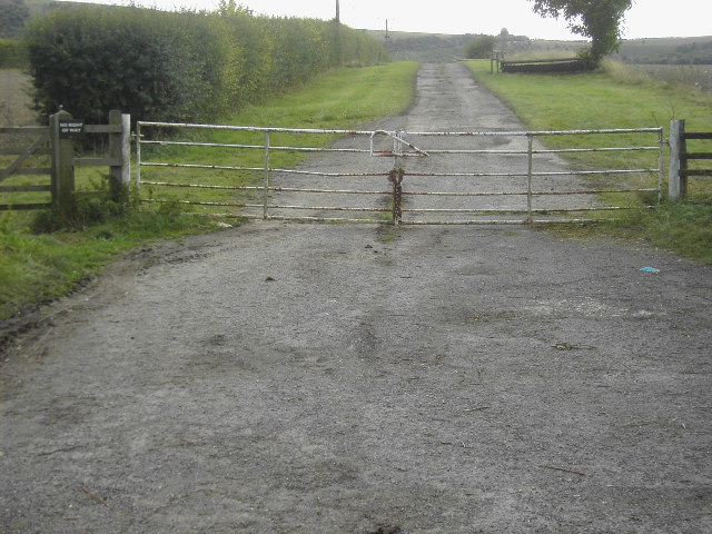
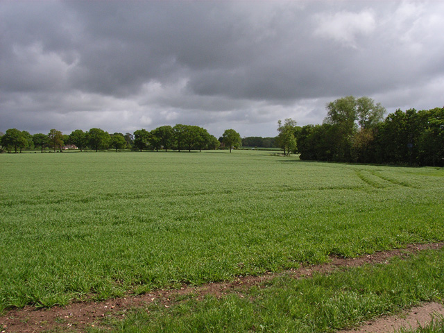
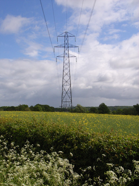
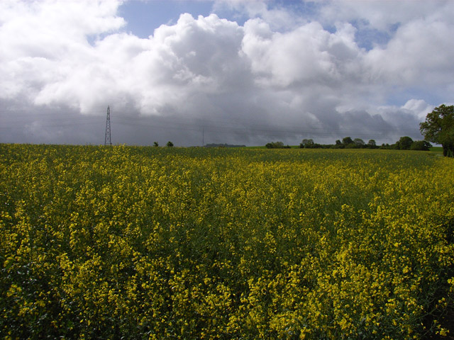
Northwood Copse Images

Images are sourced within 2km of 51.333664/-1.2621811 or Grid Reference SU5159. Thanks to Geograph Open Source API. All images are credited.
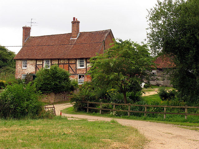
An eco-home, Ecchinswell An odd design, by Baufritz, according to the banner.
An eco-home, Ecchinswell
An odd design, by Baufritz, according to the banner.
Church in Kingsclere The church is situated in the centre of the upper half of the grid square. The picture was taken from the east side of the church looking west (hence problems with the sun!). Kingsclere is an attractive village with many very old buildings.
Church in Kingsclere
The church is situated in the centre of the upper half of the grid square. The picture was taken from the east side of the church looking west (hence problems with the sun!). Kingsclere is an attractive village with many very old buildings.
Kingsclere Village Centre The pub is on the east side of the Church in the lower centre of the upper half of the grid square in the centre of the village.
Kingsclere Village Centre
The pub is on the east side of the Church in the lower centre of the upper half of the grid square in the centre of the village.
Coldridges Farm Situated in the western section near the edge of the grid square, this picture was taken from the A339 to Newbury, looking north east.
Coldridges Farm
Situated in the western section near the edge of the grid square, this picture was taken from the A339 to Newbury, looking north east.
Farm near Ashford Hill At this point, the footpath splits and goes of at right angles to each other. This is the view at the split (Harriden's Farm).
Farm near Ashford Hill
At this point, the footpath splits and goes of at right angles to each other. This is the view at the split (Harriden's Farm).
Farmland near Ashford Hill This section of farmland is south west of Harridens Great Copse in 5360, and the view is in the north east corner of the square between Harridens farm and Halls Farm.
Farmland near Ashford Hill
This section of farmland is south west of Harridens Great Copse in 5360, and the view is in the north east corner of the square between Harridens farm and Halls Farm.
Ecchinswell Church The church is in the top left hand corner of the square, the photo was taken looking east from the road.
Ecchinswell Church
The church is in the top left hand corner of the square, the photo was taken looking east from the road.
Lychgate to Ecchinswell Church This picture is of the lychgate to Ecchinswell church, the church is in the top left hand corner of the square, the photo was taken looking east from the road.
Lychgate to Ecchinswell Church
This picture is of the lychgate to Ecchinswell church, the church is in the top left hand corner of the square, the photo was taken looking east from the road.
Royal Oak, Ecchinswell This is a picture of the 'Royal Oak' country pub in the village of Ecchinswell, it was taken from the junction of Oakfields Close and the main road through the village.
Royal Oak, Ecchinswell
This is a picture of the 'Royal Oak' country pub in the village of Ecchinswell, it was taken from the junction of Oakfields Close and the main road through the village.
Isle Hill house near Kingsclere This house is hidden behind quite a steep bank, it is at the bottom of this square.
Isle Hill house near Kingsclere
This house is hidden behind quite a steep bank, it is at the bottom of this square.
Gate near Kingsclere This is a gate across a private road in the very bottom right of the square, the picture is looking due south.
Gate near Kingsclere
This is a gate across a private road in the very bottom right of the square, the picture is looking due south.
Woodley Cottage, Ecchinswell Chocolate box village view of a 17th century thatched cottage.
[Thanks to Jane Curtis for adding to the description].
Woodley Cottage, Ecchinswell
Chocolate box village view of a 17th century thatched cottage. [Thanks to Jane Curtis for adding to the description].
Farmland near Kingsclere Looking down towards the A339 at Stanton's Farm.
Farmland near Kingsclere
Looking down towards the A339 at Stanton's Farm.
Pylon near Kingsclere From the southern approach to Porch Farm.
Pylon near Kingsclere
From the southern approach to Porch Farm.
Farmland at Porch Farm In the distance Hannington Transmitter can be seen. It stands on the downs above Kingsclere.
Farmland at Porch Farm
In the distance Hannington Transmitter can be seen. It stands on the downs above Kingsclere.
Fishing lake at Frobury Farm Frobury Farm is a country sports venue.
Fishing lake at Frobury Farm
Frobury Farm is a country sports venue.
Stream and pastures, Ecchinswell A stream descending into the village from Watership Farm shows a response to a wet afternoon.
Stream and pastures, Ecchinswell
A stream descending into the village from Watership Farm shows a response to a wet afternoon.
Isle Copse From the footpath to the east of Nuthanger Farm, rounding the edge of the wood at the western edge of the square and looking north-east towards the middle of the square.
Isle Copse
From the footpath to the east of Nuthanger Farm, rounding the edge of the wood at the western edge of the square and looking north-east towards the middle of the square.
Show me another place!

Northwood Copse is located at Grid Ref: SU5159 (Lat: 51.333664, Lng: -1.2621811)

Administrative County: Hampshire

District: Basingstoke and Deane

Police Authority: Hampshire

What 3 Words

///trailers.newsstand.number. Near Kingsclere, Hampshire

Nearby Locations

Northwood Copse

Related Wikis

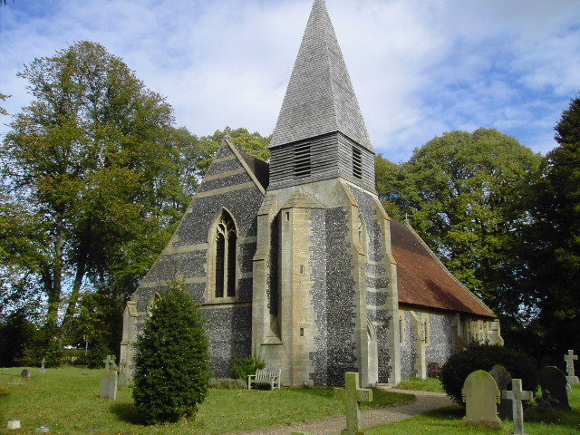
St Lawrence's Church, Ecchinswell

St Lawrence's Church (St Laurence) is a Grade II listed sacred edifice in Ecchinswell, Hampshire, England, in the rural deanery of Whitchurch, within the...

Brock's Green

Brock's Green is a small village in the Basingstoke and Deane district of Hampshire, England. Its nearest town is Newbury, which lies approximately 4.7...

Kingsclere and Whitchurch Rural District

Kingsclere and Whitchurch Rural District was a rural district between 1932 and 1974 in Hampshire, England. The district was formed as a merger of the abolished...

Kingsclere

Kingsclere is a large village and civil parish in Hampshire, England. == Geography == Kingsclere is approximately equidistant 13 kilometres (8.1 mi) from...

Ecchinswell

Ecchinswell is a village and former civil parish, now in the parish of Ecchinswell, Sydmonton and Bishops Green, in the Basingstoke and Deane district...

Ecchinswell, Sydmonton and Bishops Green

Ecchinswell, Sydmonton and Bishops Green (occasionally referred to as just Ecchinswell and Sydmonton) is a civil parish within the district of Basingstoke...

North Sydmonton

North Sydmonton is a small village in the Basingstoke and Deane district of Hampshire, England. Its nearest town is Newbury, which lies approximately 4...

Headley, Basingstoke and Deane

Headley is a village in Hampshire, England. It is close to the county boundary with Berkshire and about 4 miles (6.4 km) south-east of Newbury. == Governance... ==

Nearby Amenities

Located within 500m of 51.333664,-1.2621811
Fuel
Shell
Addr Postcode: RG20 4TA
Brand: Shell
Brand Wikidata: Q110716465
Opening Hours: Mo-Su 06:00-22:00
Operator: Motor Fuel Group
Operator Website: https://www.motorfuelgroup.com/locations/kingsclere-ps973/
Operator Wikidata: Q107271358
Phone: +44 1635 299437
Ref Navads: NVDS353_12247112
Source: GPS
Website: https://find.shell.com/gb/fuel/12247112-kingsclere-service-station
Lat/Long: 51.3324132/-1.255534
Bus Stop
The Star Ph
Bench: no
Bin: no
Bus: yes
Naptan AtcoCode: 1900HA010156
Naptan Bearing: NW
Naptan CommonName: The Star Ph
Naptan NaptanCode: hamdmdwp
Naptan ShortCommonName: Stanton's Farm
Naptan Street: Newbury Road
Naptan Verified: no
Public Transport: platform
Shelter: no
Source: naptan_import
Tactile Paving: no
Lat/Long: 51.3335567/-1.2573884
Bus Stop
The Star PH
Bench: no
Bin: no
Bus: yes
Naptan AtcoCode: 1900HA010157
Naptan Bearing: SE
Naptan CommonName: The Star Ph
Naptan NaptanCode: hamdmgam
Naptan ShortCommonName: Stanton's Farm
Naptan Street: Newbury Road
Naptan Verified: no
Public Transport: platform
Shelter: no
Source: naptan_import
Lat/Long: 51.3334927/-1.2572171
Barrier: stile
Lat/Long: 51.3371807/-1.2626905
Barrier: stile
Lat/Long: 51.3368238/-1.2589596
Power: tower
Source: bing
Lat/Long: 51.3302994/-1.257554
Frobury Farm
Landuse: farm
Note Retag: CS #48756035
Source: OS_OpenData_StreetView
Lat/Long: 51.3319462/-1.2660571
Power: pole
Lat/Long: 51.3357765/-1.2582698
Power: pole
Lat/Long: 51.3370534/-1.258294
Power: pole
Lat/Long: 51.3321166/-1.2564486
Power: pole
Lat/Long: 51.3316356/-1.2570789
Power: pole
Lat/Long: 51.3312183/-1.2576288
Material: wood
Power: pole
Lat/Long: 51.3314546/-1.2559229
Material: wood
Power: pole
Lat/Long: 51.3314454/-1.2560409
Budgens
Addr Housename: Kingsclere Service Station
Addr Postcode: RG20 4TA
Addr Street: Newbury Road
Brand: Budgens
Brand Wikidata: Q4985016
Opening Hours: 24/7
Operator: Motor Fuel Group
Operator Website: https://www.motorfuelgroup.com/locations/kingsclere-ps973/
Operator Wikidata: Q107271358
Shop: convenience
Website: https://www.budgens.co.uk/our-stores/kingsclere
Lat/Long: 51.3325615/-1.2554133
The data included in this document is from www.openstreetmap.org. The data is made available under ODbL.

Have you been to Northwood Copse?

Leave your review of Northwood Copse below (or comments, questions and feedback).