Cockshot Copse

Wood, Forest in Oxfordshire Cherwell

England

Cockshot Copse

Fields north of Kirtlington Quarry The buildings in the distance belong to Kirtlington Stud.
Fields north of Kirtlington Quarry Credit: Des Blenkinsopp

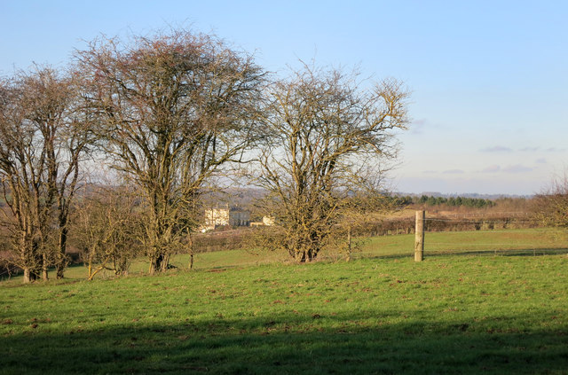
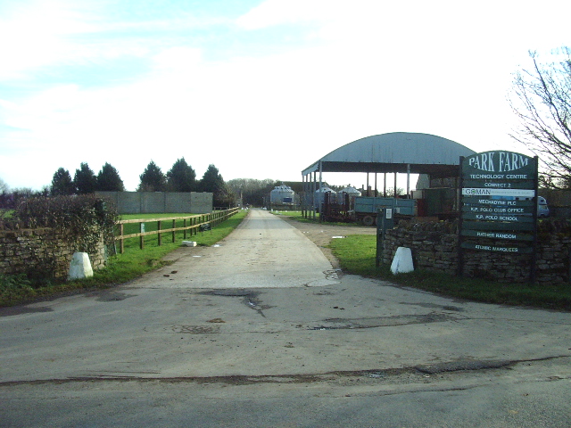
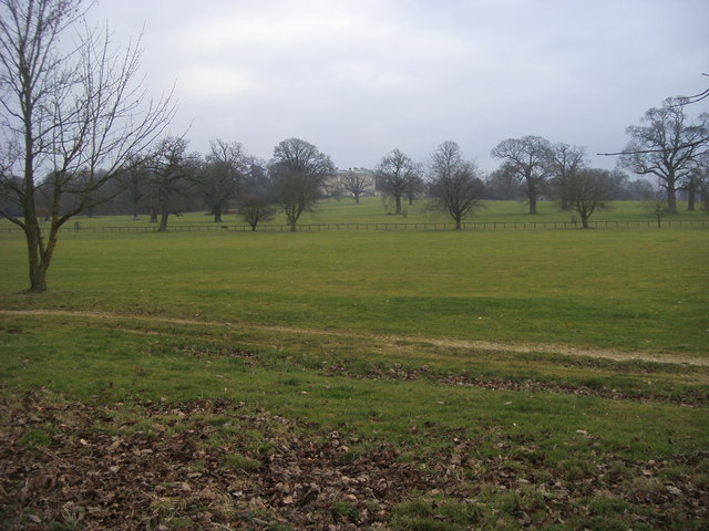
Cockshot Copse is a picturesque woodland located in Oxfordshire, England. Situated near the village of Cockshot, the copse covers an area of approximately 20 acres and is a haven for nature enthusiasts and walkers alike.

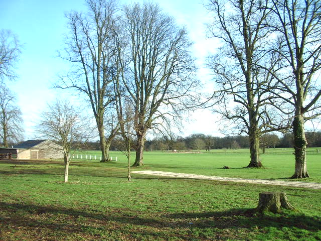
The copse is predominantly composed of native broadleaf trees, including oak, ash, and beech, which create a vibrant and diverse ecosystem. These trees provide shelter and food for a variety of wildlife, making it a popular spot for birdwatching and nature photography. Visitors may spot species such as woodpeckers, owls, and various small mammals.

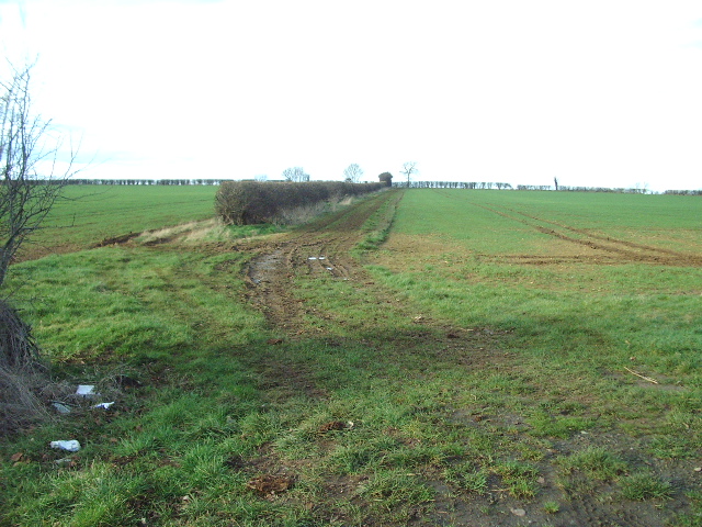
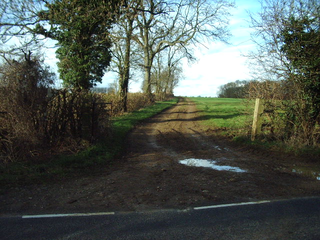
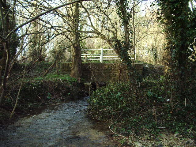
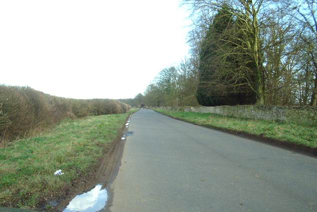
Traversing the copse is a network of well-maintained footpaths, allowing visitors to explore the area at their own pace. These paths wind through the dense undergrowth, revealing hidden clearings and offering glimpses of the surrounding countryside. The copse is also intersected by a small stream, adding to its natural charm.

During spring, Cockshot Copse becomes a spectacle of color as bluebells carpet the forest floor, creating a breathtaking sight. This time of year attracts many visitors who come to witness the beauty of these delicate flowers in bloom.

Cockshot Copse is managed by a local conservation group, ensuring its preservation and protection. The copse serves as a valuable educational resource, offering guided tours and educational programs for schools and nature enthusiasts to learn about the woodland's ecology and conservation efforts.

Overall, Cockshot Copse in Oxfordshire is a tranquil and enchanting woodland, offering a serene escape and a chance to immerse oneself in the beauty of nature.

If you have any feedback on the listing, please let us know in the comments section below.

Cockshot Copse Images

Images are sourced within 2km of 51.876127/-1.2575806 or Grid Reference SP5119. Thanks to Geograph Open Source API. All images are credited.

Fields north of Kirtlington Quarry The buildings in the distance belong to Kirtlington Stud.
Fields north of Kirtlington Quarry
The buildings in the distance belong to Kirtlington Stud.
Muddy Track Track running between the hedge and the cultivated field
Muddy Track
Track running between the hedge and the cultivated field
Muddy track to Slade Farm
Gallos Brook As it emerges from passing under the Roman Road "Akeman Street"
Gallos Brook
As it emerges from passing under the Roman Road "Akeman Street"
Park Farm It would seem that this farmer has diversified and created for himself and others a small technology park as well as keeping the farming side.
Park Farm
It would seem that this farmer has diversified and created for himself and others a small technology park as well as keeping the farming side.
Akeman Street Part of the Roman Road, on the N side of Kirklington Park
Akeman Street
Part of the Roman Road, on the N side of Kirklington Park
The polo ground at Kirklington Park
Minor Road on the line of the Roman Akeman Street
Akeman Street The old Roman road looking east.
Akeman Street
The old Roman road looking east.
Nutter! It's just not right jumping out of a serviceable aircraft.
Nutter!
It's just not right jumping out of a serviceable aircraft.
Akeman Street (Roman Road) A nice view of Akeman Street, approx halfway between Kirtlington and Weston On The Green. This roman road is in superb condition, and is very popular with cyclists like myself. This section is mostly flat, except for the slight double dip as it flows over the large brook which comes out of Kirtlington Park.
Akeman Street (Roman Road)
A nice view of Akeman Street, approx halfway between Kirtlington and Weston On The Green. This roman road is in superb condition, and is very popular with cyclists like myself. This section is mostly flat, except for the slight double dip as it flows over the large brook which comes out of Kirtlington Park.
Kirtlington Polo Ground, Kirtlington Tally ho!! This is a shot of Kirtlington Polo Ground, where polo matches are frequently played. HRH Prince Charles often plays polo here too, in the pleasant shady surroundings of Kirtlington Park. Naturally, this whole area is perfectly flat and level, and is one of the very few polo grounds left in Britain.
Kirtlington Polo Ground, Kirtlington
Tally ho!! This is a shot of Kirtlington Polo Ground, where polo matches are frequently played. HRH Prince Charles often plays polo here too, in the pleasant shady surroundings of Kirtlington Park. Naturally, this whole area is perfectly flat and level, and is one of the very few polo grounds left in Britain.
Kirtlington Polo Park, Kirtlington (tournament day) Another picture of Kirtlington Polo Park, in action with a match in progress. Tally Ho! The grounds of the park are very well bordered with a stone wall, and perfectly flat.
Kirtlington Polo Park, Kirtlington (tournament day)
Another picture of Kirtlington Polo Park, in action with a match in progress. Tally Ho! The grounds of the park are very well bordered with a stone wall, and perfectly flat.
Akeman Street (Roman Road), Kirtlington This view of Akeman Street faces East and towards the direction of nearby Bicester. This Roman road has stood the test of time, remaining in superb condition despite its frequent use. Like most Roman roads, Akeman Street is dead straight all the way to Chesterton. A long stone wall borders the grounds of Kirtlington Polo Park, also shown here. Beyond the T-junction with the A4095 just behind the camera here, Akeman Street (or the buried ruins of) continues straight in a WSW direction towards Sturdy's Castle.
Akeman Street (Roman Road), Kirtlington
This view of Akeman Street faces East and towards the direction of nearby Bicester. This Roman road has stood the test of time, remaining in superb condition despite its frequent use. Like most Roman roads, Akeman Street is dead straight all the way to Chesterton. A long stone wall borders the grounds of Kirtlington Polo Park, also shown here. Beyond the T-junction with the A4095 just behind the camera here, Akeman Street (or the buried ruins of) continues straight in a WSW direction towards Sturdy's Castle.
Akeman Street Akeman Street heading to Kirtlington Park polo club
Akeman Street
Akeman Street heading to Kirtlington Park polo club
Akeman Street Akeman Street passing footpath to Kirtlington
Akeman Street
Akeman Street passing footpath to Kirtlington
Kirtlington Park Grounds From Akeman Street looking across the grounds by the Kirtlington Park polo club to Kirtlington Park house in the distance
Kirtlington Park Grounds
From Akeman Street looking across the grounds by the Kirtlington Park polo club to Kirtlington Park house in the distance
Gates across Crowcastle Lane at Peter's Cross The plaque in the wall describes the lane as a bridleway path
Gates across Crowcastle Lane at Peter's Cross
The plaque in the wall describes the lane as a bridleway path
Show me another place!

Cockshot Copse is located at Grid Ref: SP5119 (Lat: 51.876127, Lng: -1.2575806)

Administrative County: Oxfordshire

District: Cherwell

Police Authority: Thames Valley

What 3 Words

///clerk.cabs.improvise. Near Kidlington, Oxfordshire

Related Wikis

Kirtlington

Kirtlington is a village and civil parish in Oxfordshire about 6+1⁄2 miles (10.5 km) west of Bicester. The parish includes the hamlet of Northbrook. The...

Weston Fen, Oxfordshire

Weston Fen is a 14-hectare (35-acre) biological Site of Special Scientific Interest north of Weston-on-the-Green in Oxfordshire.This site has diverse habitats...

Kirtlington Quarry

Kirtlington Quarry is a 3.1-hectare (7.7-acre) geological Site of Special Scientific Interest west of Kirtlington in Oxfordshire. It is a Geological Conservation...

Bletchingdon Park

Bletchington Park is a Grade II* listed Palladian country house in Bletchingdon, Oxfordshire. == History == Bletchington's medieval manor house was rebuilt...

RAF Weston-on-the-Green

RAF Weston-on-the-Green is a Royal Air Force station that was redeveloped after the Great War period. Much demolition took place (including the original...

Bletchingdon

Bletchingdon (also known as Bletchington) is a village and civil parish 2 miles (3 km) north of Kidlington and 6 miles (10 km) southwest of Bicester in...

Weston-on-the-Green

Weston-on-the-Green is a village and civil parish in the Cherwell district of Oxfordshire, England, about 4 miles (6 km) southwest of Bicester. The 2011...

The Manor Country House Hotel, Weston-on-the-Green

The Manor Country House Hotel in Weston-on-the-Green is a building of historical significance and is Grade II* listed on the English Heritage Register...

Related Videos

How One Of The Most Important Canals Was Built On A Pin Sized Budget | The Story of The Oxford Canal

Today me and mum explore a section of the Oxford canal, which was built 10 years later than the rest of the canal and by a ...

Facilities at Greenhill Leisure Park

View of the facilities at Greenhill Leisure Park Jan 2020.

Narrowboat Journey: Northbrook Lock to Pigeons Lock, Kirtlington, on the Oxford Canal.

Starting off below Dashwoods lock I head south to Northbrook lock, and then on down a very isolated and rural stretch of canal to ...

Nearby Amenities

Located within 500m of 51.876127,-1.2575806
Kirtlington Park
Place: locality
Lat/Long: 51.8744513/-1.2628043
The data included in this document is from www.openstreetmap.org. The data is made available under ODbL.

Have you been to Cockshot Copse?

Leave your review of Cockshot Copse below (or comments, questions and feedback).