Clump Plantation

Wood, Forest in Yorkshire

England

Clump Plantation

Tom Wood Ash Lane A residential street in Shinwell.
Tom Wood Ash Lane Credit: DS Pugh

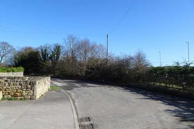
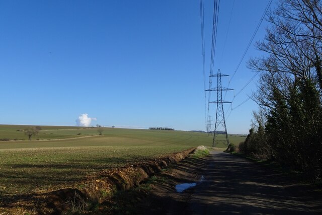
Clump Plantation is a picturesque woodland area located in the heart of Yorkshire, England. Covering an expansive area of approximately 200 acres, this enchanting plantation is nestled amidst the rolling hills and lush greenery of the region. It is situated near the village of Clump, which adds to its charm and accessibility.

The plantation is predominantly composed of a diverse range of tree species, including oak, beech, birch, and ash, which contribute to its rich and varied ecosystem. These towering trees provide a haven for an array of wildlife, including numerous bird species such as woodpeckers, owls, and thrushes, as well as small mammals like squirrels and rabbits. The plantation is also known for its vibrant flora, with carpets of bluebells and wildflowers adorning the forest floor during the spring and summer months.

Clump Plantation offers a peaceful retreat for nature enthusiasts and hikers alike. Crisscrossed by a network of footpaths, visitors can explore the plantation at their own pace and immerse themselves in the tranquility of the surroundings. The well-maintained trails meander through the woodland, leading to scenic viewpoints and secluded picnic spots where visitors can enjoy the serenity and beauty of the area.

The plantation is open to the public year-round, with no entry fee. It is managed by the local forestry commission, ensuring the preservation and conservation of the woodland. Clump Plantation is a beloved destination for locals and tourists, who flock to this idyllic woodland to reconnect with nature and experience the enchantment of Yorkshire's natural beauty.

If you have any feedback on the listing, please let us know in the comments section below.

Clump Plantation Images

Images are sourced within 2km of 53.613298/-1.2332546 or Grid Reference SE5013. Thanks to Geograph Open Source API. All images are credited.

Tom Wood Ash Lane A residential street in Shinwell.
Tom Wood Ash Lane
A residential street in Shinwell.
Bus stop on Tom Wood Ash Lane The bus stop near Bell Street in Shinwell.
Bus stop on Tom Wood Ash Lane
The bus stop near Bell Street in Shinwell.
Junction with Barnsdale Way Tom Wood Ash Lane in Shinwell with a bus stop ahead.
Junction with Barnsdale Way
Tom Wood Ash Lane in Shinwell with a bus stop ahead.
Tom Wood Ash Lane Looking along the road near the junction with Barnsdale Way in Shinwell.
Tom Wood Ash Lane
Looking along the road near the junction with Barnsdale Way in Shinwell.
Trackbed of the Hull and Barnsley railway Looking down on to the long dismantled railway from Sheepwalk Lane in Shinwell.
Trackbed of the Hull and Barnsley railway
Looking down on to the long dismantled railway from Sheepwalk Lane in Shinwell.
House near Wrangbrook Lane The alignment of the road has been altered here to stagger the junction.
House near Wrangbrook Lane
The alignment of the road has been altered here to stagger the junction.
Old Wrangbrook Lane This section of road no longer connects the main road. A new alignment has been installed in order to stagger the junction.
Old Wrangbrook Lane
This section of road no longer connects the main road. A new alignment has been installed in order to stagger the junction.
Access to pollution control valve Viewed from Wrangbrook Lane.
Access to pollution control valve
Viewed from Wrangbrook Lane.
Wrangbrook Lane near Sleep Hill Lane The road alignment has been altered to replace the crossroads with a staggered junction.
Wrangbrook Lane near Sleep Hill Lane
The road alignment has been altered to replace the crossroads with a staggered junction.
Farmland north of Sleet Hill Lane Young crops growing in fields south of Wrangbrook.
Farmland north of Sleet Hill Lane
Young crops growing in fields south of Wrangbrook.
Fields along Sleep Hill Lane Sleep Hill Lane runs between Skelbrooke and Wrangbrook.
Fields along Sleep Hill Lane
Sleep Hill Lane runs between Skelbrooke and Wrangbrook.
Electric cables over Sleep Hill Lane Sleep Hill Lane runs between Skelbrooke and Wrangbrook.
Electric cables over Sleep Hill Lane
Sleep Hill Lane runs between Skelbrooke and Wrangbrook.
Barnsdale trig Looking W from position
Barnsdale trig
Looking W from position
Doncaster Road A639 near Barnsdale Bar
Field near Barnsdale Bar Beautiful green field, looking south between the A1 and Upton.
Field near Barnsdale Bar
Beautiful green field, looking south between the A1 and Upton.
Poppy field near Barnsdale Bar A brief coffee stop at an unlovely service area beside the A1 was brightened up by the sight of these poppies and chamomile in an adjacent field.
Poppy field near Barnsdale Bar
A brief coffee stop at an unlovely service area beside the A1 was brightened up by the sight of these poppies and chamomile in an adjacent field.
Barnsdale Bar Flyover, crossing the A1, viewed from the east.
Entrance to Barnsdale bar Quarry
Show me another place!

Clump Plantation is located at Grid Ref: SE5013 (Lat: 53.613298, Lng: -1.2332546)

Division: West Riding

Unitary Authority: Doncaster

Police Authority: South Yorkshire

What 3 Words

///lamppost.sunblock.pockets. Near North Elmsall, West Yorkshire

Related Wikis

Barnsdale

Barnsdale, or Barnsdale Forest, is an area of South and West Yorkshire, England. The area falls within the modern-day districts of Doncaster and Wakefield...

Skelbrooke

Skelbrooke is a village and former civil parish, now in the parish of Hampole, in the Doncaster district, in the county of South Yorkshire, England. In...

Wrangbrook Junction

Wrangbrook Junction near Upton in West Yorkshire was a location where two lines branched off the Hull and Barnsley Railway main line from Hull Cannon Street...
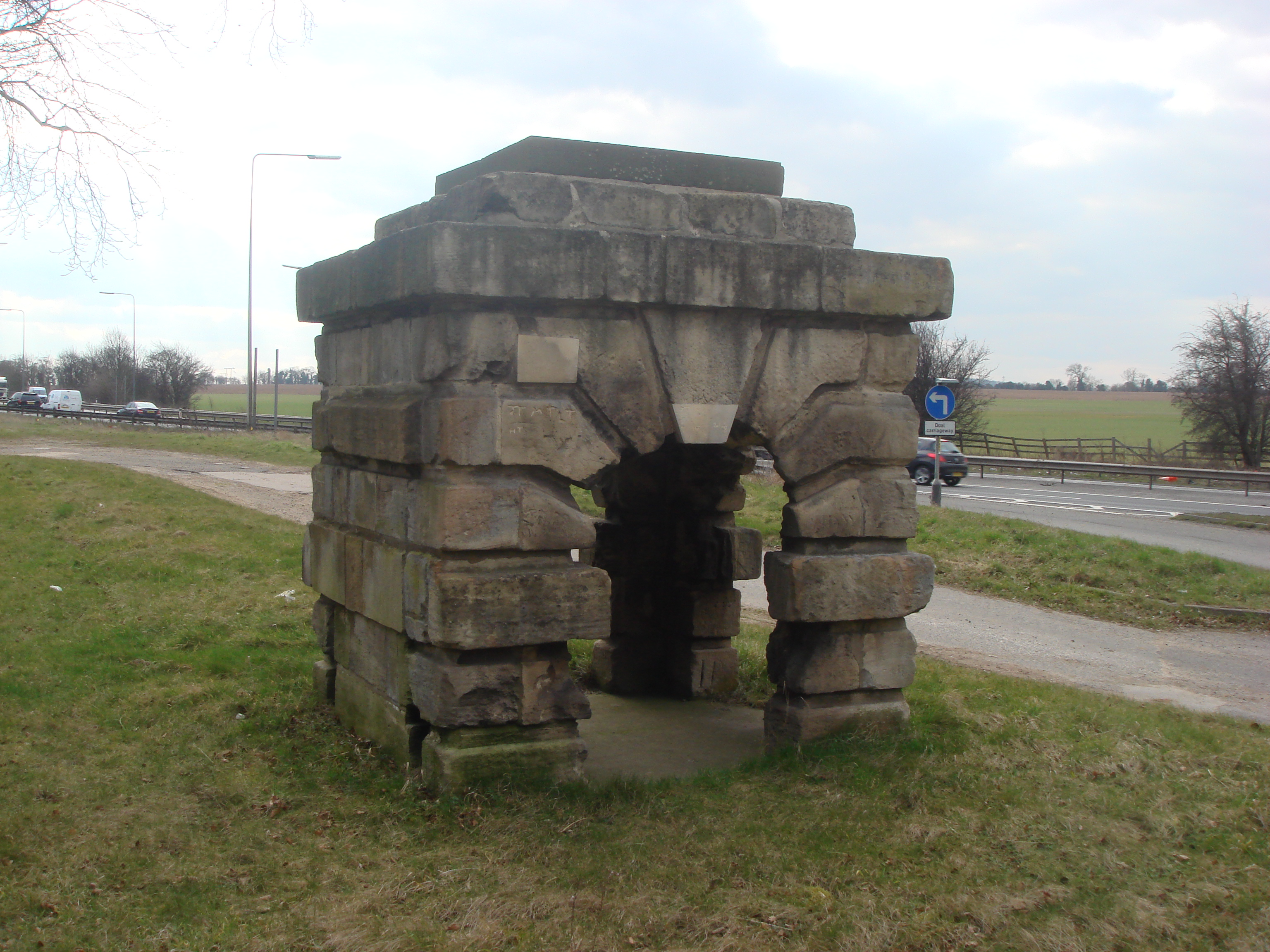
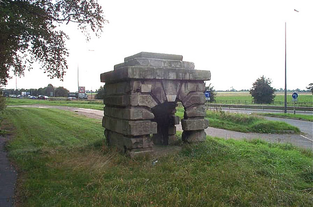
Robin Hood's Well

Robin Hood's Well is a historic structure beside the A1 road near Burghwallis, South Yorkshire, England. It was originally built in 1710 as a well house...

Nearby Amenities

Located within 500m of 53.613298,-1.2332546
Motorway Junction
Barnsdale Bar
Name Signed: yes
Ref: 39
Lat/Long: 53.617017/-1.2299567
Motorway Junction
Barnsdale Bar
Name Signed: yes
Ref: 39
Lat/Long: 53.6173018/-1.2299606
Bus Stop
Great North Road/Barnsdale Bar
Alt Name: Great North Road/Barnsdale Bar
Naptan AltCommonName: Great North Road/Barnsdale Bar
Naptan AtcoCode: 370040633
Naptan Bearing: NW
Naptan CommonName: Great North Road/Barnsdale Bar
Naptan Indicator: 40633
Naptan Landmark: A1 NORTHBOUND
Naptan Street: Great North Road
Naptan Verified: no
Source: naptan_import
Lat/Long: 53.6165889/-1.2298097
Bus Stop
Great North Road/Barnsdale Bar
Alt Name: Great North Road/Barnsdale Bar
Naptan AltCommonName: Great North Road/Barnsdale Bar
Naptan AtcoCode: 370040634
Naptan Bearing: SE
Naptan CommonName: Great North Road/Barnsdale Bar
Naptan Indicator: 40634
Naptan Landmark: A1 SOUTHBOUND
Naptan PlusbusZoneRef: ROTHCEN
Naptan Street: Great North Road
Naptan Verified: no
Source: naptan_import
Lat/Long: 53.6166556/-1.2289922
Power: tower
Lat/Long: 53.6119361/-1.2290644
Power: tower
Lat/Long: 53.6109278/-1.2386796
Power: tower
Lat/Long: 53.6115028/-1.2332925
The data included in this document is from www.openstreetmap.org. The data is made available under ODbL.

Have you been to Clump Plantation?

Leave your review of Clump Plantation below (or comments, questions and feedback).