Craven's Rough
Wood, Forest in Leicestershire Charnwood
England
Craven's Rough
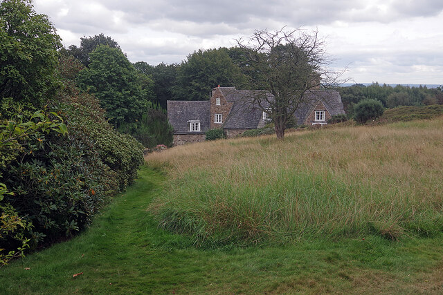
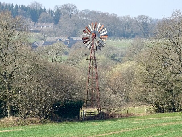
Craven's Rough is a picturesque woodland located in Leicestershire, England. Covering an area of approximately 500 acres, it is situated in the heart of the county, just a few miles north of the town of Hinckley. The woodland is part of the larger area known as the National Forest, which is an ongoing reforestation project aimed at creating a large forested area in the Midlands.
Craven's Rough is characterized by its diverse range of tree species, including oak, beech, birch, and pine. The woodland is home to a variety of wildlife, such as deer, foxes, badgers, and numerous bird species, making it a popular spot for nature enthusiasts and wildlife photographers.
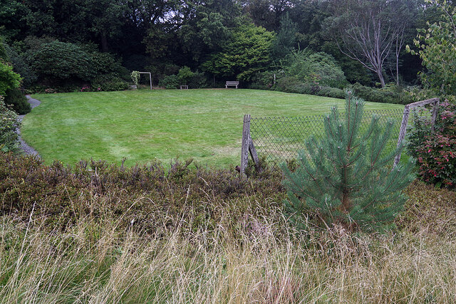
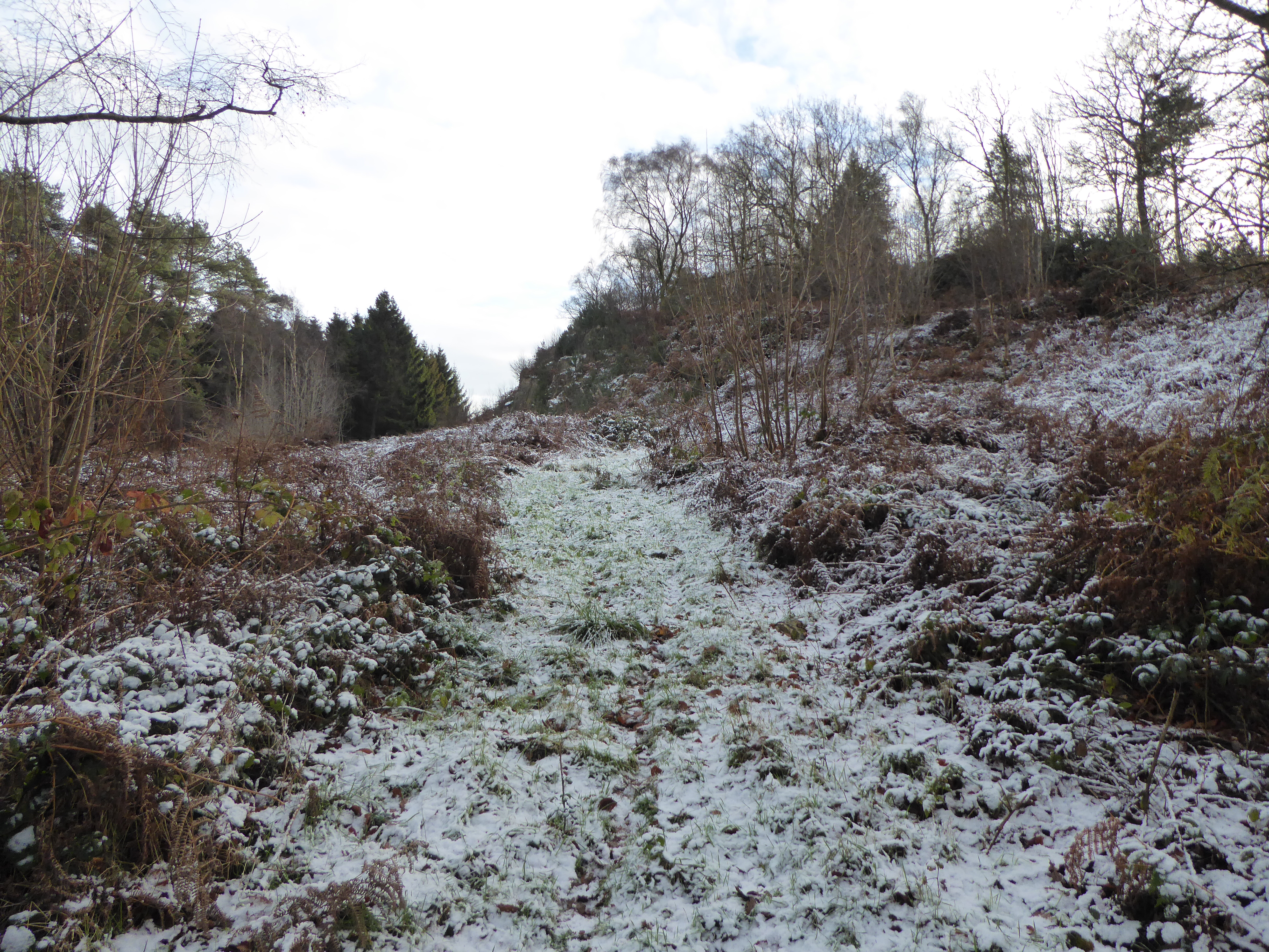
The woodland is crisscrossed by a network of well-maintained footpaths, allowing visitors to explore its natural beauty. There are also designated cycling routes for those who prefer to explore on two wheels. These trails meander through the forest, taking visitors through tranquil glades, alongside bubbling streams, and up gentle hills, offering stunning views of the surrounding countryside.
Craven's Rough is not only a haven for nature lovers but also a place of historical significance. The woodland has remnants of ancient earthworks and archaeological sites, indicating human habitation in the area for thousands of years.
Overall, Craven's Rough is a scenic and diverse woodland that offers a peaceful escape from the hustle and bustle of urban life. Whether one is seeking a leisurely stroll, a challenging hike, or simply a place to reconnect with nature, this woodland provides a perfect setting.
If you have any feedback on the listing, please let us know in the comments section below.
Craven's Rough Images
Images are sourced within 2km of 52.703169/-1.2494305 or Grid Reference SK5011. Thanks to Geograph Open Source API. All images are credited.


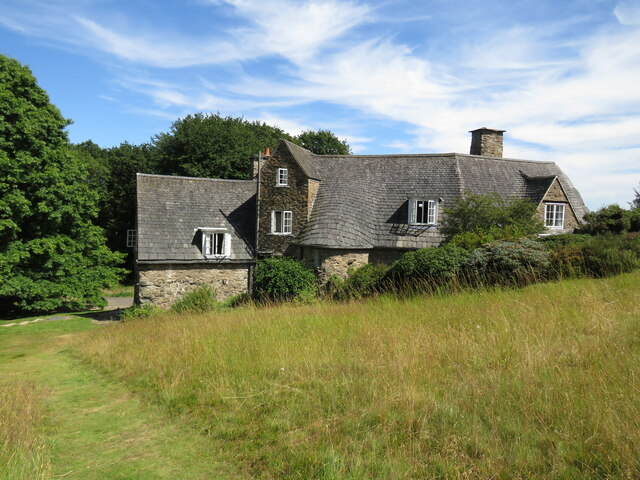
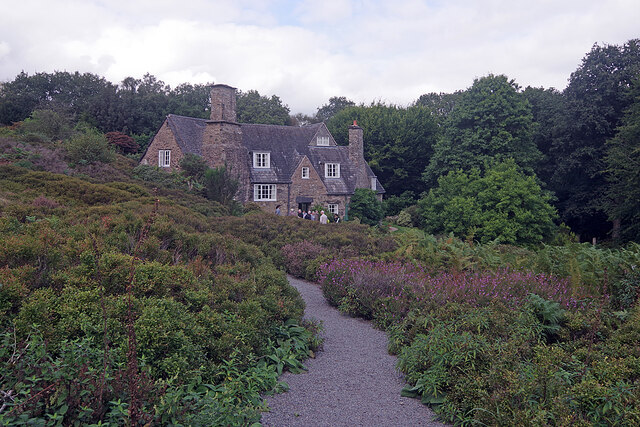
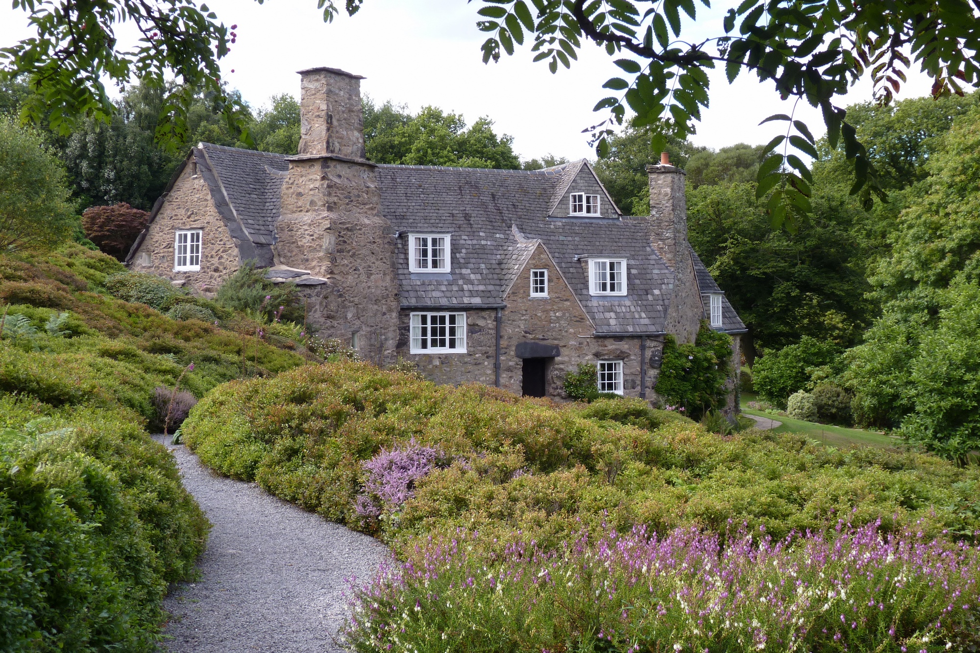
![Stoneywell [1] The cottage is seen from the garden.
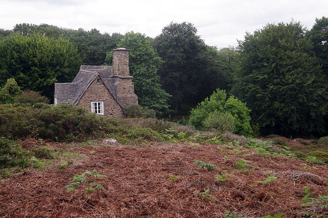
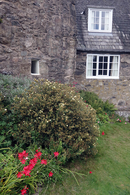
Stoneywell is a cottage, located near the village of Markfield. Some 7 miles northwest of Leicester. Designed and built in the Arts and Crafts style in 1899 by Ernest Gimson, for his brother Sydney. Ernest Gimson was one of the most inspiring and influential architect-designers of the Arts and Crafts movement, which had the ideal of ‘Nothing should be made by man’s labour which is not worth making, or must be made by labour degrading to the makers.’ The cottage is now owned by the National Trust. Listed, grade II, with details at: <span class="nowrap"><a title="https://historicengland.org.uk/listing/the-list/list-entry/1361102" rel="nofollow ugc noopener" href="https://historicengland.org.uk/listing/the-list/list-entry/1361102">Link</a><img style="margin-left:2px;" alt="External link" title="External link - shift click to open in new window" src="https://s1.geograph.org.uk/img/external.png" width="10" height="10"/></span>](https://s1.geograph.org.uk/geophotos/07/26/60/7266029_0b80d81b.jpg)
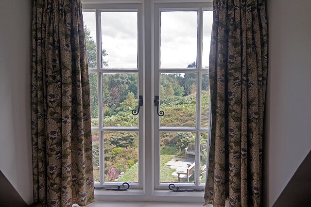
![Stoneywell [2] The interior of the cottage.
Stoneywell is a cottage, located near the village of Markfield. Some 7 miles northwest of Leicester. Designed and built in the Arts and Crafts style in 1899 by Ernest Gimson, for his brother Sydney. Ernest Gimson was one of the most inspiring and influential architect-designers of the Arts and Crafts movement, which had the ideal of ‘Nothing should be made by man’s labour which is not worth making, or must be made by labour degrading to the makers.’ The cottage is now owned by the National Trust.](https://s2.geograph.org.uk/geophotos/07/26/60/7266030_403de446.jpg)
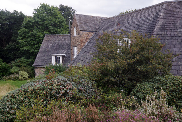
![Stoneywell [3] The interior of the cottage. A leaking chimney had required the removal of plaster from the wall, resulting in the wall construction being visible.
Stoneywell is a cottage, located near the village of Markfield. Some 7 miles northwest of Leicester. Designed and built in the Arts and Crafts style in 1899 by Ernest Gimson, for his brother Sydney. Ernest Gimson was one of the most inspiring and influential architect-designers of the Arts and Crafts movement, which had the ideal of ‘Nothing should be made by man’s labour which is not worth making, or must be made by labour degrading to the makers.’ The cottage is now owned by the National Trust.](https://s3.geograph.org.uk/geophotos/07/26/60/7266031_06385595.jpg)
![Stoneywell [4] The interior of the cottage.
Stoneywell is a cottage, located near the village of Markfield. Some 7 miles northwest of Leicester. Designed and built in the Arts and Crafts style in 1899 by Ernest Gimson, for his brother Sydney. Ernest Gimson was one of the most inspiring and influential architect-designers of the Arts and Crafts movement, which had the ideal of ‘Nothing should be made by man’s labour which is not worth making, or must be made by labour degrading to the makers.’ The cottage is now owned by the National Trust.](https://s0.geograph.org.uk/geophotos/07/26/60/7266032_1f7c4615.jpg)
![Stoneywell [5] The interior of the cottage.
Stoneywell is a cottage, located near the village of Markfield. Some 7 miles northwest of Leicester. Designed and built in the Arts and Crafts style in 1899 by Ernest Gimson, for his brother Sydney. Ernest Gimson was one of the most inspiring and influential architect-designers of the Arts and Crafts movement, which had the ideal of ‘Nothing should be made by man’s labour which is not worth making, or must be made by labour degrading to the makers.’ The cottage is now owned by the National Trust.](https://s1.geograph.org.uk/geophotos/07/26/60/7266033_0c0da5ba.jpg)
![Stoneywell [6] The interior of the cottage.
Stoneywell is a cottage, located near the village of Markfield. Some 7 miles northwest of Leicester. Designed and built in the Arts and Crafts style in 1899 by Ernest Gimson, for his brother Sydney. Ernest Gimson was one of the most inspiring and influential architect-designers of the Arts and Crafts movement, which had the ideal of ‘Nothing should be made by man’s labour which is not worth making, or must be made by labour degrading to the makers.’ The cottage is now owned by the National Trust.](https://s2.geograph.org.uk/geophotos/07/26/60/7266034_45285446.jpg)
Craven's Rough is located at Grid Ref: SK5011 (Lat: 52.703169, Lng: -1.2494305)
Administrative County: Leicestershire
District: Charnwood
Police Authority: Leicestershire
What 3 Words
///opera.invent.tiger. Near Markfield, Leicestershire
Nearby Locations
Related Wikis
Charnwood Forest
Charnwood Forest is a hilly tract in north-western Leicestershire, England, bounded by Leicester, Loughborough and Coalville. The area is undulating, rocky...

Lea Meadows
Lea Meadows is a 12-hectare (30-acre) nature reserve east of Markfield in Leicestershire. It is owned and managed by the Leicestershire and Rutland Wildlife...
Benscliffe Wood
Benscliffe Wood is a 9.8 hectares (24 acres) biological Site of Special Scientific Interest in Leicestershire.This wood has one of the richest varieties...
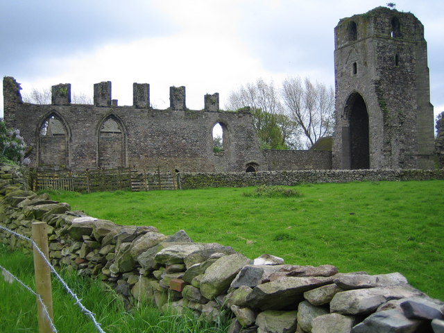
Ulverscroft Priory
Ulverscroft Priory is a former hermitage and priory in Ulverscroft, Leicestershire. == History == The priory was founded by Robert de Beaumont, 2nd Earl...
Stoneywell
Stoneywell is a National Trust property in Ulverscroft, a dispersed settlement near Coalville in Charnwood Forest, Leicestershire. Stoneywell is the largest...
Ulverscroft
Ulverscroft is a civil parish in the Charnwood district of Leicestershire. It has a population of about 100. The population in 2011 is included in the...
Rocky Plantation
Rocky Plantation is a 3.4-hectare (8.4-acre) nature reserve north of Markfield in Leicestershire. It is owned by the National Trust and managed by the...

Ulverscroft Valley
Ulverscroft Valley is a 110.8 hectares (274 acres) biological Site of Special Scientific Interest north-west of Markfield in Leicestershire. The site is...
Nearby Amenities
Located within 500m of 52.703169,-1.2494305Have you been to Craven's Rough?
Leave your review of Craven's Rough below (or comments, questions and feedback).