Druid

Settlement in Merionethshire

Wales

Druid

House at Druid On the A494.
House at Druid Credit: Trevor Harris

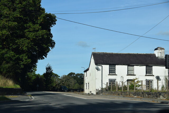
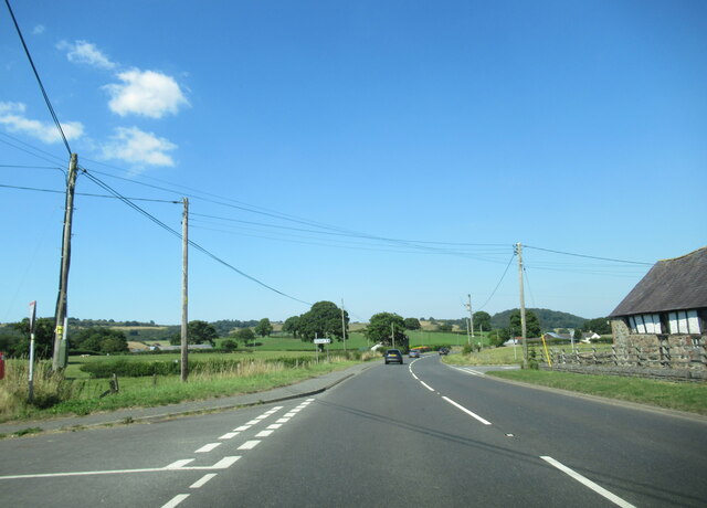
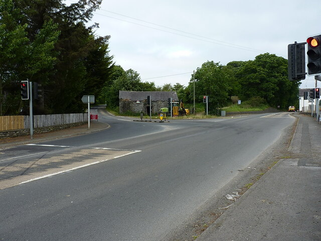
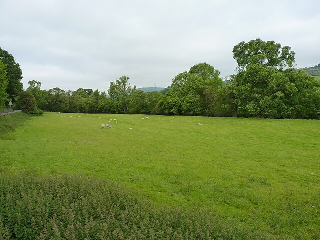
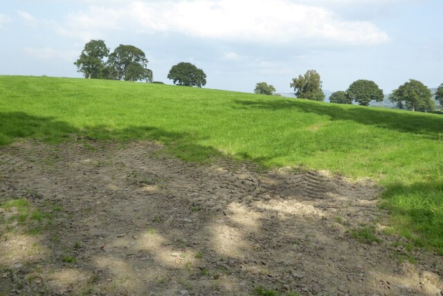
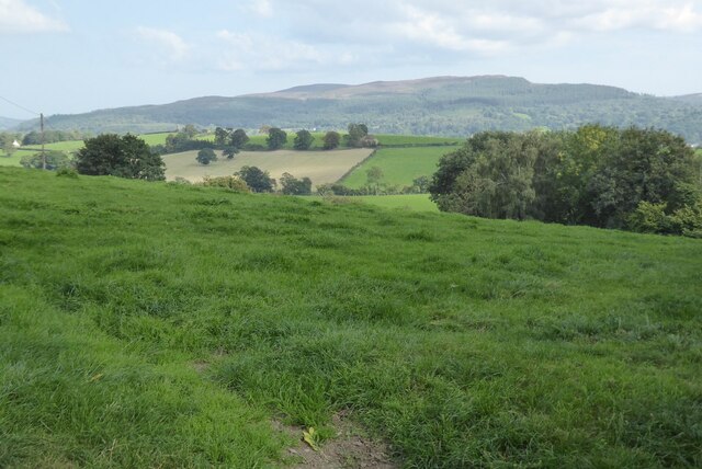
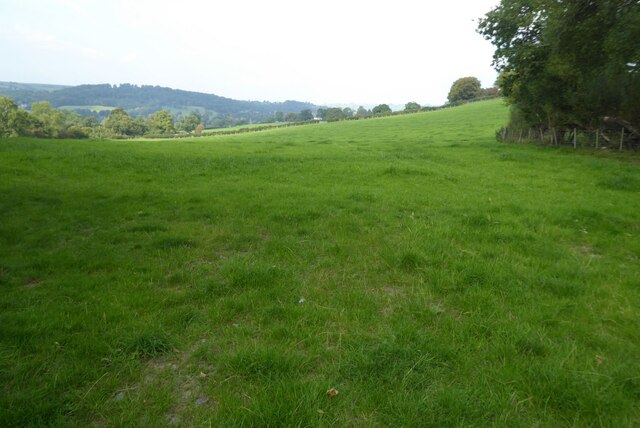
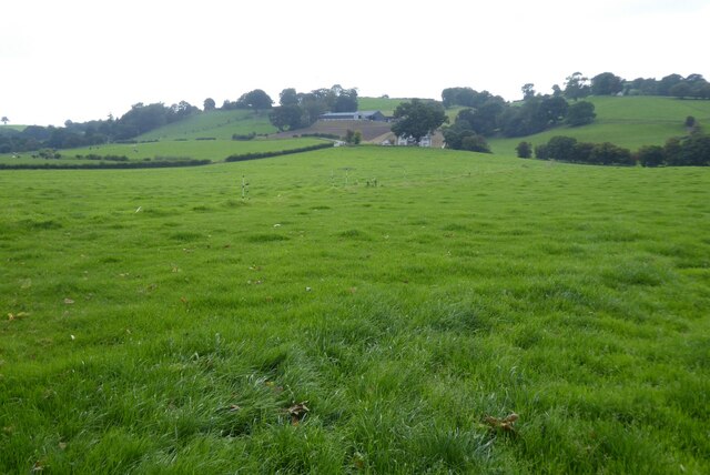
Druid is a small village located in the county of Merionethshire, Wales. Situated in the heart of Snowdonia National Park, it is surrounded by breathtaking natural beauty, including rugged mountains, cascading waterfalls, and lush green valleys. The village is nestled within the Gwynant Valley, which is known for its stunning landscapes and tranquil atmosphere.

With a population of around 200 residents, Druid maintains a strong sense of community and offers a peaceful and idyllic lifestyle. The village is characterized by its traditional Welsh cottages, many of which date back several centuries, giving it a charming and timeless feel.

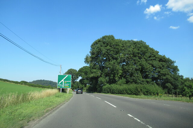
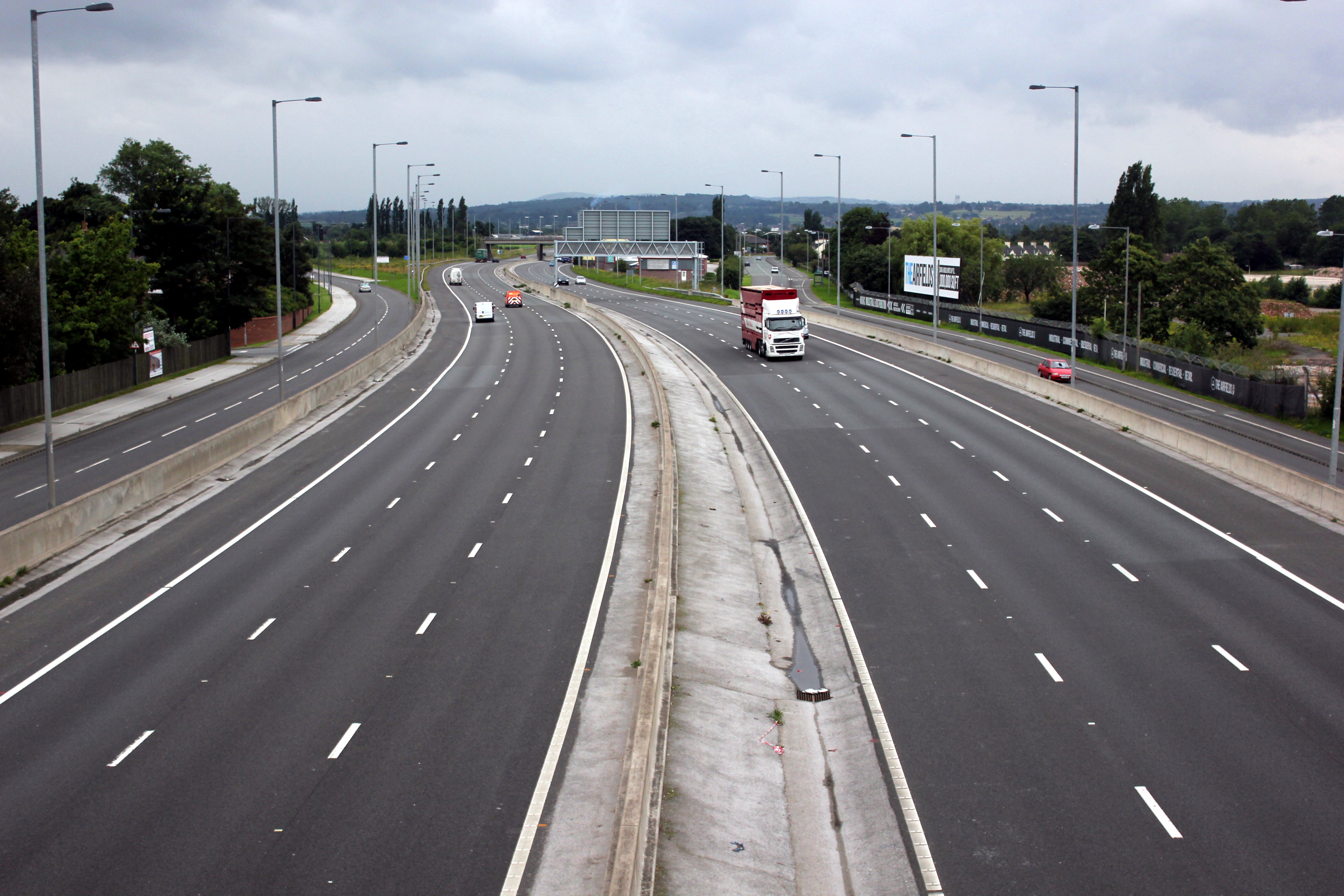
Druid is a popular destination for outdoor enthusiasts, as it provides easy access to a range of activities. The nearby Snowdon mountain range offers ample opportunities for hiking, climbing, and mountaineering, with trails suitable for both novice and experienced adventurers. The region is also renowned for its beautiful lakes and rivers, making it an ideal spot for fishing, boating, and kayaking.

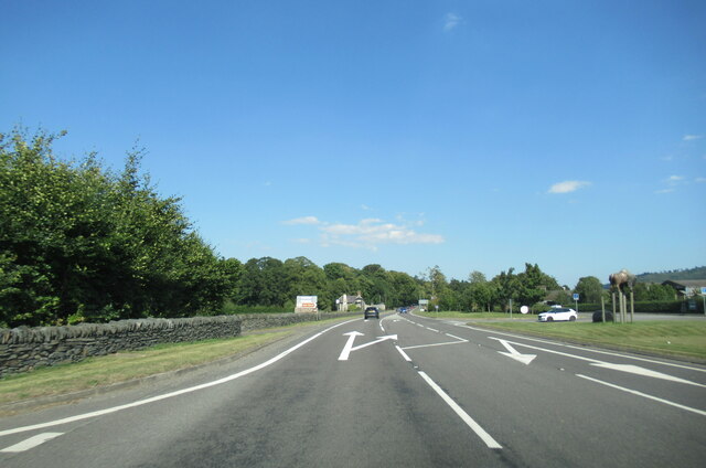
Despite its small size, Druid has a few amenities to cater to residents and visitors. There is a cozy pub and a small convenience store, providing essential goods and services. For a wider range of amenities, the nearby town of Beddgelert is just a short drive away.

Overall, Druid is a picturesque village that offers a peaceful retreat in one of the most stunning parts of Wales. Its natural beauty, sense of community, and access to outdoor activities make it a desirable place to live or visit for those seeking a tranquil and scenic environment.

If you have any feedback on the listing, please let us know in the comments section below.

Druid Images

Images are sourced within 2km of 52.979501/-3.429649 or Grid Reference SJ0443. Thanks to Geograph Open Source API. All images are credited.

House at Druid On the A494.
House at Druid
On the A494.
Alwen River near Melin Rhug At higher than its usual level after days of rain
Alwen River near Melin Rhug
At higher than its usual level after days of rain
Pont Melin Rhug The bridge was probably built in the early C18, and similar in style to the local bridges over the River Dee at Corwen, Carrog and Cynwyd. It is listed Grade II*. The A5 used this bridge until a new bridge was built just north of it.
Pont Melin Rhug
The bridge was probably built in the early C18, and similar in style to the local bridges over the River Dee at Corwen, Carrog and Cynwyd. It is listed Grade II*. The A5 used this bridge until a new bridge was built just north of it.
A494 north at Glan-yr-Afon village sign
A494 north at  Four Crosses
A494 north at Four Crosses
A494 north approaching junction with the A5
A494 north at the junction with the A5
The A5 east just after crossing the Afon Alwen
Junction of the A5 and the A494 at Druid Controlled by lights, the A494 goes left here towards Bala, whilst the main A5 truck route to Holyhead continues straight on (ie on the right in the image, granted.)
Junction of the A5 and the A494 at Druid
Controlled by lights, the A494 goes left here towards Bala, whilst the main A5 truck route to Holyhead continues straight on (ie on the right in the image, granted.)
OS flush bracket on the old Post Office at Druid Repainted sometime since Dusty's photo at <a href="https://www.geograph.org.uk/photo/5142882">SJ0443 : Ordnance Survey Flush Bracket (11364)</a> was taken, and almost illegible as a consequence. It was last recorded by the OS in 1975 at 152.418m above Ordnance Datum Newlyn. Older maps show another benchmark on the front (roadside) face of the building, at 499.6ft above Liverpool datum, but I'd guess this has been lost to alterations or render.
OS flush bracket on the old Post Office at Druid
Repainted sometime since Dusty's photo at SJ0443 : Ordnance Survey Flush Bracket (11364) was taken, and almost illegible as a consequence. It was last recorded by the OS in 1975 at 152.418m above Ordnance Datum Newlyn. Older maps show another benchmark on the front (roadside) face of the building, at 499.6ft above Liverpool datum, but I'd guess this has been lost to alterations or render.
Sheep in a field west of Druid junction The field is in the valley of the Afon Alwen, which joins the Dyfrdwy a couple of miles downstream in <a href="https://www.geograph.org.uk/gridref/SJ0642">SJ0642</a>
Sheep in a field west of Druid junction
The field is in the valley of the Afon Alwen, which joins the Dyfrdwy a couple of miles downstream in SJ0642
Field above Druid
Field above Druid
View across the Dee valley
Farmland near Cynwyd
Farmland near Cynwyd Farmland above the Dee valley near Cynwyd.
Farmland near Cynwyd
Farmland above the Dee valley near Cynwyd.
Milestone Milestone on the A5 near to Druid, Denbighshire; for overall view see <a title="https://www.geograph.org.uk/photo/5120441" href="https://www.geograph.org.uk/photo/5120441">Link</a>
Milestone
Milestone on the A5 near to Druid, Denbighshire; for overall view see Link
Holyhead 64 Milestone on the A5 near to Druid, Denbighshire; for close up view see <a title="https://www.geograph.org.uk/photo/5120436" href="https://www.geograph.org.uk/photo/5120436">Link</a>
Holyhead 64
Milestone on the A5 near to Druid, Denbighshire; for close up view see Link
Ordnance Survey Flush Bracket (11364) This OS Flush Bracket can be found on the old Post Office. It marks a point 152.418m above mean sea level.
Ordnance Survey Flush Bracket (11364)
This OS Flush Bracket can be found on the old Post Office. It marks a point 152.418m above mean sea level.
Show me another place!

Druid is located at Grid Ref: SJ0443 (Lat: 52.979501, Lng: -3.429649)

Unitary Authority: Denbighshire

Police Authority: North Wales

What 3 Words

///invisible.saturate.strut. Near Derwen, Denbighshire

Nearby Locations

Druid

Related Wikis

Druid, Denbighshire

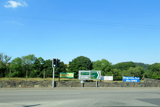
Druid (Welsh: Y Ddwyryd) is a small village in Denbighshire, Wales. The village is located where the A5 and the A494 meet, about two miles west of Corwen...

Plas Uchaf

Plas Uchaf (English: Upper Hall) is a 15th-century cruck-and-aisle-truss hall house, 1.5 miles (2.4 km) south-west of Corwen, Denbighshire, Wales and 1...

Gwerclas

Gwerclas usually refers to a former castle and farmstead close to Cymmer in the parish of Llangar in the ancient cantref of Edeyrnion, Wales. It is now...

Glan-yr-afon, Gwynedd

Glan-yr-afon is a small village near Corwen in Gwynedd, Wales and is situated on the A494. The village is on the boundary of Gwynedd and Denbighshire....

A494 road

The A494 is a trunk road in Wales and England. The route, which is officially known as the Dolgellau to South of Birkenhead Trunk Road, runs between the...

Llangar

Llangar is a former civil parish in Denbighshire in Wales, 1 mile (1.6 km) south west of Corwen, its post town, and 10 miles (16 km) north east of Bala...

Rhug

Rhug (normally Y Rug in Welsh; sometimes given the antiquarian spelling Rûg) is a township in the parish of Corwen, Denbighshire, Wales, formerly in the...
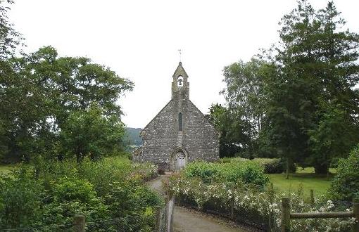
Llangar Church

Llangar Church, or All Saints Old Parish Church, Llangar, was formerly the parish church of Llangar with Cynwyd, in the Dee Valley, Denbighshire, North...

Nearby Amenities

Located within 500m of 52.979501,-3.429649
Source: npe
Lat/Long: 52.9807341/-3.4357984
Source: npe
Lat/Long: 52.9808681/-3.4346937
Source: npe
Lat/Long: 52.9812587/-3.433076
Source: npe
Lat/Long: 52.9813373/-3.4272088
Created By: Merkaartor 0.12
Lat/Long: 52.9824114/-3.4254639
Created By: Merkaartor 0.12
Lat/Long: 52.9823159/-3.4253003
Bus Stop
Bench: no
Bin: no
Bus: yes
Check Date Shelter: 2022-02-28
Public Transport: platform
Shelter: no
Tactile Paving: no
Lat/Long: 52.9804371/-3.4289825
Parking
Access: yes
Fee: no
Parking: layby
Lat/Long: 52.9775389/-3.436062
Post Box
Brand: Royal Mail
Brand Wikidata: Q638098
Operator: Royal Mail
Operator Wikidata: Q638098
Post Box Type: lamp
Lat/Long: 52.9804294/-3.4290466
Power: tower
Lat/Long: 52.9754765/-3.4298533
Power: tower
Lat/Long: 52.9760392/-3.4256136
Power: tower
Lat/Long: 52.9757866/-3.4276003
Place: farm
Lat/Long: 52.976631/-3.4244861
Place: farm
Lat/Long: 52.9806811/-3.4312324
Druid
Place: hamlet
Wikidata: Q16736852
Wikipedia: en:Druid, Denbighshire
Lat/Long: 52.9800167/-3.430433
Power: pole
Lat/Long: 52.9772145/-3.4254753
Power: pole
Lat/Long: 52.9773025/-3.427068
Power: pole
Lat/Long: 52.9770307/-3.4285677
Power: pole
Lat/Long: 52.976741/-3.4302766
Power: pole
Lat/Long: 52.9765452/-3.431345
Power: pole
Lat/Long: 52.9764273/-3.4328083
Power: pole
Lat/Long: 52.9772795/-3.4237681
Building: yes
Lat/Long: 52.9836097/-3.4303784
Power: pole
Lat/Long: 52.9757591/-3.4328654
Traffic Signals
Traffic Signals: signal
Traffic Signals Direction: forward
Lat/Long: 52.9803513/-3.4305166
Traffic Signals
Traffic Signals: signal
Traffic Signals Direction: forward
Lat/Long: 52.9804622/-3.4307034
Traffic Signals
Traffic Signals: signal
Traffic Signals Direction: backward
Lat/Long: 52.980432/-3.4301972
The data included in this document is from www.openstreetmap.org. The data is made available under ODbL.

Have you been to Druid?

Leave your review of Druid below (or comments, questions and feedback).