Ashridge Wood

Wood, Forest in Berkshire

England

Ashridge Wood

Byway and farmland, East Ilsley A restricted byway approaches the south of the village, passing between large fields of stubble.
Byway and farmland, East Ilsley Credit: Andrew Smith

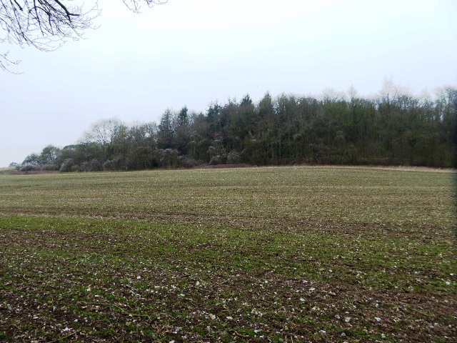
Ashridge Wood is a picturesque woodland located in the county of Berkshire, England. Covering an area of approximately 2,000 acres, it is a significant natural attraction in the region. The wood is part of the larger Ashridge Estate, which is managed by the National Trust and encompasses a variety of landscapes, including woodlands, meadows, and parkland.

Ashridge Wood is characterized by its diverse range of tree species, including beech, oak, and birch. These towering trees create a dense canopy that provides a tranquil and shaded environment for visitors to explore. The forest floor is adorned with a rich carpet of bluebells in the spring, adding a burst of vibrant color to the surroundings.

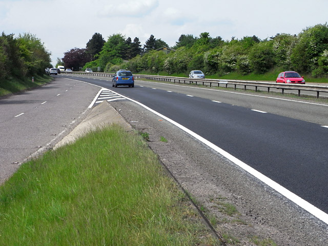
The wood is crisscrossed by a network of well-maintained footpaths and trails, making it an ideal destination for walkers, hikers, and nature enthusiasts. The Ashridge Estate also offers a visitor center, where visitors can learn more about the history and ecology of the wood through informative displays.

Apart from its natural beauty, Ashridge Wood is also steeped in history. The wood was once part of a medieval hunting forest and has witnessed centuries of human activity. Ruins of an Iron Age hillfort can still be found within its boundaries, providing a glimpse into the region's ancient past.

Overall, Ashridge Wood is a delightful destination for those seeking tranquility and a connection with nature. Its stunning vistas, diverse flora, and rich history make it a must-visit location for both locals and tourists alike.

If you have any feedback on the listing, please let us know in the comments section below.

Ashridge Wood Images

Images are sourced within 2km of 51.501711/-1.280938 or Grid Reference SU5078. Thanks to Geograph Open Source API. All images are credited.

Byway and farmland, East Ilsley A restricted byway approaches the south of the village, passing between large fields of stubble.
Byway and farmland, East Ilsley
A restricted byway approaches the south of the village, passing between large fields of stubble.
The A34 heading south from East Ilsley
Down Barn, East Ilsley construction work Construction work appears to be ongoing at Down Barn near East Ilsley on Dennisford Road. The barn and disused cottage had a planning application approved in 2021 to convert and extend the redundant former cottage building for use as a self-contained residential dwelling.
Down Barn, East Ilsley construction work
Construction work appears to be ongoing at Down Barn near East Ilsley on Dennisford Road. The barn and disused cottage had a planning application approved in 2021 to convert and extend the redundant former cottage building for use as a self-contained residential dwelling.
Dennisford Road past Down Barn Construction work appears to be ongoing at Down Barn near East Ilsley on Dennisford Road (a byway). The barn and disused cottage had a planning application approved in 2021 to convert and extend the redundant former cottage building for use as a self-contained residential dwelling.
Dennisford Road past Down Barn
Construction work appears to be ongoing at Down Barn near East Ilsley on Dennisford Road (a byway). The barn and disused cottage had a planning application approved in 2021 to convert and extend the redundant former cottage building for use as a self-contained residential dwelling.
Down Barn cottage Construction work appears to be ongoing at Down Barn near East Ilsley on Dennisford Road. The barn and disused cottage had a planning application approved in 2021 to convert and extend the redundant former cottage building for use as a self-contained residential dwelling.
Down Barn cottage
Construction work appears to be ongoing at Down Barn near East Ilsley on Dennisford Road. The barn and disused cottage had a planning application approved in 2021 to convert and extend the redundant former cottage building for use as a self-contained residential dwelling.
Down Barn, East Ilsley An agricultural building near East Ilsley.
Down Barn, East Ilsley
An agricultural building near East Ilsley.
Dennisford Road A byway between Ilsley Road and an underpass under the A34.
Dennisford Road
A byway between Ilsley Road and an underpass under the A34.
Farmland, Beedon Looking along the line of the footpath in a field of beans to the north of Beedon Manor.
Farmland, Beedon
Looking along the line of the footpath in a field of beans to the north of Beedon Manor.
Farmland, Beedon Weed-killer has been used to reinstate the footpath in this field of wheat to the south of Beedon Manor.
Farmland, Beedon
Weed-killer has been used to reinstate the footpath in this field of wheat to the south of Beedon Manor.
Track and farmland, East Ilsley The restricted byway to the east of Beedon on the boundary between Hampstead Norreys and East Ilsley parishes.
Track and farmland, East Ilsley
The restricted byway to the east of Beedon on the boundary between Hampstead Norreys and East Ilsley parishes.
The A34, Beedon Showing the end of the slip road for northbound traffic joining the trunk route.
The A34, Beedon
Showing the end of the slip road for northbound traffic joining the trunk route.
St Nicholas Church, Beedon Built of flint the nave and chancel date from circa 1200-30. Note the lancet windows and the shingled broach spire.
St Nicholas Church, Beedon
Built of flint the nave and chancel date from circa 1200-30. Note the lancet windows and the shingled broach spire.
Junction of Oxford Road and Stanmore Road Just before the A34 junction one can escape into the Berkshire countryside around Stanmore.
Junction of Oxford Road and Stanmore Road
Just before the A34 junction one can escape into the Berkshire countryside around Stanmore.
Slip roads for the A34 To the left the Oxford Road joins the northbound A34, whilst the road to the right is providing access onto the Oxford Road for southbound traffic.
Slip roads for the A34
To the left the Oxford Road joins the northbound A34, whilst the road to the right is providing access onto the Oxford Road for southbound traffic.
Oxford Road joins the A34
A34 approaches Shrill Down The A34 is a major trunk road running from Salford to Winchester. In this section over the downs it is only 2 lanes. This means that car drivers face an almost interminable stream of slower HGV's crawling up the inclines, sometimes in the inside lane, sometimes two abreast. This photo was taken on a Sunday morning, when HGV traffic is often lighter.
A34 approaches Shrill Down
The A34 is a major trunk road running from Salford to Winchester. In this section over the downs it is only 2 lanes. This means that car drivers face an almost interminable stream of slower HGV's crawling up the inclines, sometimes in the inside lane, sometimes two abreast. This photo was taken on a Sunday morning, when HGV traffic is often lighter.
Footpath on Nutfield Down Tractor tyres sunk into the ground form a portal as the footpath passes through a hedgerow.
Footpath on Nutfield Down
Tractor tyres sunk into the ground form a portal as the footpath passes through a hedgerow.
Little Ashridge Wood Field edge leading past Little Ashridge Wood.
Little Ashridge Wood
Field edge leading past Little Ashridge Wood.
Show me another place!

Ashridge Wood is located at Grid Ref: SU5078 (Lat: 51.501711, Lng: -1.280938)

Unitary Authority: West Berkshire

Police Authority: Thames Valley

What 3 Words

///confused.marathon.roadways. Near Compton, Berkshire

Related Wikis

Ashridge Wood

Ashridge Wood is a 15.9-hectare (39-acre) biological Site of Special Scientific Interest south-west of Compton in Berkshire. It is in the North Wessex...

Perborough Castle

Perborough Castle is the site of an Iron Age univallate hillfort located at Compton in Berkshire. The site covers approximately 14 acres (5.7 ha), and...

World's End, Berkshire

World's End is a hamlet in Berkshire, England. It is in the district of West Berkshire, near the A34 north of Newbury. To the north is the village of Beedon...

The Downs School, Compton

The Downs School is a comprehensive secondary school in the village of Compton, Berkshire, England. It is a state school run by West Berkshire Education...

East Ilsley

East Ilsley is a village and civil parish in the Berkshire Downs in West Berkshire, north of Newbury. The village is centred immediately east of the A34...

Bothampstead

Bothampstead is a hamlet in the English county of Berkshire, and within the civil parish of Hampstead Norreys. It consists of several houses and a farm...

Compton, Berkshire

Compton is a village and civil parish in the River Pang valley in the Berkshire Downs about 6 miles (9.7 km) south of Didcot. == Geography == Compton is...

Beedon

Beedon is a village and civil parish about 6+1⁄2 miles (10.5 km) north of Newbury in West Berkshire, England. == Geography == The village has outlying...

Have you been to Ashridge Wood?

Leave your review of Ashridge Wood below (or comments, questions and feedback).