Brumcombe Copse

Wood, Forest in Berkshire Vale of White Horse

England

Brumcombe Copse

St Leonard, Sunningwell: tower
St Leonard, Sunningwell: tower Credit: Basher Eyre

Brumcombe Copse is a captivating woodland located in Berkshire, England. Spanning across an area of approximately 200 acres, this enchanting forest boasts a diverse range of flora and fauna, making it a haven for nature enthusiasts and a popular destination for visitors.

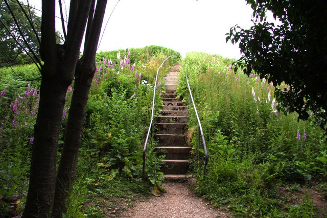
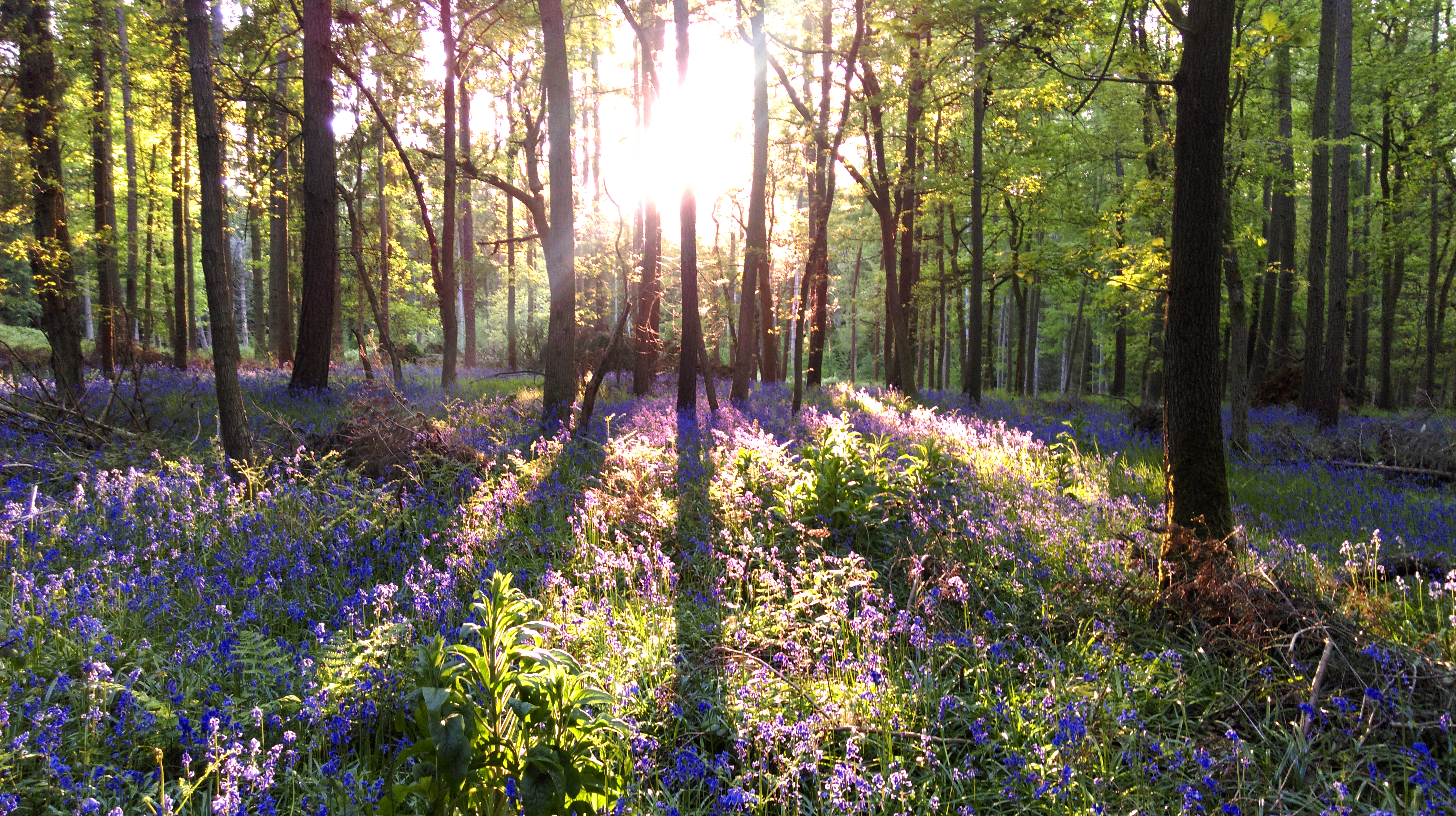
The copse is predominantly composed of native deciduous trees, such as oak, beech, and birch, which create a dense canopy that provides shade and shelter for a variety of woodland creatures. The forest floor is adorned with a rich tapestry of wildflowers, including bluebells, primroses, and wood anemones, which bloom in vibrant colors during the spring months.

Numerous walking trails meander through Brumcombe Copse, enticing visitors to explore the beauty of this natural landscape. As they stroll along the paths, visitors may encounter a plethora of wildlife, including deer, badgers, foxes, and a wide array of bird species. The tranquil atmosphere and the sound of birdsong create a serene ambiance that is perfect for relaxation and contemplation.

Brumcombe Copse is not only a haven for wildlife but also an important conservation site. The woodland is managed by local authorities and dedicated volunteers who work tirelessly to preserve its natural beauty and protect its delicate ecosystem.

Visitors to Brumcombe Copse can enjoy a day of picnicking, photography, or simply immersing themselves in the serenity of nature. With its impressive biodiversity and picturesque scenery, this woodland is a true gem in Berkshire, offering a delightful escape from the hustle and bustle of daily life.

If you have any feedback on the listing, please let us know in the comments section below.

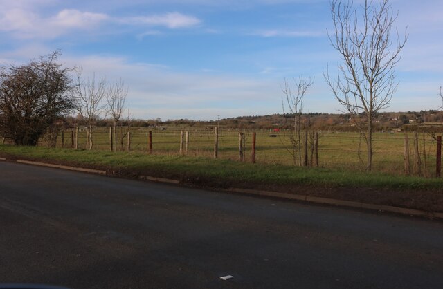
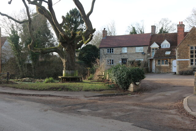
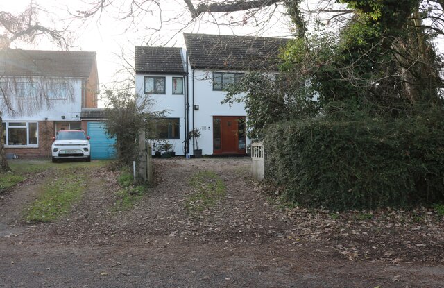
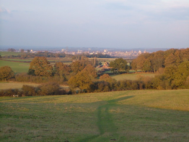
Brumcombe Copse Images

Images are sourced within 2km of 51.712718/-1.2832283 or Grid Reference SP4901. Thanks to Geograph Open Source API. All images are credited.

St Leonard, Sunningwell: tower
Remove the phonebox- have a heart This one opposite the hall at Sunningwell is now home to a defibrillator.
Remove the phonebox- have a heart
This one opposite the hall at Sunningwell is now home to a defibrillator.
Looking south-west along a wet and windy Sunningwell Road
Field by Lamborough Hill, Wootton
House on Sunningwell Road
New track in Sunningwell This has not quite been finished, the gate just went into a field before this year.
New track in Sunningwell
This has not quite been finished, the gate just went into a field before this year.
Sunningwell pond
Sunningwell pond
The centre of Sunningwell Sunningwell School of Art is on the right.
The centre of Sunningwell
Sunningwell School of Art is on the right.
Entrance to houses in Sunningwell
Pen Lane, Sunningwell
Houses on Brumcombe Lane, Bayworth
Bayworth Lane, Boars Hill
Brumcombe Lane, Bayworth
Sunningwell church St Leonard's church has a seven sided porch.  Taken from outside the Village Hall.
Sunningwell church
St Leonard's church has a seven sided porch. Taken from outside the Village Hall.
Jarn Mound Sir Arthur Evans built Jarn Mound in 1933 to try to preserve the view of Oxford across Matthew Arnold Field. The mound has shrunk and the trees have grown, though there are plans to restore the view, and the garden that Evans planted still has a huge variety of plants. Looking roughly north-east from the summit.
Jarn Mound
Sir Arthur Evans built Jarn Mound in 1933 to try to preserve the view of Oxford across Matthew Arnold Field. The mound has shrunk and the trees have grown, though there are plans to restore the view, and the garden that Evans planted still has a huge variety of plants. Looking roughly north-east from the summit.
Near Chilswell House Looking east to the edge of the grounds of the Carmelite Priory, Chilswell House (home of Robert Bridges). Taken from the bridleway on the edge of Youlbury Scout Camp.
Near Chilswell House
Looking east to the edge of the grounds of the Carmelite Priory, Chilswell House (home of Robert Bridges). Taken from the bridleway on the edge of Youlbury Scout Camp.
Old Golf Course, Boar's Hill The Oxford Preservation Trust now owns the golf course, which forms an amphitheatre sloping down to Chilswell Farm Cottages in the centre of the picture on the edge of the square. The dramatic backdrop to this square is the famous view of Oxford city centre, 4 km from the camera. Looking ENE at 3:13 pm.
Old Golf Course, Boar's Hill
The Oxford Preservation Trust now owns the golf course, which forms an amphitheatre sloping down to Chilswell Farm Cottages in the centre of the picture on the edge of the square. The dramatic backdrop to this square is the famous view of Oxford city centre, 4 km from the camera. Looking ENE at 3:13 pm.
Show me another place!

Brumcombe Copse is located at Grid Ref: SP4901 (Lat: 51.712718, Lng: -1.2832283)

Administrative County: Oxfordshire

District: Vale of White Horse

Police Authority: Thames Valley

What 3 Words

///thank.drape.given. Near Radley, Oxfordshire

Related Wikis

Midvale Ridge

The Midvale Ridge is a natural region in South Central England formed by a band of low-lying limestone hills that run from southeast to northwest from...

Boars Hill

Boars Hill is a hamlet 3 miles (5 km) southwest of Oxford, straddling the boundary between the civil parishes of Sunningwell and Wootton. Historically...

Jarn Mound

Jarn Mound is a mound on Boars Hill which was completed in 1931. It was commissioned by Sir Arthur Evans to provide and preserve the view of the "dreaming...

Chandlings

Chandlings, or Chandlings Prep School, known until 2007 as Chandlings Manor School, is an independent co-educational preparatory school at Bagley Wood...

Sunningwell

Sunningwell is a village and civil parish about 3+1⁄2 miles (6 km) south of Oxford, England. The parish includes the village of Bayworth and the eastern...

Chilswell

Chilswell is a small settlement in the parish of Cumnor, Oxfordshire. It lies between the village of South Hinksey and Boars Hill. In 1974 it was transferred...

Bagley Wood

Bagley Wood is a wood in the parish of Kennington between Oxford and Abingdon in Oxfordshire, England (in Berkshire until 1974). It is traversed from...

Bayworth

Bayworth is a hamlet in the civil parish of Sunningwell about 3 miles (5 km) south of Oxford. Bayworth was part of Berkshire until the 1974 boundary changes...

Nearby Amenities

Located within 500m of 51.712718,-1.2832283
Note: Sign marking village edge
Lat/Long: 51.7106855/-1.2787943
Post Box
Collection Times: Mo-Fr 16:45; Sa 10:00
Ref: OX1 166
Source: photograph
Lat/Long: 51.7114666/-1.288351
Barrier: kissing_gate
Lat/Long: 51.7089138/-1.2846817
Bus Stop
Bayworth Park
Bus: yes
Frequency: 0
Journeys: 6
Naptan AtcoCode: 340001376BNH
Naptan Bearing: S
Naptan BusStopType: CUS
Naptan CommonName: Bayworth Park
Naptan Indicator: Opposite
Naptan Landmark: Mobile Home Park
Naptan NaptanCode: oxfagmwg
Naptan Street: Brumcombe Lane
Public Transport: platform
Route Ref: 44
Shelter: no
Source: naptan_import
Lat/Long: 51.7104362/-1.2786038
Bus Stop
Bayworth Park
Bus: yes
Frequency: 0
Journeys: 6
Naptan AtcoCode: 340001376BWP
Naptan Bearing: N
Naptan CommonName: Bayworth Park
Naptan Indicator: Outside
Naptan Landmark: Mobile Home park
Naptan NaptanCode: oxfagmgm
Naptan Street: Brumcombe Lane
Public Transport: platform
Route Ref: 44
Shelter: no
Source: naptan_import
Lat/Long: 51.7104096/-1.2787326
Lincombe Lane
Frequency: 0
Naptan AtcoCode: 340001377ENT
Naptan Bearing: SW
Naptan BusStopType: CUS
Naptan CommonName: Lincombe Lane
Naptan Indicator: Corner
Naptan Landmark: Lincombe Lane
Naptan NaptanCode: oxfagpaw
Naptan Street: Fox Lane
Naptan Verified: no
Source: naptan_import
Lat/Long: 51.7113273/-1.2886909
Bus Stop
Lincombe Lane
Bus: yes
Frequency: 0
Naptan AtcoCode: 340001377OPP
Naptan Bearing: NE
Naptan CommonName: Lincombe Lane
Naptan Indicator: Opposite
Naptan Landmark: Lincombe Lane
Naptan NaptanCode: oxfagpat
Naptan Street: Fox Lane
Naptan Verified: no
Public Transport: platform
Source: naptan_import
Lat/Long: 51.7116616/-1.2883971
Bus Stop
Berkeley Road
Bus: yes
Frequency: 0
Naptan AtcoCode: 340001378CNR
Naptan Bearing: W
Naptan CommonName: Berkeley Road
Naptan Indicator: Westbound
Naptan Landmark: Rainbow House
Naptan NaptanCode: oxfagpap
Naptan Street: Berkeley Road
Naptan Verified: no
Public Transport: platform
Source: naptan_import
Lat/Long: 51.7143974/-1.2863847
Berkeley Road
Frequency: 0
Naptan AtcoCode: 340001378OPP
Naptan Bearing: E
Naptan BusStopType: CUS
Naptan CommonName: Berkeley Road
Naptan Indicator: Eastbound
Naptan Landmark: Rainbow House
Naptan NaptanCode: oxfagpam
Naptan Street: Berkeley Road
Naptan Verified: no
Source: naptan_import
Lat/Long: 51.7144781/-1.2863544
Grit Bin
Lat/Long: 51.7096318/-1.2863125
Barrier: stile
Lat/Long: 51.7088642/-1.2847733
Barrier: kissing_gate
Lat/Long: 51.708834/-1.2852235
Barrier: kissing_gate
Bicycle: no
Wheelchair: no
Lat/Long: 51.7096584/-1.2860979
Power: pole
Source: Bing
Lat/Long: 51.7102292/-1.280037
Power: pole
Source: Bing
Lat/Long: 51.7093617/-1.2798868
Power: pole
Source: Bing
Lat/Long: 51.7110901/-1.2798894
Power: pole
Source: Bing
Lat/Long: 51.7119843/-1.27975
Access: no
Barrier: kissing_gate
Foot: yes
Motor Vehicle: no
Lat/Long: 51.7145027/-1.2863444
Boars Hill
Ele: 133
Fixme: Exact coordinates of the peak to be checked.
Natural: peak
Lat/Long: 51.7155357/-1.2887253
Bench
Lat/Long: 51.7157207/-1.2885005
Bench
Lat/Long: 51.7156963/-1.2884845
Foxcombe Hill
Place: neighbourhood
Lat/Long: 51.713574/-1.284399
Barrier: kissing_gate
Bicycle: no
Foot: yes
Horse: no
Material: wood
Vehicle: no
Wheelchair: no
Lat/Long: 51.7155087/-1.2826949
The data included in this document is from www.openstreetmap.org. The data is made available under ODbL.

Have you been to Brumcombe Copse?

Leave your review of Brumcombe Copse below (or comments, questions and feedback).