Weaver's Wood

Wood, Forest in Berkshire

England

Weaver's Wood

Track and farmland, Shaw Oil-seed rape, oaks and a cereal crop beside the byway connecting Long Lane and the western end of Curridge.
Track and farmland, Shaw Credit: Andrew Smith

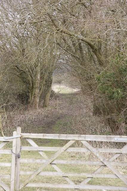
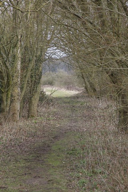
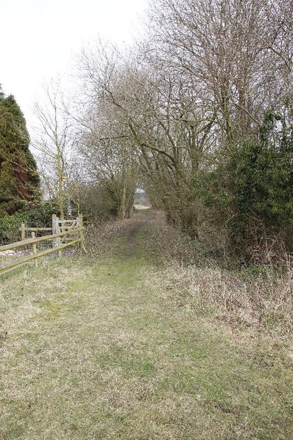
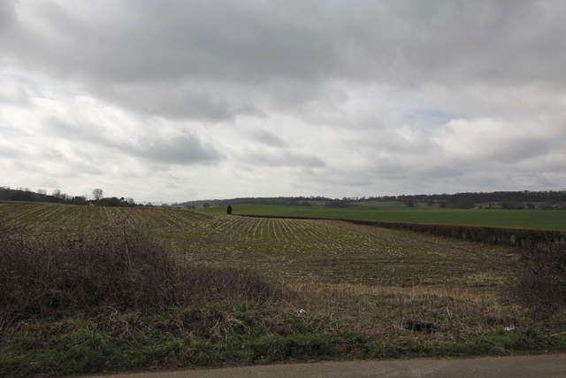
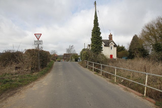
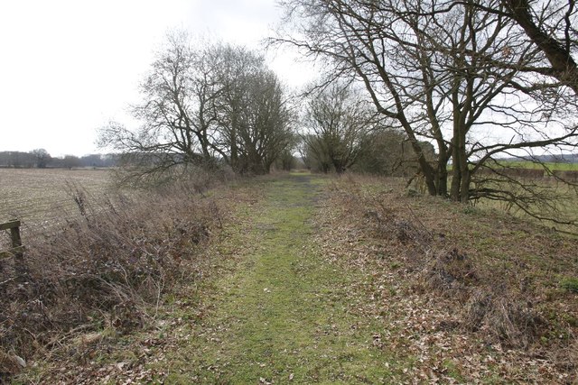
Weaver's Wood is a picturesque forest located in the county of Berkshire, England. Spread across an area of approximately 100 acres, this woodland is renowned for its natural beauty and diverse ecosystem. Situated just a few miles away from the bustling town of Reading, Weaver's Wood offers a tranquil retreat for nature enthusiasts and outdoor lovers.

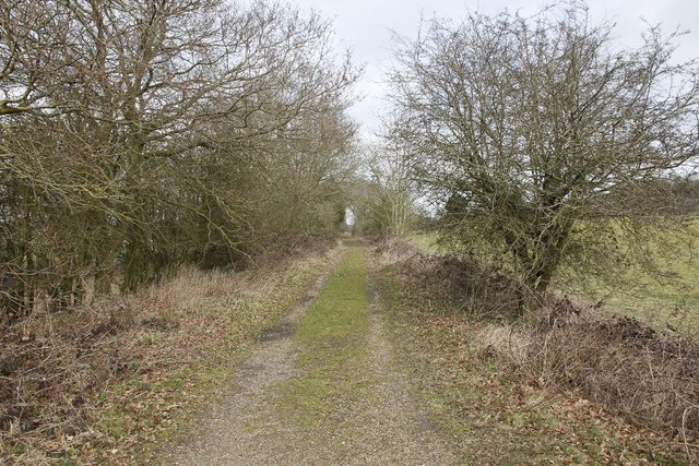
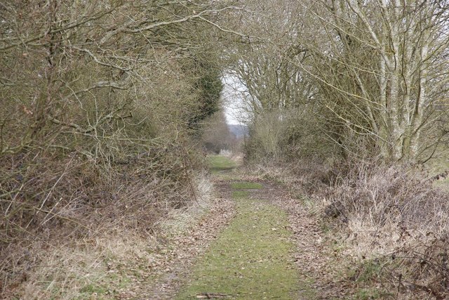
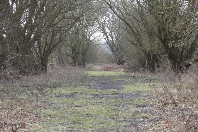
The forest is characterized by a mix of native tree species, including oak, beech, and silver birch, which provide a dense canopy and shelter for a variety of wildlife. Visitors can expect to spot a range of bird species, such as woodpeckers, owls, and thrushes, as well as small mammals like squirrels and hedgehogs. The woodland floor is adorned with an array of wildflowers, adding vibrant colors to the surroundings during the spring and summer months.

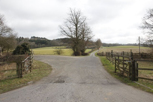
Weaver's Wood is crisscrossed by a network of well-maintained walking trails, allowing visitors to explore its enchanting nooks and crannies. These pathways cater to all levels of fitness and provide access to the different areas of the forest. Additionally, there are designated picnic areas and benches strategically placed throughout the wood, providing the perfect spots for visitors to rest and take in the peaceful atmosphere.

The forest is managed by the local Berkshire Wildlife Trust, ensuring that the delicate ecosystem is preserved and respected. The Trust also organizes educational programs and guided walks, allowing visitors to learn more about the flora and fauna that call Weaver's Wood their home.

Overall, Weaver's Wood in Berkshire is a haven of natural beauty and tranquility, offering a serene escape from the hustle and bustle of everyday life.

If you have any feedback on the listing, please let us know in the comments section below.

Weaver's Wood Images

Images are sourced within 2km of 51.420765/-1.289356 or Grid Reference SU4969. Thanks to Geograph Open Source API. All images are credited.

Track and farmland, Shaw Oil-seed rape, oaks and a cereal crop beside the byway connecting Long Lane and the western end of Curridge.
Track and farmland, Shaw
Oil-seed rape, oaks and a cereal crop beside the byway connecting Long Lane and the western end of Curridge.
Passing by the road View up towards where the old Didcot,Newbury and Southampton went near Craven Farm
Passing by the road
View up towards where the old Didcot,Newbury and Southampton went near Craven Farm
Along the line View along the old Didcot, Newbury and Southampton Railway near Craven Farm. The railway has almost been erased in farmland just past the trees to the left.
Along the line
View along the old Didcot, Newbury and Southampton Railway near Craven Farm. The railway has almost been erased in farmland just past the trees to the left.
Hedge by the road Here you can see that the old Didcot to Newbury railway (on the right) ran not far from the B4009.
Hedge by the road
Here you can see that the old Didcot to Newbury railway (on the right) ran not far from the B4009.
Gate at Fishers Lane This is where the Didcot Newbury and Southampton railway used to run at Fishers Lane crossing towards Hermitage, the land is now privately owned.
Gate at Fishers Lane
This is where the Didcot Newbury and Southampton railway used to run at Fishers Lane crossing towards Hermitage, the land is now privately owned.
Further down the track A zoomed shot of further along the track bed from the Didcot, Newbury and Southampton railway at Fishers Crossing.
Further down the track
A zoomed shot of further along the track bed from the Didcot, Newbury and Southampton railway at Fishers Crossing.
Gate in the fence The fence of a property bordering the old Didcot, Newbury and Southampton railway. The property was part of the gatekeeper's cottage.
Gate in the fence
The fence of a property bordering the old Didcot, Newbury and Southampton railway. The property was part of the gatekeeper's cottage.
Railway towards Newbury The view from Fishers lane crossing in the Newbury direction, looking here you would not realise the Didcot, Newbury and Southampton railway was here.
Railway towards Newbury
The view from Fishers lane crossing in the Newbury direction, looking here you would not realise the Didcot, Newbury and Southampton railway was here.
Towards the crossing View towards Fishers lane crossing, part of the old Didcot,Newbury and Southampton railway. The crossing is about where the rise is and to the right would have been the crossing signal box. The building in the distance was the crossing operatives house.
Towards the crossing
View towards Fishers lane crossing, part of the old Didcot,Newbury and Southampton railway. The crossing is about where the rise is and to the right would have been the crossing signal box. The building in the distance was the crossing operatives house.
In the hedge Had a quick look round for any signs of the railway and came across a piece of line, no doubt used in the fencing beside the crossing.
In the hedge
Had a quick look round for any signs of the railway and came across a piece of line, no doubt used in the fencing beside the crossing.
Line near Cold Ash Farm This is the remains of the line near Cold Ash Farm.
Line near Cold Ash Farm
This is the remains of the line near Cold Ash Farm.
Track at Cold Ash Farm Zooming in with the camera shows the track bed is still there and clear.
Track at Cold Ash Farm
Zooming in with the camera shows the track bed is still there and clear.
Towards Fishers lane Zoomed in view of the line looking towards Fishers Lane crossing from near Cold Ash farm
Towards Fishers lane
Zoomed in view of the line looking towards Fishers Lane crossing from near Cold Ash farm
Line towards Fishers lane Viewiof the trackbed looking towards Fishers Lane crossing from near Cold Ash Farm.
Line towards Fishers lane
Viewiof the trackbed looking towards Fishers Lane crossing from near Cold Ash Farm.
Cold Ash Farm Crossing Think this world have been a farm crossing for Cold Ash Farm along the former Didcot, Newbury and Southampton Railway.
Cold Ash Farm Crossing
Think this world have been a farm crossing for Cold Ash Farm along the former Didcot, Newbury and Southampton Railway.
Dallas Autos The sign stands at the entrance to Cold Ash Farm as we look towards Hermitage along the B4009.
Dallas Autos
The sign stands at the entrance to Cold Ash Farm as we look towards Hermitage along the B4009.
From the entrance View of the former Didcot, Newbury and Southampton railway as it heads off on the left towards Fishers Lane crossing. The B4009 can just be seen on the right.
From the entrance
View of the former Didcot, Newbury and Southampton railway as it heads off on the left towards Fishers Lane crossing. The B4009 can just be seen on the right.
B4009 junction with Fisher's Lane
Show me another place!

Weaver's Wood is located at Grid Ref: SU4969 (Lat: 51.420765, Lng: -1.289356)

Unitary Authority: West Berkshire

Police Authority: Thames Valley

What 3 Words

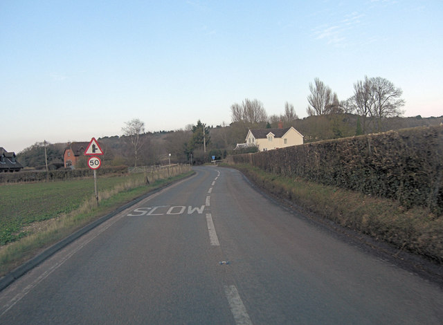
///livid.paths.absorbing. Near Cold Ash, Berkshire

Related Wikis

Ashmore Green

Ashmore Green is a small hamlet in Berkshire, England. It is situated just to the west of the village of Cold Ash and to the north of Thatcham in the West...

West Berkshire Community Hospital

West Berkshire Community Hospital is a small hospital located in the Benham Hill area of Newbury, in West Berkshire, England. It is managed by Berkshire...

Benham Hill

Benham Hill is a hill and small settlement in the Shaw portion of the civil parish of Shaw-cum-Donnington in the English county of Berkshire, between...

Cold Ash

Cold Ash is a village and civil parish in West Berkshire centred 1 mile (1.6 km) from Thatcham and 2.5 miles (4 km) northeast of Newbury. == Geography... ==

Shaw-cum-Donnington

Shaw-cum-Donnington is a civil parish in West Berkshire, England with all of its urban or suburban area immediately north of the largest town in the district...

Cold Ash Quarry

Cold Ash Quarry is a 0.4-hectare (0.99-acre) geological Site of Special Scientific Interest north of Newbury in Berkshire. It is a Geological Conservation...
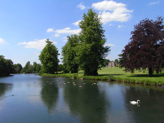
River Lambourn

The River Lambourn is a chalk stream in the English county of Berkshire. It rises in the Berkshire Downs near its namesake village of Lambourn and is a...
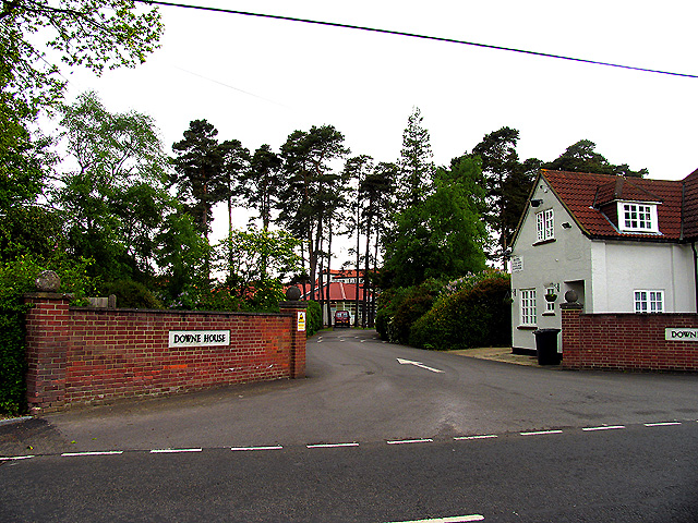
Downe House School

Downe House School is a selective independent girls' boarding and day school in Cold Ash, a village near Newbury, Berkshire, for girls aged 11–18.The Good...

Related Videos

Thatcham UK Kennet Canal 4k

Walking and fishing on the Kennet Canal, beautyfull place,nice weather. I don't catch any fish today but I had a great time which ...

Berkshire 3.3 mile circular walk: Cold Ash

Cold Ash Village & Copse - 3.3 mile circular walk Guided Walk: ...

GWR class 387 arriving at Thatcham 387147 8/8/23 #shorts

GWR class 387 arriving at Thatcham 387147.

Nearby Amenities

Located within 500m of 51.420765,-1.289356
Power: tower
Lat/Long: 51.4211228/-1.2822863
Power: tower
Lat/Long: 51.4212826/-1.2833673
Power: tower
Lat/Long: 51.4219616/-1.2880585
Power: tower
Lat/Long: 51.4222426/-1.2900674
Power: tower
Lat/Long: 51.4208393/-1.2910947
Power: tower
Lat/Long: 51.4204362/-1.2928489
Power: tower
Lat/Long: 51.4200967/-1.2943885
Power: tower
Lat/Long: 51.4197003/-1.2960917
The data included in this document is from www.openstreetmap.org. The data is made available under ODbL.

Have you been to Weaver's Wood?

Leave your review of Weaver's Wood below (or comments, questions and feedback).