Ash Thomas

Settlement in Devon Mid Devon

England

Ash Thomas

Brithem Bottom : Grassy Field A grassy field in the countryside.
Brithem Bottom : Grassy Field Credit: Lewis Clarke

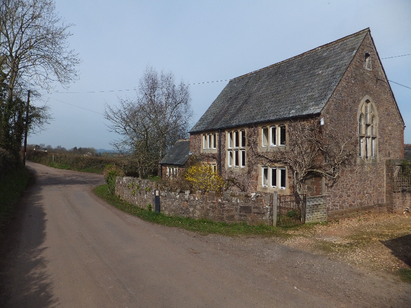
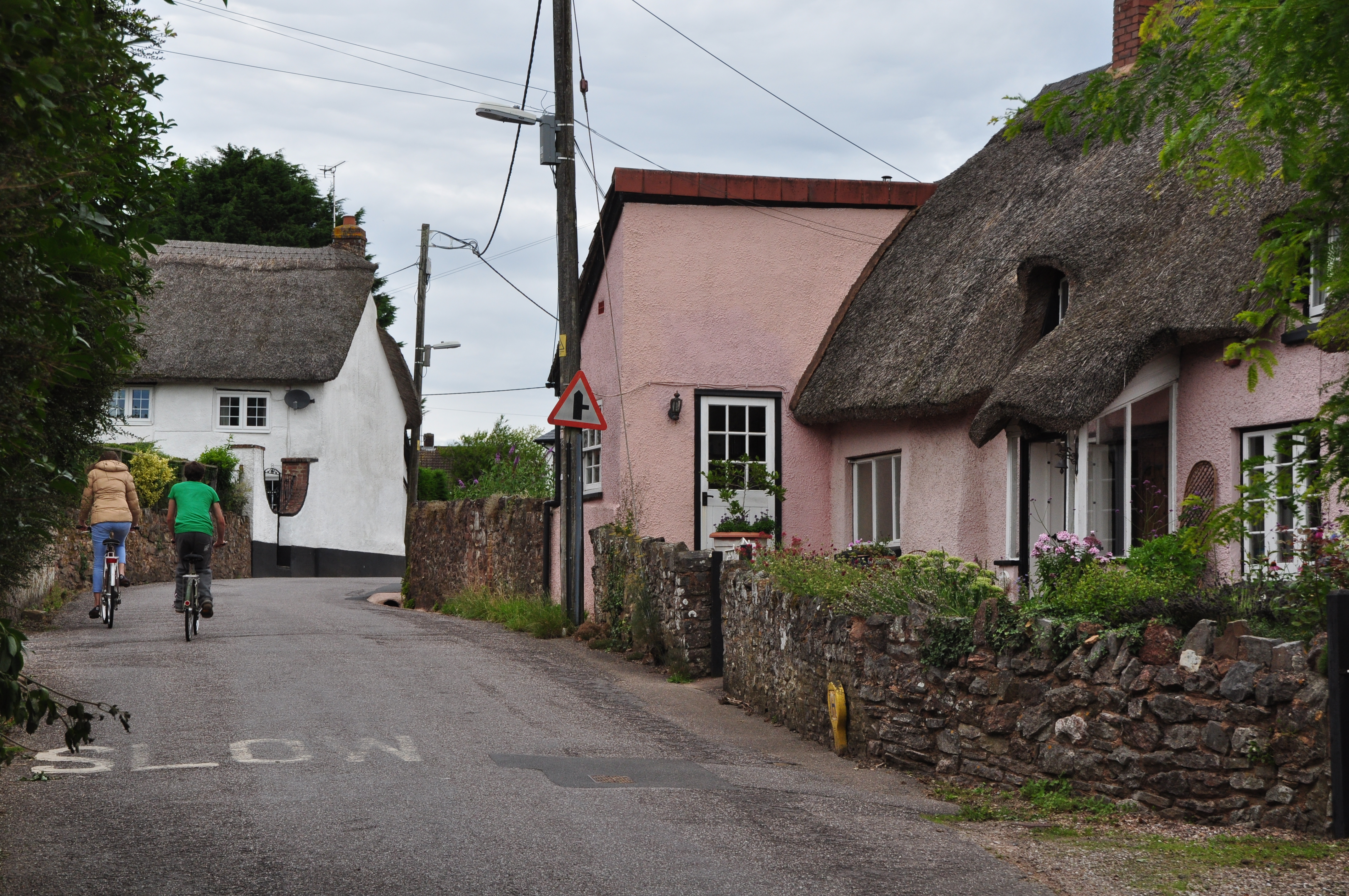
Ash Thomas is a small village located in the county of Devon, England. Situated in the South West region, Ash Thomas is part of the Mid Devon district and lies approximately 3 miles south-east of the town of Cullompton. The village is nestled in a rural setting, surrounded by picturesque countryside and rolling hills.

Ash Thomas is known for its tranquil and idyllic atmosphere, making it a popular choice for those seeking a peaceful retreat away from the hustle and bustle of city life. The village is characterized by its charming thatched cottages and traditional stone houses, which contribute to its quintessential English countryside charm.

Despite its small size, Ash Thomas boasts a close-knit community that takes great pride in maintaining the village's heritage and natural beauty. The village is home to a historic church, adding to its historical significance and architectural appeal.

For outdoor enthusiasts, Ash Thomas offers ample opportunities for exploring the surrounding countryside through scenic walks and cycling routes. The nearby Blackdown Hills Area of Outstanding Natural Beauty provides stunning landscapes and panoramic views.

While Ash Thomas may lack the amenities of larger towns, residents and visitors can find essential services and amenities in the nearby towns of Cullompton and Tiverton. Overall, Ash Thomas provides a serene and picturesque setting for those seeking a peaceful escape in the heart of the Devon countryside.

If you have any feedback on the listing, please let us know in the comments section below.

Ash Thomas Images

Images are sourced within 2km of 50.888945/-3.414605 or Grid Reference ST0010. Thanks to Geograph Open Source API. All images are credited.

Brithem Bottom : Grassy Field A grassy field in the countryside.
Brithem Bottom : Grassy Field
A grassy field in the countryside.
Brithem Bottom : Country Lane A small lane heads through the hamlet.
Brithem Bottom : Country Lane
A small lane heads through the hamlet.
Brithem Bottom : Stile A stile provides access to the field. At least, it would if it wasn't so overgrown.
Brithem Bottom : Stile
A stile provides access to the field. At least, it would if it wasn't so overgrown.
Brithem Bottom : Country Lane A small lane heads through Brithem Bottom.
Brithem Bottom : Country Lane
A small lane heads through Brithem Bottom.
Halberton : St Andrew's Church St Andrew’s Church is located near the centre of the village and is conspicuous with its magnificent tower and clock.
Halberton : St Andrew's Church
St Andrew’s Church is located near the centre of the village and is conspicuous with its magnificent tower and clock.
Halberton : St Andrew's Church The 14th Century church in Halberton.
Halberton : St Andrew's Church
The 14th Century church in Halberton.
Halberton: lane near Leonard Farm The hump in the lane indicates the course of the now vanished Moorstone Leat. It was extant in 1603 when a map was prepared showing its course and the owners of the fields it passed through: it was an irrigation leat which terminated near Moorstone Barton, then owned by the Wyndham family. In places the leat ran in a 30’ deep cutting: it doesn’t entirely follow the contours. Tapped in the 19th century to power farm machinery at Sutton Barton, it was fed by springs below Remberton
Halberton: lane near Leonard Farm
The hump in the lane indicates the course of the now vanished Moorstone Leat. It was extant in 1603 when a map was prepared showing its course and the owners of the fields it passed through: it was an irrigation leat which terminated near Moorstone Barton, then owned by the Wyndham family. In places the leat ran in a 30’ deep cutting: it doesn’t entirely follow the contours. Tapped in the 19th century to power farm machinery at Sutton Barton, it was fed by springs below Remberton
Halberton: entrance to Sutton Barton Beyond the house are two ponds; one dry, one filled in. They were supplied from the Moorstone Leat and in the 19th century powered a waterwheel in a barn on the left of the drive. For the Moorstone Leat see <a href="https://www.geograph.org.uk/gridref/ST0009">ST0009</a>
Halberton: entrance to Sutton Barton
Beyond the house are two ponds; one dry, one filled in. They were supplied from the Moorstone Leat and in the 19th century powered a waterwheel in a barn on the left of the drive. For the Moorstone Leat see ST0009
Halberton: lane near Leonard Farm Looking north west to Turley Down
Halberton: lane near Leonard Farm
Looking north west to Turley Down
Halberton: towards Leonard Farm A public footpath runs across two fields to reach the farm
Halberton: towards Leonard Farm
A public footpath runs across two fields to reach the farm
Halberton: lane to Brithem Bottom A summer evening shot
Halberton: lane to Brithem Bottom
A summer evening shot
Halberton: towards the Pond Farm turning The hump in the foreground is one of the places where the Moorstone Leat - extant 1603-1900 or so - crossed under the lane in culvert
Halberton: towards the Pond Farm turning
The hump in the foreground is one of the places where the Moorstone Leat - extant 1603-1900 or so - crossed under the lane in culvert
Halberton: chicken farm This must be relatively recent: I don't recall seeing the huts in 2005
Halberton: chicken farm
This must be relatively recent: I don't recall seeing the huts in 2005
Halberton: near the Pond Farm turning The kink in the road marks one of the places where the Moorstone Leat - extant circa 1603-1910 or so - crossed under the lane in culvert. It was an unusual leat in that it didn't follow the contours and in places ran in deep cutting: a minor feat of engineering for the early seventeenth century. Indeed it may have been constructed at an earlier date: it was used primarily for irrigation, but possibly also for potwater
Halberton: near the Pond Farm turning
The kink in the road marks one of the places where the Moorstone Leat - extant circa 1603-1910 or so - crossed under the lane in culvert. It was an unusual leat in that it didn't follow the contours and in places ran in deep cutting: a minor feat of engineering for the early seventeenth century. Indeed it may have been constructed at an earlier date: it was used primarily for irrigation, but possibly also for potwater
Halberton: Sutton Barton Seen from Beacon Lane. In the 19th century the barton made use of the Moorstone Leat, extant from at least 1603: two ponds were constructed, these powered a waterwheel in a barn which is now being converted to residential accommodation.
Halberton: Sutton Barton
Seen from Beacon Lane. In the 19th century the barton made use of the Moorstone Leat, extant from at least 1603: two ponds were constructed, these powered a waterwheel in a barn which is now being converted to residential accommodation.
Halberton: towards Cloggs Hill The west end of the hamlet of Brithem Bottom is largely hidden  behind the line of trees, centre
Halberton: towards Cloggs Hill
The west end of the hamlet of Brithem Bottom is largely hidden behind the line of trees, centre
Lane to Brithem Bottom The lane climbs a little from the Spratford Stream valley as it passes Kingsley House between frosty hedges.
Lane to Brithem Bottom
The lane climbs a little from the Spratford Stream valley as it passes Kingsley House between frosty hedges.
Moorstone Barton The farm is medieval in origin <span class="nowrap"><a title="http://www.britishlistedbuildings.co.uk/en-95352-moorstone-barton-halberton" rel="nofollow ugc noopener" href="http://www.britishlistedbuildings.co.uk/en-95352-moorstone-barton-halberton">Link</a><img style="margin-left:2px;" alt="External link" title="External link - shift click to open in new window" src="https://s1.geograph.org.uk/img/external.png" width="10" height="10"/></span> . Here the lane from Five Bridges approaches the range of outbuildings around the farmyard.
Moorstone Barton
The farm is medieval in origin LinkExternal link . Here the lane from Five Bridges approaches the range of outbuildings around the farmyard.
Show me another place!

Ash Thomas is located at Grid Ref: ST0010 (Lat: 50.888945, Lng: -3.414605)

Administrative County: Devon

District: Mid Devon

Police Authority: Devon and Cornwall

What 3 Words

///poorly.call.ferrets. Near Willand, Devon

Related Wikis

Ash Thomas

Ash Thomas is a village in Devon, England.Ash Thomas was listed in the Domesday Book of 1086.There is a village hall in Ash Thomas. == References... ==

Halberton Halt railway station

Halberton Halt railway station served the village of Halberton, Devon, England, from 1927 to 1964 on the Tiverton branch line. == History == The station...

Hillersdon House

Hillersdon House in the parish of Cullompton in Devon, is a grade II* listed late Georgian style manor house overlooking that town. It was built in 1848...

Willand Rovers F.C.

Willand Rovers Football Club is a football club based in Willand, near Exeter, in Devon. They are currently members of the Southern League Division One...

Willand

Willand is a village and civil parish in Mid Devon, England. It is about 19 km (12 mi) north of Exeter and 2.4 km (1.5 mi) north of Cullompton. In 1991...

Cullompton services

Cullompton services is a motorway service station on the M5 motorway near Exeter. It is owned by Extra MSA. It has a McDonald's restaurant which is franchised...

Crazelowman

Crazelowman (Craze Lowman) is a hamlet in mid Devon, situated near the town of Tiverton and in that town's civil parish. It is situated to the north of...

Cullompton

Cullompton () is a town and civil parish in the district of Mid Devon and the county of Devon, England. It is 13 miles (21 km) north-east of Exeter and...

Nearby Amenities

Located within 500m of 50.888945,-3.414605
Ash Thomas
Place: hamlet
Wikidata: Q4804473
Wikipedia: en:Ash Thomas
Lat/Long: 50.8892745/-3.4167188
Ash Cross
Junction: yes
Lat/Long: 50.891619/-3.4161069
Booth: K6
Covered: booth
Man Made: telephone_box
Note: No longer contains a telephone.
Lat/Long: 50.8895345/-3.4170384
Post Box
Post Box Type: lamp
Royal Cypher: EIIR
Royal Cypher Wikidata: Q33102113
Lat/Long: 50.8895639/-3.4170529
Generator Method: photovoltaic
Generator Output Electricity: yes
Generator Source: solar
Generator Type: solar_photovoltaic_panel
Location: roof
Power: generator
Lat/Long: 50.8893041/-3.4146083
Generator Method: photovoltaic
Generator Output Electricity: yes
Generator Source: solar
Generator Type: solar_photovoltaic_panel
Location: roof
Power: generator
Lat/Long: 50.8892779/-3.4144903
Generator Method: photovoltaic
Generator Output Electricity: yes
Generator Source: solar
Generator Type: solar_photovoltaic_panel
Location: roof
Power: generator
Lat/Long: 50.8896487/-3.4171423
Generator Method: photovoltaic
Generator Output Electricity: yes
Generator Source: solar
Generator Type: solar_photovoltaic_panel
Location: roof
Power: generator
Lat/Long: 50.8890649/-3.4170029
Give Way
Direction: forward
Lat/Long: 50.8893137/-3.4167139
Give Way
Direction: backward
Lat/Long: 50.8877722/-3.4195255
Give Way
Direction: forward
Lat/Long: 50.8916012/-3.4161097
Give Way
Direction: forward
Lat/Long: 50.889232/-3.4166743
Defibrillator
Defibrillator Location: outside Ash Thomas Village Hall
Emergency: defibrillator
Indoor: no
Lat/Long: 50.8885337/-3.4187579
The data included in this document is from www.openstreetmap.org. The data is made available under ODbL.

Have you been to Ash Thomas?

Leave your review of Ash Thomas below (or comments, questions and feedback).