Breach Sling Copse
Wood, Forest in Hampshire Eastleigh
England
Breach Sling Copse
Breach Sling Copse is a picturesque woodland located in Hampshire, England. Covering an area of approximately 100 acres, this enchanting forest offers visitors a serene and tranquil escape from the hustle and bustle of everyday life.
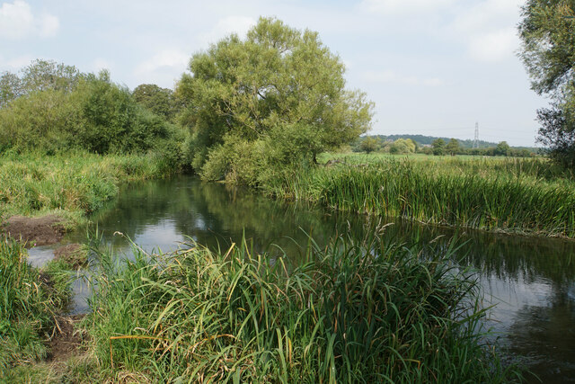
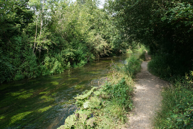
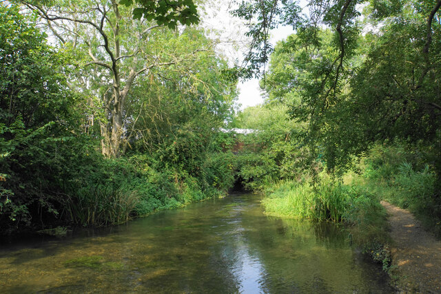
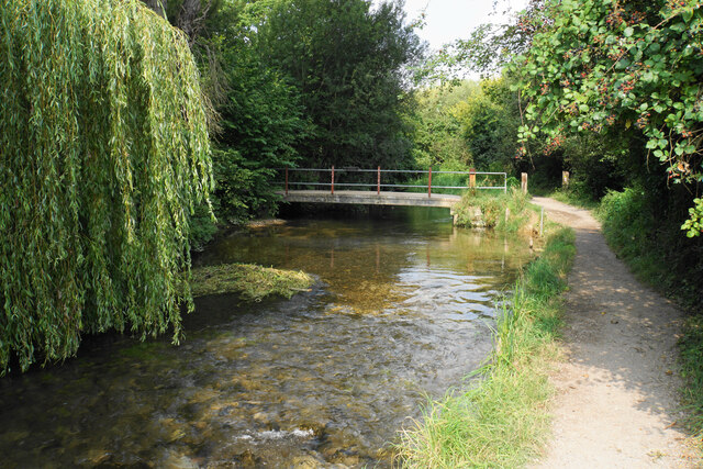
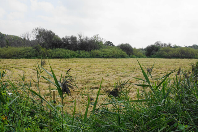
The copse is characterized by its dense canopy of trees, predominantly consisting of oak, beech, and birch, which provide a stunning display of vibrant green foliage in the spring and summer months. In autumn, the woodland transforms into a kaleidoscope of warm hues as the leaves change color, creating a breathtaking spectacle for nature enthusiasts.
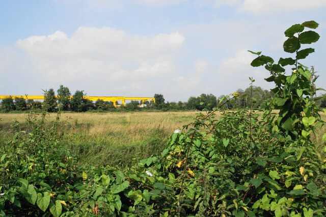
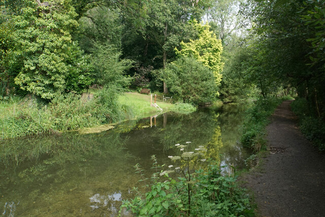
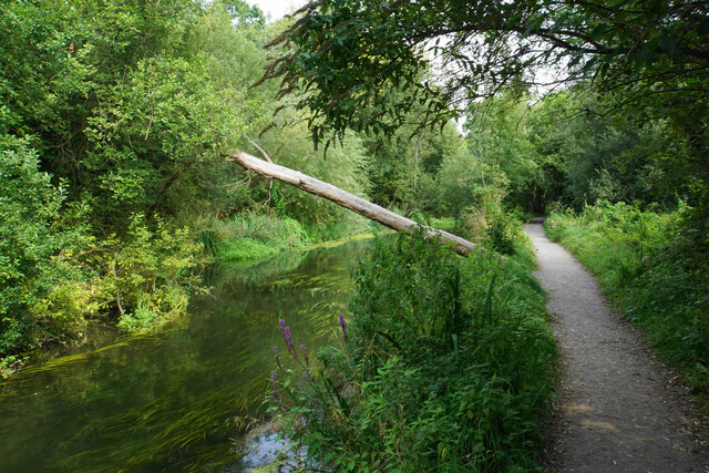
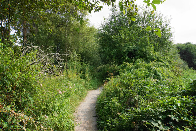
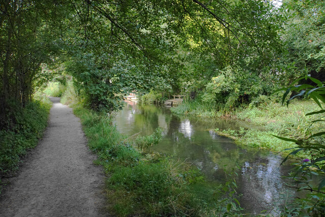
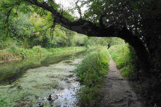
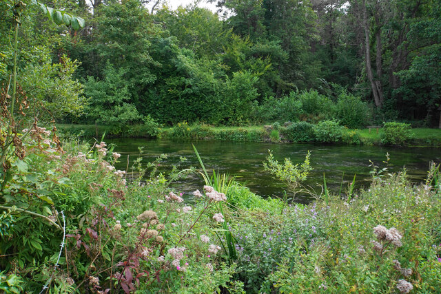
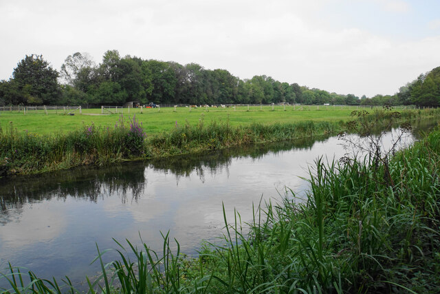
The forest floor is blanketed with a rich carpet of moss, ferns, and wildflowers, adding to the copse's natural beauty. Walking along the well-maintained paths, visitors can spot an array of wildlife, including deer, foxes, and a variety of bird species. The peaceful ambiance of the copse creates the perfect setting for birdwatching or simply enjoying a leisurely stroll.
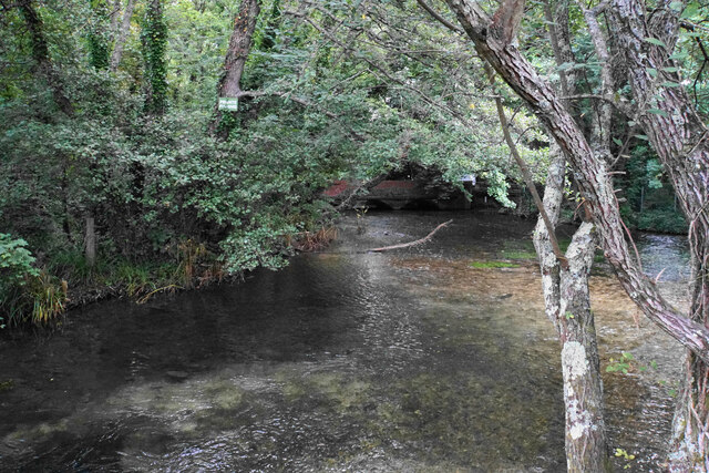
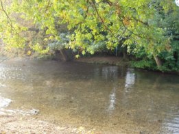
Breach Sling Copse is also home to a small stream that meanders through the woodland, providing a soothing soundtrack of babbling water. The stream serves as a refreshing watering hole for the local wildlife and adds to the copse's overall charm.
The copse is open to the public year-round and is a popular destination for nature lovers, hikers, and families seeking a day out in the great outdoors. With its stunning natural beauty and tranquil atmosphere, Breach Sling Copse offers a truly immersive and rejuvenating experience for all who visit.
If you have any feedback on the listing, please let us know in the comments section below.
Breach Sling Copse Images
Images are sourced within 2km of 50.982597/-1.3348406 or Grid Reference SU4620. Thanks to Geograph Open Source API. All images are credited.


Breach Sling Copse is located at Grid Ref: SU4620 (Lat: 50.982597, Lng: -1.3348406)
Administrative County: Hampshire
District: Eastleigh
Police Authority: Hampshire
What 3 Words
///rapid.less.hang. Near Bishopstoke, Hampshire
Nearby Locations
Related Wikis

St Mary's Church, Bishopstoke
The Church of St Mary's is an Anglican Church in Bishopstoke, Hampshire. St Mary's was designed by Edward Prioleau Warren and built during 1890/91 by Wheeler...
Bishopstoke
Bishopstoke is a village and civil parish in the Eastleigh district of Hampshire, England. It is recorded as "Stoke" as early as 948 AD when King Eadred...
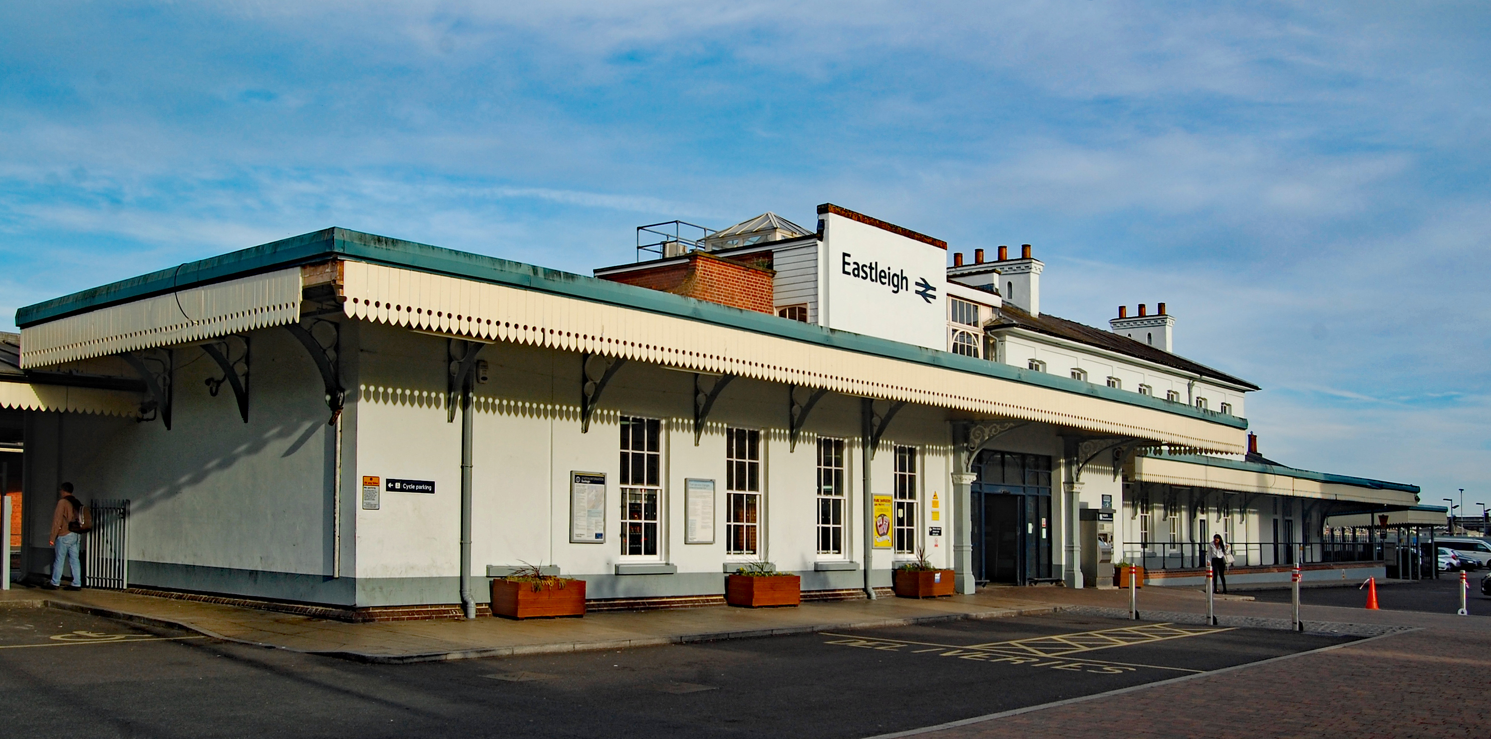
Eastleigh railway station
Eastleigh railway station serves the town of Eastleigh in the county of Hampshire in England. It is located on the South West Main Line and is the junction...

Boyatt Wood
Boyatt Wood is a small residential area and civil parish north-west of Eastleigh in Hampshire named locally after the wooded area to the south of Boyatt...
Allbrook
Allbrook is a settlement and civil parish in the Borough of Eastleigh in Hampshire, England. == Governance == Before 1974 the area formed part of the municipal...
Crestwood Community School
Crestwood Community School (known as Crestwood College prior to its name change in August 2017) is a coeducational secondary school, located in Eastleigh...

The Point, Eastleigh
The Point is a theatre and dance studio for contemporary performance and contemporary dance at Eastleigh in Hampshire, England, operating under the auspices...

Eastleigh
Eastleigh is a town in Hampshire, England, between Southampton and Winchester. It is the largest town and the administrative seat of the Borough of Eastleigh...
Nearby Amenities
Located within 500m of 50.982597,-1.3348406Have you been to Breach Sling Copse?
Leave your review of Breach Sling Copse below (or comments, questions and feedback).