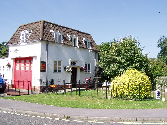
Centenary Copse

Wood, Forest in Hampshire Eastleigh

England

Centenary Copse

M27 gantry East of Moorgreen Road bridge
M27 gantry Credit: John Firth

Centenary Copse is a picturesque woodland located in Hampshire, England. Covering an area of approximately 50 acres, it is a popular destination for nature lovers and outdoor enthusiasts. The copse is situated near the village of Longparish, nestled within the beautiful Test Valley.

Centenary Copse is predominantly composed of deciduous trees, including oak, beech, and ash, which create a vibrant and diverse habitat for various species of flora and fauna. The woodland floor is adorned with an array of wildflowers during the spring and summer months, adding to the natural beauty of the area.

The copse is intersected by a network of well-maintained footpaths, allowing visitors to explore the woodland and immerse themselves in its tranquility. These paths meander through the trees, offering glimpses of sunlight streaming through the dense foliage and creating a magical atmosphere.

Centenary Copse holds great historical significance, as it was planted in 1994 to commemorate the 100th anniversary of the First World War. The copse serves as a living memorial to the brave men and women who sacrificed their lives during the war. A memorial plaque can be found at the entrance of the copse, providing visitors with a poignant reminder of the past.

The copse also provides a home to a variety of wildlife, including deer, squirrels, and a wide range of bird species. Birdwatchers can spot woodpeckers, owls, and warblers among the trees, while the lucky observer may catch a glimpse of a fox or badger roaming the woodland floor.

Centenary Copse is a serene and enchanting woodland that offers visitors the chance to connect with nature and pay respects to those who came before. Its rich biodiversity, peaceful atmosphere, and historical significance make it a truly special place to visit.

If you have any feedback on the listing, please let us know in the comments section below.

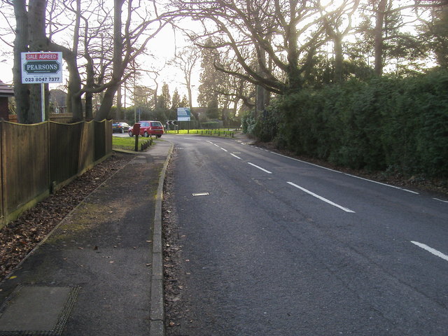
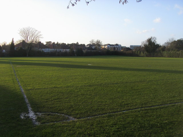
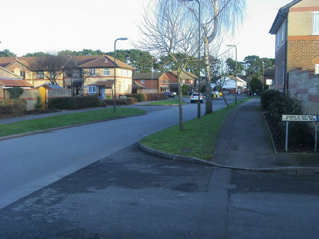
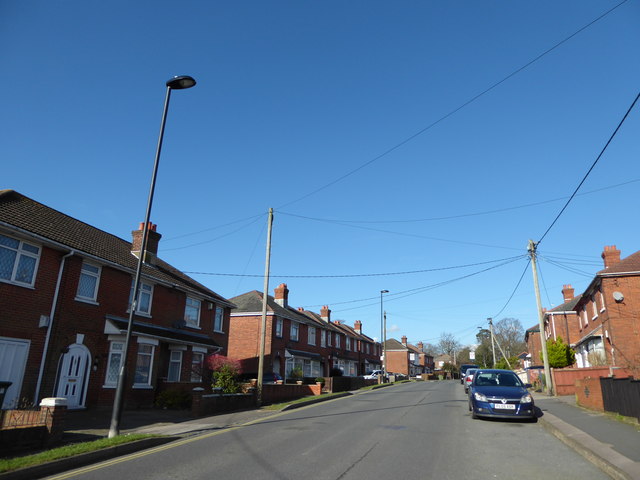
Centenary Copse Images

Images are sourced within 2km of 50.928582/-1.338471 or Grid Reference SU4614. Thanks to Geograph Open Source API. All images are credited.

M27 gantry East of Moorgreen Road bridge
M27 gantry
East of Moorgreen Road bridge
Botley Road bridge over M27
M27 gantry at junction 7
High Street High Street (B3035) heading down to the A27
High Street
High Street (B3035) heading down to the A27
Chalk Hill Chalk Hill junction with West End Road
Chalk Hill
Chalk Hill junction with West End Road
Bitterne Sports Ground Bitterne Sports Ground by Wynter Road
Bitterne Sports Ground
Bitterne Sports Ground by Wynter Road
Atalantic Park View Atalantic Park View leading to Townhill Way
Atalantic Park View
Atalantic Park View leading to Townhill Way
2016: a year on Geograph (Day 42) Top end of Hinkler Road
2016: a year on Geograph (Day 42)
Top end of Hinkler Road
2016: a year on Geograph (Day 55) I was stumped for a photo today until I passed The Ageas (née Rose) Bowl. <span class="nowrap"><a title="https://en.wikipedia.org/wiki/Rose_Bowl_(cricket_ground)" rel="nofollow ugc noopener" href="https://en.wikipedia.org/wiki/Rose_Bowl_(cricket_ground)">Link</a><img style="margin-left:2px;" alt="External link" title="External link - shift click to open in new window" src="https://s1.geograph.org.uk/img/external.png" width="10" height="10"/></span>
2016: a year on Geograph (Day 55)
I was stumped for a photo today until I passed The Ageas (née Rose) Bowl. LinkExternal link
Demolishing a house
Demolishing a house
The M27 from Charles Watts Way This is junction 7 at Hedge End
The M27 from Charles Watts Way
This is junction 7 at Hedge End
Charles Watts Way crossing the M27
Roundabout on the M27 junction 7
Oaktree Park
Oaktree Park
The former Percy Arms Now a pharmacy, but it has retained the name on the wall.
The former Percy Arms
Now a pharmacy, but it has retained the name on the wall.
The Humble Plumb A Wadworth's pub with room for a couple of guest beers. A friendly local.
The Humble Plumb
A Wadworth's pub with room for a couple of guest beers. A friendly local.
Half a house I understand that this was once a full semi, but the other half was destroyed in WW2.
Half a house
I understand that this was once a full semi, but the other half was destroyed in WW2.
Show me another place!

Centenary Copse is located at Grid Ref: SU4614 (Lat: 50.928582, Lng: -1.338471)

Administrative County: Hampshire

District: Eastleigh

Police Authority: Hampshire

What 3 Words

///staple.hiding.twig. Near West End, Hampshire

Related Wikis

St James' Church, West End

St James' Church in West End, Hampshire is an Anglican parish church in the Borough of Eastleigh. The church building is grade II listed. == History... ==

Chartwell Green

Chartwell Green is a suburb of Southampton, England, although it falls outside the formal city boundary. Instead, Chartwell Green is part of the West...

West End, Hampshire

West End is a parish in Hampshire in the borough of Eastleigh, five miles (8.0 km) east of the city of Southampton. The village of West End is small and...

Woodlands Community College

Woodlands Community College is a mixed secondary school located in east Southampton, Hampshire, in the south of England. It was officially opened as a...

Moorgreen Hospital

Moorgreen Hospital was a community hospital in West End, near Southampton. It was managed by Southampton City Primary Care Trust. == History == The hospital...

Harefield, Southampton

Harefield is a suburb and Electoral Ward near Bitterne in Southampton, England. Harefield Ward consists of a small council housing estate built around...

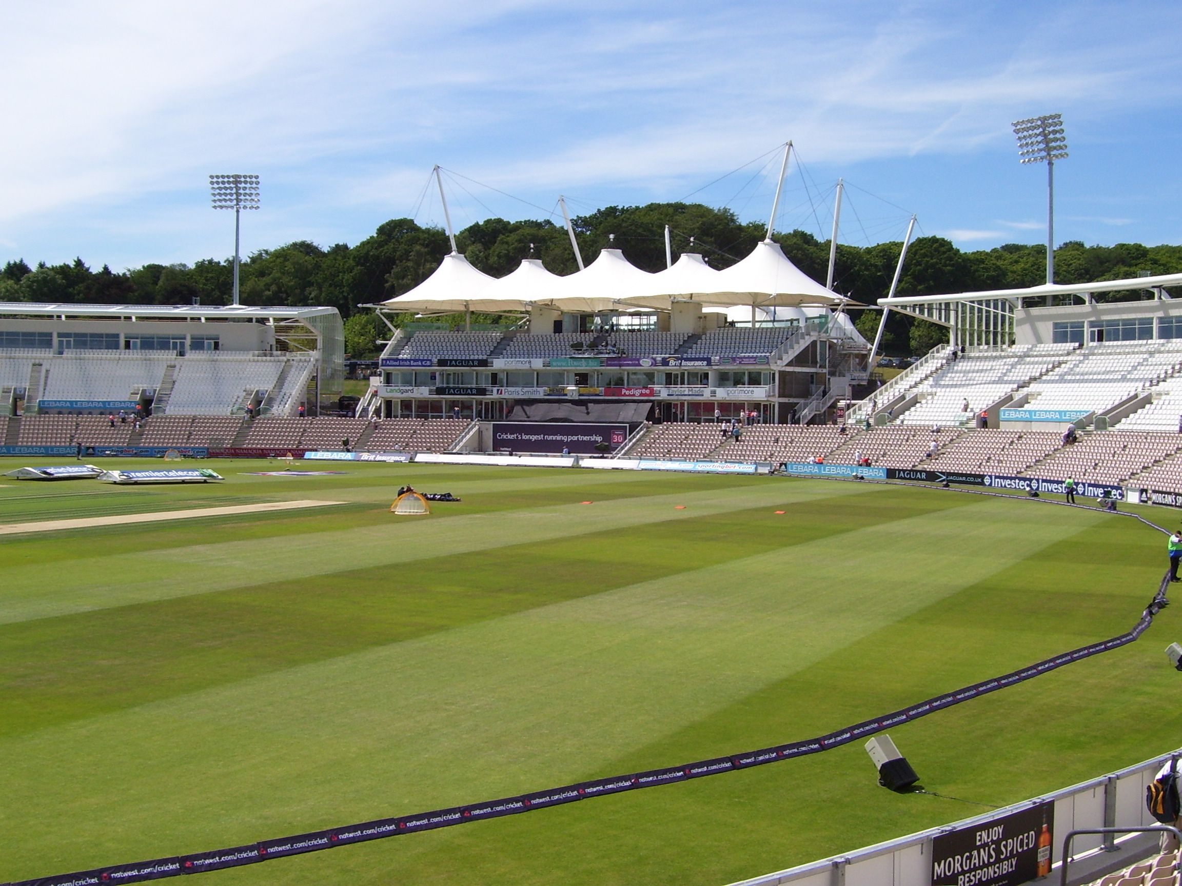
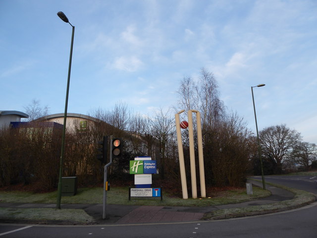
Rose Bowl (cricket ground)

The Rose Bowl, known for sponsorship reasons as Ageas Bowl is a cricket ground and hotel complex in West End, Hampshire. It is the home of Hampshire County...

Eastleigh (UK Parliament constituency)

Eastleigh is a constituency represented in the House of Commons of the UK Parliament since 2019 by Paul Holmes, a Conservative. == Constituency profile... ==

Related Videos

Itchen Valley Country Park | Hiking with family | VLOG #02

Itchen Valley Country Park | Hiking with family | #004.

Itchen Valley Country Park with my Insta360

A quick walk around the perimeter of #itchenvalleycountrypark with Bertie the #goldenretriever - one of my first #hyperlapse ...

【修咸頓生活】Southampton Walking Tour SO18 Townhill 兒童玩具及花園物料

去SO18 Townhill,主要為去Hobbycraft 買玩具,去Haskins買物料砌花園消磨時間。

The Hundred Vlog | Day 24 - Travel day to Manchester!

Day 24 of my Hundred vlog - Follow Me - Facebook page - https://www.facebook.com/amandawello Instagram page ...

Nearby Amenities

Located within 500m of 50.928582,-1.338471
Mini Roundabout
Direction: clockwise
Lat/Long: 50.9273738/-1.332715
West End
Place: village
Lat/Long: 50.9269807/-1.3361909
Mini Roundabout
Direction: clockwise
Lat/Long: 50.9243823/-1.3362241
Turning Circle
Lat/Long: 50.9286686/-1.3333767
Turning Circle
Lat/Long: 50.9279996/-1.3339402
Traffic Signals
Traffic Signals: signal
Traffic Signals Direction: forward
Lat/Long: 50.9288947/-1.3434042
Barrier: kissing_gate
Lat/Long: 50.9314993/-1.3367617
Turning Circle
Lat/Long: 50.9275167/-1.3421765
Bench
Created By: Potlatch 0.10f
Lat/Long: 50.9273771/-1.3328596
Bench
Created By: Potlatch 0.10f
Lat/Long: 50.9244524/-1.3363752
Bench
Created By: Potlatch 0.10f
Lat/Long: 50.9241657/-1.3386154
Bench
Created By: Potlatch 0.10f
Lat/Long: 50.9257184/-1.3346328
Post Box
Brand: Royal Mail
Brand Wikidata: Q638098
Brand Wikipedia: en:Royal Mail
Collection Plate: CP1
Collection Times: Mo-Fr 16:00; Sa 08:00
Operator: Royal Mail
Operator Wikidata: Q638098
Post Box Type: wall
Ref: SO30 28
Royal Cypher: GR
Royal Cypher Wikidata: Q33102273
Lat/Long: 50.924144/-1.3384952
Bench
Created By: Potlatch 0.10f
Lat/Long: 50.9274875/-1.3322639
Post Box
Brand: Royal Mail
Brand Wikidata: Q638098
Brand Wikipedia: en:Royal Mail
Collection Plate: CP1-LC
Collection Times: Mo-Fr 17:00; Sa 11:30
Operator: Royal Mail
Operator Wikidata: Q638098
Post Box Type: pillar
Ref: SO30 161
Royal Cypher: EIIR
Royal Cypher Wikidata: Q33102113
Lat/Long: 50.9276643/-1.3353462
Bench
Lat/Long: 50.9255394/-1.3364545
Bus Stop
Hilldean Centre
Bus: yes
Naptan AtcoCode: 1900HA030383
Naptan Bearing: W
Naptan CommonName: Hilldean Centre
Naptan Crossing: St James Road
Naptan NaptanCode: hamdgdpj
Naptan PlusbusZoneRef: SOTON
Naptan Street: High Street
Naptan Verified: no
Public Transport: platform
Source: naptan_import
Lat/Long: 50.9272961/-1.3318627
Bus Stop
Hilldean Centre
Bus: yes
Naptan AtcoCode: 1900HA030384
Naptan Bearing: E
Naptan CommonName: Hilldean Centre
Naptan Crossing: St James Road
Naptan NaptanCode: hamdgdpm
Naptan PlusbusZoneRef: SOTON
Naptan Street: High Street
Naptan Verified: no
Public Transport: platform
Source: naptan_import
Lat/Long: 50.927413/-1.331861
Bus Stop
West End Post Office
Bus: yes
Naptan AtcoCode: 1900HA030385
Naptan Bearing: E
Naptan CommonName: West End Post Office
Naptan Crossing: Upper New Road
Naptan NaptanCode: hamdgapm
Naptan PlusbusZoneRef: SOTON
Naptan Street: High Street
Naptan Verified: no
Public Transport: platform
Source: naptan_import
Lat/Long: 50.9276346/-1.336027
Bus Stop
West End Post Office
Bus: yes
Naptan AtcoCode: 1900HA030386
Naptan Bearing: W
Naptan CommonName: West End Post Office
Naptan Crossing: Chapel Road
Naptan NaptanCode: hamdgamt
Naptan PlusbusZoneRef: SOTON
Naptan Street: High Street
Naptan Verified: no
Public Transport: platform
Source: naptan_import
Lat/Long: 50.9276099/-1.3364258
Bus Stop
Co-Op
Bus: yes
Naptan AtcoCode: 1900HA030387
Naptan Bearing: E
Naptan CommonName: Tesco Express
Naptan Crossing: Hatch Mead
Naptan NaptanCode: hamdatmt
Naptan PlusbusZoneRef: SOTON
Naptan Street: High Street
Naptan Verified: no
Public Transport: platform
Source: naptan_import
Lat/Long: 50.9288757/-1.3423984
Bus Stop
Co-op
Bus: yes
Naptan AtcoCode: 1900HA030388
Naptan Bearing: W
Naptan CommonName: Tesco Express
Naptan Crossing: Hatch Mead
Naptan NaptanCode: hamdatmj
Naptan PlusbusZoneRef: SOTON
Naptan Street: High Street
Naptan Verified: no
Public Transport: platform
Source: naptan_import
Lat/Long: 50.9287597/-1.3425566
Parking
Lat/Long: 50.9287086/-1.3397293
Barrier: lift_gate
Opening Hours: rarely
Lat/Long: 50.9288007/-1.3397172
Barrier: kissing_gate
Lat/Long: 50.9303362/-1.3382629
Barrier: stile
Lat/Long: 50.9308278/-1.3398465
Crossing
Crossing: unmarked
Crossing Island: no
Crossing Markings: no
Tactile Paving: yes
Lat/Long: 50.9289706/-1.3431761
Library
Lat/Long: 50.9288175/-1.3372581
Atm
Brand: Barclays
Brand Wikidata: Q245343
Fee: no
Opening Hours: 24/7
Operator: Barclays
Operator Wikidata: Q245343
Lat/Long: 50.9277134/-1.3361069
Kindergarten
Lat/Long: 50.9283002/-1.3370328
Barrier: cycle_barrier
Lat/Long: 50.9306751/-1.3396786
Atm
Lat/Long: 50.9277394/-1.3351506
West End Beacon
Historic: monument
Lat/Long: 50.928882/-1.3379794
Traffic Calming: yes
Lat/Long: 50.9243094/-1.3370474
Traffic Calming: yes
Lat/Long: 50.9251359/-1.3355759
Traffic Calming: yes
Lat/Long: 50.9265969/-1.3329506
Traffic Calming: yes
Lat/Long: 50.9256132/-1.3349317
Traffic Calming: yes
Lat/Long: 50.9270751/-1.3327984
Traffic Calming: yes
Lat/Long: 50.9241125/-1.337994
Traffic Calming: yes
Lat/Long: 50.925986/-1.3342927
Traffic Calming: yes
Lat/Long: 50.9263135/-1.333655
Traffic Calming: yes
Lat/Long: 50.9248318/-1.3358658
Historic: memorial
Note: local servicemen killed in WW1 & WW2
Lat/Long: 50.9272984/-1.332567
Historic: memorial
Note: Richard St Barbe Baker
Lat/Long: 50.9283538/-1.3392799
Bench
Lat/Long: 50.9282752/-1.3390519
Bench
Lat/Long: 50.9283893/-1.3394382
Crossing
Lat/Long: 50.9275009/-1.3323969
Crossing
Crossing: traffic_signals
Lat/Long: 50.9275846/-1.3356981
Post Box
Brand: Royal Mail
Brand Wikidata: Q638098
Brand Wikipedia: en:Royal Mail
Collection Plate: CP1
Collection Times: Mo-Fr 17:00; Sa 11:30
Operator: Royal Mail
Operator Wikidata: Q638098
Post Box Type: pillar
Ref: SO30 720
Royal Cypher: EIIR
Royal Cypher Wikidata: Q33102113
Lat/Long: 50.9276891/-1.3353413
Crossing
Crossing Island: yes
Lat/Long: 50.9277725/-1.3370554
Bench
Lat/Long: 50.9303861/-1.3390098
Bench
Lat/Long: 50.9293939/-1.339081
Bench
Backrest: yes
Lat/Long: 50.9303013/-1.3374016
Bench
Backrest: yes
Lat/Long: 50.9292015/-1.3383725
Bench
Lat/Long: 50.9292737/-1.3375437
Generator Method: photovoltaic
Generator Output Electricity: yes
Generator Source: solar
Generator Type: solar_photovoltaic_panel
Location: roof
Power: generator
Lat/Long: 50.9298533/-1.3439336
Generator Method: photovoltaic
Generator Output Electricity: yes
Generator Source: solar
Generator Type: solar_photovoltaic_panel
Location: roof
Power: generator
Lat/Long: 50.9274193/-1.3397602
Generator Method: photovoltaic
Generator Output Electricity: yes
Generator Source: solar
Generator Type: solar_photovoltaic_panel
Location: roof
Power: generator
Lat/Long: 50.9275456/-1.3396205
Generator Method: photovoltaic
Generator Output Electricity: yes
Generator Source: solar
Generator Type: solar_photovoltaic_panel
Location: roof
Power: generator
Lat/Long: 50.9275035/-1.3396721
Generator Method: photovoltaic
Generator Output Electricity: yes
Generator Source: solar
Generator Type: solar_photovoltaic_panel
Location: roof
Power: generator
Lat/Long: 50.9277064/-1.3396083
Generator Method: photovoltaic
Generator Output Electricity: yes
Generator Source: solar
Generator Type: solar_photovoltaic_panel
Location: roof
Power: generator
Lat/Long: 50.9277294/-1.3396721
Generator Method: photovoltaic
Generator Output Electricity: yes
Generator Source: solar
Generator Type: solar_photovoltaic_panel
Location: roof
Power: generator
Lat/Long: 50.9276681/-1.3395142
Generator Method: photovoltaic
Generator Output Electricity: yes
Generator Source: solar
Generator Type: solar_photovoltaic_panel
Location: roof
Power: generator
Lat/Long: 50.9280031/-1.3392226
Generator Method: photovoltaic
Generator Output Electricity: yes
Generator Source: solar
Generator Type: solar_photovoltaic_panel
Location: roof
Power: generator
Lat/Long: 50.9279725/-1.339095
Generator Method: photovoltaic
Generator Output Electricity: yes
Generator Source: solar
Generator Type: solar_photovoltaic_panel
Location: roof
Power: generator
Lat/Long: 50.9277045/-1.3383813
Generator Method: photovoltaic
Generator Output Electricity: yes
Generator Source: solar
Generator Type: solar_photovoltaic_panel
Location: roof
Power: generator
Lat/Long: 50.9287574/-1.3372667
Generator Method: photovoltaic
Generator Output Electricity: yes
Generator Source: solar
Generator Type: solar_photovoltaic_panel
Location: roof
Power: generator
Lat/Long: 50.9304361/-1.3349403
Bench
Backrest: yes
Lat/Long: 50.9317573/-1.3386148
Street Lamp
Lat/Long: 50.9262723/-1.3437291
Street Lamp
Lat/Long: 50.9261768/-1.344142
Street Lamp
Lat/Long: 50.9262378/-1.3432131
Street Lamp
Lat/Long: 50.9261126/-1.3427441
Street Lamp
Lat/Long: 50.9258659/-1.3423083
Street Lamp
Lat/Long: 50.9254779/-1.34186
Street Lamp
Lat/Long: 50.9260494/-1.3429422
Street Lamp
Lat/Long: 50.9256197/-1.343132
Barrier: kissing_gate
Lat/Long: 50.9317279/-1.3379926
Board Type: nature
Direction: -155
Information: board
Tourism: information
Lat/Long: 50.9303819/-1.3383217
Blind: no
Fitness Station: straddle_jump
Leisure: fitness_station
Sport: fitness
Wheelchair: no
Lat/Long: 50.9286372/-1.3379553
Board Type: history
Information: board
Tourism: information
Lat/Long: 50.9286601/-1.3380765
Information: board
Tourism: information
Lat/Long: 50.9286244/-1.3379438
Fitness Station: parallel_bars
Leisure: fitness_station
Sport: fitness
Lat/Long: 50.9288798/-1.3385118
Fitness Station: step_up
Leisure: fitness_station
Sport: fitness
Lat/Long: 50.928951/-1.3400848
Fitness Station: pole_climb
Leisure: fitness_station
Sport: fitness
Lat/Long: 50.9303425/-1.3394929
Fitness Station: sit-up
Leisure: fitness_station
Sport: fitness
Lat/Long: 50.9301782/-1.3375589
Fitness Station: vault
Leisure: fitness_station
Sport: fitness
Lat/Long: 50.9301264/-1.3385296
Bicycle Parking
Bicycle Parking: stands
Capacity: 2
Covered: no
Fee: no
Lat/Long: 50.9276307/-1.3354182
Bicycle Parking
Bicycle Parking: stands
Capacity: 6
Covered: no
Fee: no
Lat/Long: 50.9281489/-1.3360261
Natural: shrub
Lat/Long: 50.9273928/-1.3436784
Natural: shrub
Lat/Long: 50.927556/-1.3438934
Natural: shrub
Lat/Long: 50.9278/-1.3440249
Natural: shrub
Lat/Long: 50.9279066/-1.3442537
Natural: shrub
Lat/Long: 50.9276673/-1.343835
Natural: shrub
Lat/Long: 50.9276489/-1.343807
Natural: shrub
Lat/Long: 50.9277816/-1.3439701
Natural: shrub
Lat/Long: 50.9276565/-1.3442123
Natural: shrub
Lat/Long: 50.9276941/-1.3444284
Natural: shrub
Lat/Long: 50.9277196/-1.3444668
Natural: shrub
Lat/Long: 50.9280549/-1.3436677
Traffic Signals
Traffic Signals: signal
Traffic Signals Direction: forward
Lat/Long: 50.9285922/-1.3438255
Crossing
Button Operated: yes
Crossing: traffic_signals
Crossing Island: no
Crossing Markings: dots
Tactile Paving: yes
Lat/Long: 50.9289128/-1.3441406
Traffic Signals
Traffic Signals: signal
Traffic Signals Direction: backward
Lat/Long: 50.9288643/-1.3429517
Traffic Signals
Traffic Signals: signal
Traffic Signals Direction: forward
Lat/Long: 50.9288316/-1.3436467
Crossing
Button Operated: yes
Crossing: traffic_signals
Crossing Island: no
Crossing Markings: dots
Tactile Paving: yes
Lat/Long: 50.9289122/-1.3436559
Traffic Signals
Traffic Signals: signal
Traffic Signals Direction: forward
Lat/Long: 50.928742/-1.3441301
Crossing
Button Operated: yes
Crossing: traffic_signals
Crossing Island: no
Crossing Markings: dots
Tactile Paving: yes
Lat/Long: 50.9289277/-1.3439516
Traffic Signals
Traffic Signals: signal
Traffic Signals Direction: forward
Lat/Long: 50.9289559/-1.3439854
Traffic Signals
Traffic Signals: signal
Traffic Signals Direction: forward
Lat/Long: 50.9290133/-1.3431579
Crossing
Button Operated: yes
Crossing: traffic_signals
Crossing Island: no
Crossing Markings: dots
Tactile Paving: yes
Lat/Long: 50.9288154/-1.3436983
Traffic Signals
Traffic Signals: pedestrian_crossing
Traffic Signals Direction: backward
Lat/Long: 50.9275805/-1.3356454
Traffic Signals
Traffic Signals: pedestrian_crossing
Traffic Signals Direction: forward
Lat/Long: 50.9275896/-1.3357558
Parcel Locker
Amazon Locker abd
Brand: Amazon Locker
Brand Wikidata: Q16974764
Operator: Amazon UK
Parcel Mail In: yes
Parcel Pickup: yes
Ref: abd
Lat/Long: 50.9292538/-1.3434499
The data included in this document is from www.openstreetmap.org. The data is made available under ODbL.

Have you been to Centenary Copse?

Leave your review of Centenary Copse below (or comments, questions and feedback).