Cowleaze Copse

Wood, Forest in Berkshire Vale of White Horse

England

Cowleaze Copse

The A420 Botley
The A420 Botley Credit: David Howard

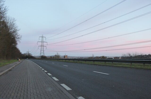
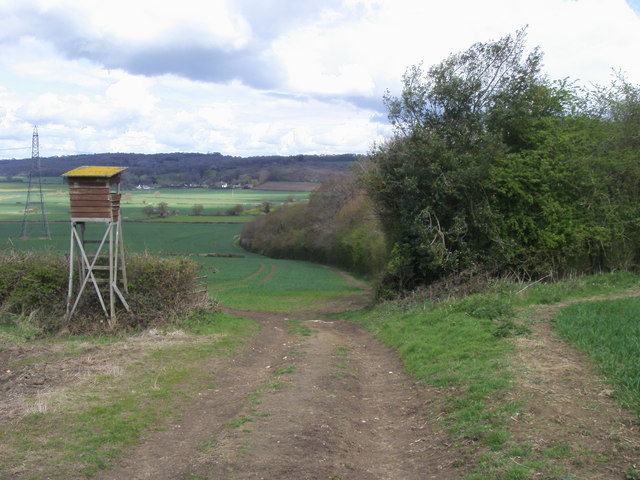
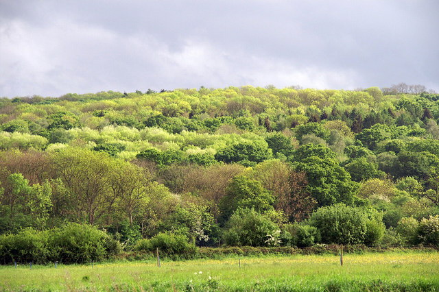
Cowleaze Copse is a beautiful wooded area located in Berkshire, England. Covering an area of approximately 45 hectares, this ancient woodland is an important natural habitat and a popular recreational destination for locals and visitors alike.

The copse is predominantly composed of deciduous trees, including oak, beech, and ash, which create a dense and enchanting canopy. The woodland floor is covered in a rich carpet of bluebells and wildflowers during the spring months, adding to its natural beauty. Numerous bird species can be found here, including woodpeckers, nuthatches, and warblers, making it a paradise for birdwatchers.

Cowleaze Copse is also home to a diverse range of wildlife. Deer, foxes, and badgers can often be spotted roaming the area, and the copse provides an important habitat for various species of insects and small mammals. The woodland is managed by the local authorities to ensure its preservation and protection.

The copse offers a network of well-maintained footpaths and trails, making it an excellent location for walking, jogging, and cycling. There are also picnic areas where visitors can relax and enjoy the tranquil surroundings. The copse is easily accessible by car, with ample parking available nearby.

Cowleaze Copse is not only a place of natural beauty but also a valuable resource for environmental education and research. Its diverse ecosystem and rich biodiversity make it an important site for ecological studies. Overall, Cowleaze Copse is a cherished natural treasure in Berkshire, providing a haven for wildlife and a peaceful retreat for nature enthusiasts.

If you have any feedback on the listing, please let us know in the comments section below.

Cowleaze Copse Images

Images are sourced within 2km of 51.758793/-1.3280225 or Grid Reference SP4606. Thanks to Geograph Open Source API. All images are credited.

The A420 Botley
The A420 Botley
The A420 Botley Looking south across the town.
The A420 Botley
Looking south across the town.
All Saints' Church, Wytham
Trucks on the A420 The Oxford - Swindon road just west of its junction with the A34.
Trucks on the A420
The Oxford - Swindon road just west of its junction with the A34.
Denman's Farm, Cumnor
Towards Red House Farm
Spraying next to Saddle Copse
Sloes by the Gate It's a pity this abundant wild fruit isn't a bit pleasanter to eat. Not being a gin fan, I make sloe vodka which is nice, but that's about it.
Did you know sloes, aka Prunus spinosa, have a tetraploid (2n=4x=32) set of chromosomes.
I didn't know that, or that the word sloe is related to the Croatian word sljiva.
 All this and more on <span class="nowrap"><a title="http://en.wikipedia.org/wiki/Prunus_spinosa" rel="nofollow ugc noopener" href="http://en.wikipedia.org/wiki/Prunus_spinosa">Link</a><img style="margin-left:2px;" alt="External link" title="External link - shift click to open in new window" src="https://s1.geograph.org.uk/img/external.png" width="10" height="10"/></span>
Sloes by the Gate
It's a pity this abundant wild fruit isn't a bit pleasanter to eat. Not being a gin fan, I make sloe vodka which is nice, but that's about it. Did you know sloes, aka Prunus spinosa, have a tetraploid (2n=4x=32) set of chromosomes. I didn't know that, or that the word sloe is related to the Croatian word sljiva. All this and more on LinkExternal link
Looking Over The Hedge I'm guessing this is a bird watching place. Farmoor reservoir over to the left.
The path is the Oxford Greenbelt Way.
Looking Over The Hedge
I'm guessing this is a bird watching place. Farmoor reservoir over to the left. The path is the Oxford Greenbelt Way.
Benchmark on #26 Eynsham Road Ordnance Survey cut mark benchmark described on the Bench Mark Database at <span class="nowrap"><a title="http://www.bench-marks.org.uk/bm39265" rel="nofollow ugc noopener" href="http://www.bench-marks.org.uk/bm39265">Link</a><img style="margin-left:2px;" alt="External link" title="External link - shift click to open in new window" src="https://s1.geograph.org.uk/img/external.png" width="10" height="10"/></span>
Benchmark on #26 Eynsham Road
Ordnance Survey cut mark benchmark described on the Bench Mark Database at LinkExternal link
Nos. 26 and 24 Eynsham Road There is a stone head and date 1879 on the wall at the junction of the two houses. Also an OS benchmark <a href="https://www.geograph.org.uk/photo/2740667">SP4805 : Benchmark on #26 Eynsham Road</a> on the side of No. 26 where the garage abuts.
Nos. 26 and 24 Eynsham Road
There is a stone head and date 1879 on the wall at the junction of the two houses. Also an OS benchmark SP4805 : Benchmark on #26 Eynsham Road on the side of No. 26 where the garage abuts.
National Grid lines crossing A420
The road into Wytham from Botley There are the remains of a concrete fencepost on the verge at the bottom left of the image.
The road into Wytham from Botley
There are the remains of a concrete fencepost on the verge at the bottom left of the image.
Benchmark on the tower of All Saints Church Ordnance Survey cut mark benchmark described on the Bench Mark Database at <span class="nowrap"><a title="http://www.bench-marks.org.uk/bm46479" rel="nofollow ugc noopener" href="http://www.bench-marks.org.uk/bm46479">Link</a><img style="margin-left:2px;" alt="External link" title="External link - shift click to open in new window" src="https://s1.geograph.org.uk/img/external.png" width="10" height="10"/></span>
Benchmark on the tower of All Saints Church
Ordnance Survey cut mark benchmark described on the Bench Mark Database at LinkExternal link
All Saints Church and churchyard There is an OS benchmark <a href="https://www.geograph.org.uk/photo/3257035">SP4708 : Benchmark on the tower of All Saints Church</a> on the tower left of the abutting wall with gate
All Saints Church and churchyard
There is an OS benchmark SP4708 : Benchmark on the tower of All Saints Church on the tower left of the abutting wall with gate
Oxford Green Belt Way Oxford Green Belt Way path by Denman's Copse heading to Filchampstead
Oxford Green Belt Way
Oxford Green Belt Way path by Denman's Copse heading to Filchampstead
Tower at Farmoor Reservoir This is a control tower at the reservoir outflow. Taken from this angle, below the reservoir embankment, it looks a bit sinister.
Tower at Farmoor Reservoir
This is a control tower at the reservoir outflow. Taken from this angle, below the reservoir embankment, it looks a bit sinister.
Wytham Abbey, Wytham, near Oxford Actually not a religious foundation but a manor house.  The Medieval Church of All Saints is in the foreground.  See <span class="nowrap"><a title="http://en.wikipedia.org/wiki/Wytham" rel="nofollow ugc noopener" href="http://en.wikipedia.org/wiki/Wytham">Link</a><img style="margin-left:2px;" alt="External link" title="External link - shift click to open in new window" src="https://s1.geograph.org.uk/img/external.png" width="10" height="10"/></span>
Wytham Abbey, Wytham, near Oxford
Actually not a religious foundation but a manor house. The Medieval Church of All Saints is in the foreground. See LinkExternal link
Show me another place!

Cowleaze Copse is located at Grid Ref: SP4606 (Lat: 51.758793, Lng: -1.3280225)

Administrative County: Oxfordshire

District: Vale of White Horse

Police Authority: Thames Valley

What 3 Words

///vest.pitch.snake. Near Wolvercote, Oxfordshire

Related Wikis

Wytham Woods

Wytham Woods are a 423.8-hectare (1,047-acre) biological Site of Special Scientific Interest north-west of Oxford in Oxfordshire. It is a Nature Conservation...

Filchampstead

Filchampstead is a hamlet within Cumnor Parish, Oxfordshire. Until the 1974 boundary changes it was in Berkshire. It lies on the Cumnor Road (B4017) between...

Dean Court, Oxfordshire

Dean Court is a suburb 2 miles (3.2 km) west of the centre of Oxford, England. Dean Court was part of Berkshire until the 1974 local government boundary...

Farmoor

Farmoor is a village 3.5 miles (5.6 km) west of the centre of Oxford, England. The village was part of Berkshire until the 1974 local government boundary...

Azad University IR in Oxford

The Azad University in Oxford (AUO) is a university campus in Oxford, England, branch of the Islamic Azad University, Iran. AUO was founded in 2004 as...
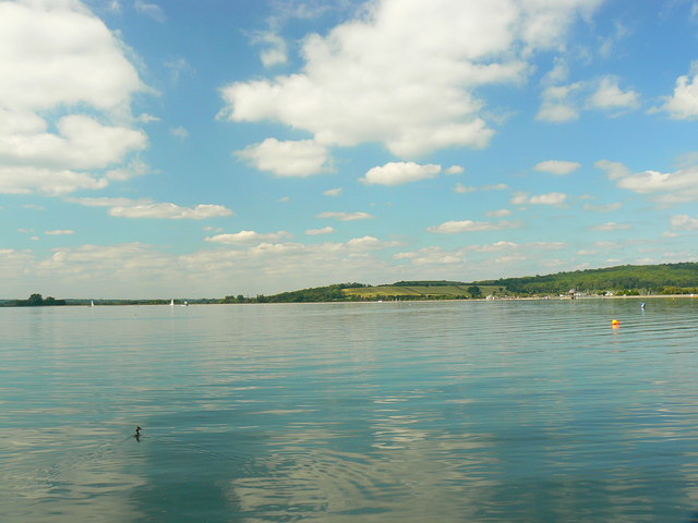
Farmoor Reservoir

Farmoor Reservoir is a reservoir at Farmoor, Oxfordshire, England, about 5 miles (8 km) outside the city of Oxford. It is close to the east bank of the...

Seacourt

Seacourt is a deserted medieval village ( DMV ) near the City of Oxford. The site is now mostly beneath the Oxford Western By-pass ( A34 ), about 0...

Oxford West and Abingdon (UK Parliament constituency)

Oxford West and Abingdon is a constituency represented in the House of Commons of the UK Parliament since 2017 by Layla Moran, a Liberal Democrat. ��2...

Nearby Amenities

Located within 500m of 51.758793,-1.3280225
Path
Lat/Long: 51.7593876/-1.3333492
Turning Circle
Lat/Long: 51.7582135/-1.3334311
Power: tower
Lat/Long: 51.7621493/-1.3265077
Power: tower
Lat/Long: 51.7608445/-1.3322851
Power: tower
Lat/Long: 51.7614488/-1.3296137
Power: pole
Lat/Long: 51.755399/-1.3241345
Power: pole
Lat/Long: 51.7556498/-1.3241318
Power: pole
Lat/Long: 51.7551323/-1.3241205
Power: pole
Lat/Long: 51.7560359/-1.3243139
Power: pole
Lat/Long: 51.75676/-1.3246186
Power: pole
Lat/Long: 51.757475/-1.3249196
Power: pole
Lat/Long: 51.7579984/-1.3251595
The data included in this document is from www.openstreetmap.org. The data is made available under ODbL.

Have you been to Cowleaze Copse?

Leave your review of Cowleaze Copse below (or comments, questions and feedback).