Terrace Wood

Wood, Forest in Nottinghamshire Bolsover

England

Terrace Wood

"The Railway Inn", Station Road, New Selston
"The Railway Inn", Station Road, New Selston Credit: Neil Theasby

Terrace Wood is a beautiful woodland area located in Nottinghamshire, England. It is situated near the village of Wood and is surrounded by a peaceful countryside setting. The wood covers an area of approximately 50 acres and is known for its diverse flora and fauna.

The woodland consists predominantly of broadleaf trees such as oak, beech, and birch, creating a lush and vibrant environment. These trees provide a canopy that offers shade and shelter for a variety of wildlife, including birds, squirrels, and deer. The wood is also home to numerous species of plants, wildflowers, and fungi, adding to its ecological significance.

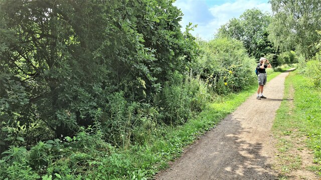
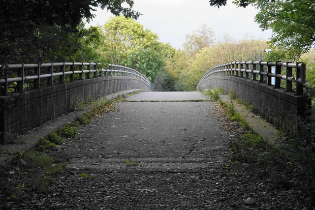
Terrace Wood is a popular destination for nature enthusiasts, walkers, and photographers. It offers a network of well-maintained footpaths and trails, allowing visitors to explore its natural beauty at their own pace. The wood's peaceful atmosphere and tranquil surroundings make it an ideal place for relaxation and contemplation.

In addition to its natural attractions, Terrace Wood also has historical significance. It is believed that the wood has been in existence for centuries, and remnants of an ancient settlement have been discovered within its boundaries. These archaeological findings add an intriguing dimension to the wood's appeal.

Overall, Terrace Wood in Nottinghamshire is a haven for nature lovers, offering a serene and picturesque setting. Its diverse wildlife, scenic beauty, and rich history make it a must-visit destination for those seeking a connection with nature and a glimpse into the past.

If you have any feedback on the listing, please let us know in the comments section below.

Terrace Wood Images

Images are sourced within 2km of 53.101547/-1.3100564 or Grid Reference SK4656. Thanks to Geograph Open Source API. All images are credited.

"The Railway Inn", Station Road, New Selston
Solar farm near Hilcote
On the Blackwell Trail
Bridge over the M1 Formerly part of the longstanding Sporton Lane, but now just a footpath.
Bridge over the M1
Formerly part of the longstanding Sporton Lane, but now just a footpath.
Radius Systems A manufacturer of pipeline components. Passing rainclouds have made this look more stark.
Radius Systems
A manufacturer of pipeline components. Passing rainclouds have made this look more stark.
Alloga UK A pharmaceutical logistics company in Amber Park. There are rain clouds behind.
Alloga UK
A pharmaceutical logistics company in Amber Park. There are rain clouds behind.
Rainbow over Wincobank Way Industrial land on the edge of South Normanton.
Rainbow over Wincobank Way
Industrial land on the edge of South Normanton.
Roundabout at South Normanton This roundabout provides access to the A38 from the B6406. On the other side of the roundabout is East Midlands Designer Outlet.
Roundabout at South Normanton
This roundabout provides access to the A38 from the B6406. On the other side of the roundabout is East Midlands Designer Outlet.
Carter Lane East Seen at the junction with Ball Hill.
Carter Lane East
Seen at the junction with Ball Hill.
Ball Hill The road is about to cross over the M1.
Ball Hill
The road is about to cross over the M1.
The M1 near South Normanton Viewed from Ball Hill. The sliproads lead to Junction 28.
The M1 near South Normanton
Viewed from Ball Hill. The sliproads lead to Junction 28.
Sad-looking pub in Pinxton This pub was put on the market a couple of years ago, but there do not seem to have been any buyers.
Sad-looking pub in Pinxton
This pub was put on the market a couple of years ago, but there do not seem to have been any buyers.
Town Street, Pinxton The street has an assortment of mostly residential buildings, with new ones being built on the right.
Town Street, Pinxton
The street has an assortment of mostly residential buildings, with new ones being built on the right.
New housing off Town Street There will be 8 three bedroom houses known as Sunnyside Mews.
New housing off Town Street
There will be 8 three bedroom houses known as Sunnyside Mews.
Woodfield Road A residential road which runs parallel to Town Street and also the M1 motorway which you can hear.
Woodfield Road
A residential road which runs parallel to Town Street and also the M1 motorway which you can hear.
Brookhill Lane The land on the right is part of the grounds of Brookhill Hall.
Brookhill Lane
The land on the right is part of the grounds of Brookhill Hall.
Grazing land by Brookhill Hall Farm Land surrounding Maghole Brook.
Grazing land by Brookhill Hall Farm
Land surrounding Maghole Brook.
Planted field by Pinxton Lane The valley ahead is known as The Dumbles. A footpath crosses the field but is not currently very defined. In the distance you can see the spire of St Wilfrid's in Kirkby-in-Ashfield.
Planted field by Pinxton Lane
The valley ahead is known as The Dumbles. A footpath crosses the field but is not currently very defined. In the distance you can see the spire of St Wilfrid's in Kirkby-in-Ashfield.
Show me another place!

Terrace Wood is located at Grid Ref: SK4656 (Lat: 53.101547, Lng: -1.3100564)

Administrative County: Derbyshire

District: Bolsover

Police Authority: Derbyshire

What 3 Words

///spades.mopped.paler. Near Pinxton, Derbyshire

Nearby Locations

Halfmoon Pond Terrace Wood

Related Wikis

Pinxton

Pinxton is a village and civil parish in Derbyshire on the western boundary of Nottinghamshire, England, just south of the Pinxton Interchange at Junction...

Frederick Gent School

The Frederick Gent Comprehensive School is a co-educational secondary school located on Mansfield Road (B6019) in South Normanton in the Bolsover district...

Pinxton and Selston railway station

Pinxton and Selston railway station served the villages of Pinxton, Derbyshire and Selston, Nottinghamshire. It was located on the Midland Railway's Mansfield...

Hilcote

Hilcote is a small village in the south of the Bolsover district in Derbyshire, England, located close to the A38 junction with the M1 (Junction 28). The...

Nearby Amenities

Located within 500m of 53.101547,-1.3100564
Barrier: stile
Steps: 1
Stile: stepover
Lat/Long: 53.1035916/-1.3055372
Barrier: stile
Steps: 1
Stile: stepover
Lat/Long: 53.1048472/-1.3068414
Barrier: lift_gate
Lat/Long: 53.1048833/-1.309491
Tourism: artwork
Lat/Long: 53.1056459/-1.3073084
Barrier: lift_gate
Lat/Long: 53.1049683/-1.3096717
Man Made: street_cabinet
Lat/Long: 53.105588/-1.3103538
Man Made: street_cabinet
Lat/Long: 53.1055795/-1.3103756
The data included in this document is from www.openstreetmap.org. The data is made available under ODbL.

Have you been to Terrace Wood?

Leave your review of Terrace Wood below (or comments, questions and feedback).