Ash Hill

Settlement in Devon Teignbridge

England

Ash Hill

Shaldon - Teign Estuary View northwards from the coastal path, across the Teign at high tide, towards Teignmouth. This is a sheltered anchorage for small boats.
Shaldon - Teign Estuary Credit: Colin Smith

Ash Hill is a small village located in the county of Devon, in the southwestern part of England. Situated in the picturesque countryside, it is nestled amidst rolling hills and lush green fields, offering a serene and idyllic setting.

The village itself is relatively small, with a population of around 500 residents. It provides a close-knit community atmosphere, with a friendly and welcoming ambiance. The architecture in Ash Hill is predominantly traditional, with charming cottages and well-maintained houses lining the streets.

One of the main attractions in the village is St. Mary's Church, a beautiful medieval church that dates back to the 12th century. It is a significant historical landmark and serves as a hub for local religious activities. Additionally, the village boasts a primary school, a village hall, and a local pub, which often acts as a social gathering point for residents.

Surrounded by stunning natural beauty, Ash Hill offers ample opportunities for outdoor activities. The nearby countryside provides a multitude of walking and hiking trails, allowing visitors to explore the scenic surroundings. Additionally, the village is within easy reach of several notable attractions, including Dartmoor National Park and the historic city of Exeter.

In summary, Ash Hill is a charming and peaceful village in Devon, offering a tranquil escape from the hustle and bustle of city life. Its picturesque countryside, historical landmarks, and strong sense of community make it an appealing destination for both residents and visitors alike.

If you have any feedback on the listing, please let us know in the comments section below.

Ash Hill Images

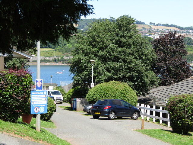
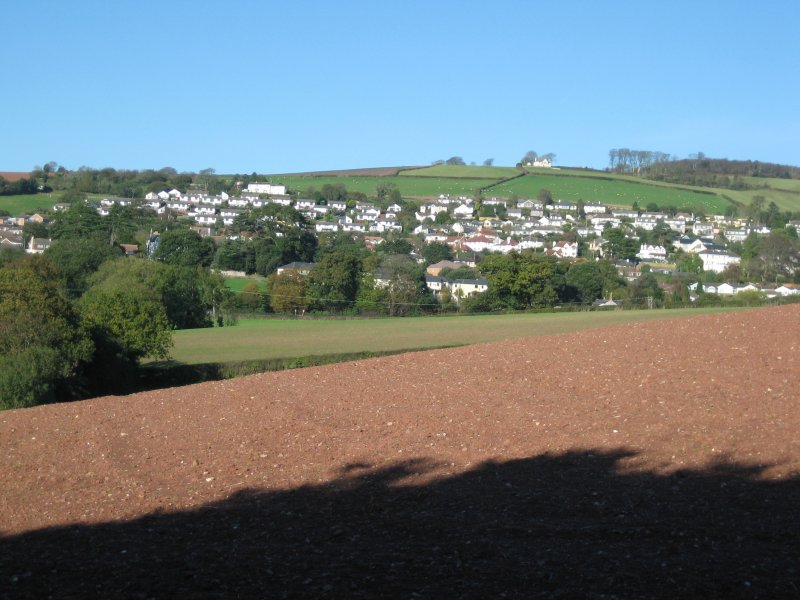
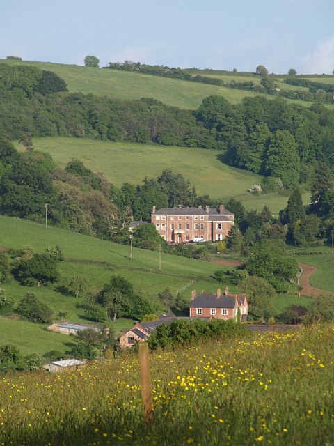
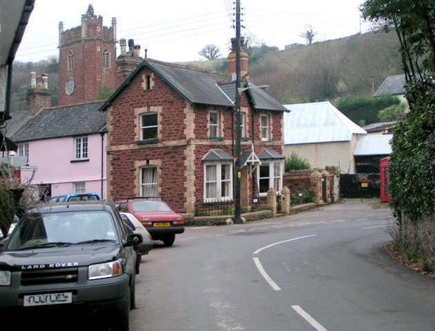
Images are sourced within 2km of 50.546573/-3.5397824 or Grid Reference SX9173. Thanks to Geograph Open Source API. All images are credited.

Shaldon - Teign Estuary View northwards from the coastal path, across the Teign at high tide, towards Teignmouth. This is a sheltered anchorage for small boats.
Shaldon - Teign Estuary
View northwards from the coastal path, across the Teign at high tide, towards Teignmouth. This is a sheltered anchorage for small boats.
Shaldon - Ringmore Towers A distinctive red sandstone castellated building, with conical tower and built ca 1930. It is now holiday accommodation.
Shaldon - Ringmore Towers
A distinctive red sandstone castellated building, with conical tower and built ca 1930. It is now holiday accommodation.
Ringmore - The Strand Garden with view across the Teign estuary towards the Shaldon-Teignmouth Bridge.
Ringmore - The Strand
Garden with view across the Teign estuary towards the Shaldon-Teignmouth Bridge.
Ringmore - Coast Path The path (Templer Way) at Ringmore Strand following the shore of the Teign is under water at high tide necessitating a parallel way through the village.
Ringmore - Coast Path
The path (Templer Way) at Ringmore Strand following the shore of the Teign is under water at high tide necessitating a parallel way through the village.
Ringmore - The Strand The small Teignmouth-registered boat (TH8) bobs in the water at high tide.
Ringmore - The Strand
The small Teignmouth-registered boat (TH8) bobs in the water at high tide.
Ringmore - Holiday Village Entrance to a large holiday complex by the Teign estuary west of Shaldon.
Ringmore - Holiday Village
Entrance to a large holiday complex by the Teign estuary west of Shaldon.
Ringmore - Dagra Lane Red sandstone path descending the hillside towards the Teign estuary.
Ringmore - Dagra Lane
Red sandstone path descending the hillside towards the Teign estuary.
Ringmore - Dagra Lane Freshly harvested hay field south of the Teign estuary. In the background are small, hedge-lined fields on the hillside.
Ringmore - Dagra Lane
Freshly harvested hay field south of the Teign estuary. In the background are small, hedge-lined fields on the hillside.
Ringmore - Harvest A tractor harvests hay in a field south of the Teign estuary. In the background are small, hedge-lined fields on the hillside.
Ringmore - Harvest
A tractor harvests hay in a field south of the Teign estuary. In the background are small, hedge-lined fields on the hillside.
Bishopsteignton Bishopsteignton is a large village on the north bank of the Teign Estuary, 1-2 miles west of Teignmouth - viewed here from the south above Ringmore.
Bishopsteignton
Bishopsteignton is a large village on the north bank of the Teign Estuary, 1-2 miles west of Teignmouth - viewed here from the south above Ringmore.
Ringmore Small village on the south bank of the Teign Estuary - seen here from The Beacon.
Ringmore
Small village on the south bank of the Teign Estuary - seen here from The Beacon.
Combeteignhead : River Teign Looking across the River Teign estuary.
Combeteignhead : River Teign
Looking across the River Teign estuary.
Combeteignhead : Coombe Cellars Inn Looking towards a pub on the banks of the River Teign.
Combeteignhead : Coombe Cellars Inn
Looking towards a pub on the banks of the River Teign.
Combeteignhead : Coombe Cellars Inn As of 2016 it is owned by Mitchells & Butlers.
Combeteignhead : Coombe Cellars Inn
As of 2016 it is owned by Mitchells & Butlers.
Combeteignhead : Coombe Cellars Inn As of 2016 it is owned by Mitchells & Butlers.
Combeteignhead : Coombe Cellars Inn
As of 2016 it is owned by Mitchells & Butlers.
Combeteignhead : River Teign Looking across the river estuary.
Combeteignhead : River Teign
Looking across the river estuary.
Combeteignhead : River Teign Looking across the River Teign estuary.
Combeteignhead : River Teign
Looking across the River Teign estuary.
Combeteignhead : Hearn Field Benches on Hearn Field.
Combeteignhead : Hearn Field
Benches on Hearn Field.
Show me another place!

Ash Hill is located at Grid Ref: SX9173 (Lat: 50.546573, Lng: -3.5397824)

Administrative County: Devon

District: Teignbridge

Police Authority: Devon and Cornwall

What 3 Words

///flock.recline.tolerates. Near Bishopsteignton, Devon

Nearby Locations

Ash Hill

Related Wikis

Bishopsteignton

Bishopsteignton is a village and civil parish in South Devon, England, between Newton Abbot and Teignmouth, close to the Teign Estuary. The village is...

Coombe Cellars

Coombe Cellars Inn is a public house on the south bank of the estuary of the River Teign in south Devon, England. It is in the parish of Haccombe with...

Haccombe with Combe

Haccombe with Combe is a civil parish in the Teignbridge local government district of Devon, England. The parish lies immediately to the east of the town...

Combeinteignhead

Combeinteignhead or Combe-in-Teignhead is a village in Teignbridge, South Devon, England. It lies within the civil parish of Haccombe with Combe, between...

Ashwell, Devon

Ashwell is a village in Devon, England.

Coombe, Teignmouth

Coombe is an area of the town of Teignmouth in the English county of Devon. grid reference SX929741

Teignmouth A.F.C.

Teignmouth Association Football Club is a football club based in Teignmouth, England. They are currently members of the South West Peninsula League Premier...

Shaldon

Shaldon is a village and civil parish in the Teignbridge district, in south Devon, England, on the south bank of the estuary of the River Teign, opposite...

Nearby Amenities

Located within 500m of 50.546573,-3.5397824
Source: PGS
Lat/Long: 50.5453527/-3.543083
Source: PGS
Lat/Long: 50.5454106/-3.5422647
Source: PGS
Lat/Long: 50.5454052/-3.5418871
Source: PGS
Lat/Long: 50.545148/-3.5396527
Source: PGS
Lat/Long: 50.5452849/-3.5395096
Source: PGS
Lat/Long: 50.5449251/-3.5375333
Source: PGS
Lat/Long: 50.5450082/-3.5373149
Source: PGS
Lat/Long: 50.5452404/-3.5373237
Source: PGS
Lat/Long: 50.5465948/-3.5351168
Source: PGS
Lat/Long: 50.546746/-3.5345359
Post Box
Brand: Royal Mail
Brand Wikidata: Q638098
Brand Wikipedia: en:Royal Mail
Collection Times: Mo-Fr 09:00; Sa 07:00; Su off
Drive Through: no
Operator: Royal Mail
Operator Wikidata: Q638098
Post Box Mounting: concrete_post
Post Box Type: lamp
Ref: TQ14 48D
Royal Cypher: EIIR
Royal Cypher Wikidata: Q33102113
Source: survey;streetlevel imagery;aerial imagery;local knowledge
Lat/Long: 50.548734/-3.5372841
Bus Stop
Coles Barn
Bench: no
Bin: yes
Bus: yes
Lit: yes
Public Transport: platform
Shelter: yes
Tactile Paving: no
Lat/Long: 50.5483482/-3.5376955
Bus Stop
Bus: yes
Public Transport: platform
Lat/Long: 50.547558/-3.5410242
Flow Point
Natural: headland
Place: locality
Lat/Long: 50.5453241/-3.5379184
Seamark Buoy Lateral Category: starboard
Seamark Buoy Lateral Colour: green
Seamark Type: buoy_lateral
Lat/Long: 50.54434/-3.53661
Seamark Buoy Lateral Category: port
Seamark Buoy Lateral Colour: red
Seamark Type: buoy_lateral
Lat/Long: 50.54392/-3.53672
Bus Stop
Coles Barn
Bench: no
Bin: yes
Bus: yes
Public Transport: platform
Shelter: yes
Tactile Paving: no
Lat/Long: 50.5486515/-3.5365099
Parking
Capacity: 18
Lat/Long: 50.5499122/-3.5411879
Parking
Capacity: 14
Lat/Long: 50.5500741/-3.5408768
Generator Method: photovoltaic
Generator Output Electricity: yes
Generator Source: solar
Generator Type: solar_photovoltaic_panel
Location: roof
Power: generator
Lat/Long: 50.5494341/-3.5410304
Generator Method: photovoltaic
Generator Output Electricity: yes
Generator Source: solar
Generator Type: solar_photovoltaic_panel
Location: roof
Power: generator
Lat/Long: 50.5495159/-3.5399388
Generator Method: photovoltaic
Generator Output Electricity: yes
Generator Source: solar
Generator Type: solar_photovoltaic_panel
Location: roof
Power: generator
Lat/Long: 50.5486637/-3.5398932
Generator Method: photovoltaic
Generator Output Electricity: yes
Generator Source: solar
Generator Type: solar_photovoltaic_panel
Location: roof
Power: generator
Lat/Long: 50.5493548/-3.5430262
Generator Method: photovoltaic
Generator Output Electricity: yes
Generator Source: solar
Generator Type: solar_photovoltaic_panel
Location: roof
Power: generator
Lat/Long: 50.5492604/-3.5428492
Generator Method: photovoltaic
Generator Output Electricity: yes
Generator Source: solar
Generator Type: solar_photovoltaic_panel
Location: roof
Power: generator
Lat/Long: 50.5504628/-3.5429214
Generator Method: photovoltaic
Generator Output Electricity: yes
Generator Source: solar
Generator Type: solar_photovoltaic_panel
Location: roof
Power: generator
Lat/Long: 50.5488626/-3.5410309
The data included in this document is from www.openstreetmap.org. The data is made available under ODbL.

Have you been to Ash Hill?

Leave your review of Ash Hill below (or comments, questions and feedback).