Poor's Wood

Wood, Forest in Berkshire

England

Poor's Wood

St Margaret's Church, Catmore
St Margaret's Church, Catmore Credit: AJD

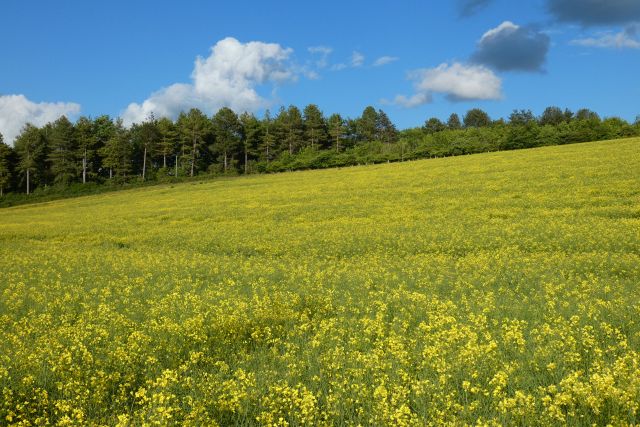
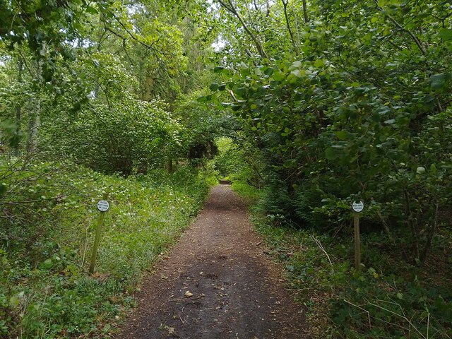
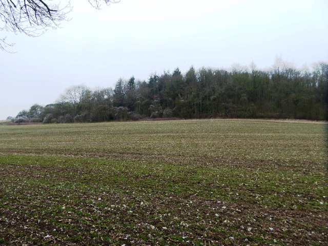
Poor's Wood is a picturesque woodland area located in the county of Berkshire, England. Nestled within the heart of the countryside, the wood covers an approximate area of 50 acres and is a popular destination for nature enthusiasts and hikers alike.

The wood boasts a diverse range of tree species, including oak, beech, birch, and pine, creating a rich tapestry of colors throughout the year. It is also home to various wildlife, such as deer, foxes, and a variety of bird species, making it a haven for nature lovers and birdwatchers.

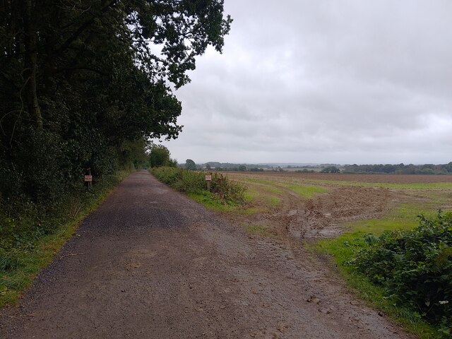
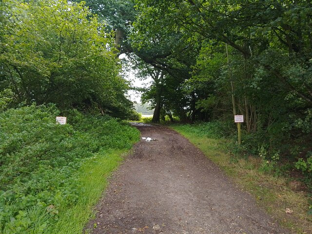
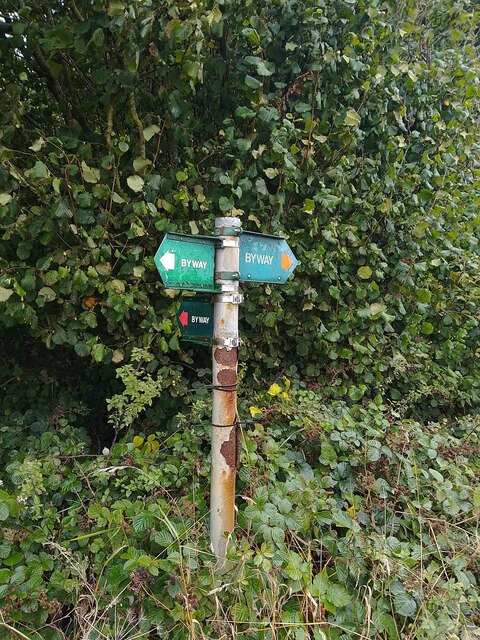
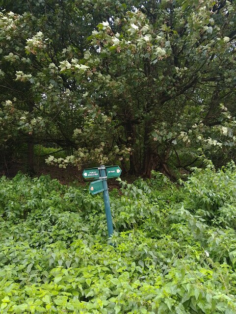
Visitors can explore the wood through a network of well-maintained footpaths, allowing them to immerse themselves in the tranquility of nature. The paths meander through the dense foliage, offering glimpses of sunlight filtering through the canopy and creating a magical ambiance.

For those seeking a peaceful retreat, Poor's Wood provides several secluded spots, perfect for picnics or simply unwinding amidst the serene surroundings. The wood also features a small stream that adds to its charm, offering a soothing soundtrack of flowing water.

Throughout the year, the wood undergoes seasonal transformations, with vibrant bluebells carpeting the forest floor in spring and a riot of colors during the autumn months. These natural spectacles attract visitors from far and wide, eager to witness the beauty of nature in all its glory.

Overall, Poor's Wood in Berkshire is a captivating woodland retreat, offering a welcome escape from the hustle and bustle of everyday life. Its natural beauty and diverse wildlife provide a delightful experience for all who visit.

If you have any feedback on the listing, please let us know in the comments section below.

Poor's Wood Images

Images are sourced within 2km of 51.52193/-1.3368604 or Grid Reference SU4680. Thanks to Geograph Open Source API. All images are credited.

St Margaret's Church, Catmore
Byway and farmland, Catmore
Farmland, Catmore
Farmland, Catmore
Old Street Row byway A byway and unadopted road between Hailey Lane and Old Street (a byway). The byway curves through the woodland of Old Street Row rather than following Old Street at this point, though ahead it rejoins Old Street.
Old Street Row byway
A byway and unadopted road between Hailey Lane and Old Street (a byway). The byway curves through the woodland of Old Street Row rather than following Old Street at this point, though ahead it rejoins Old Street.
Old Street Bizarrely, this stretch of Old Street / Old Street Lane is private property. The byway which follows the rest of the track curves off to the left through the woodland (Old Street Row).
Old Street
Bizarrely, this stretch of Old Street / Old Street Lane is private property. The byway which follows the rest of the track curves off to the left through the woodland (Old Street Row).
Old Street Row byway A byway and unadopted road between Hailey Lane and Old Street (a byway). The byway curves through the woodland of Old Street Row rather than following Old Street at this point.
Old Street Row byway
A byway and unadopted road between Hailey Lane and Old Street (a byway). The byway curves through the woodland of Old Street Row rather than following Old Street at this point.
Catmore farmland A field of farmland to the east of Catmore.
Catmore farmland
A field of farmland to the east of Catmore.
Old Street A byway between Catmore Road in Catmore and an unnamed byway through Old Street Row.
Old Street
A byway between Catmore Road in Catmore and an unnamed byway through Old Street Row.
Track to Woolver's Borders The signs helpfully point out there is no right of way here.
Track to Woolver's Borders
The signs helpfully point out there is no right of way here.
Old Street A byway between Catmore Road in Catmore and an unnamed byway through Old Street Row.
Old Street
A byway between Catmore Road in Catmore and an unnamed byway through Old Street Row.
Old Street A byway between Catmore Road in Catmore and an unnamed byway through Old Street Row. A byway heads right (north east) from here, but reaches a dead end after High Robins, before Woolver's Borders.
Old Street
A byway between Catmore Road in Catmore and an unnamed byway through Old Street Row. A byway heads right (north east) from here, but reaches a dead end after High Robins, before Woolver's Borders.
Old Street byway signpost Showing the route of Old Street and a byway heading north east.
Old Street byway signpost
Showing the route of Old Street and a byway heading north east.
Byway through High Robins/Knapp's Copse A byway passing between High Robins and Knapp's Copse, both small woodlands. Two signs request for dogs to be kept on leads. The byway is a dead end after High Robins for vehicular traffic.
Byway through High Robins/Knapp's Copse
A byway passing between High Robins and Knapp's Copse, both small woodlands. Two signs request for dogs to be kept on leads. The byway is a dead end after High Robins for vehicular traffic.
Catmore farmland Growing at the edge of a field.
Catmore farmland
Growing at the edge of a field.
Byway towards bridleway The byway reaches an abrupt dead end ahead, as it ends at the start of the field and becomes a bridleway that leads to Catmore Road.
Byway towards bridleway
The byway reaches an abrupt dead end ahead, as it ends at the start of the field and becomes a bridleway that leads to Catmore Road.
Old Street byway and bridleway signpost A very short signpost showing the route of a byway and a bridleway: the byway is Old Street. The bridleway sign should read byway, as the track is a byway for a very small distance, and then becomes a bridleway. Logic prevails, however, and the sign is sensible.
Old Street byway and bridleway signpost
A very short signpost showing the route of a byway and a bridleway: the byway is Old Street. The bridleway sign should read byway, as the track is a byway for a very small distance, and then becomes a bridleway. Logic prevails, however, and the sign is sensible.
Old Street A byway between Catmore Road in Catmore and an unnamed byway through Old Street Row.
Old Street
A byway between Catmore Road in Catmore and an unnamed byway through Old Street Row.
Stripped tree near Catmore A tree stripped of its bark near to Catmore, next to a bridleway.
Stripped tree near Catmore
A tree stripped of its bark near to Catmore, next to a bridleway.
Show me another place!

Poor's Wood is located at Grid Ref: SU4680 (Lat: 51.52193, Lng: -1.3368604)

Unitary Authority: West Berkshire

Police Authority: Thames Valley

What 3 Words

///monument.variety.responded. Near Farnborough, Berkshire

Related Wikis

Catmore

Catmore is a civil parish and village in West Berkshire about 5+1⁄2 miles (9 km) southeast of Wantage. Catmore is in the Berkshire Downs and the centre...

Stanmore, Berkshire

Stanmore is a hamlet in Berkshire, England. In the 2011 Census it was included in the civil parish of Beedon. It is situated west of the A34, 7 miles north...
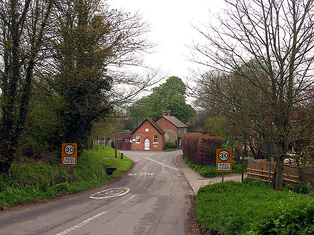
West Ilsley

West Ilsley is a village and civil parish in Berkshire, England. The population of the village at the 2011 Census was 332. == Location and amenities... ==

Farnborough, Berkshire

Farnborough is a village and civil parish in West Berkshire, about 4 miles (6.4 km) south of Wantage. The village is 720 feet (220 m) above sea level on...

Peasemore

Peasemore is a village and civil parish in the English ceremonial and historic county of Berkshire in the West Berkshire unitary authority area, west of...

Brightwalton

Brightwalton is a village and civil parish in the Berkshire Downs centred 7 miles (11 km) NNW of Newbury in West Berkshire. == Parish church == The Church...

Brightwalton Green

Brightwalton Green is a hamlet in the civil parish of Brightwalton in the county of Berkshire, England. The settlement lies near to the A338 road, and...

Ashridge Wood

Ashridge Wood is a 15.9-hectare (39-acre) biological Site of Special Scientific Interest south-west of Compton in Berkshire. It is in the North Wessex...

Nearby Amenities

Located within 500m of 51.52193,-1.3368604
Power: pole
Source: Bing
Lat/Long: 51.5221673/-1.3421852
Power: pole
Source: Bing
Lat/Long: 51.5251305/-1.338983
Power: pole
Source: Bing
Lat/Long: 51.5239813/-1.3402459
Power: pole
Source: Bing
Lat/Long: 51.5245638/-1.3396371
Power: pole
Source: Bing
Lat/Long: 51.5259438/-1.3371104
Power: pole
Source: Bing
Lat/Long: 51.5255583/-1.3380868
Power: pole
Source: Bing
Lat/Long: 51.520989/-1.3434431
Power: pole
Source: Bing
Lat/Long: 51.526361/-1.3361797
Power: pole
Source: Bing
Lat/Long: 51.5215564/-1.3428182
Power: pole
Source: Bing
Lat/Long: 51.5233655/-1.3409004
Power: pole
Source: Bing
Lat/Long: 51.5227681/-1.3415468
The data included in this document is from www.openstreetmap.org. The data is made available under ODbL.

Have you been to Poor's Wood?

Leave your review of Poor's Wood below (or comments, questions and feedback).