Thornaby High Wood

Wood, Forest in Yorkshire

England

Thornaby High Wood

Stainsby Wood Burnt out car in Stainsby Wood gradually being reclaimed by nature including a Robin’s nest in the door.
Stainsby Wood Credit: John Peacock

Thornaby High Wood is a picturesque woodland located in the county of Yorkshire, England. Situated in the town of Thornaby-on-Tees, this wood is known for its natural beauty and rich biodiversity. Spanning across approximately 10 hectares, Thornaby High Wood is a popular destination for nature enthusiasts and those looking for a peaceful escape from urban life.

The wood is primarily composed of deciduous trees, including oak, beech, and birch, which create a dense canopy that provides shade during the hot summer months. The forest floor is carpeted with a variety of wildflowers, ferns, and mosses, adding to the enchanting atmosphere of the wood. Thornaby High Wood is also home to a diverse range of wildlife, including various bird species, small mammals, and insects.

Visitors to Thornaby High Wood can enjoy a network of well-maintained footpaths and trails that crisscross through the woodland, allowing for leisurely walks or more adventurous hikes. The wood is also equipped with picnic areas and benches, providing visitors with the opportunity to relax and soak in the tranquil surroundings.

Thornaby High Wood offers a unique opportunity for educational purposes, with local schools often using the wood as an outdoor classroom. Students can learn about the various plants and animals that inhabit the area, as well as the importance of conservation and environmental stewardship.

Overall, Thornaby High Wood is a natural gem in Yorkshire, offering visitors a chance to connect with nature and experience the beauty of a traditional English woodland.

If you have any feedback on the listing, please let us know in the comments section below.

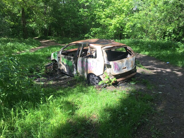
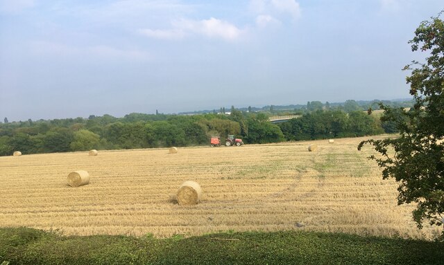
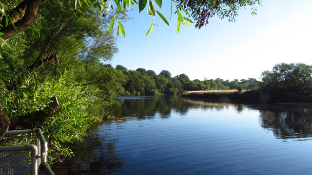
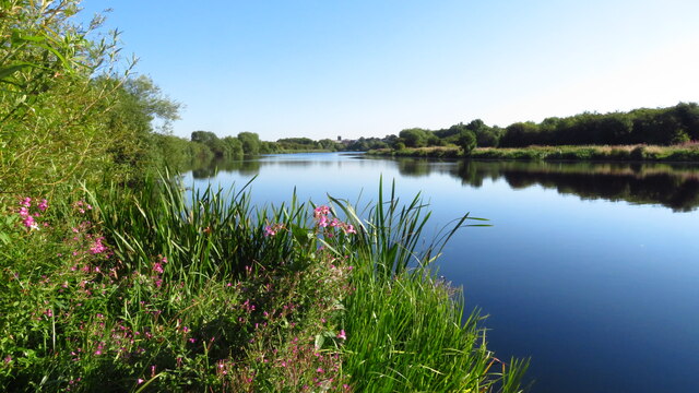
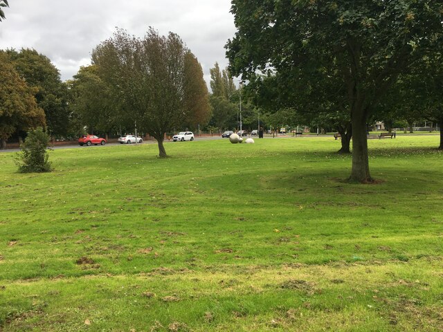
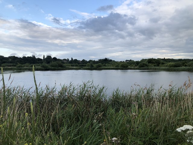
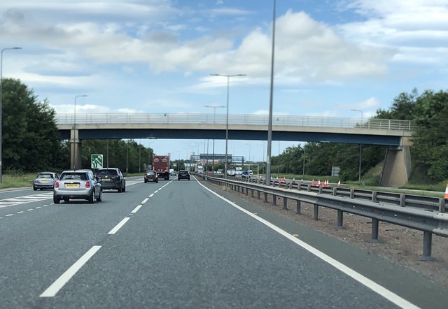
Thornaby High Wood Images

Images are sourced within 2km of 54.540197/-1.3073483 or Grid Reference NZ4416. Thanks to Geograph Open Source API. All images are credited.

Stainsby Wood Burnt out car in Stainsby Wood gradually being reclaimed by nature including a Robin’s nest in the door.
Stainsby Wood
Burnt out car in Stainsby Wood gradually being reclaimed by nature including a Robin’s nest in the door.
Harvest time A view of farmland between Thornaby and Acklam.
Harvest time
A view of farmland between Thornaby and Acklam.
Teesside Industrial Estate The benchmark is cut into a modern brick built factory on the west side of Sadler Forster Way.
Teesside Industrial Estate
The benchmark is cut into a modern brick built factory on the west side of Sadler Forster Way.
Teesside Industrial Estate There is a benchmark cut into the modern brick built factory on the west side of Sadler Forster Way. It is cut to the left of this large expanse of brickwork.
Teesside Industrial Estate
There is a benchmark cut into the modern brick built factory on the west side of Sadler Forster Way. It is cut to the left of this large expanse of brickwork.
R Tees at Preston Park, Eaglescliffe
R Tees, upstream of Thornaby-on-Tees Church
Green space near Teesdale Park
Lay-by on the A66
Lay-by on the A66
Rialto Court, Bridge Road, Stockton A block of student accommodation for students at Queen's Campus, Durham University's outpost in Thornaby.
Rialto Court, Bridge Road, Stockton
A block of student accommodation for students at Queen's Campus, Durham University's outpost in Thornaby.
Elizabeth II Postbox on Mandale Road, Thornaby-on-Tees Postbox No. TS17 318.

See <a href="https://www.geograph.org.uk/photo/5886849">NZ4518 : Shops on Mandale Road, Thornaby-on-Tees</a> for context.
Elizabeth II Postbox on Mandale Road, Thornaby-on-Tees
Postbox No. TS17 318. See NZ4518 : Shops on Mandale Road, Thornaby-on-Tees for context.
Shops on Mandale Road, Thornaby-on-Tees Showing position of Postbox No. TS17 318.

See <a href="https://www.geograph.org.uk/photo/5886847">NZ4518 : Elizabeth II Postbox on Mandale Road, Thornaby-on-Tees</a> for postbox.
Shops on Mandale Road, Thornaby-on-Tees
Showing position of Postbox No. TS17 318. See NZ4518 : Elizabeth II Postbox on Mandale Road, Thornaby-on-Tees for postbox.
Thornaby on Tees, North Yorkshire, St Paul
Surtees Bridge The Surtees Road Bridge carries the A66 across the river Tees. The structure is a 2008 rebuild of the 1981 bridge that suffered stress issues due to excessive settlement. Adjacent are two iterations of the Tees Bridge that carry the Tees Valley railway across the river. The 2009 built Tees Bridge takes the current railway infrastructure and sandwiches the 1906 Tees Bridge between itself and Surtees Bridge. The tracks on the 1906 Tees bridge were lifted following completion of the 2009 bridge.
Surtees Bridge
The Surtees Road Bridge carries the A66 across the river Tees. The structure is a 2008 rebuild of the 1981 bridge that suffered stress issues due to excessive settlement. Adjacent are two iterations of the Tees Bridge that carry the Tees Valley railway across the river. The 2009 built Tees Bridge takes the current railway infrastructure and sandwiches the 1906 Tees Bridge between itself and Surtees Bridge. The tracks on the 1906 Tees bridge were lifted following completion of the 2009 bridge.
Bowesfield Nature Reserve An area of former farmland, now a large wetland reserve.

More info: <span class="nowrap"><a title="https://www.teeswildlife.org/nature-reserve/bowesfield/" rel="nofollow ugc noopener" href="https://www.teeswildlife.org/nature-reserve/bowesfield/">Link</a><img style="margin-left:2px;" alt="External link" title="External link - shift click to open in new window" src="https://s1.geograph.org.uk/img/external.png" width="10" height="10"/></span>
Bowesfield Nature Reserve
An area of former farmland, now a large wetland reserve. More info: LinkExternal link
Gilmour Street, Thornaby Terraced houses on Gilmour Street.
Gilmour Street, Thornaby
Terraced houses on Gilmour Street.
Pedestrian Bridge Over A19
South Stockton railway station (site), Yorkshire Opened in 1830 by the Stockton & Darlington Railway on its line to Middlesbrough, the station here has variously been called Guisborough Lane, Stockton, Stockton South and South Stockton. It was rebuilt numerous times and appears to have moved from one side of the Guisborough Lane (now Mandale Street) bridge, visible here, to the other. The 1848 rebuild seems to have been located in the immediate foreground, at which time the previous S&DR terminus station over the river (see <a href="https://www.geograph.org.uk/photo/4300027">NZ4418 : Stockton (S&DR) Bridge Road railway station (site), County Durham</a>) was closed to passengers. However, enlargements were required again in 1853, then in 1858 a new station was opened on the far side of the bridge. In 1882, this station was also rebuilt, now by the North Eastern Railway, and including a large island platform. In 1892 it was renamed Thornaby, the platform of which can just be seen through the right hand arch of the bridge.
South Stockton railway station (site), Yorkshire
Opened in 1830 by the Stockton & Darlington Railway on its line to Middlesbrough, the station here has variously been called Guisborough Lane, Stockton, Stockton South and South Stockton. It was rebuilt numerous times and appears to have moved from one side of the Guisborough Lane (now Mandale Street) bridge, visible here, to the other. The 1848 rebuild seems to have been located in the immediate foreground, at which time the previous S&DR terminus station over the river (see NZ4418 : Stockton (S&DR) Bridge Road railway station (site), County Durham) was closed to passengers. However, enlargements were required again in 1853, then in 1858 a new station was opened on the far side of the bridge. In 1882, this station was also rebuilt, now by the North Eastern Railway, and including a large island platform. In 1892 it was renamed Thornaby, the platform of which can just be seen through the right hand arch of the bridge.
Development site off Pottery Wharf
Show me another place!

Thornaby High Wood is located at Grid Ref: NZ4416 (Lat: 54.540197, Lng: -1.3073483)

Division: North Riding

Unitary Authority: Stockton-on-Tees

Police Authority: Cleveland

What 3 Words

///windy.joke.darker. Near Thornaby-on-Tees, Co. Durham

Related Wikis

Church of St Peter ad Vincula, Thornaby-on-Tees

The Church of St Peter ad Vincula, Thornaby, is an Anglican church in Thornaby, North Yorkshire, England. The structure, which is grade II* listed, is...

RAF Thornaby

Royal Air Force Thornaby, or more simply RAF Thornaby, is a former Royal Air Force Station located in the town of Thornaby-on-Tees, in the North Riding...

Bassleton Wood and The Holmes

Bassleton Wood and The Holmes is a Local Nature Reserve in the town of Thornaby-on-Tees, in the borough of Stockton-on-Tees, England.Bassleton Wood is...

St Patrick's Catholic College

St Patrick's Catholic College is a coeducational secondary school located in Thornaby-on-Tees in the Borough of Stockton-on-Tees, England.Previously a...

Nearby Amenities

Located within 500m of 54.540197,-1.3073483
Source: PGS
Lat/Long: 54.5421938/-1.3114762
Source: PGS
Lat/Long: 54.5423744/-1.3116819
Source: PGS
Lat/Long: 54.543065/-1.3118908
Source: PGS
Lat/Long: 54.5436675/-1.3117878
Source: PGS
Lat/Long: 54.5442504/-1.3104702
Source: PGS
Lat/Long: 54.543625/-1.311027
Source: PGS
Lat/Long: 54.5431391/-1.3108737
Source: PGS
Lat/Long: 54.5427984/-1.3107768
Source: PGS
Lat/Long: 54.5425663/-1.3106479
Source: PGS
Lat/Long: 54.5411431/-1.3100884
Source: PGS
Lat/Long: 54.5412775/-1.3102514
Source: PGS
Lat/Long: 54.5414219/-1.3104574
Source: PGS
Lat/Long: 54.5416261/-1.3107578
Source: PGS
Lat/Long: 54.54188/-1.3111271
Source: PGS
Lat/Long: 54.5423713/-1.3104106
Source: PGS
Lat/Long: 54.5420375/-1.3100583
Source: PGS
Lat/Long: 54.5415445/-1.309426
Source: PGS
Lat/Long: 54.5413887/-1.3092399
Source: PGS
Lat/Long: 54.5406899/-1.3094959
Source: PGS
Lat/Long: 54.5410037/-1.3098824
Source: PGS
Lat/Long: 54.5387862/-1.30737
Source: PGS
Lat/Long: 54.5389733/-1.3080281
Source: PGS
Lat/Long: 54.5392858/-1.3080113
Source: PGS
Lat/Long: 54.5396543/-1.3082945
Source: PGS
Lat/Long: 54.5398734/-1.3084747
Source: PGS
Lat/Long: 54.5402136/-1.3088581
Source: PGS
Lat/Long: 54.540255/-1.3090068
Source: PGS
Lat/Long: 54.5405289/-1.309359
Source: PGS
Lat/Long: 54.5406261/-1.3082784
Source: PGS
Lat/Long: 54.540205/-1.3077819
Source: PGS
Lat/Long: 54.5398984/-1.3074724
Source: PGS
Lat/Long: 54.5392381/-1.3072163
Source: PGS
Lat/Long: 54.5381987/-1.3087183
Source: PGS
Lat/Long: 54.5381364/-1.3093835
Source: PGS
Lat/Long: 54.5383757/-1.3109678
Source: PGS
Lat/Long: 54.5387679/-1.3122982
Source: PGS
Lat/Long: 54.5391662/-1.3133067
Source: PGS
Lat/Long: 54.5396828/-1.3147337
Source: PGS
Lat/Long: 54.5399256/-1.3137252
Source: PGS
Lat/Long: 54.5395646/-1.3126415
Source: PGS
Lat/Long: 54.5393218/-1.3119764
Source: PGS
Lat/Long: 54.5388986/-1.310646
Source: PGS
Lat/Long: 54.5386435/-1.3095305
Source: PGS
Lat/Long: 54.5386932/-1.308747
Source: PGS
Lat/Long: 54.5387865/-1.308232
Source: PGS
Lat/Long: 54.5384974/-1.3076347
Source: PGS
Lat/Long: 54.538292/-1.3081712
Source: PGS
Lat/Long: 54.5365819/-1.3119337
Source: PGS
Lat/Long: 54.5378902/-1.313575
Source: PGS
Lat/Long: 54.5376163/-1.3121802
Source: PGS
Lat/Long: 54.5370561/-1.3106138
Source: PGS
Lat/Long: 54.5368196/-1.3106138
Source: PGS
Lat/Long: 54.5364461/-1.3107425
Traffic Signals
Lat/Long: 54.5405401/-1.3035727
Turning Circle
Lat/Long: 54.535915/-1.3066616
Pub
The Jolly Farmer
Addr City: Stockton-on-Tees
Addr Housenumber: 412
Addr Postcode: TS17 8QH
Addr Street: Thornaby Road
Addr Suburb: Thornaby
Fhrs Id: 250639
Source Addr: FHRS Open Data
Lat/Long: 54.544074/-1.3042863
Pub
Oldfellows Arms
Alt Name: The Oddie
Lat/Long: 54.5403555/-1.303966
Turning Circle
Lat/Long: 54.5411684/-1.3075376
Turning Circle
Lat/Long: 54.5386652/-1.3061826
Police
Thornaby Police Station
Lat/Long: 54.540195/-1.3009661
Citroematic
Shop: car_repair
Lat/Long: 54.5394589/-1.3023719
Xtra loacal
Shop: convenience
Lat/Long: 54.5428379/-1.3032694
Public Transport: stop_position
Lat/Long: 54.542993/-1.3031966
Traffic Calming: hump
Lat/Long: 54.5430784/-1.3014418
Crossing
Crossing: island
Lat/Long: 54.5431224/-1.3037083
Bus: yes
Public Transport: stop_position
Lat/Long: 54.5391955/-1.3034946
Bus: yes
Public Transport: stop_position
Lat/Long: 54.5394766/-1.3035226
Public Transport: stop_position
Lat/Long: 54.5427146/-1.3036125
Public Transport: stop_position
Lat/Long: 54.543314/-1.3037724
Bus Stop
Oldfellows Arms
Local Ref: 1
Naptan AtcoCode: 077072768A
Naptan NaptanCode: sktjdmj
Lat/Long: 54.5404799/-1.3022215
Bus Stop
Oldfellows Arms
Local Ref: 2
Naptan AtcoCode: 077072768B
Naptan NaptanCode: sktjdmp
Lat/Long: 54.5405834/-1.3024629
Thornaby Aerodrome Memorial
Historic: memorial
Lat/Long: 54.5369697/-1.3025569
Bus Stop
Laburnum Avenue
Loc Ref: 3
Local Ref: 3
Naptan AtcoCode: 077072309C
Naptan NaptanCode: sktajta
Public Transport: platform
Shelter: no
Lat/Long: 54.5427166/-1.303529
Bus Stop
Laburnum Avenue
Bench: no
Local Ref: 1
Naptan AtcoCode: 077072309A
Naptan NaptanCode: sktajpt
Public Transport: platform
Shelter: no
Source: survey
Lat/Long: 54.543028/-1.3032182
Bus Stop
Laburnum Avenue
Loc Ref: 2
Local Ref: 2
Public Transport: platform
Shelter: no
Source: Bing
Lat/Long: 54.5433157/-1.3038327
Premier
Addr City: Stockton-on-Tees
Addr Parentstreet: Laburnum Avenue
Addr Postcode: TS17 8ND
Addr Street: South View
Addr Suburb: Thornaby
Fhrs Id: 251516
Opening Hours: Mo-Su 06:00-22:00
Shop: supermarket
Source: survey
Source Addr: FHRS Open Data
Lat/Long: 54.5432077/-1.3029994
Fast Food
Red Rose
Addr City: Stockton-on-Tees
Addr Housenumber: 2
Addr Postcode: TS17 8ND
Addr Street: Laburnum Avenue
Addr Suburb: Thornaby
Cuisine: fish_and_chips
Fhrs Id: 251441
Source Addr: FHRS Open Data
Lat/Long: 54.5428925/-1.3024017
Shop: convenience
Lat/Long: 54.5407702/-1.3031473
Aerodrome Marker Post
Historic: monument
Lat/Long: 54.5370306/-1.3021161
Fast Food
Cuisine: kebab
Lat/Long: 54.5427605/-1.3032647
Building: yes
Lat/Long: 54.5423177/-1.3024388
Barrier: cycle_barrier
Lat/Long: 54.5362027/-1.3072574
Bus Stop
Oldfellows Arms
Local Ref: 2
Naptan AtcoCode: 077072350B
Naptan NaptanCode: sktapjp
Public Transport: platform
Lat/Long: 54.5394756/-1.3035925
Bus Stop
Oldfellows Arms
Local Ref: 1
Naptan AtcoCode: 077072350A
Naptan NaptanCode: sktapjm
Public Transport: platform
Lat/Long: 54.539197/-1.3033699
The data included in this document is from www.openstreetmap.org. The data is made available under ODbL.

Have you been to Thornaby High Wood?

Leave your review of Thornaby High Wood below (or comments, questions and feedback).