Cockshutt Woods

Wood, Forest in Derbyshire Bolsover

England

Cockshutt Woods

Cottages at Hardwick Hall Some of the original buildings outside the garden walls have recently been converted to holiday accommodation.
Cottages at Hardwick Hall Credit: Graham Hogg

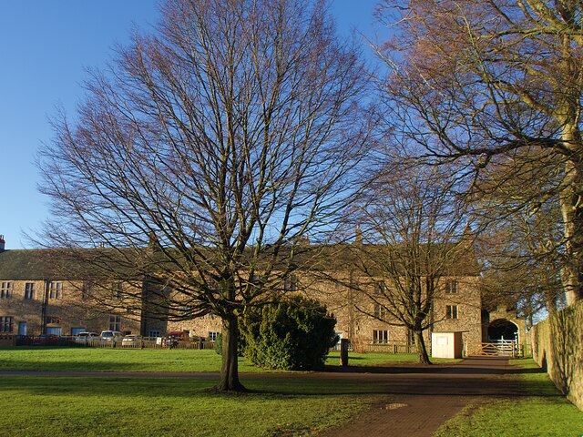
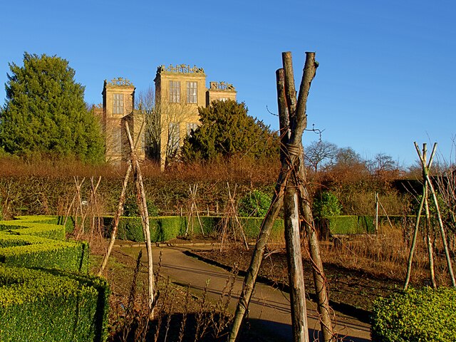
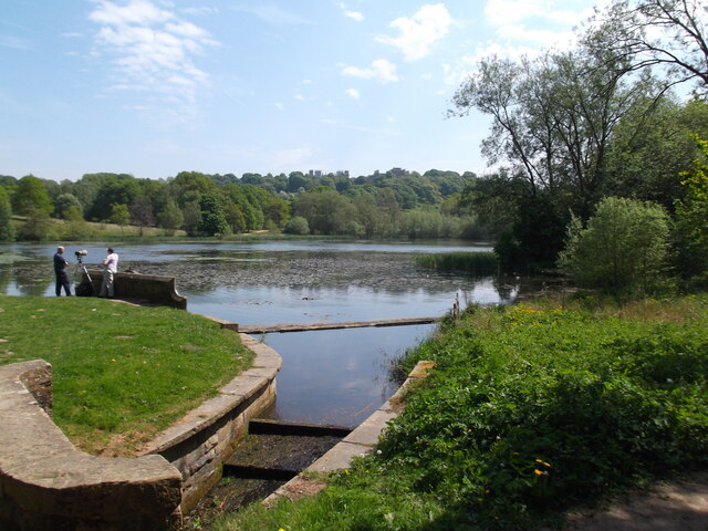
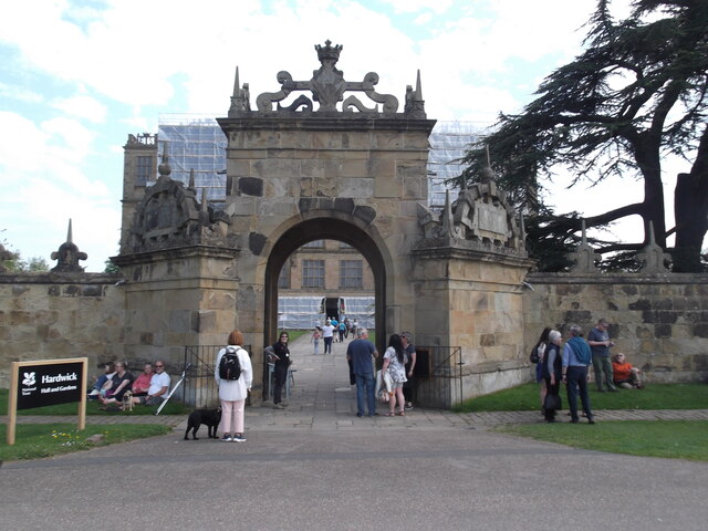
Cockshutt Woods is a picturesque woodland located in Derbyshire, England. Situated near the village of Cockshutt, this woodland covers an area of approximately 100 acres. It is a popular destination for nature enthusiasts, hikers, and dog walkers alike.

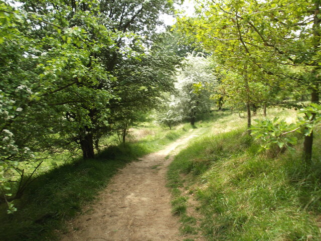
The wood is predominantly composed of deciduous trees, including oak, beech, and birch. These trees create a rich and diverse ecosystem, providing a habitat for various wildlife species. Visitors to Cockshutt Woods may spot a range of animals, such as squirrels, deer, and a variety of bird species.

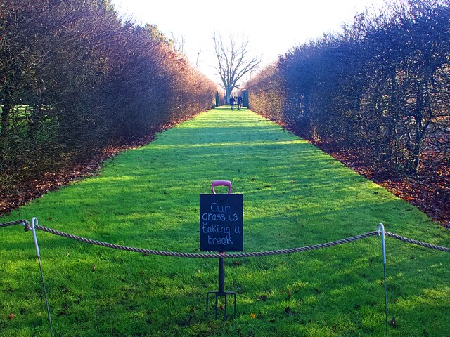
Trails and footpaths meander through the woods, offering visitors the opportunity to explore the natural beauty of the area. The paths are well-maintained, making it accessible for people of all ages and abilities. Along the way, there are benches and picnic spots, perfect for taking a break and immersing oneself in the tranquil surroundings.

Cockshutt Woods is also known for its vibrant display of wildflowers, particularly in the spring and summer months. Bluebells, primroses, and cowslips carpet the forest floor, creating a stunning visual spectacle.

For those interested in the history of the area, Cockshutt Woods holds archaeological significance. It is believed that the woods were once part of an ancient woodland that covered the region. Remnants of old boundary walls and ditches can still be seen, hinting at the wood's past.

Overall, Cockshutt Woods is a beautiful and serene woodland that offers visitors the chance to connect with nature, enjoy peaceful walks, and appreciate the natural wonders of Derbyshire.

If you have any feedback on the listing, please let us know in the comments section below.

Cockshutt Woods Images

Images are sourced within 2km of 53.172008/-1.3298114 or Grid Reference SK4464. Thanks to Geograph Open Source API. All images are credited.

Cottages at Hardwick Hall Some of the original buildings outside the garden walls have recently been converted to holiday accommodation.
Cottages at Hardwick Hall
Some of the original buildings outside the garden walls have recently been converted to holiday accommodation.
Grassed garden path in Hardwick Hall  Grassed walkways divide the walled garden at Hardwick into quarters. At the time of this visit in early January they were out of use to allow the grass to recover.
Grassed garden path in Hardwick Hall
Grassed walkways divide the walled garden at Hardwick into quarters. At the time of this visit in early January they were out of use to allow the grass to recover.
Hardwick Hall reflection The east face of the Hall reflected in the garden pond
Hardwick Hall reflection
The east face of the Hall reflected in the garden pond
Hardwick Hall The east face of the Hall viewed from the orchard.
Hardwick Hall
The east face of the Hall viewed from the orchard.
Hardwick Hall The south face of the Hall viewed from the walled garden in winter.
Hardwick Hall
The south face of the Hall viewed from the walled garden in winter.
The Great Pond, Hardwick Estate
Tree-lined path through the park
A busy day at Hardwick Hall
M1 at Deep Lane overbridge
M1 near Stainsby
M1 near Stainsby
Hardwick Old Hall The south facade of the shell of the old hall
Hardwick Old Hall
The south facade of the shell of the old hall
Hardwick Hall The west facade viewed from a high platform in the old hall
Hardwick Hall
The west facade viewed from a high platform in the old hall
Russets in the orchard A taste of autumn in this National Trust estate.
Russets in the orchard
A taste of autumn in this National Trust estate.
Herb garden at Hardwick Hall Order has been restored since the lockdown but the garden is now showing the signs of autumn.
Herb garden at Hardwick Hall
Order has been restored since the lockdown but the garden is now showing the signs of autumn.
Great Pond Part of Hardwick Park, showing some autumn mellowness.
Great Pond
Part of Hardwick Park, showing some autumn mellowness.
Gildageford Bridge, Mill Lane
Footbridge and culvert by the M1 A stream emerges from a culvert under the M1, where it is crossed by a footbridge, before flowing into the river Doe Lea.
Footbridge and culvert by the M1
A stream emerges from a culvert under the M1, where it is crossed by a footbridge, before flowing into the river Doe Lea.
Hardwick Hall The east elevation of Hardwick Hall, a National Trust manor house.
Hardwick Hall
The east elevation of Hardwick Hall, a National Trust manor house.
Show me another place!

Cockshutt Woods is located at Grid Ref: SK4464 (Lat: 53.172008, Lng: -1.3298114)

Administrative County: Derbyshire

District: Bolsover

Police Authority: Derbyshire

What 3 Words

///animates.wagers.ruled. Near Tibshelf, Derbyshire

Related Wikis

Blackwell Rural District

Blackwell was a rural district in Derbyshire, England from 1894 to 1974. It was created under the Local Government Act 1894 based on that part of the...

Astwith

Astwith is a village in Derbyshire, England. Astwith is in the parish of Ault Hucknall. For many decades it was a part of the manor of Stainsby, which...

Hardstoft

Hardstoft is a hamlet in Derbyshire, England. It is located four miles east of Clay Cross, on the B6039 road. The Mexican Eagle Petroleum Company found...

Stainsby, Derbyshire

Stainsby is a small village in Derbyshire, England. It is near Chesterfield and Bolsover, and the villages of Heath and Doe Lea. The village population...

Nearby Amenities

Located within 500m of 53.172008,-1.3298114
Ele: 167.1536865
Lat/Long: 53.1682443/-1.3332162
Ele: 165.7116699
Lat/Long: 53.1682575/-1.3331736
Ele: 106
Lat/Long: 53.1698679/-1.3232265
Check Date: 2023-11-12
Ele: 101
Information: board
Tourism: information
Lat/Long: 53.1712773/-1.3234133
Bench
Ele: 101.0634766
Lat/Long: 53.1720426/-1.3236761
Ele: 100.5828857
Lat/Long: 53.1722358/-1.3236997
Ele: 102
Lat/Long: 53.1736981/-1.3229439
Ele: 102
Lat/Long: 53.1732674/-1.3232797
Parking
Description: Patch of dirt
Ele: 111.8782959
Lat/Long: 53.1738683/-1.3333315
Ele: 123
Lat/Long: 53.1739447/-1.3295751
Passing Place
Lat/Long: 53.173809/-1.3283843
Ele: 116
Lat/Long: 53.1692991/-1.328165
Ele: 128
Lat/Long: 53.1688816/-1.329317
Ele: 130
Lat/Long: 53.1688401/-1.3293504
Hazard: slow_lorries
Note: 'Slow lorries for 2 miles' hazard sign
Traffic Sign: hazard
Lat/Long: 53.1704152/-1.3245148
Ele: 111
Lat/Long: 53.1703838/-1.3237469
Barrier: kissing_gate
Lat/Long: 53.1738907/-1.3296551
Barrier: stile
Steps: 1
Stile: stepover
Lat/Long: 53.1726667/-1.3309306
Barrier: stile
Steps: 2
Stile: stepover
Lat/Long: 53.1717031/-1.3262663
Note: There's something described as a "Dog Nature Trail" around here. What exactly is it?
Lat/Long: 53.1720479/-1.3239307
Information: route_marker
Tourism: information
Lat/Long: 53.1698418/-1.323261
Camera Mount: pole
Camera Type: panning
Man Made: surveillance
Surveillance: public
Surveillance Type: camera
Surveillance Zone: traffic
Lat/Long: 53.1692572/-1.3247733
Camera Mount: pole
Camera Type: panning
Man Made: surveillance
Surveillance: public
Surveillance Type: camera
Surveillance Zone: traffic
Lat/Long: 53.1730135/-1.3250136
Camera Mount: pole
Camera Type: panning
Man Made: surveillance
Surveillance: public
Surveillance Type: camera
Surveillance Zone: traffic
Lat/Long: 53.1752951/-1.3248146
The data included in this document is from www.openstreetmap.org. The data is made available under ODbL.

Have you been to Cockshutt Woods?

Leave your review of Cockshutt Woods below (or comments, questions and feedback).