Ouseburn Carr Wood
Wood, Forest in Yorkshire Harrogate
England
Ouseburn Carr Wood
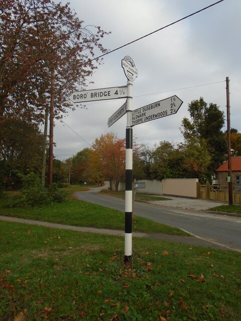
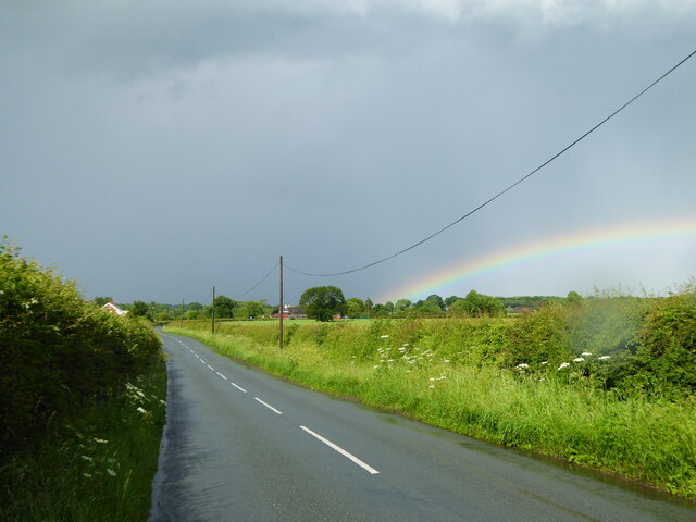
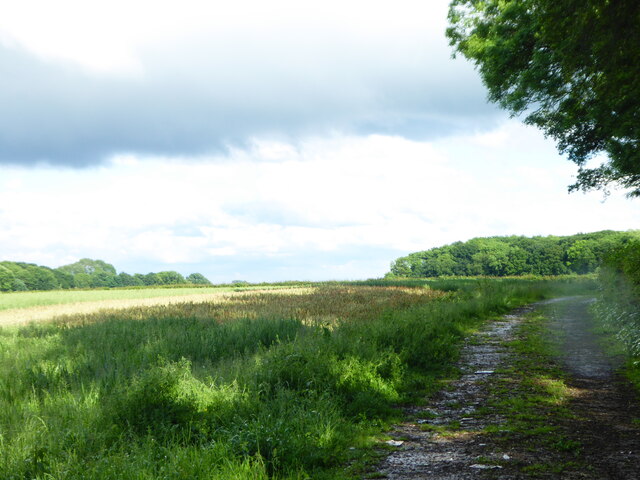
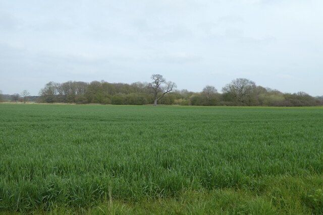
Ouseburn Carr Wood is a stunning woodland located in the county of Yorkshire, England. Covering an area of approximately 100 hectares, it is situated near the village of Ouseburn, just a few miles east of the town of Boroughbridge. The wood is part of the larger Yorkshire Forests and Moors, which encompasses a vast expanse of natural beauty.
The woodland is characterized by its diverse range of flora and fauna, making it a haven for nature enthusiasts. The dominant tree species in Ouseburn Carr Wood include oak, ash, birch, and beech, creating a rich and vibrant canopy. The forest floor is covered in a lush carpet of bluebells, ferns, and mosses, adding to its enchanting appeal.
The wood is crisscrossed with a network of well-maintained trails, providing visitors with the opportunity to explore its beauty on foot. These paths lead to various viewpoints, allowing for breathtaking vistas of the surrounding countryside. Additionally, there are picnic areas and benches scattered throughout the wood, providing the perfect spots to relax and appreciate the tranquil atmosphere.
Ouseburn Carr Wood is home to a diverse array of wildlife, including deer, badgers, foxes, and a multitude of bird species. Birdwatchers will be delighted to spot woodpeckers, thrushes, and owls among the trees. The wood also boasts a small pond, attracting amphibians and dragonflies.
Overall, Ouseburn Carr Wood is a captivating natural gem in Yorkshire, offering visitors a chance to immerse themselves in the beauty of the forest, observe its wildlife, and enjoy a peaceful retreat from the hustle and bustle of everyday life.
If you have any feedback on the listing, please let us know in the comments section below.
Ouseburn Carr Wood Images
Images are sourced within 2km of 54.04678/-1.3218688 or Grid Reference SE4461. Thanks to Geograph Open Source API. All images are credited.


Ouseburn Carr Wood is located at Grid Ref: SE4461 (Lat: 54.04678, Lng: -1.3218688)
Division: West Riding
Administrative County: North Yorkshire
District: Harrogate
Police Authority: North Yorkshire
What 3 Words
///meals.adopts.configure. Near Linton upon Ouse, North Yorkshire
Nearby Locations
Related Wikis

Great Ouseburn
Great Ouseburn is a village and civil parish in the Harrogate district of North Yorkshire, England. It is situated 4 miles (6 km) south-east of Boroughbridge...

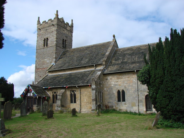
St Mary the Virgin's Church, Great Ouseburn
St Mary the Virgin's Church is in the village of Great Ouseburn, North Yorkshire, England. It is an active Anglican parish church in the deanery of Ripon...

Little Ouseburn
Little Ouseburn is a small village and civil parish in the Harrogate district of North Yorkshire, England. It is situated near the A1(M) motorway and 6...
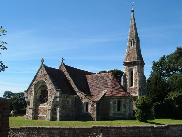
Holy Trinity Church, Little Ouseburn
Holy Trinity Church stands to the northeast of the village of Little Ouseburn, North Yorkshire, England. It is an Anglican parish church in the deanery...
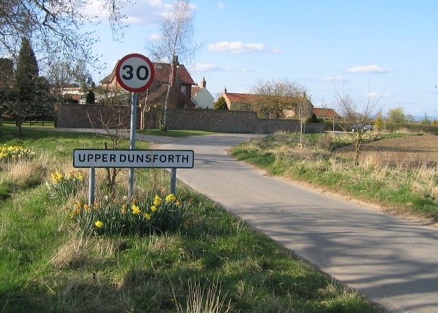
Upper Dunsforth
Upper Dunsforth is a village in located in the civil parish of Dunsforths, in the Borough of Harrogate of North Yorkshire, England. It was mentioned in...

Thorpe Underwood, North Yorkshire
Thorpe Underwood is a settlement and (as Thorpe Underwoods) a civil parish about 10 miles (16 km) north of York, in the former Harrogate district of North...

Queen Ethelburga's Collegiate
Queen Ethelburga's Collegiate incorporates four boarding and day schools for girls and boys from 3 months to 19 years old, located in Thorpe Underwood...
Aldwark, Hambleton
Aldwark is a village and civil parish in the Hambleton District of North Yorkshire, England. It is situated on the River Ouse about 14 miles from York...
Nearby Amenities
Located within 500m of 54.04678,-1.3218688Have you been to Ouseburn Carr Wood?
Leave your review of Ouseburn Carr Wood below (or comments, questions and feedback).