Brooks Copse

Wood, Forest in Hampshire Winchester

England

Brooks Copse

Beechwood Crescent, looking west Do high hedges make good neighbours, as fences are supposed to?
Beechwood Crescent, looking west Credit: Christine Johnstone

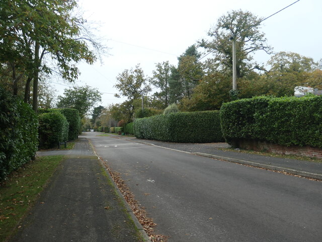
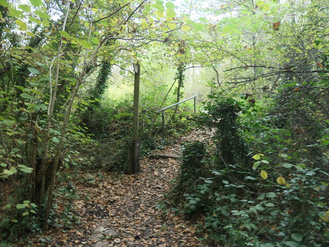
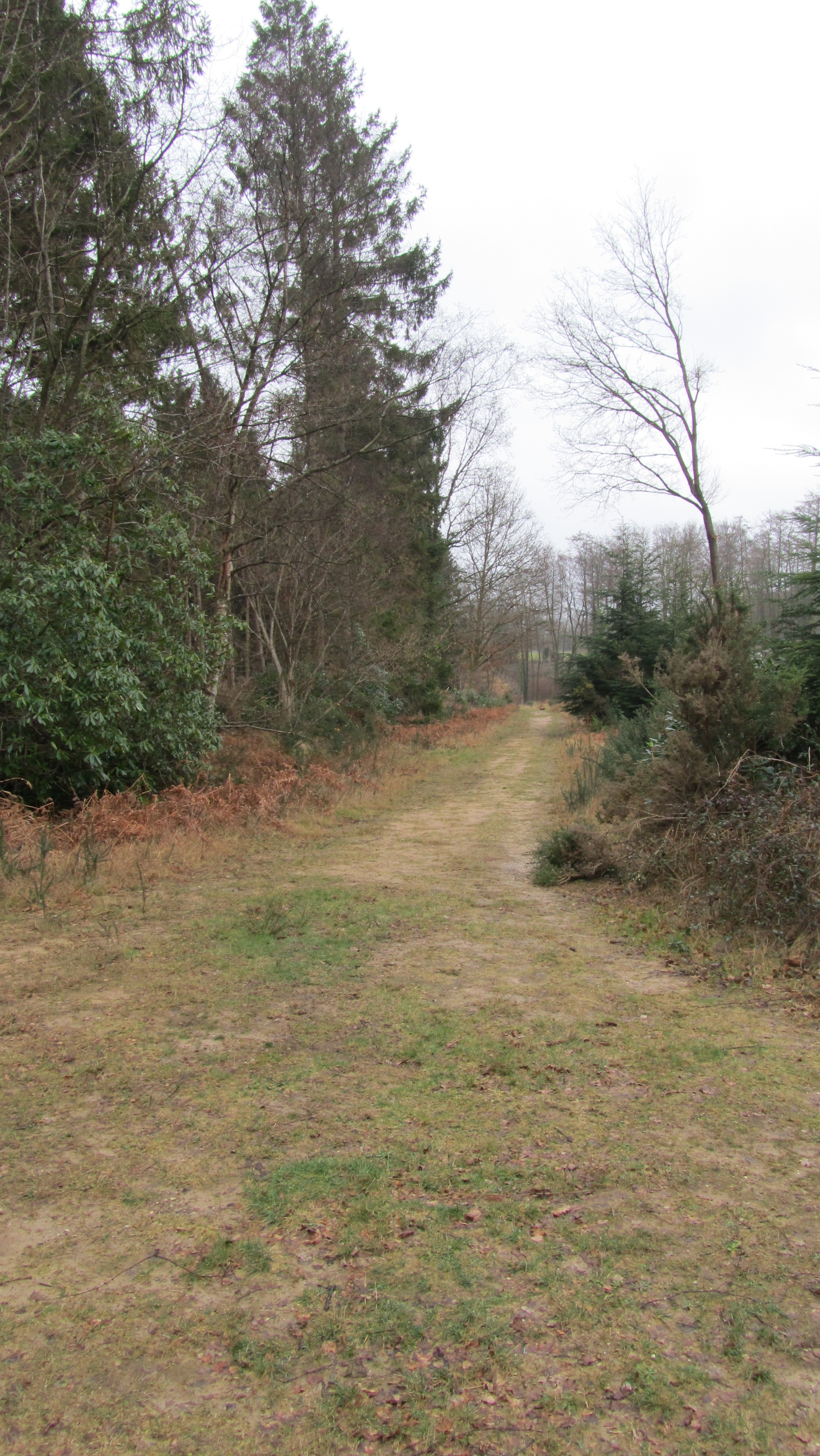
Brooks Copse, located in Hampshire, England, is a picturesque woodland area encompassing approximately 20 acres. Situated in the heart of the South Downs National Park, this ancient forest offers visitors a tranquil and captivating experience.

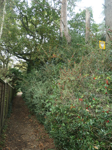
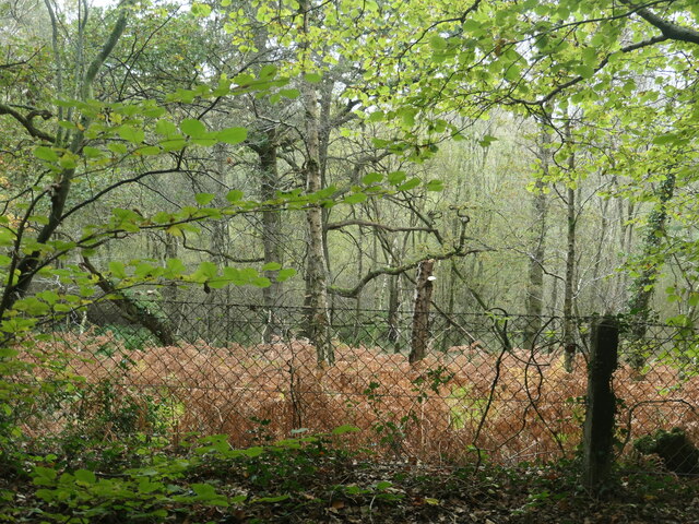
The copse, predominantly consisting of oak and beech trees, boasts a diverse range of flora and fauna. The woodland floor is adorned with a vibrant carpet of bluebells in the spring, creating a stunning spectacle for nature enthusiasts and photographers alike. The trees provide a home to various bird species, including woodpeckers and tawny owls, attracting birdwatchers to the area.

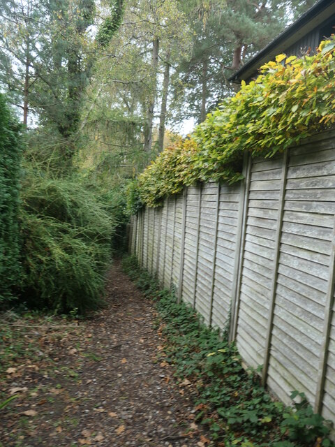
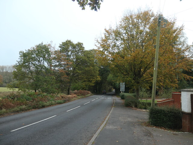
Visitors to Brooks Copse can explore the network of well-maintained footpaths that wind through the forest, offering a chance to immerse oneself in nature and enjoy a peaceful stroll. The dense foliage provides ample shade on hot summer days, making it an ideal spot for picnics and family gatherings.

The copse is also renowned for its rich history. Evidence of human habitation dating back to the Iron Age has been found within its boundaries, and the area has witnessed significant agricultural activity over the centuries. Today, remnants of ancient field systems can still be seen, adding an intriguing layer to the copse's charm.

Brooks Copse is a popular destination for nature lovers, hikers, and those seeking a retreat from the hustle and bustle of everyday life. With its enchanting beauty and fascinating history, it offers a memorable experience for all who venture into its leafy embrace.

If you have any feedback on the listing, please let us know in the comments section below.

Brooks Copse Images

Images are sourced within 2km of 51.015847/-1.3867695 or Grid Reference SU4324. Thanks to Geograph Open Source API. All images are credited.

Beechwood Crescent, looking west Do high hedges make good neighbours, as fences are supposed to?
Beechwood Crescent, looking west
Do high hedges make good neighbours, as fences are supposed to?
Neighbourhood Watch sign, off Beechwood Crescent Alongside the public footpath heading north-west to Hook Crescent.
Neighbourhood Watch sign, off Beechwood Crescent
Alongside the public footpath heading north-west to Hook Crescent.
Public footpath with signpost and waymark At the southern end of Hook Crescent.
Public footpath with signpost and waymark
At the southern end of Hook Crescent.
Public footpath from Hook Crescent to Hook Road Dropping north-westwards between woodland and a back garden.
Public footpath from Hook Crescent to Hook Road
Dropping north-westwards between woodland and a back garden.
Woodland south of Hook Road With an autumnal carpet of dead bracken.
Woodland south of Hook Road
With an autumnal carpet of dead bracken.
Steps up to Hook Road The northern end of the public footpath from Hook Crescent.
Steps up to Hook Road
The northern end of the public footpath from Hook Crescent.
Small bridge on Hook Road The road crosses a small stream, a tributary of Monks Brook.
Small bridge on Hook Road
The road crosses a small stream, a tributary of Monks Brook.
Polluted woodland stream, south of Hook Road A nameless tributary of Monks Brook, seen from the road bridge.
Polluted woodland stream, south of Hook Road
A nameless tributary of Monks Brook, seen from the road bridge.
Signs at a bend on Hook Road At the eastern end of Broadgate.
Signs at a bend on Hook Road
At the eastern end of Broadgate.
Sheep grazing near Broadgate On the north side of Hook Road, at the eastern edge of the village.
Sheep grazing near Broadgate
On the north side of Hook Road, at the eastern edge of the village.
Autumn trees along Hook Road At the eastern end of Broadgate.
Autumn trees along Hook Road
At the eastern end of Broadgate.
Public bridleway from Hook Road to Hursley Road Heading north-east.
Public bridleway from Hook Road to Hursley Road
Heading north-east.
Field south-west of Hawstead Farm Looking north from the public bridleway. About 75 metres above sea level.
Field south-west of Hawstead Farm
Looking north from the public bridleway. About 75 metres above sea level.
Fenced ponds, south-west of Hawstead Farm Not shown on the 1:25,000 OS map which was revised in 2010.
Fenced ponds, south-west of Hawstead Farm
Not shown on the 1:25,000 OS map which was revised in 2010.
Farm track, near Hawstead Farm Heading westwards from the public bridleway.
Farm track, near Hawstead Farm
Heading westwards from the public bridleway.
Fenced ponds from the east Stepping down a hillside. Not sure of their purpose.
Fenced ponds from the east
Stepping down a hillside. Not sure of their purpose.
Private gated track into Hocombe Upper Plantation The gate appears to be out-of-use.
Private gated track into Hocombe Upper Plantation
The gate appears to be out-of-use.
Left for the Egg Shed, right for the public footpath Waymarked bridleway and footpath junction near Hawstead Farm.
Left for the Egg Shed, right for the public footpath
Waymarked bridleway and footpath junction near Hawstead Farm.
Show me another place!

Brooks Copse is located at Grid Ref: SU4324 (Lat: 51.015847, Lng: -1.3867695)

Administrative County: Hampshire

District: Winchester

Police Authority: Hampshire

What 3 Words

///livid.tilts.pegged. Near Compton, Hampshire

Related Wikis

Hursley

Hursley is a village and civil parish in Hampshire, England with a population of around 900 in 2011. It is located roughly midway between Romsey and Winchester...

The Quarters, Hursley Park

The Quarters is a cricket ground located off Hursley Park Road in the grounds of the former Hursley Park Estate at Hursley, Hampshire, England. Set in...

IBM Hursley

IBM Hursley is a research and development laboratory belonging to International Business Machines in the village of Hursley, Hampshire, England. Established...

Hursley House

Hursley House is an 18th-century Queen Anne style mansion in Hursley, near Winchester in the English county of Hampshire. The building is Grade II* listed...

Hocombe Mead

Hocombe Mead is a 8.3-hectare (21-acre) Local Nature Reserve in Eastleigh in Hampshire. It is owned by Eastleigh Borough Council and managed by Eastleigh...

Cranbury Park

Cranbury Park is a stately home and country estate situated in the parish of Hursley, Winchester, England. It was formerly the home to Sir Isaac Newton...

Ratlake Meadows

Ratlake Meadows is a 4.2-hectare (10-acre) biological Site of Special Scientific Interest north of Chandler's Ford in Hampshire.These unimproved meadows...

Hiltingbury

Hiltingbury is an area within the Borough of Eastleigh in Hampshire, England. There are two electoral wards representing Hiltingbury, returning a total...

Nearby Amenities

Located within 500m of 51.015847,-1.3867695
Traffic Signals
Lat/Long: 51.0176473/-1.3917799
Bus Stop
Red House
Bus: yes
Naptan AtcoCode: 1900HA110245
Naptan Bearing: N
Naptan CommonName: Red House
Naptan NaptanCode: hamawdpt
Naptan Street: Hursley Road
Naptan Verified: no
Public Transport: platform
Source: naptan_import
Lat/Long: 51.0138777/-1.3915196
Bus Stop
Red House
Bus: yes
Naptan AtcoCode: 1900HA110246
Naptan Bearing: S
Naptan CommonName: Red House
Naptan NaptanCode: hamawdwd
Naptan Street: Hursley Road B3043
Naptan Verified: no
Public Transport: platform
Source: naptan_import
Lat/Long: 51.0138702/-1.3913975
Bus Stop
Junction With A31
Bus: yes
Naptan AtcoCode: 1900HA110247
Naptan Bearing: N
Naptan CommonName: Junction With A31
Naptan NaptanCode: hamawdpm
Naptan Street: Hursley Road
Naptan Verified: no
Public Transport: platform
Source: naptan_import
Lat/Long: 51.0167214/-1.3915391
Bus Stop
Junction With A31
Bus: yes
Naptan AtcoCode: 1900HA110248
Naptan Bearing: S
Naptan CommonName: Junction With A31
Naptan NaptanCode: hamawdtm
Naptan Street: Hursley Road
Naptan Verified: no
Public Transport: platform
Source: naptan_import
Lat/Long: 51.0167208/-1.391425
Barrier: kissing_gate
Bicycle: no
Foot: yes
Lat/Long: 51.0114642/-1.3857008
Post Box
Collection Plate: CP7
Collection Times: Mo-Fr 16:30; Sa 08:00
Operator: Royal Mail
Post Box Type: lamp
Ref: SO21 67
Royal Cypher: EIIR
Royal Cypher Wikidata: Q33102113
Lat/Long: 51.0139328/-1.3912988
Barrier: cattle_grid
Bicycle: no
Lat/Long: 51.0130799/-1.3893755
Barrier: kissing_gate
Bicycle: no
Foot: yes
Horse: no
Motor Vehicle: no
Lat/Long: 51.0139868/-1.3911251
Barrier: kissing_gate
Bicycle: no
Foot: yes
Lat/Long: 51.0182107/-1.3907857
Veterinary
Anderson Moores
Lat/Long: 51.0187738/-1.381433
Power: pole
Lat/Long: 51.0131041/-1.3893494
Power: pole
Lat/Long: 51.0124215/-1.3902748
Power: pole
Lat/Long: 51.0149224/-1.3884187
Power: pole
Lat/Long: 51.0161036/-1.3878447
Power: pole
Lat/Long: 51.0172847/-1.387158
Power: pole
Lat/Long: 51.0173893/-1.38093
Power: pole
Lat/Long: 51.0177032/-1.3830918
Power: pole
Lat/Long: 51.0174872/-1.3851678
Power: pole
Lat/Long: 51.0195664/-1.3892696
Power: pole
Lat/Long: 51.016141/-1.3931959
Power: pole
Lat/Long: 51.0153469/-1.3933204
Power: pole
Lat/Long: 51.0145267/-1.393427
Power: pole
Lat/Long: 51.0136915/-1.3926151
Power: pole
Lat/Long: 51.0136173/-1.3917235
Power: pole
Lat/Long: 51.0168704/-1.3930769
Power: pole
Lat/Long: 51.0173507/-1.3920502
Power: pole
Lat/Long: 51.0184207/-1.3907061
Power: pole
Lat/Long: 51.0191155/-1.3859573
Power: pole
Lat/Long: 51.0192839/-1.3876544
Power: pole
Lat/Long: 51.0187659/-1.3841338
Power: pole
Lat/Long: 51.0185249/-1.3824442
Hunting Stand
Lat/Long: 51.0133825/-1.3810252
Man Made: tower
Tower Type: communication
Lat/Long: 51.019179/-1.3858335
Ladwell
Place: hamlet
Lat/Long: 51.0135203/-1.3903936
The data included in this document is from www.openstreetmap.org. The data is made available under ODbL.

Have you been to Brooks Copse?

Leave your review of Brooks Copse below (or comments, questions and feedback).