Magdalen Plantations

Wood, Forest in Berkshire

England

Magdalen Plantations

Old entrance lodge, Benham Park. Benham Park is a Georgian mansion which was built for Lord Craven in 1775. It is now an office complex and the entrance is now at the other end of the park near the A4/A34 junction.
Old entrance lodge, Benham Park. Credit: Martyn Pattison

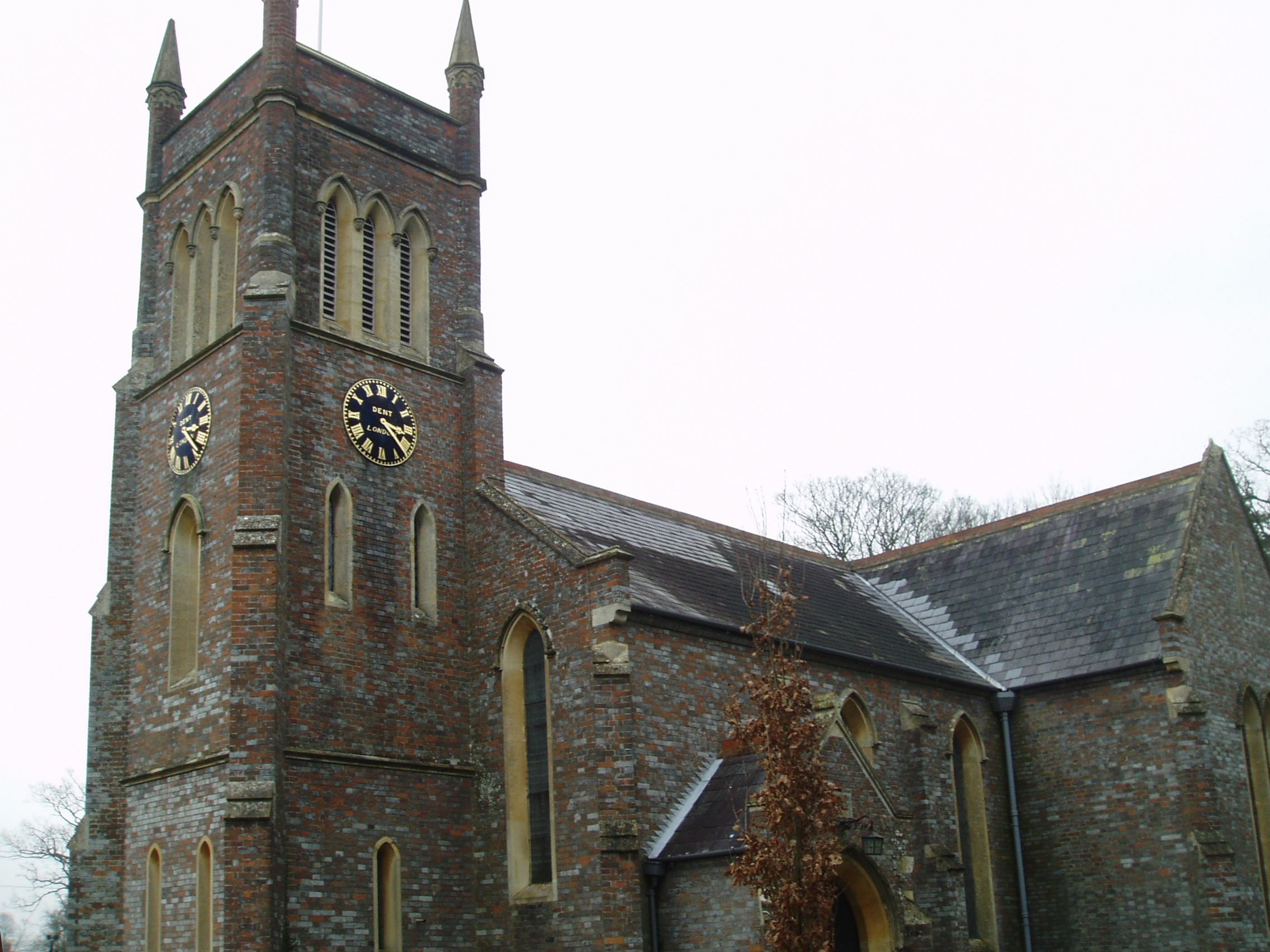
Magdalen Plantations is a sprawling woodland area located in the county of Berkshire, England. Covering a vast expanse, the plantation is renowned for its dense forest and rich biodiversity. The plantation is specifically nestled within the larger region known as Wood, Forest, which itself is known for its picturesque landscapes and natural beauty.

The woodland in Magdalen Plantations is primarily composed of an assortment of trees, including oak, beech, and pine, which together create a stunning canopy of greenery. This diverse range of trees provides a habitat for numerous species of animals and birds, making it a paradise for nature enthusiasts and wildlife lovers. Visitors can often spot squirrels, deer, and a variety of bird species as they explore the plantation.

The plantation is also home to several walking trails and footpaths, allowing visitors to truly immerse themselves in the natural surroundings. These paths wind through the forest, providing breathtaking views of the surrounding countryside and allowing visitors to explore the flora and fauna up close.

Magdalen Plantations is a popular destination for outdoor activities such as hiking, birdwatching, and photography. The tranquil ambiance of the forest, coupled with its scenic beauty, makes it a perfect spot for those seeking solace in nature.

Overall, Magdalen Plantations in Berkshire's Wood, Forest is a haven for nature enthusiasts, offering a diverse range of flora and fauna set against a backdrop of stunning landscapes.

If you have any feedback on the listing, please let us know in the comments section below.

Magdalen Plantations Images

Images are sourced within 2km of 51.408202/-1.3844998 or Grid Reference SU4267. Thanks to Geograph Open Source API. All images are credited.

Old entrance lodge, Benham Park. Benham Park is a Georgian mansion which was built for Lord Craven in 1775. It is now an office complex and the entrance is now at the other end of the park near the A4/A34 junction.
Old entrance lodge, Benham Park.
Benham Park is a Georgian mansion which was built for Lord Craven in 1775. It is now an office complex and the entrance is now at the other end of the park near the A4/A34 junction.
Benham Valence: near Speen and Newbury This location of this stately building is now an office park. The main building is situated in the north western section of the grid square. The various parking areas have been cleverly disguised in wooded areas.
Benham Valence: near Speen and Newbury
This location of this stately building is now an office park. The main building is situated in the north western section of the grid square. The various parking areas have been cleverly disguised in wooded areas.
Gates to Benham Valence These gates are at the east lodge on the A4 to Hungerford. This once country estate is now a business park.
Gates to Benham Valence
These gates are at the east lodge on the A4 to Hungerford. This once country estate is now a business park.
The Lake Benham Park: Near Speen and Newbury This lake view is of the far western section of the lake and situated in the centre of this grid square. This picture was taken from the north side of the lake looking south west.
The Lake Benham Park: Near Speen and Newbury
This lake view is of the far western section of the lake and situated in the centre of this grid square. This picture was taken from the north side of the lake looking south west.
Benham Marsh Lock Area This house is situated in the north western section of the square. The picture was taken from the bridge across the canal looking south west.
Benham Marsh Lock Area
This house is situated in the north western section of the square. The picture was taken from the bridge across the canal looking south west.
St Mary's Church at Hamstead Marshall (Benham Marsh) The church is located in the north eastern section of the grid square, just inside the grid line. The picture was taken more or less from the east side of the building. The church is NE of the village centre.
St Mary's Church at Hamstead Marshall (Benham Marsh)
The church is located in the north eastern section of the grid square, just inside the grid line. The picture was taken more or less from the east side of the building. The church is NE of the village centre.
Hamstead Lock at Marsh Benham The lock is situated in the southern most edge of the grid square. This picture was taken looking west.
Hamstead Lock at Marsh Benham
The lock is situated in the southern most edge of the grid square. This picture was taken looking west.
The Red House: Benham Marsh This really nice bistro/pub is situated in the centre of the grid square near the intersection. The picture was taken from the northern side of the pub.
The Red House: Benham Marsh
This really nice bistro/pub is situated in the centre of the grid square near the intersection. The picture was taken from the northern side of the pub.
Deanwood Golf Course This golf course is open to non-members and is largely situated in the eastern half of the grid square.
Deanwood Golf Course
This golf course is open to non-members and is largely situated in the eastern half of the grid square.
Woodspeen Farm: Ploughed field This grid square is largely farmland and the view is of the north eastern section of the square. The picture was taken from the intersection of the lane leading up to Woodspeen farm and the minor B4494 road.
Woodspeen Farm: Ploughed field
This grid square is largely farmland and the view is of the north eastern section of the square. The picture was taken from the intersection of the lane leading up to Woodspeen farm and the minor B4494 road.
Plantation Area near Speen This grid square is almost all woodland/plantation through which a few roads pass. This intersection is  in the southern half of the grid square.
Plantation Area near Speen
This grid square is almost all woodland/plantation through which a few roads pass. This intersection is in the southern half of the grid square.
Canal bridge at Marsh Benham View West towards road bridge over canal at Marsh Benham.
Canal bridge at Marsh Benham
View West towards road bridge over canal at Marsh Benham.
Benham Lock, Kennet and Avon canal View East from Benham Lock, bridge over canal carries a footpath to Enborne Road.
Benham Lock, Kennet and Avon canal
View East from Benham Lock, bridge over canal carries a footpath to Enborne Road.
Stockcross Woodland Near Stockcross - the intense pine smell was matched only by the strong humid aromas from the bracken after a rain shower.
Stockcross Woodland
Near Stockcross - the intense pine smell was matched only by the strong humid aromas from the bracken after a rain shower.
Pasture near Hamstead Marshall This pasture lies to the south west of the sharp bend in the minor road in the north eastern section of the square. The square is mostly farmland.
Pasture near Hamstead Marshall
This pasture lies to the south west of the sharp bend in the minor road in the north eastern section of the square. The square is mostly farmland.
Flytipping near Hamstead Marshall A flytip at the side of the road where it has a sharp turn to the east, in the north eastern section of the square.
Flytipping near Hamstead Marshall
A flytip at the side of the road where it has a sharp turn to the east, in the north eastern section of the square.
Farmland near Hamstead Marshall Looking south down the track at the point where the road turns to the east in the north eastern section of the square.
Farmland near Hamstead Marshall
Looking south down the track at the point where the road turns to the east in the north eastern section of the square.
Reclaimed Farmland near Speen This landscape, once farmland, then used as a landfill site for the building of the infamous Newbury Bypass and now owned by the Wessex Recovery Company, is being reclaimed. The company is currently redistributing topsoil over the landfill site to restore the 12 acres to its previous state.
Reclaimed Farmland near Speen
This landscape, once farmland, then used as a landfill site for the building of the infamous Newbury Bypass and now owned by the Wessex Recovery Company, is being reclaimed. The company is currently redistributing topsoil over the landfill site to restore the 12 acres to its previous state.
Show me another place!

Magdalen Plantations is located at Grid Ref: SU4267 (Lat: 51.408202, Lng: -1.3844998)

Unitary Authority: West Berkshire

Police Authority: Thames Valley

What 3 Words

///masking.deprives.strut. Near Newbury, Berkshire

Related Wikis

Marsh Benham

Marsh Benham is a village in the civil parish of Speen in the county of Berkshire, England. It is situated in the unitary authority of West Berkshire,...

Stockcross

Stockcross is a village in Berkshire, England. The village lies to the west of Newbury in the civil parish of Speen and the district of West Berkshire...
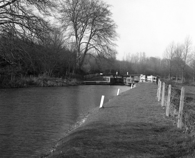
Copse Lock

Copse Lock is a lock on the Kennet and Avon Canal, between Kintbury and Newbury, Berkshire, England. The lock has a rise/fall of 6 ft 0 in (1.82 m)....

Hamstead Lock

Hamstead Lock is a lock on the Kennet and Avon Canal, at Hamstead Marshall between Kintbury and Newbury, Berkshire, England. The lock has a rise/fall...

Nearby Amenities

Located within 500m of 51.408202,-1.3844998
Source: NPE
Lat/Long: 51.4053703/-1.3888536
Pub
The Red House
Addr Postcode: RG20 8LY
Addr Street: Milkhouse Road
Cuisine: regional;local
Email: info@theredhousepub.com
Phone: +44 1635 582017
Website: https://www.theredhousepub.com/
Lat/Long: 51.4050999/-1.3879307
Marsh Benham
Place: hamlet
Wikidata: Q1840862
Lat/Long: 51.4048484/-1.3873815
Historic: milestone
Inscription: To Newbury 3; To London 59
Lat/Long: 51.4117565/-1.388251
Power: pole
Source: Bing
Lat/Long: 51.4079184/-1.3774647
Power: pole
Source: Bing
Lat/Long: 51.4072709/-1.3782881
Power: pole
Source: Bing
Lat/Long: 51.4066719/-1.3790767
Post Box
Operator: Royal Mail
Post Box Type: wall
Ref: RG20 29
Royal Cypher: VR
Royal Cypher Wikidata: Q33102356
Lat/Long: 51.405058/-1.3854133
The data included in this document is from www.openstreetmap.org. The data is made available under ODbL.

Have you been to Magdalen Plantations?

Leave your review of Magdalen Plantations below (or comments, questions and feedback).