Four Acre Copse

Wood, Forest in Hampshire Basingstoke and Deane

England

Four Acre Copse

The Battle Proms Hosted by Highclere Castle. The singers can just be seen on the left hand side of the stage, further to the left they can be seen more clearly on the large screen.
The Battle Proms Credit: Peter Jeffery

Four Acre Copse is a charming woodland located in the county of Hampshire, England. Spanning approximately four acres, this copse is a delightful retreat for nature lovers and outdoor enthusiasts. It is situated in a secluded area, providing a serene and tranquil environment away from the hustle and bustle of urban life.

The copse is predominantly composed of native deciduous trees, such as oak, beech, and birch, which create a dense canopy that filters the sunlight and casts dappled shadows on the forest floor. These trees provide a habitat for a variety of wildlife, including birds, squirrels, and a diverse range of insects.

A network of well-maintained footpaths winds through Four Acre Copse, allowing visitors to explore and appreciate the natural beauty of the woodland. These paths are surrounded by an abundance of wildflowers and ferns, adding color and texture to the landscape.

In addition to its aesthetic appeal, Four Acre Copse also serves as an important ecological site. The woodland plays a crucial role in maintaining biodiversity, providing habitat for numerous plant and animal species. It also contributes to the local ecosystem by purifying the air, absorbing carbon dioxide, and preventing soil erosion.

Four Acre Copse is a popular destination for nature walks, picnics, and birdwatching. It offers a peaceful and scenic setting for individuals and families to connect with nature and enjoy the great outdoors. Whether one seeks solitude, wildlife encounters, or simply a break from the city, Four Acre Copse is a splendid destination to immerse oneself in the wonders of Hampshire's woodlands.

If you have any feedback on the listing, please let us know in the comments section below.

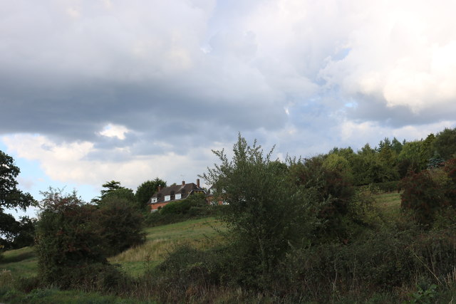
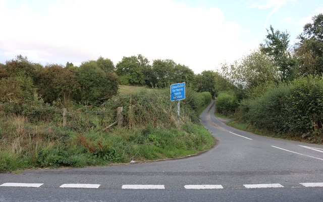
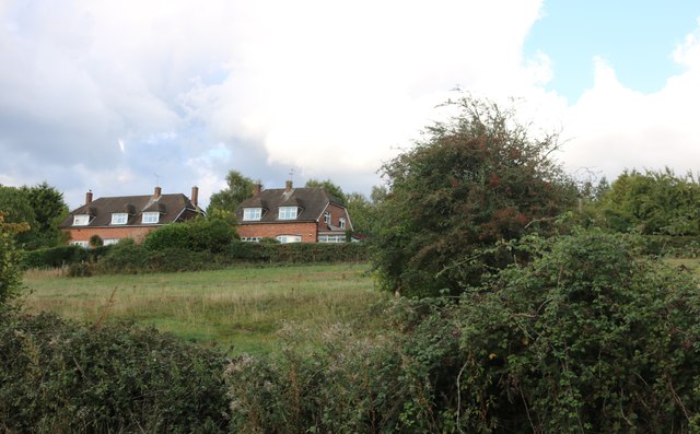
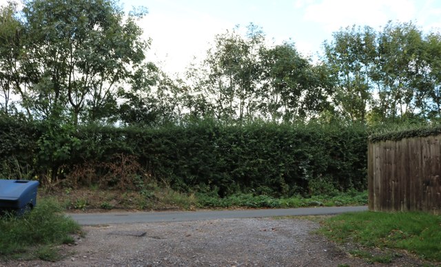
Four Acre Copse Images

Images are sourced within 2km of 51.33612/-1.3855082 or Grid Reference SU4259. Thanks to Geograph Open Source API. All images are credited.

The Battle Proms Hosted by Highclere Castle. The singers can just be seen on the left hand side of the stage, further to the left they can be seen more clearly on the large screen.
The Battle Proms
Hosted by Highclere Castle. The singers can just be seen on the left hand side of the stage, further to the left they can be seen more clearly on the large screen.
After The Concert Twelve hours after the "Battle Proms", only the skeleton of the stage remains.
After The Concert
Twelve hours after the "Battle Proms", only the skeleton of the stage remains.
Basingstoke and Deane : Highclere Park - Stable Block Part of the Stable Block now being used as the toilets.
Basingstoke and Deane : Highclere Park - Stable Block
Part of the Stable Block now being used as the toilets.
Basingstoke and Deane : Highclere Park - Stable Block The stable block of Highclere Castle.
Basingstoke and Deane : Highclere Park - Stable Block
The stable block of Highclere Castle.
Basingstoke and Deane : Highclere Castle Around the side of Highclere Castle.
Basingstoke and Deane : Highclere Castle
Around the side of Highclere Castle.
Basingstoke and Deane : Highclere Park Around the back of the main house is the cafe and a place to sit outside and eat.
Basingstoke and Deane : Highclere Park
Around the back of the main house is the cafe and a place to sit outside and eat.
Basingstoke and Deane : Highclere Park Horses alongside the driveway and in the field.
Basingstoke and Deane : Highclere Park
Horses alongside the driveway and in the field.
Basingstoke and Deane : Dairy Farm Dairy Farm on the Highclere Castle estate.
Basingstoke and Deane : Dairy Farm
Dairy Farm on the Highclere Castle estate.
Basingstoke and Deane : Butlers Cottage Butlers Cottage on the Highclere Castle estate.
Basingstoke and Deane : Butlers Cottage
Butlers Cottage on the Highclere Castle estate.
Basingstoke and Deane : Highclere Park On the Highclere Park estate with sheep grazing.
Basingstoke and Deane : Highclere Park
On the Highclere Park estate with sheep grazing.
Basingstoke and Deane : Highclere Park On the Highclere Castle estate.
Basingstoke and Deane : Highclere Park
On the Highclere Castle estate.
Highclere Castle viewed from Beacon Hill
Fields by the A343, Hollington Cross
Highclere Street at the junction of the A343
Houses on Highclere Street, Hollington Cross By the A343
Houses on Highclere Street, Hollington Cross
By the A343
Highclere Street, Hollington Cross
Old Milestone by the A343, Ashmansworth parish Carved stone post by the A343, in parish of ASHMANSWORTH (BASINGSTOKE AND DEANE District), half way up hill to Three Legs House, on sharp bend in broad verge under bushes and in front of hazard arrows, on West side of road. Newbury waist, erected by the Andover & Chilton Pond turnpike trust in the 18th century. 

Inscription reads:-
: NEWBURY / 5 - (6!) : SARUM / 28  : (OXFORD / 32) : : ANDOVER / 10 :
Old benchmark at base front.

Grade II listed.  
List Entry Number: 1419217 <span class="nowrap"><a title="https://historicengland.org.uk/listing/the-list/list-entry/1419217" rel="nofollow ugc noopener" href="https://historicengland.org.uk/listing/the-list/list-entry/1419217">Link</a><img style="margin-left:2px;" alt="External link" title="External link - shift click to open in new window" src="https://s1.geograph.org.uk/img/external.png" width="10" height="10"/></span>

Milestone Society National ID: HA_NEAN06.
Old Milestone by the A343, Ashmansworth parish
Carved stone post by the A343, in parish of ASHMANSWORTH (BASINGSTOKE AND DEANE District), half way up hill to Three Legs House, on sharp bend in broad verge under bushes and in front of hazard arrows, on West side of road. Newbury waist, erected by the Andover & Chilton Pond turnpike trust in the 18th century. Inscription reads:- : NEWBURY / 5 - (6!) : SARUM / 28 : (OXFORD / 32) : : ANDOVER / 10 : Old benchmark at base front. Grade II listed. List Entry Number: 1419217 LinkExternal link Milestone Society National ID: HA_NEAN06.
Old Milestone by the A343, near Highclere Farm, Highclere parish Carved stone post by the A343, in parish of HIGHCLERE (BASINGSTOKE AND DEANE District), near Highclere Farm, South of village, just before bridge, deep in the hedge, on West side of road. Newbury waist, erected by the Andover & Chilton Pond turnpike trust in the 18th century. 

Inscription reads:-
: NEWBURY / 5 : : SARUM / 29 (overpainted 27) / (OXFORD / 31) : : ANDOVER / 11 (overpainted 10) :

Grade II listed.  
List Entry Number: 1419228 <span class="nowrap"><a title="https://historicengland.org.uk/listing/the-list/list-entry/1419228" rel="nofollow ugc noopener" href="https://historicengland.org.uk/listing/the-list/list-entry/1419228">Link</a><img style="margin-left:2px;" alt="External link" title="External link - shift click to open in new window" src="https://s1.geograph.org.uk/img/external.png" width="10" height="10"/></span>

Milestone Society National ID: HA_NEAN05.
Old Milestone by the A343, near Highclere Farm, Highclere parish
Carved stone post by the A343, in parish of HIGHCLERE (BASINGSTOKE AND DEANE District), near Highclere Farm, South of village, just before bridge, deep in the hedge, on West side of road. Newbury waist, erected by the Andover & Chilton Pond turnpike trust in the 18th century. Inscription reads:- : NEWBURY / 5 : : SARUM / 29 (overpainted 27) / (OXFORD / 31) : : ANDOVER / 11 (overpainted 10) : Grade II listed. List Entry Number: 1419228 LinkExternal link Milestone Society National ID: HA_NEAN05.
Show me another place!

Four Acre Copse is located at Grid Ref: SU4259 (Lat: 51.33612, Lng: -1.3855082)

Administrative County: Hampshire

District: Basingstoke and Deane

Police Authority: Hampshire

What 3 Words

///premature.grain.hangs. Near Highclere, Hampshire

Related Wikis

Highclere

Highclere (pronounced ) is a village and civil parish situated in the North Wessex Downs (an Area of Outstanding Natural Beauty) in the Basingstoke and...

Woolton Hill

Woolton Hill is a village in Hampshire, England, in the civil parish of East Woodhay. The village lies approximately 4 miles (6 km) south-west of the centre...

Highclere Castle

Highclere Castle is a Grade I listed country house built in 1679 and largely renovated in the 1840s, with a park designed by Capability Brown in the 18th...

Gainsborough Stud

Gainsborough Stud is a stud farm based in Woolton Hill, Hampshire, 3 miles (4.8 km) outside Newbury. It is owned by United Arab Emirates-based international...

Stargroves

Stargroves (also known as Stargrove House) is a manor house and associated estate at East Woodhay in the English county of Hampshire. The house belonged...

Hambledon Rural District

Hambledon Rural District was a local government district that existed in south-west Surrey in England from 1894 until 1974. Its headquarters were in Guildford...

Whitway

Whitway is a hamlet in the civil parish of Burghclere in the Basingstoke and Deane district of Hampshire, England. Its nearest town is Newbury, which lies...

Highclere Park

Highclere Park is a 69.6-hectare (172-acre) biological Site of Special Scientific Interest east of Highclere in Hampshire. It is the park of Highclere...

Nearby Amenities

Located within 500m of 51.33612,-1.3855082
Barrier: stile
Foot: yes
Lat/Long: 51.3387367/-1.3868691
Barrier: stile
Foot: yes
Lat/Long: 51.3382729/-1.3835062
Pill Hill
Ele: 160
Natural: peak
Source: OS_OpenData_StreetView
Lat/Long: 51.3328762/-1.3868747
Vinnicks Cottage
Building: residential
Source: OS_OpenData_StreetView
Lat/Long: 51.3327019/-1.3878832
Clereview
Building: residential
Source: OS_OpenData_StreetView
Lat/Long: 51.3348342/-1.3828836
Kinnersley House
Building: residential
Source: OS_OpenData_StreetView
Lat/Long: 51.3370052/-1.3808451
Crowshott Park Farm
Landuse: farm
Note Retag: CS #48756035
Source: OS_OpenData_StreetView
Lat/Long: 51.3381045/-1.3793645
Barrier: stile
Lat/Long: 51.3329394/-1.390146
Barrier: stile
Lat/Long: 51.332807/-1.3899851
The data included in this document is from www.openstreetmap.org. The data is made available under ODbL.

Have you been to Four Acre Copse?

Leave your review of Four Acre Copse below (or comments, questions and feedback).