Little Pittdown Plantation

Wood, Forest in Hampshire Winchester

England

Little Pittdown Plantation

Path in West Wood Forestry Commission woodland, and also part of Farley Mount Country Park.
Path in West Wood Credit: Robin Webster

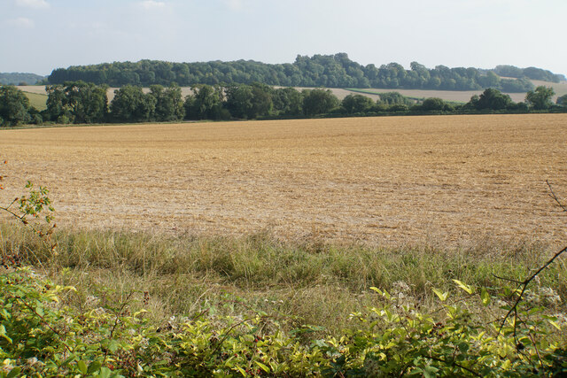
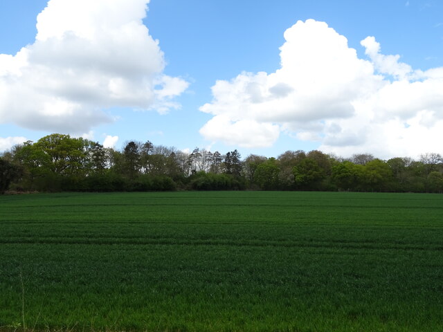
Little Pittdown Plantation is a picturesque woodland located in Hampshire, England. Situated near the village of Pittdown, the plantation covers an area of approximately 50 acres and is renowned for its natural beauty and diverse flora and fauna.

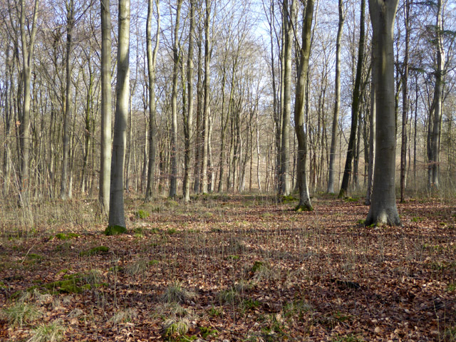
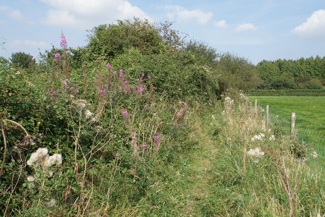
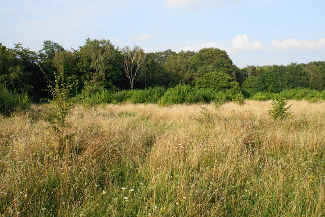
The woodland is predominantly comprised of mature deciduous trees, including oak, beech, and ash, which create a dense canopy overhead, providing shade and shelter for a variety of wildlife. The forest floor is carpeted with an array of wildflowers, ferns, and mosses, adding to the enchanting atmosphere of the woodland.

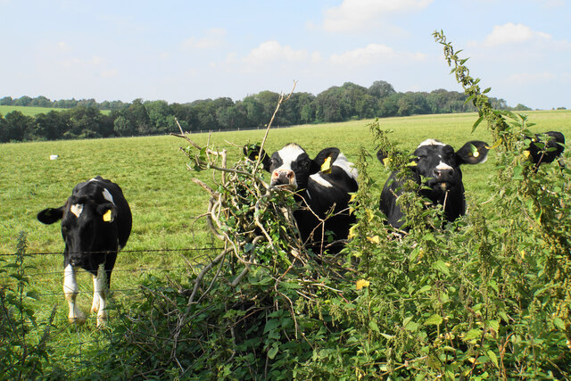
Little Pittdown Plantation is home to a plethora of wildlife species, making it a haven for nature enthusiasts and birdwatchers alike. The woodland provides a habitat for numerous bird species, such as the great spotted woodpecker, tawny owl, and chiffchaff. It is also a haven for small mammals, including badgers, foxes, and deer, which can often be spotted gliding through the undergrowth.

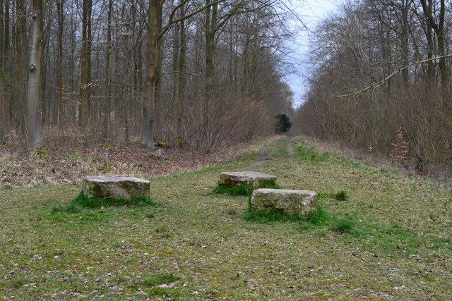
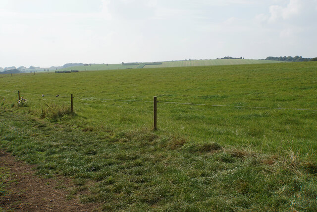
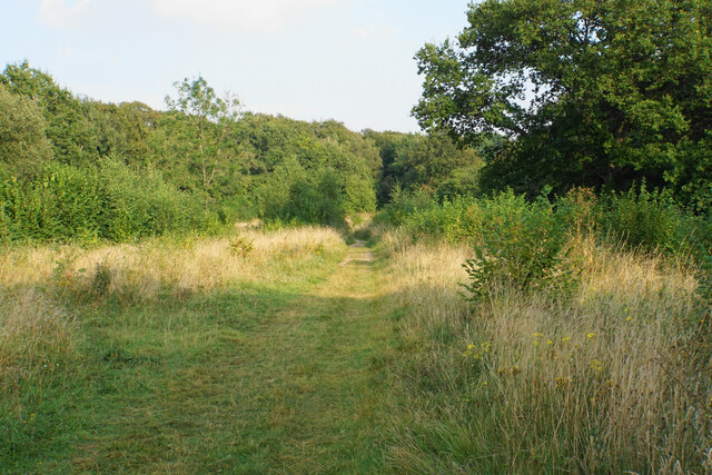
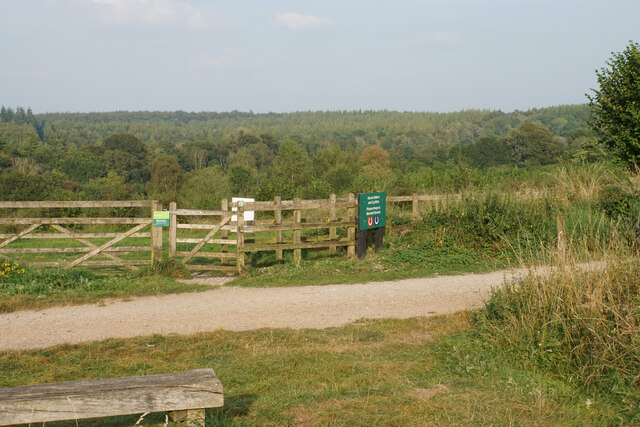
The plantation offers several well-maintained walking trails, allowing visitors to explore the woodland at their own pace. These paths wind through the trees, offering glimpses of hidden streams and small ponds, adding to the tranquility of the surroundings. The plantation is open to the public throughout the year and offers a peaceful retreat for those seeking solace in nature.

In conclusion, Little Pittdown Plantation in Hampshire is a stunning woodland that showcases the beauty of the English countryside. With its diverse range of trees, abundance of wildlife, and serene atmosphere, it is a must-visit destination for nature lovers and those looking to escape the hustle and bustle of everyday life.

If you have any feedback on the listing, please let us know in the comments section below.

Little Pittdown Plantation Images

Images are sourced within 2km of 51.052522/-1.3962724 or Grid Reference SU4228. Thanks to Geograph Open Source API. All images are credited.

Path in West Wood Forestry Commission woodland, and also part of Farley Mount Country Park.
Path in West Wood
Forestry Commission woodland, and also part of Farley Mount Country Park.
In West Wood A beech plantation in the part mapped as Shedden Oak Copse. Forestry Commission woodland, and also part of Farley Mount Country Park.
In West Wood
A beech plantation in the part mapped as Shedden Oak Copse. Forestry Commission woodland, and also part of Farley Mount Country Park.
Three rocks in woodland path Seats perhaps?
Three rocks in woodland path
Seats perhaps?
Clearing above Ashmore Hill Copse A view down the slope from Spindle Car Park.
Clearing above Ashmore Hill Copse
A view down the slope from Spindle Car Park.
Footpath off Spindle Car Park Showing summer abundance of foliage. The path heads towards Farley Mount Country Park.
Footpath off Spindle Car Park
Showing summer abundance of foliage. The path heads towards Farley Mount Country Park.
Path on Pitt Down It doesn't look too bad here, but progress along this path is a battle with brambles, nettles and bindweed mainly. This is looking into the bright sun.
Path on Pitt Down
It doesn't look too bad here, but progress along this path is a battle with brambles, nettles and bindweed mainly. This is looking into the bright sun.
Path on Pitt Down The path follows a band of overgrown scrub between two fields.
Path on Pitt Down
The path follows a band of overgrown scrub between two fields.
Cattle on Pitt Down The southern slopes of the down. South Lynch Farm is at the bottom and Violet Hill is behind.
Cattle on Pitt Down
The southern slopes of the down. South Lynch Farm is at the bottom and Violet Hill is behind.
Grazing land on Pitt Down The Farley Mount monument is visible on the far hill.
Grazing land on Pitt Down
The Farley Mount monument is visible on the far hill.
Footpath on Pitt Down The combination of brambles, nettles and bindweed make this route not particularly pleasant.
Footpath on Pitt Down
The combination of brambles, nettles and bindweed make this route not particularly pleasant.
Curious cattle above Heath Close Corner Grazing on the side of Pitt Down.
Curious cattle above Heath Close Corner
Grazing on the side of Pitt Down.
Field of haystacks on Mount Down Looking up from the bottom of the field by Heath Close Corner.
Field of haystacks on Mount Down
Looking up from the bottom of the field by Heath Close Corner.
Arable field at the bottom of Mount Down Violet Hill rises on the other side of the dip.
Arable field at the bottom of Mount Down
Violet Hill rises on the other side of the dip.
Scrub by the Clarendon Way The OS map suggests the Clarendon Way follows the lane, but it has a parallel route past this scrub. I might have hoped for a view off the hill to the north, but the opportunities are rare because of the growth.
Scrub by the Clarendon Way
The OS map suggests the Clarendon Way follows the lane, but it has a parallel route past this scrub. I might have hoped for a view off the hill to the north, but the opportunities are rare because of the growth.
The Clarendon Way It runs parallel to the lane, and not along it as suggested by the OS map. Views are limited by the foliage in all directions.
The Clarendon Way
It runs parallel to the lane, and not along it as suggested by the OS map. Views are limited by the foliage in all directions.
Path by Farley Mount Car Park The northern side of Pitt Down. Ahead are acres of woodland which form part of Farley Mount Country Park.
Path by Farley Mount Car Park
The northern side of Pitt Down. Ahead are acres of woodland which form part of Farley Mount Country Park.
Crop field towards Stopham's Copse Off the A3090.
Crop field towards Stopham's Copse
Off the A3090.
A3090 towards Hursley
Show me another place!

Little Pittdown Plantation is located at Grid Ref: SU4228 (Lat: 51.052522, Lng: -1.3962724)

Administrative County: Hampshire

District: Winchester

Police Authority: Hampshire

What 3 Words

///overheat.lookout.hacking. Near Compton, Hampshire

Related Wikis

Crab Wood

Crab Wood is a 73-hectare (180-acre) biological Site of Special Scientific Interest west of Winchester in Hampshire. An area of 37.8 hectares (93 acres...

Sparsholt Roman Villa

Sparsholt Roman Villa was a Roman villa near the village of Sparsholt, Hampshire, England. It was constructed in phases from the 2nd to the 5th century...

Farley Mount

Farley Mount is one of the highest points in Hampshire at 174 metres ASL (571ft). It is in Farley Mount Country Park, about four miles west of the historic...

IBM Hursley

IBM Hursley is a research and development laboratory belonging to International Business Machines in the village of Hursley, Hampshire, England. Established...

Hursley House

Hursley House is an 18th-century Queen Anne style mansion in Hursley, near Winchester in the English county of Hampshire. The building is Grade II* listed...

Sparsholt, Hampshire

Sparsholt (/ˈspɑːʃəʊlt/) is a village and civil parish in Hampshire, England, 2+1⁄2 miles (4 km) west of Winchester. In 1908 its area was 3,672 acres...

Oliver's Battery

Oliver's Battery is a civil parish in Hampshire, England, of some 700 households located just to the south of the City of Winchester. The parish was formed...

Hursley

Hursley is a village and civil parish in Hampshire, England with a population of around 900 in 2011. It is located roughly midway between Romsey and Winchester...

Nearby Amenities

Located within 500m of 51.052522,-1.3962724
Power: tower
Source: Bing
Lat/Long: 51.0510018/-1.3961792
Power: tower
Source: Bing
Lat/Long: 51.0509125/-1.4007367
Power: tower
Source: Bing
Lat/Long: 51.0509592/-1.3983543
Power: tower
Source: Bing
Lat/Long: 51.0511167/-1.3903156
Power: tower
Source: Bing
Lat/Long: 51.0510571/-1.3933572
The data included in this document is from www.openstreetmap.org. The data is made available under ODbL.

Have you been to Little Pittdown Plantation?

Leave your review of Little Pittdown Plantation below (or comments, questions and feedback).