Beech Grove

Wood, Forest in Durham

England

Beech Grove

The Village, Castle Eden A quiet no through road called simply The Village leads to the parish church, an 18th century mansion called The Castle, and a handful of other houses.
Just because it has a bright red door, the nearest building looks like an old fire station, but I don't suppose it was.
The Village, Castle Eden Credit: Des Blenkinsopp

Beech Grove is a picturesque woodland area located in Durham, England. Nestled within the larger Durham Forest, it is known for its dense beech trees and is a popular destination for nature enthusiasts and hikers. The grove is spread over a sprawling area, providing ample space for exploration and outdoor activities.

The beech trees in Beech Grove are the dominant feature of the landscape, creating a unique and enchanting atmosphere. The tall, slender trunks of the trees rise majestically, offering shade and shelter to various wildlife species. The canopy formed by the trees creates a cool and serene environment, making it an ideal spot for a peaceful walk or a picnic.

The grove is home to a diverse range of flora and fauna. Besides the beech trees, visitors can also spot oak, ash, and sycamore trees, adding to the rich biodiversity of the area. The forest floor is adorned with a carpet of wildflowers, providing a burst of color during the spring and summer months.

Wildlife enthusiasts will find Beech Grove to be a haven for various animal species. Squirrels, rabbits, and deer are commonly sighted, while birdwatchers can enjoy the melodious songs of woodpeckers, thrushes, and finches. The grove also provides habitat for smaller creatures like insects and amphibians, adding to its ecological significance.

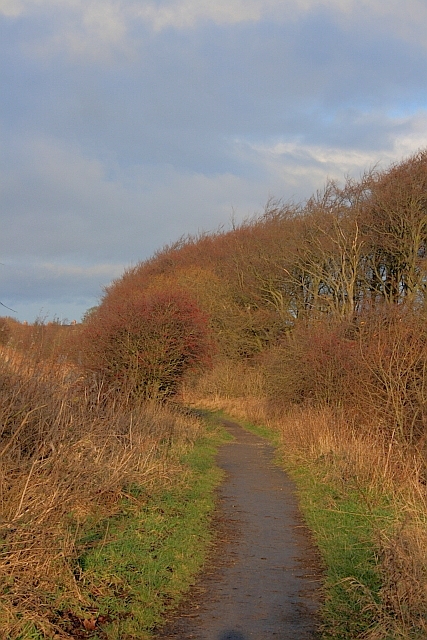
Access to Beech Grove is facilitated by well-maintained footpaths and trails, allowing visitors to explore the area at their own pace. The grove is particularly popular among families, nature lovers, and photographers, who are drawn to its natural beauty and tranquility.

In summary, Beech Grove in Durham is a captivating woodland area characterized by its dense beech trees, diverse flora and fauna, and peaceful ambiance. It offers visitors a chance to immerse themselves in nature and experience the serenity of the forest.

If you have any feedback on the listing, please let us know in the comments section below.
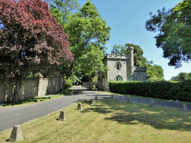
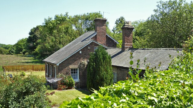
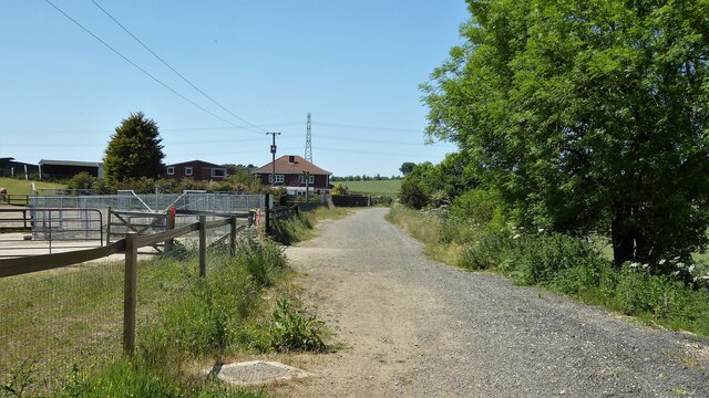
Beech Grove Images

Images are sourced within 2km of 54.74224/-1.3445878 or Grid Reference NZ4238. Thanks to Geograph Open Source API. All images are credited.

The Village, Castle Eden A quiet no through road called simply The Village leads to the parish church, an 18th century mansion called The Castle, and a handful of other houses.
Just because it has a bright red door, the nearest building looks like an old fire station, but I don't suppose it was.
The Village, Castle Eden
A quiet no through road called simply The Village leads to the parish church, an 18th century mansion called The Castle, and a handful of other houses. Just because it has a bright red door, the nearest building looks like an old fire station, but I don't suppose it was.
Castle Eden War Memorial Castle Eden's memorial is on a small triangular green by a bend in the road.
In the background past what looks like a lodge house, a road leads to an estate called Parklands.
Castle Eden War Memorial
Castle Eden's memorial is on a small triangular green by a bend in the road. In the background past what looks like a lodge house, a road leads to an estate called Parklands.
The Factory, Castle Eden A housing terrace called The Factory.
Something I found on the web about it says "The Factory is the name given to a row of houses located in Castle Eden. During the 1800s, they were used to produce rope and sails."
The Factory, Castle Eden
A housing terrace called The Factory. Something I found on the web about it says "The Factory is the name given to a row of houses located in Castle Eden. During the 1800s, they were used to produce rope and sails."
Shotton Hall, Peterlee, south frontage 18th to 19th century rebuild of earlier manor house, now used by Peterlee Town Council as offices, conference centre, function suites.
Shotton Hall, Peterlee, south frontage
18th to 19th century rebuild of earlier manor house, now used by Peterlee Town Council as offices, conference centre, function suites.
North side of Shotton Hall, Peterlee
Hesleden WMC On Front Street
Hesleden WMC
On Front Street
Cycle path following route of former railway Approaching a dangerous crossing of a track used by quarry wagons. To the left of this view is a former colliery spoil heap which is being remediated.
Cycle path following route of former railway
Approaching a dangerous crossing of a track used by quarry wagons. To the left of this view is a former colliery spoil heap which is being remediated.
Church of St James
Church of St James
West Lodge To the Castle Eden Estate
West Lodge
To the Castle Eden Estate
Former station buildings On the Hart to Haswell route
Former station buildings
On the Hart to Haswell route
Cycle path following route of former railway Approaching Headshope cottages the site of Castle Eden junction on the Hart to Haswell route
Cycle path following route of former railway
Approaching Headshope cottages the site of Castle Eden junction on the Hart to Haswell route
Peterlee Memorial Methodist Church Part of the new town
Peterlee Memorial Methodist Church
Part of the new town
Viewpoint for the Apollo Pavilion in Peterlee
Cycle Track Along the old railway track. Part of the National Cycle Network.
Cycle Track
Along the old railway track. Part of the National Cycle Network.
Farmland, Hesleden
Farmland, Hesleden
Gary Avenue towards Hesleden Village
Haswell to Hart railway path heading east
The Green, Shotton
The Green, Shotton
Show me another place!

Beech Grove is located at Grid Ref: NZ4238 (Lat: 54.74224, Lng: -1.3445878)

Unitary Authority: County Durham

Police Authority: Durham

What 3 Words

///listening.fidelity.available. Near Peterlee, Co. Durham

Related Wikis

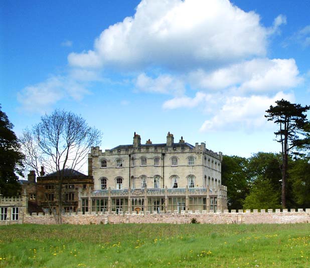
The Castle, Castle Eden

The Castle at Castle Eden, County Durham, England, is an 18th-century, Palladian style, mansion house and a Grade II* listed building. No trace remains...

Castle Eden

Castle Eden is a village in County Durham, in England. The population of the parish at the 2011 census was 642. It is situated a short distance to the...

The Academy at Shotton Hall

The Academy At Shotton Hall is a coeducational secondary school in Peterlee, County Durham, England. It is a school for 11- to 16-year-olds and is a specialist...

Apollo Pavilion

The Apollo Pavilion, also known as the Pasmore Pavilion, is a piece of public art in the new town of Peterlee in County Durham in the North East of England...

Nearby Amenities

Located within 500m of 54.74224,-1.3445878
Bench
Lat/Long: 54.742477/-1.3391581
Bus Stop
Bywell Drive
Bus: yes
Naptan AtcoCode: 13003229B
Naptan Bearing: NE
Naptan CommonName: Bywell Drive
Naptan Indicator: north east bound
Naptan Landmark: Landmark not known
Naptan NaptanCode: durapgpt
Naptan Notes: 13.6m from west wall of 1 bywell drive- peterlee
Naptan Street: Durham Way
Naptan Verified: no
Public Transport: platform
Source: naptan_import
Lat/Long: 54.7464682/-1.3433054
Bus Stop
Bywell Drive
Bench: yes
Bus: yes
Departures Board: timetable
Naptan AtcoCode: 13003229F
Naptan Bearing: SW
Naptan CommonName: Bywell Drive
Naptan Indicator: south west bound
Naptan Landmark: Landmark not known
Naptan NaptanCode: durapgpw
Naptan Notes: directly parralel and opposite west wall of 1 bywell drive- peterlee
Naptan Street: Durham Way
Naptan Verified: no
Public Transport: platform
Shelter: yes
Source: naptan_import
Lat/Long: 54.7464309/-1.3430419
Bus Stop
Brancepeth Close
Bus: yes
Naptan AtcoCode: 13003230D
Naptan Bearing: W
Naptan CommonName: Brancepeth Close
Naptan Indicator: west bound
Naptan Landmark: Landmark not known
Naptan NaptanCode: durapgtd
Naptan Notes: 8.55m from east sideedge of 22 brancepeth chare- peterlee
Naptan Street: Durham Way
Naptan Verified: no
Public Transport: platform
Source: naptan_import
Lat/Long: 54.7456126/-1.3496264
Generator Method: photovoltaic
Generator Output Electricity: yes
Generator Source: solar
Generator Type: solar_photovoltaic_panel
Location: roof
Power: generator
Lat/Long: 54.7463904/-1.3474778
Generator Method: photovoltaic
Generator Output Electricity: yes
Generator Source: solar
Generator Type: solar_photovoltaic_panel
Location: roof
Power: generator
Lat/Long: 54.7460436/-1.3405067
Generator Method: photovoltaic
Generator Output Electricity: yes
Generator Source: solar
Generator Type: solar_photovoltaic_panel
Location: roof
Power: generator
Lat/Long: 54.7454569/-1.3409493
Generator Method: photovoltaic
Generator Output Electricity: yes
Generator Source: solar
Generator Type: solar_photovoltaic_panel
Location: roof
Power: generator
Lat/Long: 54.7455668/-1.3405764
Generator Method: photovoltaic
Generator Output Electricity: yes
Generator Source: solar
Generator Type: solar_photovoltaic_panel
Location: roof
Power: generator
Lat/Long: 54.745412/-1.3413301
Deserted medieval village
HE Ref: 1015842
Archaeological Site: settlement
Designation: scheduled_monument
Historic: archaeological_site
Wikidata: Q17674685
Lat/Long: 54.7407699/-1.3381004
Generator Method: photovoltaic
Generator Output Electricity: yes
Generator Source: solar
Generator Type: solar_photovoltaic_panel
Location: roof
Power: generator
Lat/Long: 54.7440368/-1.3495079
Generator Method: photovoltaic
Generator Output Electricity: yes
Generator Source: solar
Generator Type: solar_photovoltaic_panel
Location: roof
Power: generator
Lat/Long: 54.7440275/-1.3511454
Generator Method: photovoltaic
Generator Output Electricity: yes
Generator Source: solar
Generator Type: solar_photovoltaic_panel
Location: roof
Power: generator
Lat/Long: 54.7445075/-1.3512057
Generator Method: photovoltaic
Generator Output Electricity: yes
Generator Source: solar
Generator Type: solar_photovoltaic_panel
Location: roof
Power: generator
Lat/Long: 54.7448497/-1.3496634
Generator Method: photovoltaic
Generator Output Electricity: yes
Generator Source: solar
Generator Type: solar_photovoltaic_panel
Location: roof
Power: generator
Lat/Long: 54.7447769/-1.3487971
Generator Method: photovoltaic
Generator Output Electricity: yes
Generator Source: solar
Generator Type: solar_photovoltaic_panel
Location: roof
Power: generator
Lat/Long: 54.7451392/-1.3478234
Generator Method: photovoltaic
Generator Output Electricity: yes
Generator Source: solar
Generator Type: solar_photovoltaic_panel
Location: roof
Power: generator
Lat/Long: 54.7446608/-1.3459405
Generator Method: photovoltaic
Generator Output Electricity: yes
Generator Source: solar
Generator Type: solar_photovoltaic_panel
Location: roof
Power: generator
Lat/Long: 54.7453048/-1.347295
Generator Method: photovoltaic
Generator Output Electricity: yes
Generator Source: solar
Generator Type: solar_photovoltaic_panel
Location: roof
Power: generator
Lat/Long: 54.7453079/-1.347228
Generator Method: photovoltaic
Generator Output Electricity: yes
Generator Source: solar
Generator Type: solar_photovoltaic_panel
Location: roof
Power: generator
Lat/Long: 54.7451872/-1.3448811
Generator Method: photovoltaic
Generator Output Electricity: yes
Generator Source: solar
Generator Type: solar_photovoltaic_panel
Location: roof
Power: generator
Lat/Long: 54.74563/-1.3445324
Generator Method: photovoltaic
Generator Output Electricity: yes
Generator Source: solar
Generator Type: solar_photovoltaic_panel
Location: roof
Power: generator
Lat/Long: 54.7461997/-1.3451922
Generator Method: photovoltaic
Generator Output Electricity: yes
Generator Source: solar
Generator Type: solar_photovoltaic_panel
Location: roof
Power: generator
Lat/Long: 54.7460093/-1.3467962
Generator Method: photovoltaic
Generator Output Electricity: yes
Generator Source: solar
Generator Type: solar_photovoltaic_panel
Location: roof
Power: generator
Lat/Long: 54.7460557/-1.3467479
Barrier: kissing_gate
Bicycle: no
Foot: yes
Lat/Long: 54.7423296/-1.3389316
Welcome To Castle Eden Dene
Board Type: geology
Information: board
Tourism: information
Lat/Long: 54.7424434/-1.3390077
The data included in this document is from www.openstreetmap.org. The data is made available under ODbL.

Have you been to Beech Grove?

Leave your review of Beech Grove below (or comments, questions and feedback).