Rooksnest Copse

Wood, Forest in Berkshire

England

Rooksnest Copse

Rabbit's eye view What do the smaller creatures actually see?  This is an attempt at seeing the field of wheat from the point of view of a rabbit or similar sized creature.
Rabbit's eye view Credit: Graham Horn

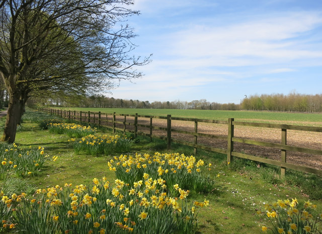
Rooksnest Copse, located in Berkshire, England, is a serene and verdant woodland area that spans approximately 1 square kilometer. Nestled within the picturesque countryside, this copse offers visitors a tranquil escape from the hustle and bustle of everyday life.

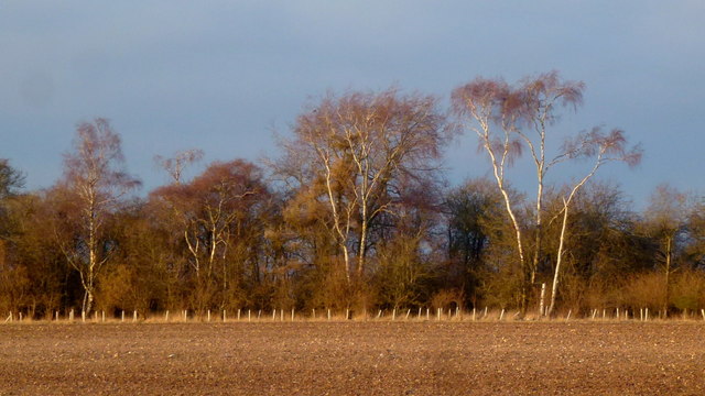
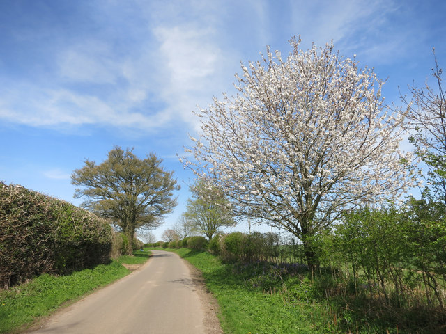
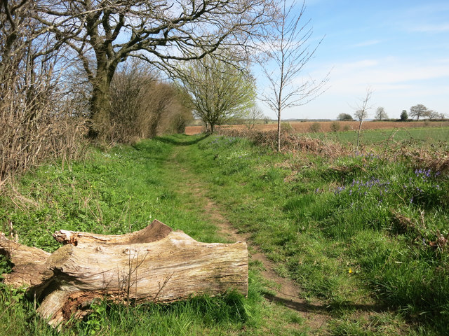
The copse is predominantly made up of deciduous trees, including oak, beech, and ash, which create a dense canopy overhead, providing shade and shelter for the diverse range of wildlife that call Rooksnest Copse their home. The forest floor is blanketed with a rich tapestry of wildflowers, ferns, and mosses, adding to the copse's natural beauty and biodiversity.

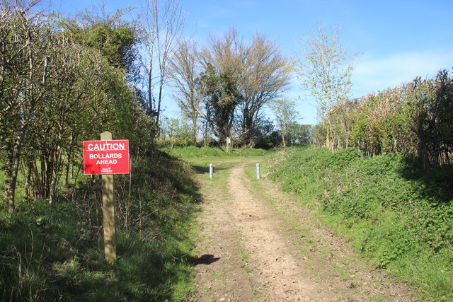
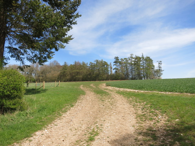
Numerous walking trails wind their way through Rooksnest Copse, allowing visitors to immerse themselves in the peaceful surroundings and explore the various habitats within the woodland. These trails lead to hidden clearings, babbling brooks, and occasional glimpses of local fauna, such as deer, foxes, and a variety of bird species.

Rooksnest Copse is a popular destination for nature enthusiasts, hikers, and birdwatchers alike. Its tranquil atmosphere and untouched beauty make it an ideal location for those seeking a peaceful retreat or a chance to reconnect with nature. The copse is also a valuable educational resource, with regular guided nature walks and workshops organized by local conservation groups.

In summary, Rooksnest Copse is a charming woodland area in Berkshire, England, boasting a diverse range of trees, flora, and fauna. Its peaceful atmosphere, picturesque trails, and abundance of wildlife make it a must-visit destination for nature lovers and those seeking a tranquil escape.

If you have any feedback on the listing, please let us know in the comments section below.

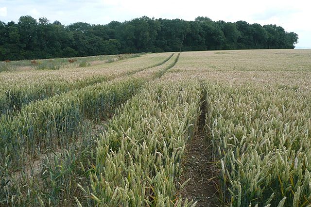
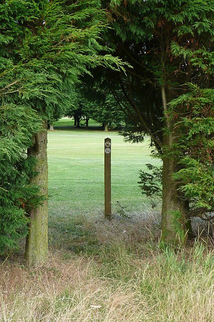
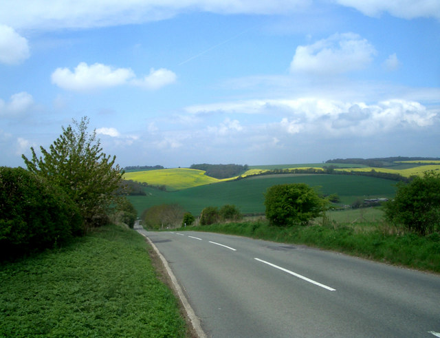
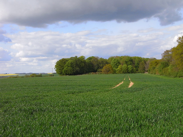
Rooksnest Copse Images

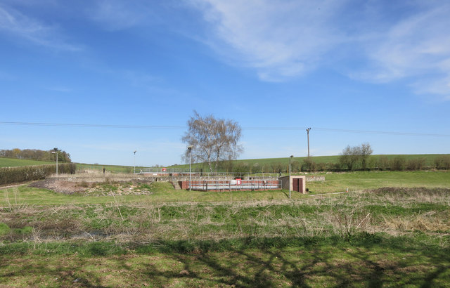
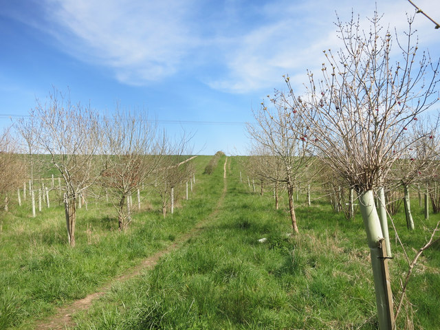
Images are sourced within 2km of 51.481061/-1.4035076 or Grid Reference SU4175. Thanks to Geograph Open Source API. All images are credited.

Rabbit's eye view What do the smaller creatures actually see?  This is an attempt at seeing the field of wheat from the point of view of a rabbit or similar sized creature.
Rabbit's eye view
What do the smaller creatures actually see? This is an attempt at seeing the field of wheat from the point of view of a rabbit or similar sized creature.
Elton Wood In the eastern part of the square the arable field give way to this woodland.
Elton Wood
In the eastern part of the square the arable field give way to this woodland.
Entrance to the golf course The footpath entrance goes under this hedge and immediately onto one of the fairways.  A footpath sign directs you across the course, but it is easy to miss the route after the first fairway is crossed.
Entrance to the golf course
The footpath entrance goes under this hedge and immediately onto one of the fairways. A footpath sign directs you across the course, but it is easy to miss the route after the first fairway is crossed.
The Shefford Valley A view over the top end of this dry valley from the hill on the eastern side.
Did I say dry. Most years a stream forms during the winter in the lower section of the valley.
A few years ago so much water was trying to get down a partially blocked and poorly maintained channel that some properties in Great Shefford were flooded.
A couple of editions before the present one, the OS map even showed a pond at the bottom of this hill. There could well have been when they did their survey, but it's only there for a few weeks every few years.
The Shefford Valley
A view over the top end of this dry valley from the hill on the eastern side. Did I say dry. Most years a stream forms during the winter in the lower section of the valley. A few years ago so much water was trying to get down a partially blocked and poorly maintained channel that some properties in Great Shefford were flooded. A couple of editions before the present one, the OS map even showed a pond at the bottom of this hill. There could well have been when they did their survey, but it's only there for a few weeks every few years.
Farmland, Chaddleworth A crop of wheat to the south of Buckham Hill.
Farmland, Chaddleworth
A crop of wheat to the south of Buckham Hill.
View from Buckham Hill At the top of a steep descent to Wantage Road in the valley.
View from Buckham Hill
At the top of a steep descent to Wantage Road in the valley.
Oak tree by Hangman's Stone Lane The last rays of a March afternoon lights the scene looking south-east towards Boxford.
Oak tree by Hangman's Stone Lane
The last rays of a March afternoon lights the scene looking south-east towards Boxford.
Scrubby birch woodland View north from Hangman's Stone Lane in the Berkshire Downs.
Scrubby birch woodland
View north from Hangman's Stone Lane in the Berkshire Downs.
Roadside Seat at Manor Farm
Barn and Watch Tower Most of this square is private, and the bit you can see from the road isn't very interesting. The map shows a lot of something going on on the other side of the hill, but this bit of roof and a look out tower is all you can see of it.
Barn and Watch Tower
Most of this square is private, and the bit you can see from the road isn't very interesting. The map shows a lot of something going on on the other side of the hill, but this bit of roof and a look out tower is all you can see of it.
Derelict Hut near Manor Farm Standing on its own in the corner of a field, this old place has the look of something left over from WW2.  I guess it was an outbuilding from RAF Welford which is nearby.
Derelict Hut near Manor Farm
Standing on its own in the corner of a field, this old place has the look of something left over from WW2. I guess it was an outbuilding from RAF Welford which is nearby.
Bollards Ahead Not what you'd expect, but bollards there are, and quite new ones. The small print on the notice says West Berkshire, so it looks like the council put them in.
Bollards Ahead
Not what you'd expect, but bollards there are, and quite new ones. The small print on the notice says West Berkshire, so it looks like the council put them in.
Track into Stirt Copse
Leckhampstead STW A small sewage treatment works belonging to Thames Water.
Leckhampstead STW
A small sewage treatment works belonging to Thames Water.
Lane near Oak Ash Farm
Path near Oak Ash Farm In a lot better state than when Graham was here <a href="https://www.geograph.org.uk/photo/862733">SU4277 : Welcome to the footpath</a>
The old iron has been replaced by a log, but I suspect the purpose of both is to deter off-roaders.
Path near Oak Ash Farm
In a lot better state than when Graham was here SU4277 : Welcome to the footpath The old iron has been replaced by a log, but I suspect the purpose of both is to deter off-roaders.
Footpath to Leckhampstead
Daffodils down the drive The driveway to Oak Ash Farm is also a public footpath.
Daffodils down the drive
The driveway to Oak Ash Farm is also a public footpath.
Show me another place!

Rooksnest Copse is located at Grid Ref: SU4175 (Lat: 51.481061, Lng: -1.4035076)

Unitary Authority: West Berkshire

Police Authority: Thames Valley

What 3 Words

///command.churn.florists. Near Chaddleworth, Berkshire

Related Wikis

Poughley Priory

Poughley Priory was a priory of Austin Canons at Chaddleworth in the English county of Berkshire, located between Great Shefford and Leckhampstead. It...

West Berkshire Golf Club

West Berkshire Golf Club is a golf club located in Chaddleworth, Berkshire, England. It is located about 3 miles from Woodlands St Mary. The club was established...
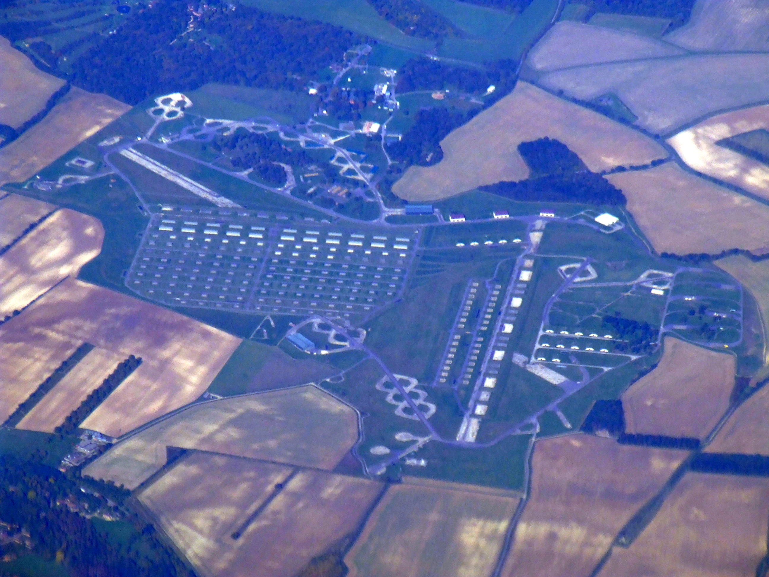
RAF Welford

Royal Air Force Welford or more simply RAF Welford is an active Royal Air Force station in Berkshire, England. The station is located approximately 6 miles...

Chaddleworth

Chaddleworth is a village and civil parish in the English county of Berkshire. == Geography == The village of Chaddleworth lies below the southern slopes...

Nearby Amenities

Located within 500m of 51.481061,-1.4035076
Crossing
Lat/Long: 51.4834688/-1.4091061
Parking
Access: private
Lat/Long: 51.4783156/-1.4019881
Power: pole
Source: Bing
Lat/Long: 51.4830235/-1.4063626
Power: pole
Source: Bing
Lat/Long: 51.4835814/-1.4080632
Power: pole
Source: Bing
Lat/Long: 51.4833106/-1.4073014
Power: pole
Source: Bing
Lat/Long: 51.4826059/-1.4048123
Power: pole
Source: Bing
Lat/Long: 51.4816705/-1.401422
Power: pole
Source: Bing
Lat/Long: 51.4811694/-1.3995874
Power: pole
Source: Bing
Lat/Long: 51.4822017/-1.4033586
Power: pole
Source: Bing
Lat/Long: 51.4843598/-1.4068723
Crossing
Lat/Long: 51.4833685/-1.4091771
Power: pole
Lat/Long: 51.4806563/-1.3978601
Man Made: mast
Lat/Long: 51.4787467/-1.4007537
The data included in this document is from www.openstreetmap.org. The data is made available under ODbL.

Have you been to Rooksnest Copse?

Leave your review of Rooksnest Copse below (or comments, questions and feedback).