Ackton Pasture Wood

Wood, Forest in Yorkshire

England

Ackton Pasture Wood

A view from a bridge, Cutsyke View from old railway bridge (now a bridle/footpath) at Cutsyke, Castleford, looking towards the crossroads.
A view from a bridge, Cutsyke Credit: derek dye

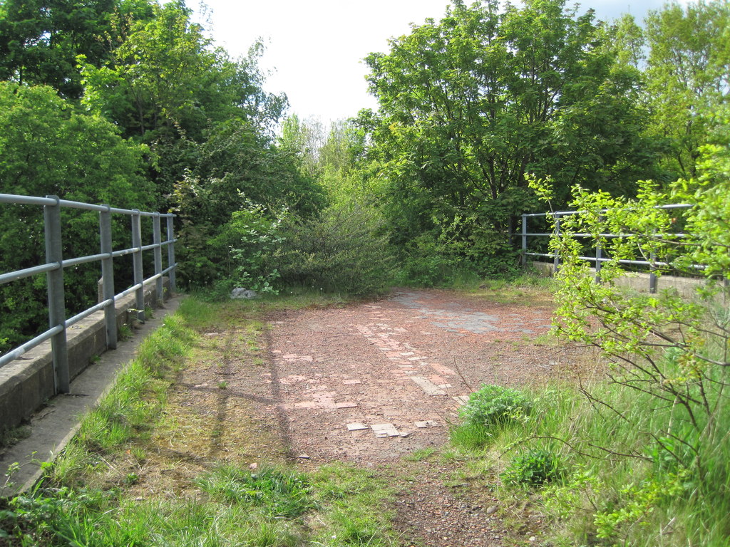
Ackton Pasture Wood is a picturesque woodland located in the county of Yorkshire, England. Spanning over an area of approximately 50 acres, it is a delightful combination of ancient woodland and newer plantations. The wood is situated near the village of Ackton and is easily accessible by foot or bicycle.

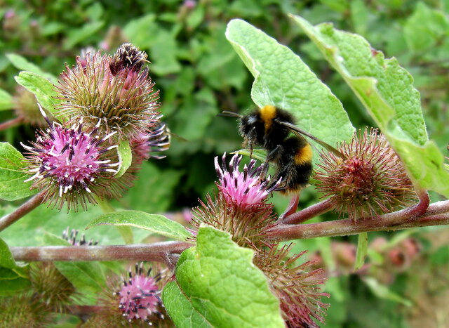
The woodland boasts a diverse range of flora and fauna, making it a haven for nature enthusiasts. The ancient trees, including oak, beech, and ash, provide a dense canopy that filters sunlight, creating a serene and tranquil atmosphere. Bluebells, primroses, and wild garlic carpet the forest floor during spring, creating a stunning display of colors.

Ackton Pasture Wood is also home to a variety of wildlife. Deer, foxes, and badgers can often be spotted roaming the woodland, while a multitude of bird species, such as woodpeckers, owls, and warblers, can be heard singing from the treetops.

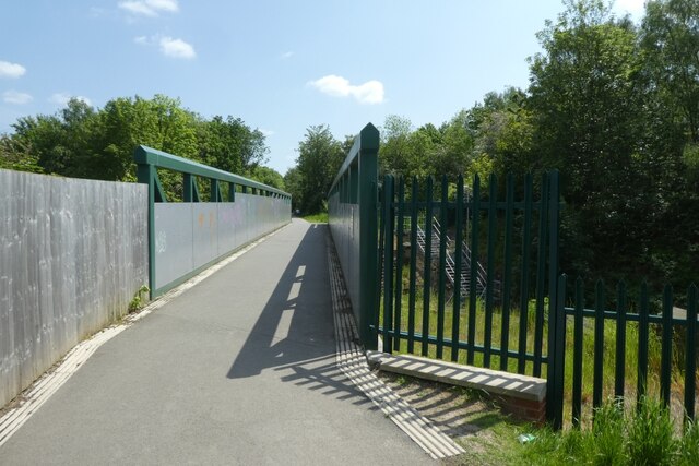
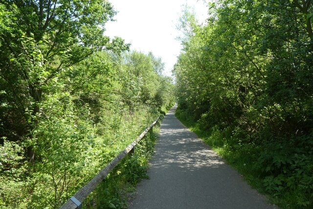
The wood offers several well-maintained trails, allowing visitors to explore its beauty at their own pace. These paths wind through the trees, offering glimpses of open clearings and picturesque ponds. Along the way, benches and picnic areas are strategically placed, providing opportunities to rest and enjoy the surroundings.

The woodland is managed by the local council, which ensures its preservation and maintenance. It is open to the public throughout the year, free of charge. Whether it's for a peaceful stroll, birdwatching, or simply immersing oneself in nature, Ackton Pasture Wood offers a tranquil retreat for visitors of all ages.

If you have any feedback on the listing, please let us know in the comments section below.

Ackton Pasture Wood Images

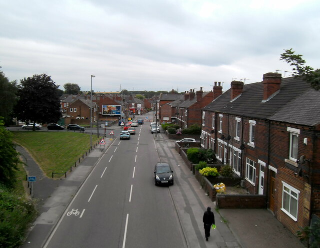
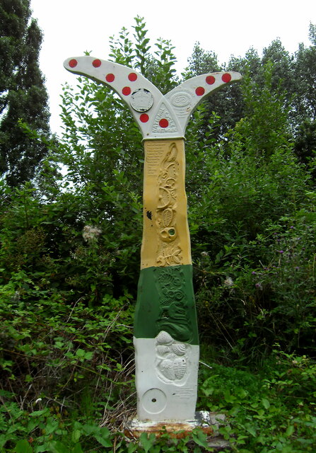
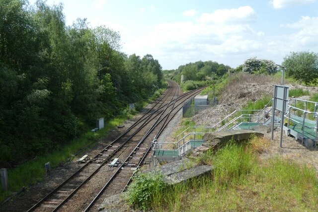
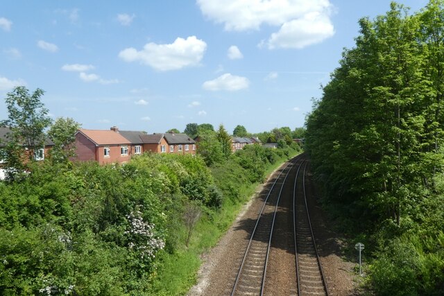
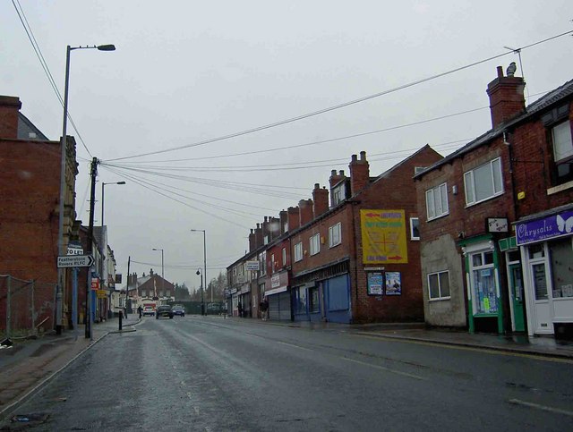
Images are sourced within 2km of 53.707309/-1.37427 or Grid Reference SE4123. Thanks to Geograph Open Source API. All images are credited.

A view from a bridge, Cutsyke View from old railway bridge (now a bridle/footpath) at Cutsyke, Castleford, looking towards the crossroads.
A view from a bridge, Cutsyke
View from old railway bridge (now a bridle/footpath) at Cutsyke, Castleford, looking towards the crossroads.
Cutsyke bridle path way marker
Bee collecting pollen from a Thistle
Bridge over the railway lines at Whitwood Junction The path uses the former railway line between Glasshoughton and Methley Junction and is crossing over Whitwood Junction.
Bridge over the railway lines at Whitwood Junction
The path uses the former railway line between Glasshoughton and Methley Junction and is crossing over Whitwood Junction.
Whitwood Junction Looking down from a path along the former railway line between Glasshoughton and Methley Junction. Ahead the lines diverge, with the left hand being the Normanton lines and the right hand the Methley lines.
Whitwood Junction
Looking down from a path along the former railway line between Glasshoughton and Methley Junction. Ahead the lines diverge, with the left hand being the Normanton lines and the right hand the Methley lines.
Railway lines towards Castleford Crossing Whitwood Junction on a path along the former railway line between Glasshoughton and Methley Junction. The lines below head to Castleford.
Railway lines towards Castleford
Crossing Whitwood Junction on a path along the former railway line between Glasshoughton and Methley Junction. The lines below head to Castleford.
Cycle path near Whitwood Junction A cycle path runs along the former railway line between Glasshoughton and Methley Junction.
Cycle path near Whitwood Junction
A cycle path runs along the former railway line between Glasshoughton and Methley Junction.
Cycle path approaching the bridge over Whitwood Junction A cycle path runs along the former railway line between Glasshoughton and Methley Junction and is part of National Cycle Network route 69.
Cycle path approaching the bridge over Whitwood Junction
A cycle path runs along the former railway line between Glasshoughton and Methley Junction and is part of National Cycle Network route 69.
Cycle path to Lumley Hill A short spur off the cycle path which runs along the former railway line between Glasshoughton and Methley Junction forming part of National Cycle Network route 69.
Cycle path to Lumley Hill
A short spur off the cycle path which runs along the former railway line between Glasshoughton and Methley Junction forming part of National Cycle Network route 69.
Bridge carrying Lumley Hill A cycle path runs along the former railway line between Glasshoughton and Methley Junction and is part of National Cycle Network route 69.
Bridge carrying Lumley Hill
A cycle path runs along the former railway line between Glasshoughton and Methley Junction and is part of National Cycle Network route 69.
Cycle path east of Lumley Street A cycle path runs along the former railway line between Glasshoughton and Methley Junction and is part of National Cycle Network route 69.
Cycle path east of Lumley Street
A cycle path runs along the former railway line between Glasshoughton and Methley Junction and is part of National Cycle Network route 69.
Cycle path and Lumley Street access A cycle path runs along the former railway line between Glasshoughton and Methley Junction and is part of National Cycle Network route 69. On the left is the path access from Lumley Street.
Cycle path and Lumley Street access
A cycle path runs along the former railway line between Glasshoughton and Methley Junction and is part of National Cycle Network route 69. On the left is the path access from Lumley Street.
Field beside the cycle path A cycle path runs along the former railway line between Glasshoughton and Methley Junction and is part of National Cycle Network route 69. A path off it enters this field giving access to Savile Park.
Field beside the cycle path
A cycle path runs along the former railway line between Glasshoughton and Methley Junction and is part of National Cycle Network route 69. A path off it enters this field giving access to Savile Park.
Cycle path near Barnsdale Estate A cycle path runs along the former railway line between Glasshoughton and Methley Junction and is part of National Cycle Network route 69.
Cycle path near Barnsdale Estate
A cycle path runs along the former railway line between Glasshoughton and Methley Junction and is part of National Cycle Network route 69.
NCN Milepost A cycle path runs along the former railway line between Glasshoughton and Methley Junction and is part of National Cycle Network route 69. This is one of the National Cycle Network waymarkers.
NCN Milepost
A cycle path runs along the former railway line between Glasshoughton and Methley Junction and is part of National Cycle Network route 69. This is one of the National Cycle Network waymarkers.
Cycle path near the marker post A cycle path runs along the former railway line between Glasshoughton and Methley Junction and is part of National Cycle Network route 69. This is taken beside the post seen in <a href="https://www.geograph.org.uk/photo/7496397">SE4124 : NCN Milepost</a>.
Cycle path near the marker post
A cycle path runs along the former railway line between Glasshoughton and Methley Junction and is part of National Cycle Network route 69. This is taken beside the post seen in SE4124 : NCN Milepost.
Aketon Road Looking down from the cycle path running along the former railway line between Glasshoughton and Methley Junction and is part of National Cycle Network route 69.
Aketon Road
Looking down from the cycle path running along the former railway line between Glasshoughton and Methley Junction and is part of National Cycle Network route 69.
Cycle path exit on to Granville Street A cycle path runs along the former railway line between Glasshoughton and Methley Junction and is part of National Cycle Network route 69. The path joins Leeds Road for a short section, before rejoining the side of the railway to head to Glasshoughton.
Cycle path exit on to Granville Street
A cycle path runs along the former railway line between Glasshoughton and Methley Junction and is part of National Cycle Network route 69. The path joins Leeds Road for a short section, before rejoining the side of the railway to head to Glasshoughton.
Show me another place!

Ackton Pasture Wood is located at Grid Ref: SE4123 (Lat: 53.707309, Lng: -1.37427)

Division: West Riding

Unitary Authority: Wakefield

Police Authority: West Yorkshire

What 3 Words

///yacht.funnels.themes. Near Castleford, West Yorkshire

Nearby Locations

Ackton Pasture Wood

Related Wikis

Featherstone

Featherstone is a town and civil parish in the City of Wakefield, West Yorkshire, England, two miles south-west of Pontefract. Historically part of the...

Castleford Cutsyke railway station

Castleford Cutsyke railway station served the Cutsyke of Castleford in West Yorkshire, England, from 1860 to 1968 on the Pontefract and Methley Junction...

Normanton, Pontefract and Castleford (UK Parliament constituency)

Normanton, Pontefract and Castleford is a constituency in West Yorkshire represented in the House of Commons of the UK Parliament by Yvette Cooper of the...

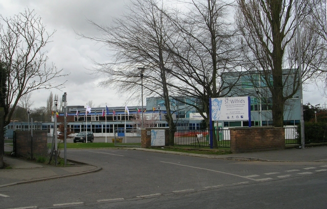
St Wilfrid's Catholic High School, North Featherstone

St Wilfrid's Catholic High School is a mixed secondary school and sixth form with academy status located in Featherstone, West Yorkshire, England. It has...

Nearby Amenities

Located within 500m of 53.707309,-1.37427
Bus Stop
Cutsyke Road Castleford Lane
Bench: no
Bin: no
Bus: yes
Local Ref: 45018234
Naptan AtcoCode: 450018234
Naptan Bearing: N
Naptan CommonName: Cutsyke Road Castleford Lane
Naptan Crossing: Castleford Lane
Naptan Indicator: Stop 45018234
Naptan Landmark: Motorway Bridge
Naptan PlusbusZoneRef: LEEDS
Naptan ShortCommonName: Castleford Lane
Naptan Street: Cutsyke Road
Naptan Verified: no
Public Transport: platform
Shelter: no
Source: naptan_import
Lat/Long: 53.706987/-1.3680076
Bus Stop
Cutsyke Road Castleford Lane
Bench: no
Bin: no
Bus: yes
Local Ref: 45050590
Naptan AtcoCode: 450050590
Naptan Bearing: W
Naptan BusStopType: CUS
Naptan CommonName: Cutsyke Road Castleford Lane
Naptan Indicator: Stop 45050590
Naptan PlusbusZoneRef: LEEDS
Naptan ShortCommonName: Low Laithe Farm
Naptan Street: Cutsyke Road
Naptan Verified: no
Public Transport: platform
Shelter: no
Source: naptan_import
Lat/Long: 53.7070886/-1.3678307
Parking
Lat/Long: 53.7094262/-1.3799909
Barrier: block
Motor Vehicle: no
Lat/Long: 53.703487/-1.3703016
Crossing
Lat/Long: 53.7090061/-1.373318
Phone
Emergency: phone
Lat/Long: 53.7078066/-1.377704
Phone
Emergency: phone
Lat/Long: 53.7081005/-1.3776658
Design: h-frame
Material: wood
Power: pole
Lat/Long: 53.7102359/-1.3685055
Design: h-frame
Material: wood
Power: pole
Lat/Long: 53.7046535/-1.3733523
Design: h-frame
Material: wood
Power: pole
Lat/Long: 53.7035958/-1.3742121
Design: h-frame
Material: wood
Power: pole
Lat/Long: 53.7051847/-1.3719962
Design: h-frame
Material: wood
Power: pole
Lat/Long: 53.7056963/-1.370637
Crossing
Crossing: unmarked
Crossing Island: yes
Tactile Paving: yes
Lat/Long: 53.7081971/-1.3670523
Generator Method: photovoltaic
Generator Output Electricity: yes
Generator Source: solar
Generator Type: solar_photovoltaic_panel
Location: roof
Power: generator
Lat/Long: 53.71112/-1.3779734
Generator Method: photovoltaic
Generator Output Electricity: yes
Generator Source: solar
Generator Type: solar_photovoltaic_panel
Location: roof
Power: generator
Lat/Long: 53.7097188/-1.3785169
Crossing
Crossing: marked
Lat/Long: 53.708703/-1.3790555
Design: h-frame
Material: wood
Power: pole
Lat/Long: 53.7078368/-1.3696265
Design: h-frame
Material: wood
Power: pole
Lat/Long: 53.707222/-1.3699038
Design: h-frame
Material: wood
Power: pole
Lat/Long: 53.7090944/-1.3690427
Barrier: block
Motor Vehicle: no
Lat/Long: 53.7042578/-1.3702734
Crossing
Crossing: unmarked
Crossing Island: yes
Tactile Paving: yes
Lat/Long: 53.708219/-1.3669668
Noexit: yes
Lat/Long: 53.7095269/-1.3712618
Noexit: yes
Lat/Long: 53.7095361/-1.3712303
The data included in this document is from www.openstreetmap.org. The data is made available under ODbL.

Have you been to Ackton Pasture Wood?

Leave your review of Ackton Pasture Wood below (or comments, questions and feedback).