Bedlam's Copse

Wood, Forest in Hampshire Basingstoke and Deane

England

Bedlam's Copse

Farmland, St Mary Bourne A well reinstated footpath through barley to the west of Upper Wyke.
Farmland, St Mary Bourne Credit: Andrew Smith

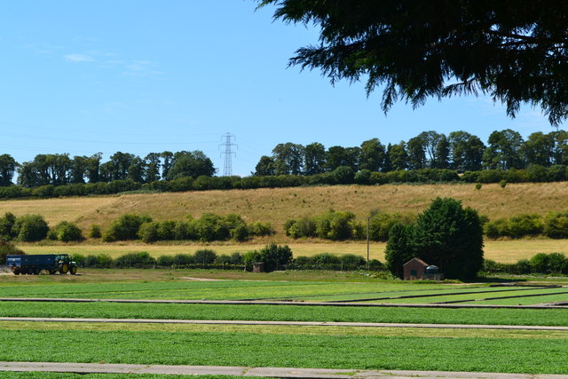
Bedlam's Copse is a picturesque woodland located in Hampshire, England. Covering an area of approximately 50 acres, it is situated near the village of Buriton and is a popular destination for nature enthusiasts and hikers.

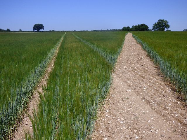
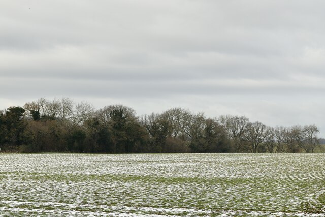
The copse is characterized by its dense and diverse vegetation, consisting mainly of deciduous trees such as oak, beech, ash, and birch. The leafy canopy provides ample shade during the summer months, creating a cool and tranquil atmosphere. The forest floor is adorned with a colorful carpet of wildflowers, including bluebells, primroses, and wood anemones, adding to the copse's natural beauty.

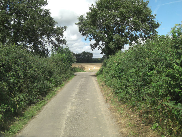
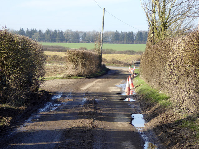
A network of well-maintained footpaths and trails meanders through the copse, allowing visitors to explore its enchanting surroundings. These paths offer opportunities for leisurely walks, jogging, and even horseback riding. The copse is also home to a variety of wildlife, including deer, foxes, badgers, and numerous bird species, making it a haven for nature lovers and birdwatchers.

In addition to its natural allure, Bedlam's Copse holds historical significance. It is believed that the copse served as a hiding place for local villagers during the English Civil War in the 17th century. The name "Bedlam's Copse" is derived from the archaic term "bedlam," meaning a place of chaos or madness, possibly alluding to the turbulent times of the war.

Overall, Bedlam's Copse in Hampshire is a captivating woodland that offers a sanctuary for both nature and history enthusiasts. With its lush vegetation, well-maintained trails, and abundant wildlife, it provides a serene and captivating experience for all who visit.

If you have any feedback on the listing, please let us know in the comments section below.

Bedlam's Copse Images

Images are sourced within 2km of 51.248454/-1.4091854 or Grid Reference SU4150. Thanks to Geograph Open Source API. All images are credited.

Farmland, St Mary Bourne A well reinstated footpath through barley to the west of Upper Wyke.
Farmland, St Mary Bourne
A well reinstated footpath through barley to the west of Upper Wyke.
St. Mary Bourne: Trinley Wood
Farmland, St Mary Bourne A field of wheat with the well reinstated (and much straightened) footpath heading towards Upper Wyke.
Farmland, St Mary Bourne
A field of wheat with the well reinstated (and much straightened) footpath heading towards Upper Wyke.
Entrance to The Trinley Estate The notice boards list various do's and don'ts, as well as enumerating eco-farming practices carried out on the estate.
Entrance to The Trinley Estate
The notice boards list various do's and don'ts, as well as enumerating eco-farming practices carried out on the estate.
Un-named lane junction with Stoke Road
Badly pot-holed lane Not typical of the rest of the lane, just this stretch suffered somewhat before meeting the main road.
Badly pot-holed lane
Not typical of the rest of the lane, just this stretch suffered somewhat before meeting the main road.
Watercress beds
Watercress beds
View across watercress beds
Farmland, St Mary Bourne Barley to the south of Lower Wyke.
Farmland, St Mary Bourne
Barley to the south of Lower Wyke.
Farmland, St Mary Bourne Barley beside the Test Way near Lower Wyke.
Farmland, St Mary Bourne
Barley beside the Test Way near Lower Wyke.
Myrtle Cottage, St Mary Bourne, Hampshire C18. One storey and attic, 2 windows at the ground floor. Thatched roof, hipped at the west end, half-hipped at the east. The timber frame is exposed mainly in the upper part, bricknogged; other walling is of flint with brick quoins. Small casements. Boarded door in solid frame.

(Source:Historic England)
Myrtle Cottage, St Mary Bourne, Hampshire
C18. One storey and attic, 2 windows at the ground floor. Thatched roof, hipped at the west end, half-hipped at the east. The timber frame is exposed mainly in the upper part, bricknogged; other walling is of flint with brick quoins. Small casements. Boarded door in solid frame. (Source:Historic England)
Village houses, St Mary Bourne, Hampshire
Village house, St Mary Bourne, Hampshire
Bourne Cottage, St Mary Bourne, Hampshire C18, early C19. One storey and attic, 4 windows. Half-hipped thatch roof, 3 eyebrow dormers. Walling of red brickwork in Flemish bond, with a section of flint panels at the east side; the upper gables have exposed framing. Casements. One plain door and another with side windows.

(Source:Historic England)
Bourne Cottage, St Mary Bourne, Hampshire
C18, early C19. One storey and attic, 4 windows. Half-hipped thatch roof, 3 eyebrow dormers. Walling of red brickwork in Flemish bond, with a section of flint panels at the east side; the upper gables have exposed framing. Casements. One plain door and another with side windows. (Source:Historic England)
The Malt House, St Mary Bourne, Hampshire Early C19. Two-storeyed house with a shop front, 3 upper windows. Slate roof, stepped brick eaves. Red brick walling with long and short flint panels, brick plinth, stone cills. Sashes in reveals; the ground floor at the south-east side has an original moulded cornice, frieze and thin pilasters to a shop front which has been made narrower, by the infill of flint and brick walling on the east side. Four-panelled door in a solid frame, with a hood on carved brackets. The easternmost quarter of the front turns at a slight angle, to continue straight along the front of the adjoining building.

(Source:Historic England)
The Malt House, St Mary Bourne, Hampshire
Early C19. Two-storeyed house with a shop front, 3 upper windows. Slate roof, stepped brick eaves. Red brick walling with long and short flint panels, brick plinth, stone cills. Sashes in reveals; the ground floor at the south-east side has an original moulded cornice, frieze and thin pilasters to a shop front which has been made narrower, by the infill of flint and brick walling on the east side. Four-panelled door in a solid frame, with a hood on carved brackets. The easternmost quarter of the front turns at a slight angle, to continue straight along the front of the adjoining building. (Source:Historic England)
Little Thatch, St Mary Bourne, Hampshire C18. One storey and attic, 3 windows. Thatched roof, with eaves raised above the upper windows, which have cills at eaves level. Red brick walling in Flemish bond, cambered ground floor openings, cement plinth. Casements. Two boarded doors in solid frames. The easternmost quarter of the front turns at a slight angle, to continue straight along the front of the adjoining building.

(Source:Historic England)
Little Thatch, St Mary Bourne, Hampshire
C18. One storey and attic, 3 windows. Thatched roof, with eaves raised above the upper windows, which have cills at eaves level. Red brick walling in Flemish bond, cambered ground floor openings, cement plinth. Casements. Two boarded doors in solid frames. The easternmost quarter of the front turns at a slight angle, to continue straight along the front of the adjoining building. (Source:Historic England)
St Peter's Cottage, St Mary Bourne, Hampshire C17. One storey and attic, irregular fenestration. Thatched roof, hipped at the east, half-hipped at the west end, eyebrow to one small dormer. Exposed timber-frame with painted brick infill. Casements. Boarded door on solid frames.

(Source:Historic England)
St Peter's Cottage, St Mary Bourne, Hampshire
C17. One storey and attic, irregular fenestration. Thatched roof, hipped at the east, half-hipped at the west end, eyebrow to one small dormer. Exposed timber-frame with painted brick infill. Casements. Boarded door on solid frames. (Source:Historic England)
Mundays, St Mary Bourne, Hampshire C17, late C18. House at right-angles to the road; one storey and attic, to ground floor windows. Thatched roof, 2 eyebrow dormers. Walling of flint with brick dressings, and also of brickwork, both now painted; some cambered openings. Casements, one sash. Plain doorways. Heavy beams within, and a massive open hearth with a timber bressumer inscribed RHA 1676. Modern extensions on the west end, containing a garage.

(Source:Historic England)
Mundays, St Mary Bourne, Hampshire
C17, late C18. House at right-angles to the road; one storey and attic, to ground floor windows. Thatched roof, 2 eyebrow dormers. Walling of flint with brick dressings, and also of brickwork, both now painted; some cambered openings. Casements, one sash. Plain doorways. Heavy beams within, and a massive open hearth with a timber bressumer inscribed RHA 1676. Modern extensions on the west end, containing a garage. (Source:Historic England)
Show me another place!

Bedlam's Copse is located at Grid Ref: SU4150 (Lat: 51.248454, Lng: -1.4091854)

Administrative County: Hampshire

District: Basingstoke and Deane

Police Authority: Hampshire

What 3 Words

///leader.sonic.biked. Near Andover, Hampshire

Nearby Locations

Bedlam's Copse

Related Wikis

Middle Wyke

Middle Wyke is a hamlet in the Basingstoke and Deane district of Hampshire, England. Its nearest town is Andover, which lies approximately 3.7 miles...

St Mary Bourne

St Mary Bourne is a village and civil parish in the Basingstoke and Deane district of Hampshire, England. It lies on the valley of the Bourne Rivulet,...

Lower Wyke

Lower Wyke is a hamlet in the Basingstoke and Deane district of Hampshire, England. It is in the civil parish of St. Mary Bourne. Its nearest town is...

Stoke, Basingstoke and Deane

Stoke is a small village in northwest Hampshire. At the 2011 Census the population of the village was included in the civil parish of St Mary Bourne....

Hurstbourne railway station

Hurstbourne railway station served the village of Hurstbourne Priors in Hampshire, England. It was on the London and South Western Railway's West of England...

Finkley

Finkley is a hamlet in the Test Valley district of Hampshire, England. The nearest town is Andover, which lies approximately 2.8 miles (4.2 km) south-west...

Binley, Hampshire

Binley is a village in Hampshire, England. The village lies near the A34 road between Whitchurch and Stockbridge. Its nearest town is Whitchurch, which...

Little London, Andover, Hampshire

Little London is a hamlet and civil parish which lies 3.5 miles north of Andover in Hampshire, England. The hamlet is in the parish of Smannell (where...

Nearby Amenities

Located within 500m of 51.248454,-1.4091854
Five Lanes
Place: locality
Source: OS_OpenData_StreetView
Lat/Long: 51.2486903/-1.4109709
Slaughter House
Landuse: farm
Note Retag: CS #48756035
Source: OS_OpenData_StreetView;Bing
Lat/Long: 51.2477904/-1.4089003
Grit Bin
Operator: Hampshire County Council
Lat/Long: 51.2490831/-1.4075378
Turning Loop
Lat/Long: 51.2473069/-1.4084212
Give Way
Direction: backward
Lat/Long: 51.2487247/-1.4111488
Give Way
Direction: forward
Lat/Long: 51.2486932/-1.4110958
Give Way
Direction: backward
Lat/Long: 51.2486365/-1.4109749
Give Way
Direction: backward
Lat/Long: 51.2487871/-1.4108711
The data included in this document is from www.openstreetmap.org. The data is made available under ODbL.

Have you been to Bedlam's Copse?

Leave your review of Bedlam's Copse below (or comments, questions and feedback).