Colliery Plantation

Wood, Forest in Derbyshire Amber Valley

England

Colliery Plantation

Tesco superstore in Alfreton A significant presence in the centre of Alfreton. It looks much like any other Tesco.
Tesco superstore in Alfreton Credit: Bill Boaden

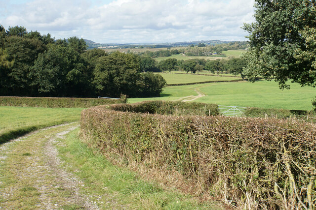
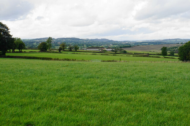
Colliery Plantation is a picturesque woodland located in Derbyshire, England. Situated near the town of Wood, the plantation encompasses an area of approximately 200 acres and is a haven for nature enthusiasts and outdoor lovers.

The plantation is characterized by its dense forest, consisting primarily of oak, beech, and ash trees, which provide a rich habitat for a variety of wildlife. The diverse ecosystem supports an abundance of flora and fauna, including rare species such as the white-letter hairstreak butterfly and the lesser spotted woodpecker.

Visitors to Colliery Plantation can explore a network of well-maintained trails that wind through the woodland, offering a tranquil and serene environment for walking, jogging, or cycling. The paths are clearly marked and range in difficulty, catering to both casual strollers and more experienced hikers.

The plantation also boasts a small lake, which adds to the scenic beauty of the area. The lake is home to various waterfowl, including ducks and swans, providing an idyllic spot for bird watching or a peaceful picnic by the water's edge.

In addition to its natural beauty, Colliery Plantation has historical significance. The area was once a working colliery, or coal mine, during the industrial revolution. Though the mining activity has long ceased, remnants of the past can still be seen, adding a touch of nostalgia and interest to the woodland.

Overall, Colliery Plantation is a hidden gem in Derbyshire, offering a sanctuary for nature lovers, history enthusiasts, and those seeking solace in the great outdoors. With its diverse wildlife, well-maintained trails, and historical charm, it is a must-visit destination for anyone looking to connect with nature and explore the rich heritage of the region.

If you have any feedback on the listing, please let us know in the comments section below.

Colliery Plantation Images

Images are sourced within 2km of 53.088309/-1.3861779 or Grid Reference SK4154. Thanks to Geograph Open Source API. All images are credited.

Tesco superstore in Alfreton A significant presence in the centre of Alfreton. It looks much like any other Tesco.
Tesco superstore in Alfreton
A significant presence in the centre of Alfreton. It looks much like any other Tesco.
The Old Market Square The town received a charter to hold a market in 1252, but the only market activity now is in the nearby market hall.
The Old Market Square
The town received a charter to hold a market in 1252, but the only market activity now is in the nearby market hall.
Church Street, Alfreton Leading to St Martin's Church, and on foot to the countryside beyond.
Church Street, Alfreton
Leading to St Martin's Church, and on foot to the countryside beyond.
Path to Shirland The path follows a farm track down to the valley of Alfreton Brook. The hills behind are the higher ground surrounding Ashover.
Path to Shirland
The path follows a farm track down to the valley of Alfreton Brook. The hills behind are the higher ground surrounding Ashover.
Path to Shirland Following a good farm track with a firm base. The ground slopes down towards Alfreton Brook. Some of the land ahead would be affected by the proposals for a new solar farm.
Path to Shirland
Following a good farm track with a firm base. The ground slopes down towards Alfreton Brook. Some of the land ahead would be affected by the proposals for a new solar farm.
Path to Alfreton There is a steady gentle climb to get to St Martin's Church, which is the first part of Alfreton that you reach.
Path to Alfreton
There is a steady gentle climb to get to St Martin's Church, which is the first part of Alfreton that you reach.
Farmland north west of Alfreton This view will be severely affected by the proposed solar farm on the farmland.
Farmland north west of Alfreton
This view will be severely affected by the proposed solar farm on the farmland.
Crossroads Tavern A pub towards the eastern end of Alfreton's High Street. It is situated on a crossroads.
Crossroads Tavern
A pub towards the eastern end of Alfreton's High Street. It is situated on a crossroads.
High Street, Alfreton The traffic is not always as busy as this.
High Street, Alfreton
The traffic is not always as busy as this.
Institute Lane, Alfreton Now part of the pedestrianised precinct.
Institute Lane, Alfreton
Now part of the pedestrianised precinct.
Bus station in Alfreton
Alfreton Cemetery
Alfreton Cemetery
Alfreton Cemetery
Alfreton Cemetery
Crane hire depot The western end of Meadow Lane Industrial Estate. You can see the cranes from the surrounding countryside in the valley of Alfreton Brook.
Crane hire depot
The western end of Meadow Lane Industrial Estate. You can see the cranes from the surrounding countryside in the valley of Alfreton Brook.
Alfreton Sewage Treatment Works A necessary facility sited by Alfreton Brook.
Alfreton Sewage Treatment Works
A necessary facility sited by Alfreton Brook.
Alfreton railway station Viewed from Mansfield Road as evening approaches. The station is a kilometre away from the town centre.
Alfreton railway station
Viewed from Mansfield Road as evening approaches. The station is a kilometre away from the town centre.
Part of an industrial estate in Alfreton, Derbyshire The unit ahead is leased by Mountain Outfitters as a factory shop for Rab and Lowe Alpine outdoor gear and stocks sleeping bags and down jackets and the like at around 50% discounted prices compared to the high street retailers.
Part of an industrial estate in Alfreton, Derbyshire
The unit ahead is leased by Mountain Outfitters as a factory shop for Rab and Lowe Alpine outdoor gear and stocks sleeping bags and down jackets and the like at around 50% discounted prices compared to the high street retailers.
Industrial unit on an estate in Alfreton Mountain Outfitters retail Rab and Lowe Alpine products here and manufacture them next door I believe.
Industrial unit on an estate in Alfreton
Mountain Outfitters retail Rab and Lowe Alpine products here and manufacture them next door I believe.
Show me another place!

Colliery Plantation is located at Grid Ref: SK4154 (Lat: 53.088309, Lng: -1.3861779)

Administrative County: Derbyshire

District: Amber Valley

Police Authority: Derbyshire

What 3 Words

///tent.reds.fall. Near Alfreton, Derbyshire

Related Wikis

David Nieper Academy

David Nieper Academy is a co-educational secondary school and sixth form located in Alfreton in the English county of Derbyshire. == History == The school...

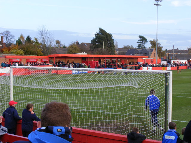
North Street (stadium)

North Street, currently known as the Impact Arena for sponsorship purposes, is a football stadium in Alfreton, Derbyshire, England. It is the home of Alfreton...

Alfreton Urban District

Alfreton was an Urban District in Derbyshire, England from 1894 to 1974. It was created under the Local Government Act 1894. It was enlarged in 1935 when...
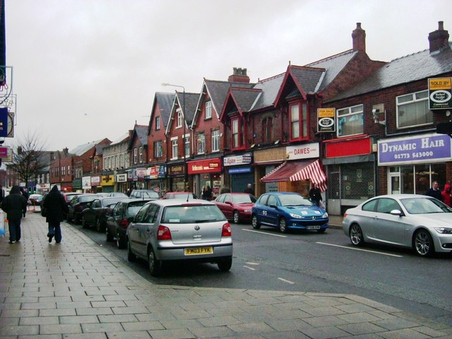
Alfreton

Alfreton ( AL-frih-tən) is a town and civil parish in the Amber Valley district of Derbyshire, England. The town was formerly a Norman Manor and later...

Alfreton War Memorial

Alfreton War Memorial is a 20th-century grade II listed war memorial in Alfreton, Derbyshire. == History == The war memorial was unveiled on 31 July 1927...
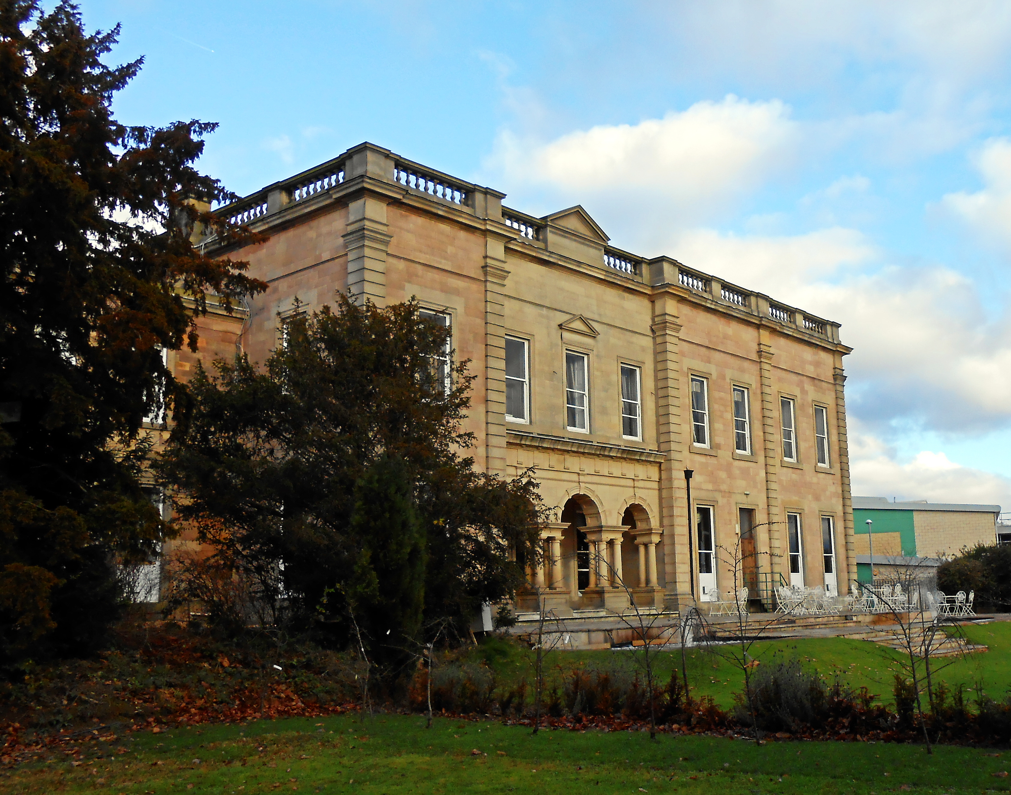
Alfreton Hall

Alfreton Hall is a country house in Alfreton, Derbyshire. It was at the heart of local social and industrial history in the county. The history of the...

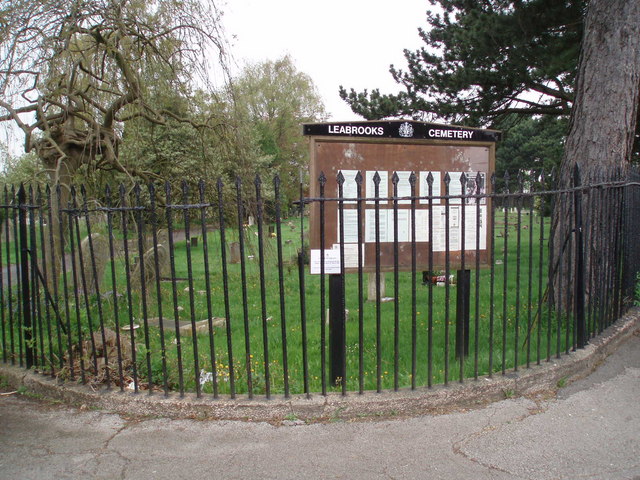
Leabrooks, Derbyshire

Leabrooks is a small urban locality in Derbyshire that merges with the village of Somercotes and the locality of Greenhill Lane. It is named after a stream...

Somercotes

Somercotes is a village and civil parish in the district of Amber Valley in the English county of Derbyshire, close to the border with Nottinghamshire...

Nearby Amenities

Located within 500m of 53.088309,-1.3861779
Motorway Junction
Alfreton Interchange
Lat/Long: 53.0889321/-1.3911102
Turning Circle
Lat/Long: 53.0910153/-1.3908685
Ele: 100
Lat/Long: 53.0884384/-1.3924218
Barrier: cycle_barrier
Lat/Long: 53.0896827/-1.390182
Barrier: stile
Steps: 1
Stile: stepover
Lat/Long: 53.0867241/-1.3857466
Barrier: horse_stile
Lat/Long: 53.0867884/-1.3861392
Barrier: cycle_barrier
Lat/Long: 53.0921024/-1.3891378
Barrier: cycle_barrier
Lat/Long: 53.0921238/-1.3887324
Mini Roundabout
Lat/Long: 53.0857686/-1.3920692
Direction: 165
Generator Method: photovoltaic
Generator Output Electricity: yes
Generator Solar Modules: 16
Generator Source: solar
Generator Type: solar_photovoltaic_panel
Location: roof
Power: generator
Lat/Long: 53.091141/-1.3890724
Direction: 165
Generator Method: photovoltaic
Generator Output Electricity: yes
Generator Solar Modules: 16
Generator Source: solar
Generator Type: solar_photovoltaic_panel
Location: roof
Power: generator
Lat/Long: 53.0910298/-1.3890201
Direction: 165
Generator Method: photovoltaic
Generator Output Electricity: yes
Generator Solar Modules: 16
Generator Source: solar
Generator Type: solar_photovoltaic_panel
Location: roof
Power: generator
Lat/Long: 53.0909344/-1.3889759
Direction: 170
Generator Method: photovoltaic
Generator Output Electricity: yes
Generator Solar Modules: 16
Generator Source: solar
Generator Type: solar_photovoltaic_panel
Location: roof
Note: possibly 18 modules
Power: generator
Lat/Long: 53.0907767/-1.3892615
Direction: 165
Generator Method: photovoltaic
Generator Output Electricity: yes
Generator Solar Modules: 16
Generator Source: solar
Generator Type: solar_photovoltaic_panel
Location: roof
Power: generator
Lat/Long: 53.0909844/-1.3885112
Direction: 165
Generator Method: photovoltaic
Generator Output Electricity: yes
Generator Solar Modules: 16
Generator Source: solar
Generator Type: solar_photovoltaic_panel
Location: roof
Power: generator
Lat/Long: 53.0914744/-1.3887358
Parking
Access: private
Lat/Long: 53.0884297/-1.3888481
Direction: 170
Generator Method: photovoltaic
Generator Output Electricity: yes
Generator Solar Modules: 16
Generator Source: solar
Generator Type: solar_photovoltaic_panel
Location: roof
Power: generator
Lat/Long: 53.089917/-1.3908866
Direction: 170
Generator Method: photovoltaic
Generator Output Electricity: yes
Generator Solar Modules: 12
Generator Source: solar
Generator Type: solar_photovoltaic_panel
Location: roof
Power: generator
Lat/Long: 53.0898779/-1.3910321
Direction: 170
Generator Method: photovoltaic
Generator Output Electricity: yes
Generator Solar Modules: 12
Generator Source: solar
Generator Type: solar_photovoltaic_panel
Location: roof
Power: generator
Lat/Long: 53.0899605/-1.3905902
Direction: 80
Generator Method: photovoltaic
Generator Output Electricity: yes
Generator Solar Modules: 10
Generator Source: solar
Generator Type: solar_photovoltaic_panel
Location: roof
Power: generator
Lat/Long: 53.089958/-1.3901255
Direction: 260
Generator Method: photovoltaic
Generator Output Electricity: yes
Generator Solar Modules: 10
Generator Source: solar
Generator Type: solar_photovoltaic_panel
Location: roof
Power: generator
Lat/Long: 53.0899508/-1.3901912
Direction: 170
Generator Method: photovoltaic
Generator Output Electricity: yes
Generator Solar Modules: 10
Generator Source: solar
Generator Type: solar_photovoltaic_panel
Location: roof
Power: generator
Lat/Long: 53.0895567/-1.3910797
Direction: 170
Generator Method: photovoltaic
Generator Output Electricity: yes
Generator Solar Modules: 16
Generator Source: solar
Generator Type: solar_photovoltaic_panel
Location: roof
Power: generator
Lat/Long: 53.0895/-1.3915424
Direction: 170
Generator Method: photovoltaic
Generator Output Electricity: yes
Generator Solar Modules: 16
Generator Source: solar
Generator Type: solar_photovoltaic_panel
Location: roof
Power: generator
Lat/Long: 53.0894911/-1.3916215
The data included in this document is from www.openstreetmap.org. The data is made available under ODbL.

Have you been to Colliery Plantation?

Leave your review of Colliery Plantation below (or comments, questions and feedback).