Doomsday Green

Settlement in Sussex Horsham

England

Doomsday Green

Inholms Gill A tributary of the River Arun that rises in St Leonard's Forest.
Inholms Gill Credit: Simon Carey

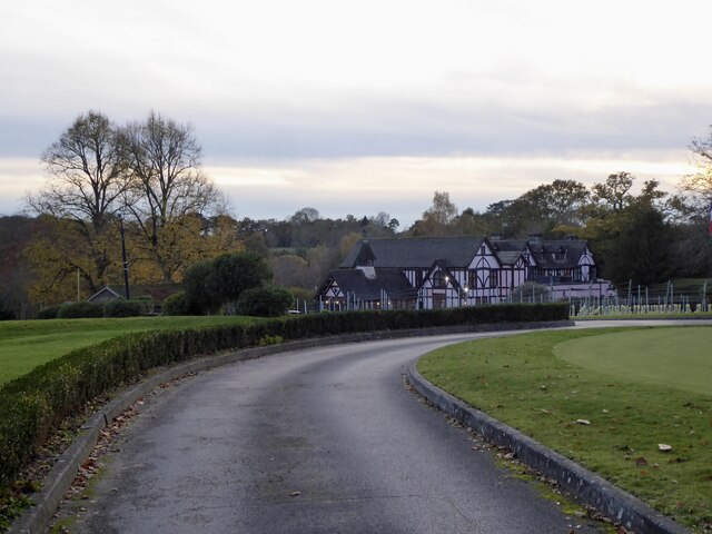
Doomsday Green is a small village located in the county of Sussex, England. Situated amidst the picturesque countryside, it is known for its idyllic setting and tranquil atmosphere. With a population of around 500 residents, the village exudes a sense of tight-knit community and traditional values.

The village takes its name from a historic event that occurred in the 12th century when a devastating plague wreaked havoc on the local population. Legend has it that the village was spared from complete annihilation, hence the name "Doomsday Green."

The village is predominantly residential, with a few small businesses catering to the needs of the locals. The architecture of Doomsday Green reflects its rich history, with charming cottages and stone houses lining the streets. The village church, St. Mary's, stands as a prominent landmark, its spire visible from afar.

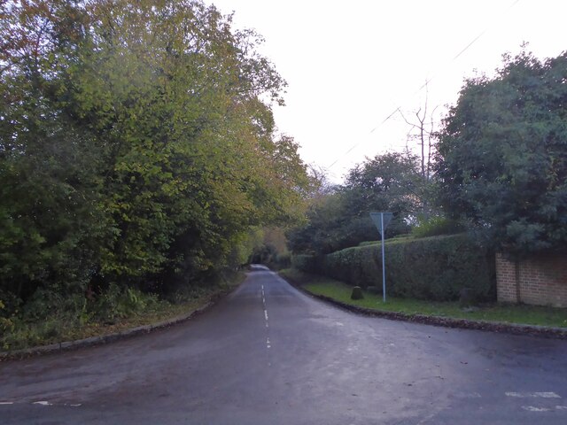
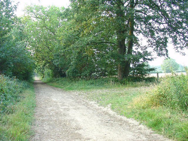
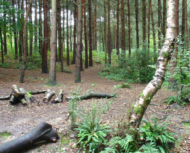
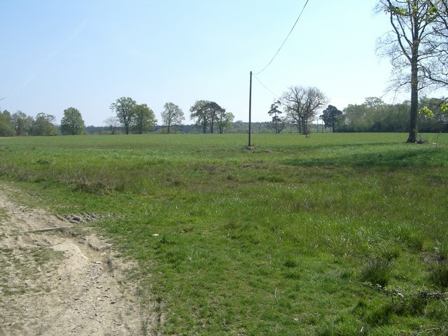
Surrounded by lush green fields and rolling hills, Doomsday Green offers ample opportunities for outdoor activities. The village is a haven for nature lovers and hikers, with several walking trails that showcase the area's natural beauty. The village also boasts a small park with a playground, perfect for families with young children.

Although Doomsday Green lacks major amenities, it is within easy reach of larger towns and cities, making it an ideal place for those seeking a peaceful retreat while still having access to urban facilities. Overall, Doomsday Green offers a charming slice of rural life in the heart of Sussex, where history and natural beauty converge.

If you have any feedback on the listing, please let us know in the comments section below.

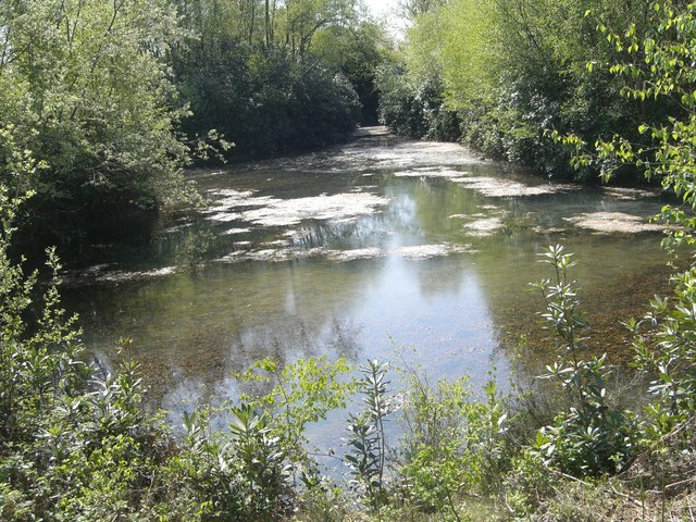
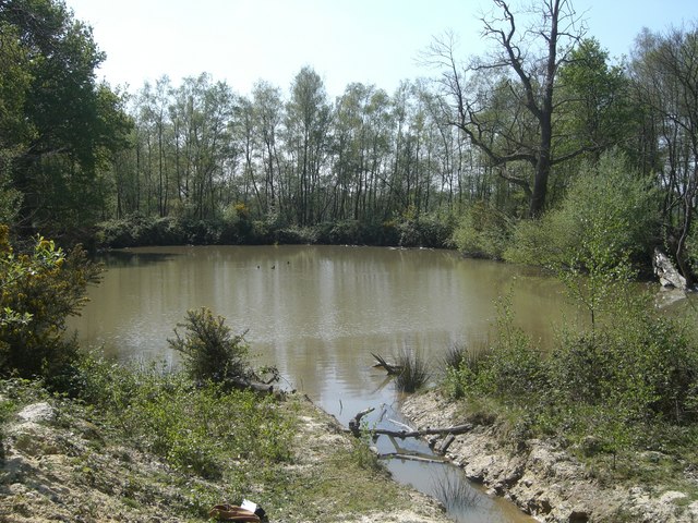
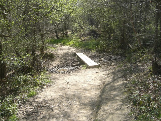
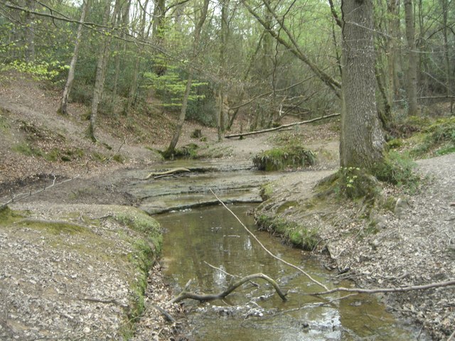
Doomsday Green Images

Images are sourced within 2km of 51.055119/-0.300601 or Grid Reference TQ1929. Thanks to Geograph Open Source API. All images are credited.

Inholms Gill A tributary of the River Arun that rises in St Leonard's Forest.
Inholms Gill
A tributary of the River Arun that rises in St Leonard's Forest.
Track, St Leonard's Forest The surfaced track heads north from the car park on Hammerpond Road to Mick's Cross.
Track, St Leonard's Forest
The surfaced track heads north from the car park on Hammerpond Road to Mick's Cross.
Club House, Mannings Heath Golf Course Opened in 1905 the site contains 36 holes spread over two courses; Waterfall, the original course, and Kingfisher.
Club House, Mannings Heath Golf Course
Opened in 1905 the site contains 36 holes spread over two courses; Waterfall, the original course, and Kingfisher.
Goldings Lane Viewed from the junction with Hammerpond Road. The lane heads south to Mannings Heath.
Goldings Lane
Viewed from the junction with Hammerpond Road. The lane heads south to Mannings Heath.
Rural Bridleway near Horsham, West Sussex This bridleway runs up a straight avenue of trees that cuts across the old St. Leonards estate from a gate lodge on the public road to the "Big House". Offered a very pleasant cycle ride on the day of the photo! Photo taken looking N along the avenue. Corn fields can be seen on the other side of the trees on the right.
Rural Bridleway near Horsham, West Sussex
This bridleway runs up a straight avenue of trees that cuts across the old St. Leonards estate from a gate lodge on the public road to the "Big House". Offered a very pleasant cycle ride on the day of the photo! Photo taken looking N along the avenue. Corn fields can be seen on the other side of the trees on the right.
Stew Pond, adjacent to bridleway, St Leonards Park Estate, Near Horsham, West Sussex. The original purpose of this pond (and an adjacent pond) is not obvious, but its proximity to the main estate buildings may mean that it was used as water storage or a fish pond to supply the estate. Relatively overgrown and unused these days!
Stew Pond, adjacent to bridleway, St Leonards Park Estate, Near Horsham, West Sussex.
The original purpose of this pond (and an adjacent pond) is not obvious, but its proximity to the main estate buildings may mean that it was used as water storage or a fish pond to supply the estate. Relatively overgrown and unused these days!
Owlbeech Woods, Horsham, West Sussex Mixed woodland. The part shown is a coniferous plantation. The woods join on to Leechpool woods <a href="https://www.geograph.org.uk/gridref/TQ1931">TQ1931</a>. Owned an run by Horsham District Council, who permit general public access.
Owlbeech Woods, Horsham, West Sussex
Mixed woodland. The part shown is a coniferous plantation. The woods join on to Leechpool woods TQ1931. Owned an run by Horsham District Council, who permit general public access.
Motocross track near to Horsham, West Sussex A view facing roughly north of the start line, with St. Leonard's forest in the background.
Motocross track near to Horsham, West Sussex
A view facing roughly north of the start line, with St. Leonard's forest in the background.
Turf  Plain Turf Plain looking to the south east.  The ground dips just beyond the trees to Sheepwash Ghyll and then rises to Scragged Oak Hill in St Leonard's Forest.
Bottom left of the picture passes the High Weald Landscape Trail.
Turf Plain
Turf Plain looking to the south east. The ground dips just beyond the trees to Sheepwash Ghyll and then rises to Scragged Oak Hill in St Leonard's Forest. Bottom left of the picture passes the High Weald Landscape Trail.
Turf Plain Lodge The ground floor pattern of Turf Plain Lodge can be clearly seen.  The High Weald Landscape Trail passes just beyond the remains.
Turf Plain Lodge
The ground floor pattern of Turf Plain Lodge can be clearly seen. The High Weald Landscape Trail passes just beyond the remains.
Turf Plain pond One of several ponds on Turf Plain.  This one feeds to a commercial fishery.
Turf Plain pond
One of several ponds on Turf Plain. This one feeds to a commercial fishery.
Pond on Turf  Plain Another pond on Turf Plain, this one drains a nearby motocross circuit.
Pond on Turf Plain
Another pond on Turf Plain, this one drains a nearby motocross circuit.
Plank bridge by Sheepwash Ghyll A small stream runs down to Sheepwash ghyll and is crossed by this two plank bridge.
Plank bridge by Sheepwash Ghyll
A small stream runs down to Sheepwash ghyll and is crossed by this two plank bridge.
Ford across Sheepwash Ghyll, Lower Beeding A slab of 'Horsham stone' in the bed of Sheepwash Ghyll provides a shallow ford and a small waterfall for the footpath as it heads east up Scragged Oak Hill.
Sheepwash Ghyll?
In 1332 Sheepwash farm was the home of Philip atte Shepewash of West Grinstead which adjoins Nuthurst.  However Sheepwash farm is some 6km to the south at TQ184244 and the Ghyll itself after passing through Roosthole flows west under Birchen bridge as the river Arun.
Ford across Sheepwash Ghyll, Lower Beeding
A slab of 'Horsham stone' in the bed of Sheepwash Ghyll provides a shallow ford and a small waterfall for the footpath as it heads east up Scragged Oak Hill. Sheepwash Ghyll? In 1332 Sheepwash farm was the home of Philip atte Shepewash of West Grinstead which adjoins Nuthurst. However Sheepwash farm is some 6km to the south at TQ184244 and the Ghyll itself after passing through Roosthole flows west under Birchen bridge as the river Arun.
Sheepwash  Ghyll, St Leonard's Forest Sheepwash Ghyll has cut a deep ravine running over a base of sandstone often forming small 'waterfalls' as here and providing a ford for the footpath going up Scragged Oak Hill (to the right).
Sheepwash Ghyll flows out of Whitevane Pond, about 1.5km to the north of this photo, through Roosthole Pond and as Goldings stream into (Birchen) Mill Pond.  Flowing out of (Birchen) Mill Pond and under the A281 it emerges as the river Arun on its way to the sea at Littlehampton.
Sheepwash Ghyll, St Leonard's Forest
Sheepwash Ghyll has cut a deep ravine running over a base of sandstone often forming small 'waterfalls' as here and providing a ford for the footpath going up Scragged Oak Hill (to the right). Sheepwash Ghyll flows out of Whitevane Pond, about 1.5km to the north of this photo, through Roosthole Pond and as Goldings stream into (Birchen) Mill Pond. Flowing out of (Birchen) Mill Pond and under the A281 it emerges as the river Arun on its way to the sea at Littlehampton.
Entrance to Laurel Walk, St Leonard's Forest The cast iron gate posts and four bar iron gate show this was once a more formal way to Laurel Walk and so to Laurel Walk Wood and was once part of St Leonard's Park.
A footpath from the West Sussex County Council stile, but cyclists can whip round the tree to the left.
Entrance to Laurel Walk, St Leonard's Forest
The cast iron gate posts and four bar iron gate show this was once a more formal way to Laurel Walk and so to Laurel Walk Wood and was once part of St Leonard's Park. A footpath from the West Sussex County Council stile, but cyclists can whip round the tree to the left.
St Leonards Park St Leonards Park, a grade II* Georgian building, recently a care home, now divided into a number of luxurious apartments.
The occupants of the house were responsible for the nearby landscape touches; one such occupant in 1881 being John Aldridge JP, Colonel in Militia (RG11 1108 f116).
St Leonards Park
St Leonards Park, a grade II* Georgian building, recently a care home, now divided into a number of luxurious apartments. The occupants of the house were responsible for the nearby landscape touches; one such occupant in 1881 being John Aldridge JP, Colonel in Militia (RG11 1108 f116).
St  Leonards Park House From 'The buildings of England, Sussex' by Ian Nairn and Nikolaus Pevsner: ...all c.1840, still classical - e.g. the third storey with pediment and the porte-cochère ... underneath the centre seems late C18.

A grade II* listed building, St Leonards Park House, was recently a nursing home but has now been converted into apartments.
St Leonards Park House
From 'The buildings of England, Sussex' by Ian Nairn and Nikolaus Pevsner: ...all c.1840, still classical - e.g. the third storey with pediment and the porte-cochère ... underneath the centre seems late C18. A grade II* listed building, St Leonards Park House, was recently a nursing home but has now been converted into apartments.
Show me another place!

Doomsday Green is located at Grid Ref: TQ1929 (Lat: 51.055119, Lng: -0.300601)

Administrative County: West Sussex

District: Horsham

Police Authority: Sussex

What 3 Words

///winks.sushi.caged. Near Horsham, West Sussex

Related Wikis

Horsham Riverside (electoral division)

Horsham Riverside is an electoral division of West Sussex in the United Kingdom and returns one member to sit on West Sussex County Council. == Extent... ==

The Forest School, Horsham

The Forest School is a comprehensive secondary school in Horsham, West Sussex, England. It educates students between the ages of 11 and 16 and is a specialist...

Millais School

Millais School is a girls' secondary school for students aged 11–16 in Horsham, West Sussex, England. There is no sixth form. The number on roll is over...

St Leonard's Park Ponds

St Leonard's Park Ponds is a 3.9-hectare (9.6-acre) biological Site of Special Scientific Interest east of Horsham in West Sussex.These ponds and adjacent...

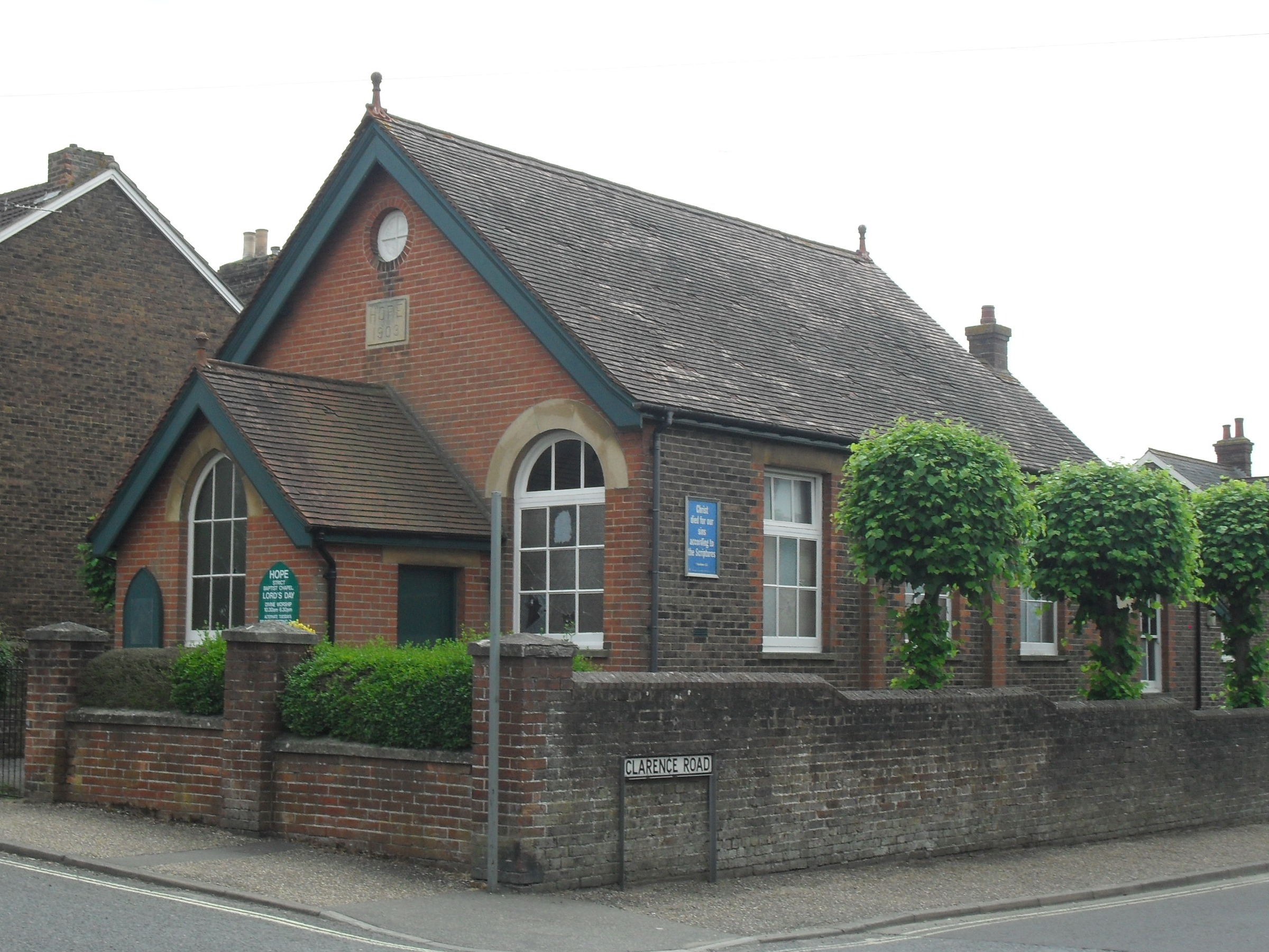
Hope Chapel, Horsham

The Hope Chapel is a Strict Baptist place of worship in the town of Horsham in the English county of West Sussex. The chapel was built in 1903. Horsham...
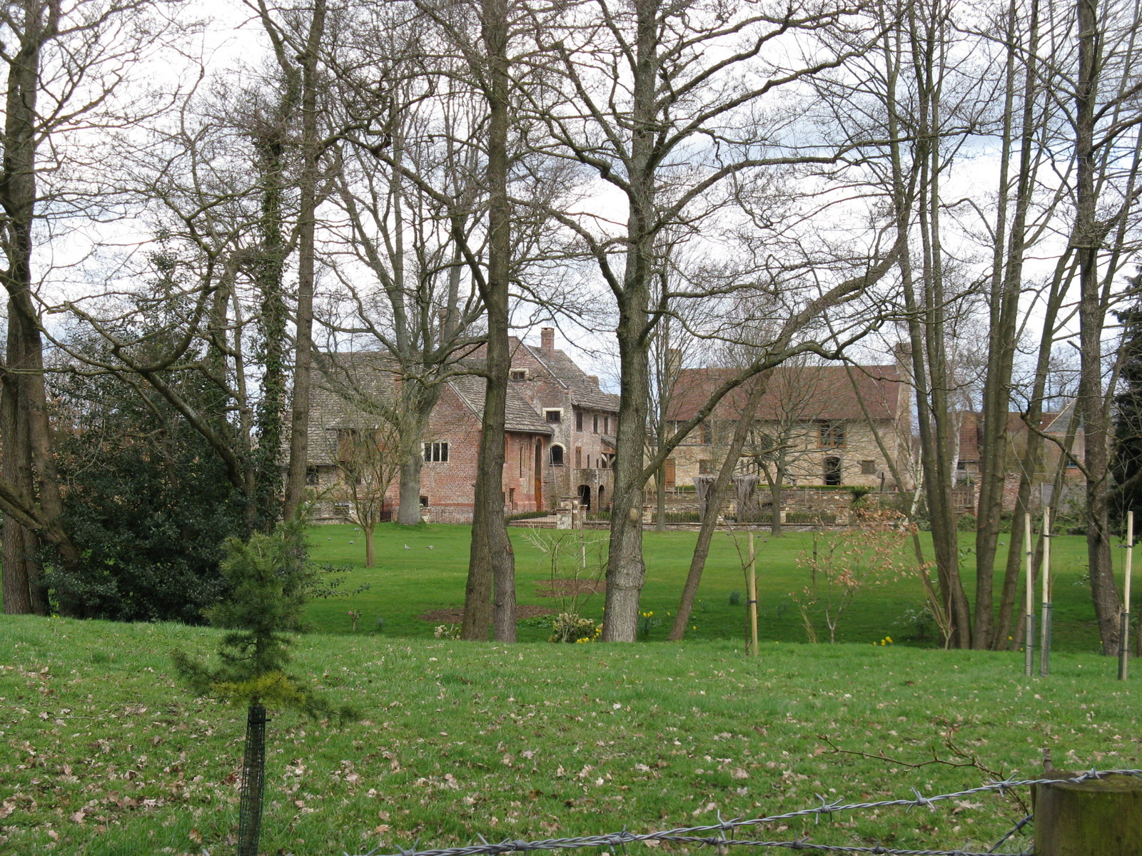
Chesworth House

Chesworth House is a former Tudor manor house, located a mile south of Horsham, West Sussex, England. The original Manor house became a farmhouse and has...

Horsham YMCA F.C.

Horsham YMCA is a football club based in Horsham, West Sussex, England. They are currently members of the Southern Combination Premier Division and play...

Mannings Heath

Mannings Heath is a village in the civil parish of Nuthurst and the Horsham District of West Sussex, England. The village is on the A281 road, 2 miles...

Nearby Amenities

Located within 500m of 51.055119,-0.300601
Huxleys Bird of Prey Centre
Addr City: Horsham
Addr Postcode: RH13 6QA
Addr Street: Brighton Road
Tourism: yes
Lat/Long: 51.053086/-0.30481
Addr City: Horsham
Addr Housenumber: 7
Addr Postcode: RH13 6AZ
Addr Street: Brambling Close
Lat/Long: 51.0577526/-0.3013825
Addr City: Horsham
Addr Housenumber: 9
Addr Postcode: RH13 6AZ
Addr Street: Brambling Close
Lat/Long: 51.0576949/-0.3013789
Addr City: Horsham
Addr Housenumber: 11
Addr Postcode: RH13 6AZ
Addr Street: Brambling Close
Lat/Long: 51.057341/-0.301345
Addr City: Horsham
Addr Housenumber: 13
Addr Postcode: RH13 6AZ
Addr Street: Brambling Close
Lat/Long: 51.0573026/-0.3013483
Doomsday Green
Place: hamlet
Lat/Long: 51.055531/-0.2976571
A & R Bailey's
Addr City: Horsham
Addr Postcode: RH13 6QA
Addr Street: Brighton Road
Fhrs Id: 876661
Shop: butcher
Lat/Long: 51.0535332/-0.3066342
Entrance: yes
Lat/Long: 51.0535489/-0.3064217
Entrance: yes
Lat/Long: 51.0536111/-0.3061872
Coolhurst
Place: hamlet
Lat/Long: 51.0537627/-0.2961195
Addr City: Horsham
Addr Housename: The Folly, Coolhurst House
Addr Postcode: RH13 6PL
Addr Street: Manor Lane
Lat/Long: 51.053674/-0.2961611
Bus Stop
The Hornbrook Inn
Bus: yes
Naptan AtcoCode: 4400HO0244
Naptan Bearing: E
Naptan BusStopType: MKD
Naptan CommonName: The Hornbrook Inn
Naptan Indicator: opp
Naptan Landmark: The Hornbrook Inn
Naptan NaptanCode: wsxatdgp
Naptan Street: A281 Brighton Road
Naptan Verified: no
Public Transport: platform
Source: naptan_import
Lat/Long: 51.0543289/-0.3076252
Hornbrook Farm
Place: isolated_dwelling
Lat/Long: 51.0546695/-0.3073638
The data included in this document is from www.openstreetmap.org. The data is made available under ODbL.

Have you been to Doomsday Green?

Leave your review of Doomsday Green below (or comments, questions and feedback).