Birley Spa Wood

Wood, Forest in Derbyshire

England

Birley Spa Wood

A6135 Moor Valley, at Moor Valley Close
A6135 Moor Valley, at Moor Valley Close Credit: Colin Pyle

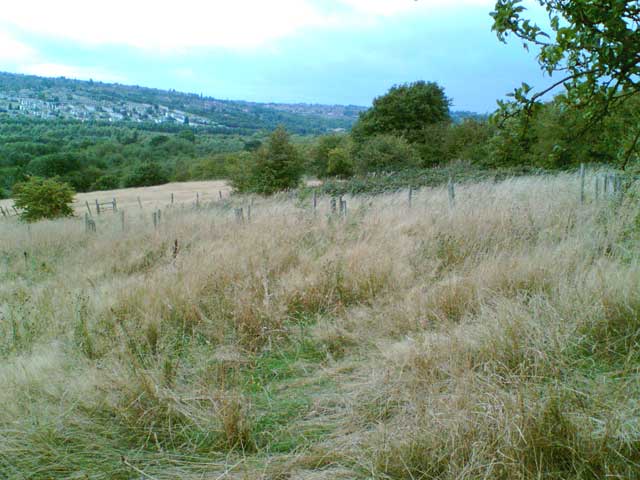
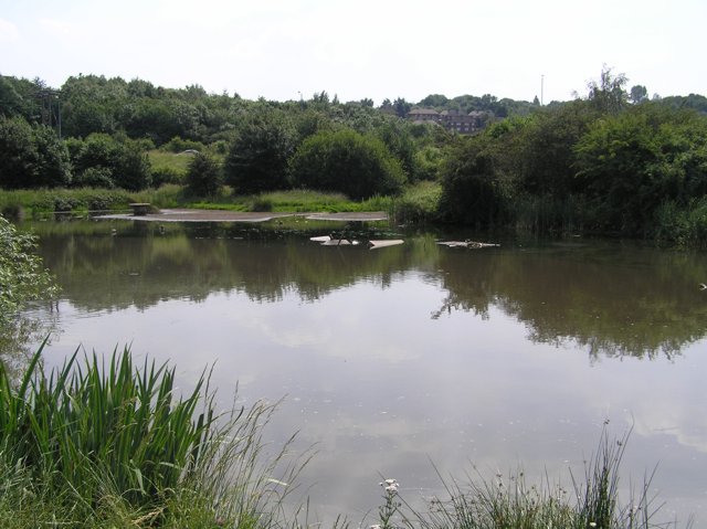
Birley Spa Wood is a picturesque woodland located in the county of Derbyshire, England. Covering an area of approximately 24 hectares, it is situated near the village of Birley, about 10 kilometers east of Sheffield. The wood is part of the larger Birley Spa area, which also includes a historic spa site and a golf course.

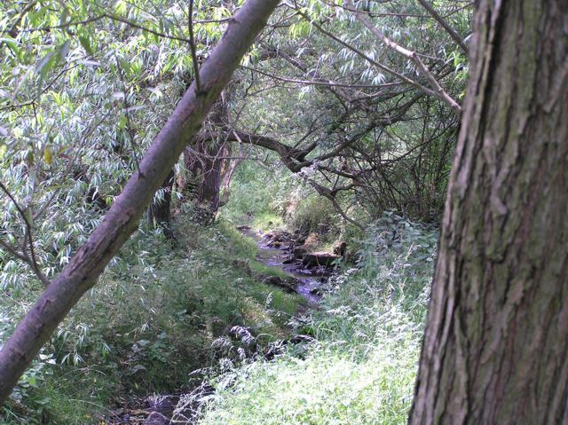
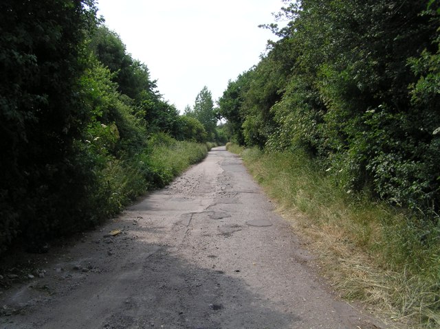
The woodland is predominantly composed of native broadleaf trees, such as oak, birch, and beech, creating a diverse and vibrant ecosystem. The forest floor is carpeted with a variety of wildflowers and ferns, adding to the beauty of the surroundings. The wood is intersected by several footpaths, allowing visitors to explore its enchanting trails.

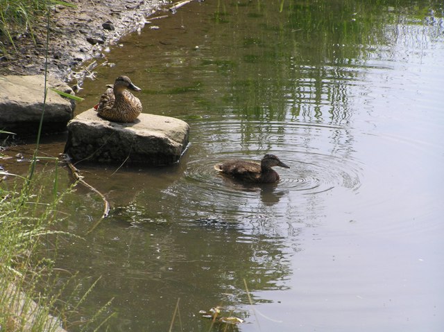
Birley Spa Wood is home to a rich array of wildlife, including numerous bird species like woodpeckers, owls, and warblers. Small mammals like squirrels and rabbits can also be spotted in the area. The wood provides a vital habitat for these creatures, as well as a peaceful retreat for nature enthusiasts and walkers.

The woodland is well-maintained by the local authorities, ensuring that it remains a sanctuary for both flora and fauna. Regular conservation efforts are carried out to protect the natural biodiversity of the area. Birley Spa Wood is a popular destination for both locals and tourists, offering a tranquil escape from the hustle and bustle of city life.

Overall, Birley Spa Wood is a charming and diverse woodland, offering visitors the chance to immerse themselves in nature and experience the beauty of Derbyshire's countryside.

If you have any feedback on the listing, please let us know in the comments section below.

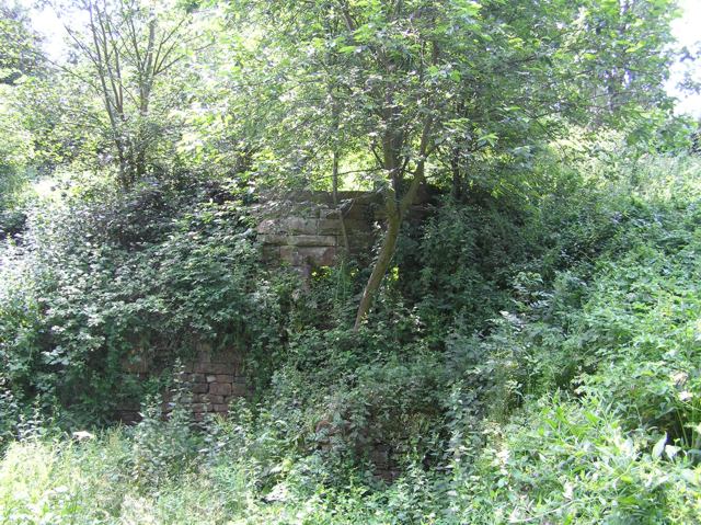
Birley Spa Wood Images

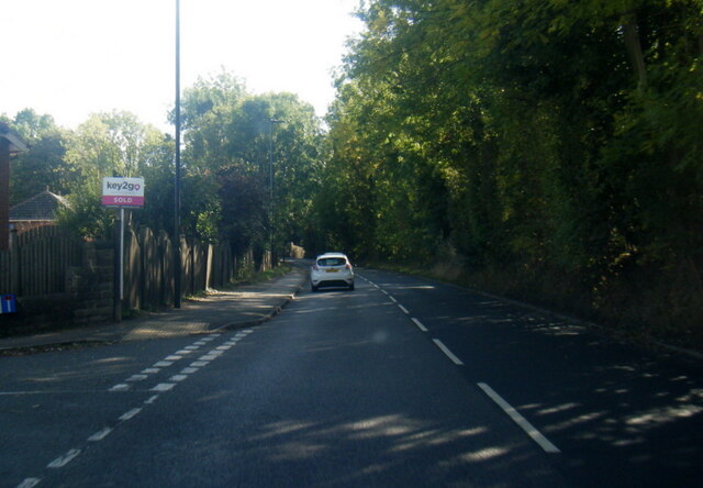
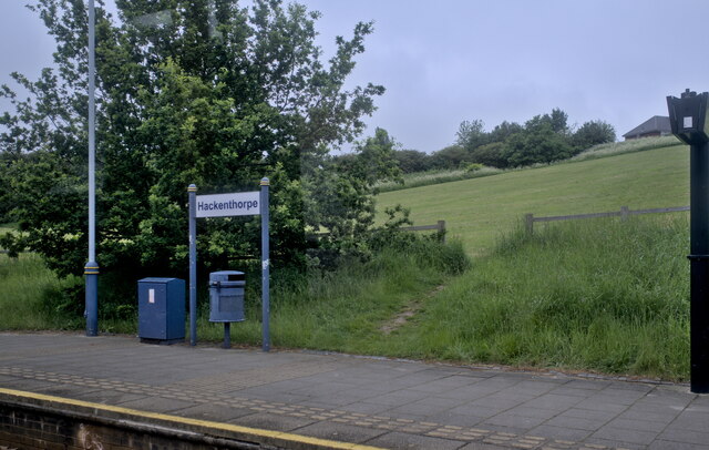
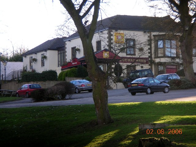
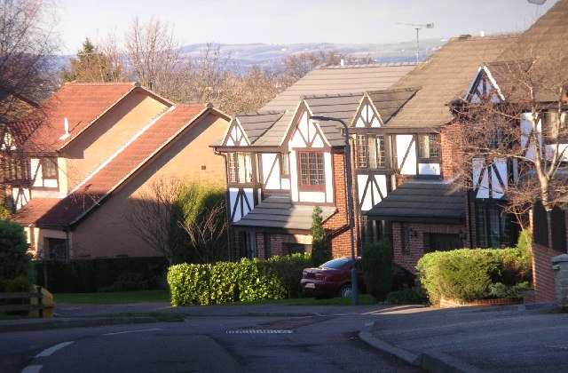
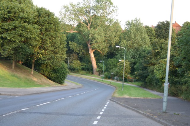
Images are sourced within 2km of 53.347881/-1.3874596 or Grid Reference SK4083. Thanks to Geograph Open Source API. All images are credited.

A6135 Moor Valley, at Moor Valley Close
Hackenthorpe tram stop
Entrance path to Woodhouse Health Centre
Shirebrook Nature Reserve taken at Shirebrook Nature Reserve, near the Visitor Centre
Shirebrook Nature Reserve
taken at Shirebrook Nature Reserve, near the Visitor Centre
Shirebrook Nature Reserve Photo taken on the path outside the Visitor Centre.
Shirebrook Nature Reserve
Photo taken on the path outside the Visitor Centre.
Shirebrook Nature Reserve At Sally Clarke's Meadow looking east.
Shirebrook Nature Reserve
At Sally Clarke's Meadow looking east.
Transpennine Trail By the Transppennine Trail at Sally Clarke's Meadow, Shirebrook Nature Reserve.
Transpennine Trail
By the Transppennine Trail at Sally Clarke's Meadow, Shirebrook Nature Reserve.
Ridgeway Arms, Mosborough Moor, Nr Sheffield.
Parkgate Drive, off Quarry Hill, near Ridgeway.
Shops, Beighton Road, Woodhouse At the top of Beighton Road in Woodhouse stands a row of shops. The road down to the left goes past the railway station and on down to Woodhouse Mill.
Shops, Beighton Road, Woodhouse
At the top of Beighton Road in Woodhouse stands a row of shops. The road down to the left goes past the railway station and on down to Woodhouse Mill.
Beaver Hill Road, Woodhouse From outside the fire service training centre <a href="https://www.geograph.org.uk/photo/193087">SK4185 : South Yorkshire Fire Training School</a>, this image looks down Beaver Hill Road towards Woodhouse. In the bottom, just visible is the bridge crossing Shirtcliff Brook.
Beaver Hill Road, Woodhouse
From outside the fire service training centre SK4185 : South Yorkshire Fire Training School, this image looks down Beaver Hill Road towards Woodhouse. In the bottom, just visible is the bridge crossing Shirtcliff Brook.
Carr Forge Dam In the Shirebrook Valley below Woodhouse were several waterwheels, possibly dating back to Tudor times, and part of Sheffield's early industrial heritage. This shows Carr Forge Dam with the water levels lower than usual because of the prolonged dry spell. The Shire Brook was in times past the border between the ancient kingdoms of Mercia and Northumbria and more lately between Yorkshire and Derbyshire, hence the name Shire Brook.
Carr Forge Dam
In the Shirebrook Valley below Woodhouse were several waterwheels, possibly dating back to Tudor times, and part of Sheffield's early industrial heritage. This shows Carr Forge Dam with the water levels lower than usual because of the prolonged dry spell. The Shire Brook was in times past the border between the ancient kingdoms of Mercia and Northumbria and more lately between Yorkshire and Derbyshire, hence the name Shire Brook.
Shire Brook In the Shirebrook Valley, the brook itself fed several waterwheels in times past including <a href="https://www.geograph.org.uk/photo/194486">SK4184 : Carr Forge Dam</a>.
Shire Brook
In the Shirebrook Valley, the brook itself fed several waterwheels in times past including SK4184 : Carr Forge Dam.
Stone Lane, Woodhouse This road once served the sewage works and Badger Tools. Both have now gone, but the sewage works buildings have been converted into buildings for the Shirebrook Valley Nature Reserve. The end of the road (behind me) seems to be a place where old cars go to die, or be burned out by the local yoofs. The speed ramps are probably there to stop the yoofs damaging themselves too much when the cars are crashed into the gates at the end.
Stone Lane, Woodhouse
This road once served the sewage works and Badger Tools. Both have now gone, but the sewage works buildings have been converted into buildings for the Shirebrook Valley Nature Reserve. The end of the road (behind me) seems to be a place where old cars go to die, or be burned out by the local yoofs. The speed ramps are probably there to stop the yoofs damaging themselves too much when the cars are crashed into the gates at the end.
Ducks on Carr Forge Dam Since a youngster nearly killed himself when his fishing pole touched overhead live wires a few years ago, fishing on the dam has been banned by order of Sheffield Council, so the ducks have free rein. Here, mummy-duck sits on the stone keeping an eye on youngster. As I cycled past, another five of this year's brood appeared out from under the shelter of the bank.
Ducks on Carr Forge Dam
Since a youngster nearly killed himself when his fishing pole touched overhead live wires a few years ago, fishing on the dam has been banned by order of Sheffield Council, so the ducks have free rein. Here, mummy-duck sits on the stone keeping an eye on youngster. As I cycled past, another five of this year's brood appeared out from under the shelter of the bank.
Houses on Scowerdons estate Can't really say much more. This is the bottom end of Hackenthorpe, the opposite side of the Shirebrook Valley to Woodhouse and Beighton.
Houses on Scowerdons estate
Can't really say much more. This is the bottom end of Hackenthorpe, the opposite side of the Shirebrook Valley to Woodhouse and Beighton.
Remains of Nether Wheel, Woodhouse Along with <a href="https://www.geograph.org.uk/photo/194486">SK4184 : Carr Forge Dam</a>, the Nether Wheel was yet another of the waterwheels along the Shirebrook Valley. This one still has visible remains of the buildings, buried in woodland although accessible by waymarked footpaths. This wheel probably drove grinding stones or similar for the manufacture of agricultural tools.
Remains of Nether Wheel, Woodhouse
Along with SK4184 : Carr Forge Dam, the Nether Wheel was yet another of the waterwheels along the Shirebrook Valley. This one still has visible remains of the buildings, buried in woodland although accessible by waymarked footpaths. This wheel probably drove grinding stones or similar for the manufacture of agricultural tools.
Police Station, Mosborough Close to Crystal Peaks is the new police station which replaced the old Hackenthorpe nick.
Police Station, Mosborough
Close to Crystal Peaks is the new police station which replaced the old Hackenthorpe nick.
Show me another place!

Birley Spa Wood is located at Grid Ref: SK4083 (Lat: 53.347881, Lng: -1.3874596)

Unitary Authority: Sheffield

Police Authority: South Yorkshire

What 3 Words

///chief.scout.trails. Near Beighton, South Yorkshire

Nearby Locations

Birley Spa Wood Birley

Related Wikis

Birley Spa

Birley Spa is a grade-II listed community bath hall and a Victorian bathhouse in the Hackenthorpe district of the City of Sheffield, England. == History... ==

Birley

Birley ward — which includes the districts of Base Green, Birley Estate, Charnock, Frecheville, Scowerdons and part of Hackenthorpe — is one of the 28...

Hackenthorpe

Hackenthorpe is a village 5 miles south east of Sheffield’s city centre, now classed as a historic township of the city. Due to much expansion, the village...

Christ Church, Hackenthorpe

Christ Church is a church situated in Hackenthorpe, a suburb of the City of Sheffield. It is located on Sheffield road, and was built in 1899. The church...

Nearby Amenities

Located within 500m of 53.347881,-1.3874596
Birley Spa
Historic: spa
Lat/Long: 53.3479187/-1.3866637
Bus Stop
Wickfield Road/Silkstone Road
Bench: no
Bin: no
Bus: yes
Departures Board: timetable
Naptan AtcoCode: 370021564
Naptan Bearing: N
Naptan CommonName: Wickfield Road/Silkstone Road
Naptan Indicator: 21564
Naptan Landmark: Rows of Houses
Naptan PlusbusZoneRef: ROTHCEN
Naptan Street: Wickfield Road
Naptan Verified: no
Operator: First South Yorkshire
Public Transport: platform
Ref: 37021564
Shelter: no
Source: naptan_import
Tactile Paving: no
Lat/Long: 53.3510517/-1.3908164
Bus Stop
Dyke Vale Road/Silkstone Road
Bus: yes
Naptan AtcoCode: 370021565
Naptan Bearing: NW
Naptan CommonName: Dyke Vale Road/Silkstone Road
Naptan Indicator: 21565
Naptan Landmark: Housing Blocks
Naptan PlusbusZoneRef: ROTHCEN
Naptan Street: Dyke Vale Road
Naptan Verified: no
Public Transport: platform
Source: naptan_import
Lat/Long: 53.3506582/-1.3859545
Bus Stop
Dyke Vale Road/Silkstone Road
Bus: yes
Naptan AtcoCode: 370021566
Naptan Bearing: SE
Naptan CommonName: Dyke Vale Road/Silkstone Road
Naptan Indicator: 21566
Naptan Landmark: Opposite Fields
Naptan PlusbusZoneRef: ROTHCEN
Naptan Street: Dyke Vale Road
Naptan Verified: no
Public Transport: platform
Source: naptan_import
Lat/Long: 53.3508467/-1.3858917
Bus Stop
Silkstone Road/Dyke Vale Road
Alt Name: Silkstone Road/Dyke Vale Road
Bus: yes
Naptan AltCommonName: Silkstone Road/Dyke Vale Road
Naptan AtcoCode: 370021567
Naptan Bearing: SW
Naptan CommonName: Silkstone Road/Dyke Vale Road
Naptan Indicator: 21567
Naptan Landmark: Opposite Rows of Houses
Naptan PlusbusZoneRef: ROTHCEN
Naptan Street: Silkstone Road
Naptan Verified: no
Public Transport: platform
Source: naptan_import
Lat/Long: 53.3507307/-1.3878163
Bus Stop
Silkstone Road/Wickfield Grove
Bus: yes
Departures Board: timetable
Naptan AtcoCode: 370021568
Naptan Bearing: E
Naptan CommonName: Silkstone Road/Wickfield Grove
Naptan Indicator: 21568
Naptan Landmark: Jack In A Box
Naptan PlusbusZoneRef: ROTHCEN
Naptan Street: Silkstone Road
Naptan Verified: no
Operator: First South Yorkshire, TM Travel
Public Transport: platform
Ref: 37021568
Shelter: no
Source: naptan_import
Lat/Long: 53.3502749/-1.3927765
Bus Stop
Silkstone Road/Wickfield Grove
Bus: yes
Departures Board: timetable
Naptan AtcoCode: 370021569
Naptan Bearing: W
Naptan CommonName: Silkstone Road/Wickfield Grove
Naptan Indicator: 21569
Naptan Landmark: Opposite Jack In A Box
Naptan PlusbusZoneRef: ROTHCEN
Naptan Street: Silkstone Road
Naptan Verified: no
Operator: First South Yorkshire, TM Travel
Public Transport: platform
Ref: 37021569
Shelter: yes
Source: naptan_import
Lat/Long: 53.3502145/-1.3925499
Bus Stop
Birley Spa Lane/Occupation Lane
Bus: yes
Naptan AtcoCode: 370021573
Naptan Bearing: NW
Naptan CommonName: Birley Spa Lane/Occupation Lane
Naptan Indicator: 21573
Naptan Landmark: Opp Number 2
Naptan PlusbusZoneRef: ROTHCEN
Naptan Street: Birley Spa Lane
Naptan Verified: no
Public Transport: platform
Source: naptan_import
Lat/Long: 53.3450896/-1.3903456
Bus Stop
Birley Spa Lane/Spa View Road
Alt Name: Birley Spa Lane/Spa View Road
Bus: yes
Naptan AltCommonName: Birley Spa Lane/Spa View Road
Naptan AtcoCode: 370021574
Naptan Bearing: SE
Naptan CommonName: Birley Spa Lane/Spa View Road
Naptan Indicator: 21574
Naptan Landmark: GOLDEN PLOVER
Naptan PlusbusZoneRef: ROTHCEN
Naptan Street: Birley Spa Lane
Naptan Verified: no
Public Transport: platform
Source: naptan_import
Lat/Long: 53.3455343/-1.3894229
Bus Stop
Birley Spa Lane/Jermyn Crescent
Bus: yes
Naptan AtcoCode: 370021575
Naptan Bearing: NE
Naptan CommonName: Birley Spa Lane/Jermyn Crescent
Naptan Indicator: 21575
Naptan Landmark: Birley Spa Junior School
Naptan PlusbusZoneRef: ROTHCEN
Naptan Street: Birley Spa Lane
Naptan Verified: no
Public Transport: platform
Source: naptan_import
Lat/Long: 53.3464569/-1.388346
Bus Stop
Occupation Lane/Weakland Crescent
Bus: yes
Naptan AtcoCode: 370021578
Naptan Bearing: W
Naptan CommonName: Occupation Lane/Weakland Crescent
Naptan Indicator: 21578
Naptan Landmark: OPPOSITE NO. 25
Naptan PlusbusZoneRef: ROTHCEN
Naptan Street: Sheffield Road
Naptan Verified: no
Public Transport: platform
Source: naptan_import
Lat/Long: 53.3447657/-1.3920626
Bus Stop
Occupation Lane/Weakland Crescent
Bus: yes
Naptan AtcoCode: 370021579
Naptan Bearing: E
Naptan CommonName: Occupation Lane/Weakland Crescent
Naptan Indicator: 21579
Naptan Landmark: Opposite Weakland Crescent
Naptan PlusbusZoneRef: ROTHCEN
Naptan Street: Sheffield Road
Naptan Verified: no
Public Transport: platform
Source: naptan_import
Lat/Long: 53.3449115/-1.3924511
Bus Stop
Dyke Vale Road/Dyke Vale Avenue
Alt Name: Dyke Vale Road/Dyke Vale Avenue
Bus: yes
Naptan AltCommonName: Dyke Vale Road/Dyke Vale Avenue
Naptan AtcoCode: 370021740
Naptan Bearing: SE
Naptan CommonName: Dyke Vale Road/Dyke Vale Avenue
Naptan Indicator: 21740
Naptan Landmark: OPPOSITE DYKE VALE ROAD
Naptan PlusbusZoneRef: ROTHCEN
Naptan Street: Dyke Vale Road
Naptan Verified: no
Public Transport: platform
Source: naptan_import
Lat/Long: 53.348164/-1.3816489
Bus Stop
Dyke Vale Road/Carr Forge Road
Bus: yes
Naptan AtcoCode: 370021741
Naptan Bearing: NW
Naptan CommonName: Dyke Vale Road/Carr Forge Road
Naptan Indicator: 21741
Naptan Landmark: OPPOSITE CAR FORGE ROAD
Naptan PlusbusZoneRef: ROTHCEN
Naptan Street: Dyke Vale Road
Naptan Verified: no
Public Transport: platform
Source: naptan_import
Lat/Long: 53.3485582/-1.3831305
Bus Stop
Birley Spa Lane/Spring Water Avenue
Bus: yes
Naptan AtcoCode: 370021742
Naptan Bearing: NW
Naptan CommonName: Birley Spa Lane/Spring Water Avenue
Naptan Indicator: 21742
Naptan Landmark: OPPOSITE NUMBER 47
Naptan PlusbusZoneRef: ROTHCEN
Naptan Street: Birley Spa Lane
Naptan Verified: no
Public Transport: platform
Shelter: yes
Source: naptan_import
Lat/Long: 53.3468367/-1.3839815
Bus Stop
Birley Spa Lane/Spring Water Avenue
Bus: yes
Naptan AtcoCode: 370021743
Naptan Bearing: E
Naptan CommonName: Birley Spa Lane/Spring Water Avenue
Naptan Indicator: 21743
Naptan Landmark: HOUSE NO. 58
Naptan PlusbusZoneRef: ROTHCEN
Naptan Street: Birley Spa Lane
Naptan Verified: no
Public Transport: platform
Shelter: yes
Source: naptan_import
Lat/Long: 53.3468568/-1.3826443
Bus Stop
Birley Spa Lane/Jermyn Crescent
Bus: yes
Naptan AtcoCode: 370023755
Naptan Bearing: SW
Naptan CommonName: Birley Spa Lane/Jermyn Crescent
Naptan Indicator: 23755
Naptan Landmark: 23755
Naptan PlusbusZoneRef: ROTHCEN
Naptan Street: Birley Spa Lane
Naptan Verified: no
Public Transport: platform
Source: naptan_import
Lat/Long: 53.3467374/-1.3875828
Turning Circle
Spa Brook Close
Source: GPS
Lat/Long: 53.3508607/-1.3896782
Turning Circle
Source: Bing
Lat/Long: 53.3477073/-1.3828931
Turning Circle
Source: Bing
Lat/Long: 53.3453333/-1.3889002
Turning Circle
Source: Bing
Lat/Long: 53.3446968/-1.3873022
Power: pole
Lat/Long: 53.3506475/-1.3839396
Power: pole
Lat/Long: 53.3508236/-1.3832905
Crossing
Crossing: unmarked
Crossing Island: no
Kerb: lowered
Tactile Paving: no
Lat/Long: 53.3521085/-1.3873297
Turning Circle
Source: Bing
Lat/Long: 53.3517879/-1.3860319
Crossing
Crossing: unmarked
Crossing Island: no
Kerb: lowered
Tactile Paving: no
Lat/Long: 53.3503757/-1.3892292
Kerb: raised
Lat/Long: 53.3522771/-1.388143
Turning Circle
Source: Bing
Lat/Long: 53.3455879/-1.3929948
Turning Circle
Source: Bing
Lat/Long: 53.3443416/-1.3911027
Turning Circle
Source: Bing
Lat/Long: 53.3439842/-1.3893223
Turning Circle
Source: Bing
Lat/Long: 53.3461427/-1.3867742
Turning Circle
Source: Bing
Lat/Long: 53.3472508/-1.3830057
Turning Circle
Source: Bing
Lat/Long: 53.3458513/-1.3838667
Turning Circle
Source: Bing
Lat/Long: 53.3450747/-1.3857094
Turning Circle
Source: Bing
Lat/Long: 53.3484206/-1.3811739
Turning Circle
Source: Bing
Lat/Long: 53.3454112/-1.3818527
Power: pole
Lat/Long: 53.3503174/-1.3839704
Barrier: motorcycle_barrier
Lat/Long: 53.3501829/-1.3930145
Barrier: motorcycle_barrier
Lat/Long: 53.3500584/-1.3910908
Barrier: motorcycle_barrier
Lat/Long: 53.3499741/-1.385405
Barrier: motorcycle_barrier
Lat/Long: 53.3505161/-1.3857982
Barrier: cycle_barrier
Bicycle: no
Lat/Long: 53.3478618/-1.3849741
Barrier: motorcycle_barrier
Lat/Long: 53.3474427/-1.3902827
Bench
Backrest: yes
Material: wood
Lat/Long: 53.3485782/-1.3860837
Information: board
Tourism: information
Lat/Long: 53.3467048/-1.3879831
Post Box
Post Box Type: pillar
Ref: S12 17
Lat/Long: 53.3467527/-1.3826974
Post Box
Post Box Type: pillar
Ref: S12 737
Lat/Long: 53.3459917/-1.3938899
Post Box
Collection Times: Mo-Fr 09:00; Sa 07:00
Post Box Type: pillar
Ref: S12 967D
Royal Cypher: EIIR
Royal Cypher Wikidata: Q33102113
Lat/Long: 53.3501368/-1.3907385
Post Box
Collection Times: Mo-Fr 17:00; Sa 11:45
Post Box Type: pillar
Ref: S12 783
Royal Cypher: EIIR
Royal Cypher Wikidata: Q33102113
Lat/Long: 53.3456972/-1.3873001
Post Office
Spa View Road Post Office
Addr City: Sheffield
Addr Country: GB
Addr Housenumber: 39
Addr Postcode: S12 4HE
Addr Street: Spa View Road
Brand: Post Office
Brand Wikidata: Q1783168
Opening Hours: Mo-Su 08:30-19:00
Ref Pol Id: 11769
Website: https://www.postoffice.co.uk/branch-finder/2933403/spa-view-road
Lat/Long: 53.3456595/-1.3871981
Post Box
Collection Times: Mo-Fr 09:00; Sa 07:00
Post Box Type: pillar
Ref: S12 1020
Royal Cypher: EIIR
Royal Cypher Wikidata: Q33102113
Lat/Long: 53.3522194/-1.3881472
Shire Brook Valley
Place: locality
Lat/Long: 53.3490426/-1.3901757
Leisure: playground
Lat/Long: 53.3494458/-1.3828932
Bench
Backrest: no
Lat/Long: 53.3484087/-1.3917772
Bench
Backrest: no
Lat/Long: 53.3490391/-1.3876246
Power: transformer
Lat/Long: 53.3504375/-1.3845453
Power: transformer
Lat/Long: 53.3505553/-1.3844168
Power: switch
Lat/Long: 53.3504382/-1.3843071
Power: pole
Lat/Long: 53.3507668/-1.3824699
Grit Bin
Operator: Sheffield City Council
Operator Type: government
Operator Wikidata: Q7492609
Seasonal: no
Lat/Long: 53.3500215/-1.3910041
Grit Bin
Operator: Sheffield City Council
Operator Type: government
Operator Wikidata: Q7492609
Seasonal: no
Lat/Long: 53.3459388/-1.3941565
Birley Spa
Place: neighbourhood
Lat/Long: 53.3459035/-1.3882535
Defibrillator
Access: yes
Defibrillator Location: On the outside wall by the entrance.
Emergency: defibrillator
Indoor: no
Lat/Long: 53.34587/-1.3885941
Building: entrance
Lat/Long: 53.3458688/-1.3885594
The data included in this document is from www.openstreetmap.org. The data is made available under ODbL.

Have you been to Birley Spa Wood?

Leave your review of Birley Spa Wood below (or comments, questions and feedback).