Holmhouse Wood

Wood, Forest in Durham

England

Holmhouse Wood

Field near Sloshmire Gate
Field near Sloshmire Gate Credit: David Brown

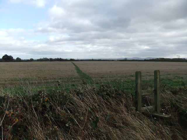
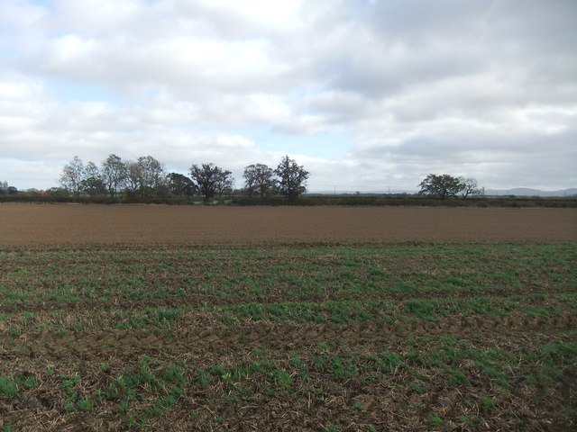
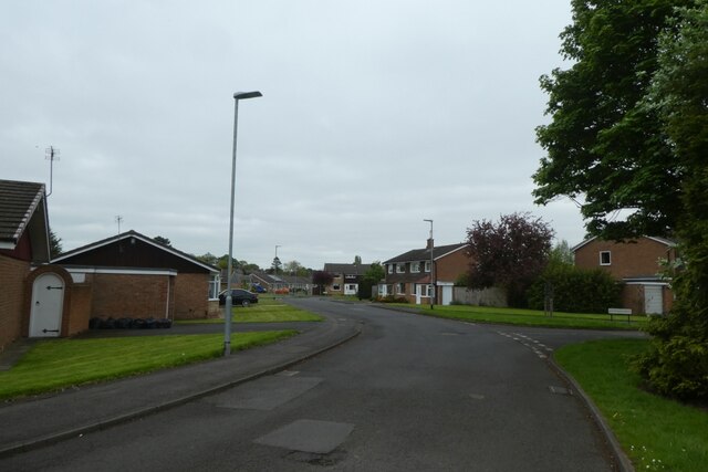
Holmhouse Wood is a picturesque wooded area located in Durham, a county in the northeast of England. This enchanting forest covers an area of approximately 40 acres and is a popular destination for nature lovers, hikers, and families seeking a tranquil retreat.

The wood is predominantly made up of native broadleaf trees, including oak, ash, and beech, which create a lush and vibrant canopy. The forest floor is adorned with a carpet of bluebells during the spring, providing a breathtaking visual display.

Holmhouse Wood is home to a variety of wildlife, making it an ideal spot for birdwatching and nature photography. Visitors may catch a glimpse of woodland birds such as woodpeckers, thrushes, and tits, as well as small mammals like squirrels and rabbits. The occasional sighting of deer adds to the woodland's natural charm.

A network of well-maintained footpaths crisscrosses the wood, offering visitors the opportunity to explore its beauty at their own pace. The paths wind through the trees, leading to peaceful clearings where visitors can sit and enjoy a picnic surrounded by nature.

The wood also boasts a small pond, adding to its ecological diversity and attracting additional wildlife. The tranquil waters provide a habitat for frogs, newts, and various aquatic plants. This pond is a popular spot for children to observe and learn about the delicate balance of nature.

Overall, Holmhouse Wood in Durham is a captivating forest that offers a serene escape from the hustle and bustle of everyday life. It provides a haven for both wildlife and humans, showcasing the beauty of nature in all its glory.

If you have any feedback on the listing, please let us know in the comments section below.

Holmhouse Wood Images

Images are sourced within 2km of 54.50461/-1.3737368 or Grid Reference NZ4012. Thanks to Geograph Open Source API. All images are credited.

Field near Sloshmire Gate
"Footpath" near West Moor
Yarm  High  Street,  long  with  cobbled  sides
Yarm High Street, long with cobbled sides
Yarm  Town  Hall  in  the  centre  of  the  High  Street Built in 1710, the date on the weather vane
Yarm Town Hall in the centre of the High Street
Built in 1710, the date on the weather vane
Pedestrian  crossing  point  Yarm  High  Street Business's and houses line this very long street
Pedestrian crossing point Yarm High Street
Business's and houses line this very long street
The  aptly  named  Bridge  Street The street goes through one of the 43 arches of this railway viaduct built in 1849
The aptly named Bridge Street
The street goes through one of the 43 arches of this railway viaduct built in 1849
The  A67  crossing  Yarm  Bridge  over  River  Tees  northbound Pevsner states that it is still the bridge built by Bishop Skirlaw of Durham about 1400 even if much repaired since! Walter Skirlaw was born in Skirlaugh East Riding of Yorkshire. He was Bishop of Lichfield then Wells before Durham. He gave the parish church of St Augustine to his native village, built 1401-5
The A67 crossing Yarm Bridge over River Tees northbound
Pevsner states that it is still the bridge built by Bishop Skirlaw of Durham about 1400 even if much repaired since! Walter Skirlaw was born in Skirlaugh East Riding of Yorkshire. He was Bishop of Lichfield then Wells before Durham. He gave the parish church of St Augustine to his native village, built 1401-5
Village Green And Medieval Cross, Egglescliffe
Old Boundary Marker on the A67, Yarm Bridge, Egglescliffe parish County Boundary Marker on the north side of a lamp post in a refuge on the east side of Yarm Bridge on the A67 Yarm Road and High Street. See also YN_YARM01cb. Egglescliffe parish. 

Milestone Society National ID: DU_EGGLES01cb
Old Boundary Marker on the A67, Yarm Bridge, Egglescliffe parish
County Boundary Marker on the north side of a lamp post in a refuge on the east side of Yarm Bridge on the A67 Yarm Road and High Street. See also YN_YARM01cb. Egglescliffe parish. Milestone Society National ID: DU_EGGLES01cb
Old Boundary Marker on the A67, Yarm Bridge, Yarm parish County Boundary Marker on the south side of a lamp post in a refuge on the east side of Yarm Bridge on the A67 Yarm Road and High Street. See also DU_EGGLES01cb. Yarm parish. 

Milestone Society National ID: YN_YARM01cb
Old Boundary Marker on the A67, Yarm Bridge, Yarm parish
County Boundary Marker on the south side of a lamp post in a refuge on the east side of Yarm Bridge on the A67 Yarm Road and High Street. See also DU_EGGLES01cb. Yarm parish. Milestone Society National ID: YN_YARM01cb
Old Milestone, B1264, Yarm Out of place milestone on Green Lane, near Yarm railway station, serving as garden decoration. It would originally have read "Yᴹ 8". The original location was on the A167 Northallerton Road, near the Toll Bar Garage. CB is for Catterick Bridge, Yᴹ for Yarm.

Inscription: CB / 9 // Yᴹ 1

Milestone Society National ID: TBC
Old Milestone, B1264, Yarm
Out of place milestone on Green Lane, near Yarm railway station, serving as garden decoration. It would originally have read "Yᴹ 8". The original location was on the A167 Northallerton Road, near the Toll Bar Garage. CB is for Catterick Bridge, Yᴹ for Yarm. Inscription: CB / 9 // Yᴹ 1 Milestone Society National ID: TBC
Yarm Railway Viaduct over the R Tees The viaduct extends for over 2,280 feet in a north/south direction over the town of Yarm and across the River Tees. It consists of 43 arches; 41 of them are 40 feet span and are constructed of 7.5 million red bricks. The other two arches are constructed from stone and are 67 feet across with one pier standing in the river. The two spans across the river are composed of 139,000 cubic feet of stone and are skewed across the river by 20 degrees. On the downstream side of the viaduct (eastern side) is a large plaque set into the stone section of where the bridge spans the river. This commemorates the engineers and contractors on the project.
Yarm Railway Viaduct over the R Tees
The viaduct extends for over 2,280 feet in a north/south direction over the town of Yarm and across the River Tees. It consists of 43 arches; 41 of them are 40 feet span and are constructed of 7.5 million red bricks. The other two arches are constructed from stone and are 67 feet across with one pier standing in the river. The two spans across the river are composed of 139,000 cubic feet of stone and are skewed across the river by 20 degrees. On the downstream side of the viaduct (eastern side) is a large plaque set into the stone section of where the bridge spans the river. This commemorates the engineers and contractors on the project.
Yarm, Town Hall & High St
George & Dragon PH, Yarm High St The George and Dragon on Yarm High Street was the location of the promoters meeting of the Stockton and Darlington Railway on 12th February 1820. Meynell laid the first rail on 23rd May 1822 and went on to be chairman of the railway.
George & Dragon PH, Yarm High St
The George and Dragon on Yarm High Street was the location of the promoters meeting of the Stockton and Darlington Railway on 12th February 1820. Meynell laid the first rail on 23rd May 1822 and went on to be chairman of the railway.
Pleasure craft on R Tees downstream from Yarm road bridge
Yarm School & the R Tees
Uldale Drive Looking along Uldale Drive where Honister Walk emerges onto it.
Uldale Drive
Looking along Uldale Drive where Honister Walk emerges onto it.
Grisedale Crescent Looking towards the junction with Martindale Grove.
Grisedale Crescent
Looking towards the junction with Martindale Grove.
Show me another place!

Holmhouse Wood is located at Grid Ref: NZ4012 (Lat: 54.50461, Lng: -1.3737368)

Unitary Authority: Stockton-on-Tees

Police Authority: Cleveland

What 3 Words

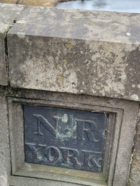
///embellish.jots.trick. Near Yarm, Co. Durham

Related Wikis

Aislaby, County Durham

Aislaby ( AYZ-əl-bi) is a small village and civil parish on the north bank of the River Tees within the borough of Stockton-on-Tees and the ceremonial...
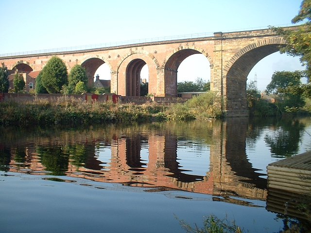
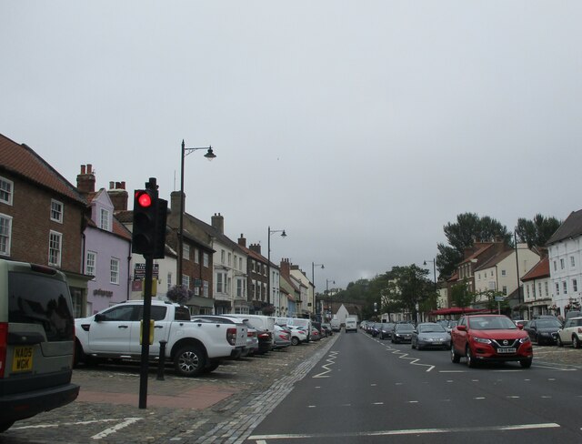
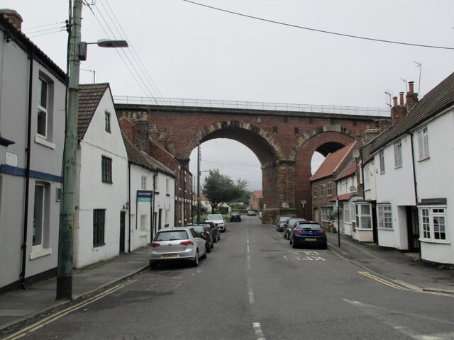
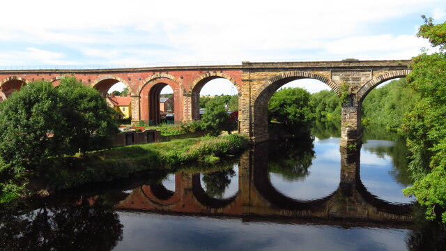
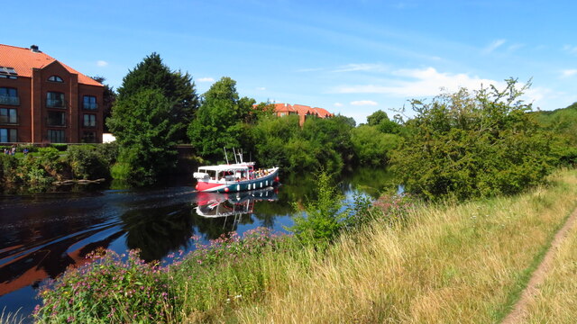
Yarm Viaduct

Yarm Viaduct is a railway viaduct carrying the railways above the town of Yarm in North Yorkshire, England. It crosses the River Tees which forms the boundary...

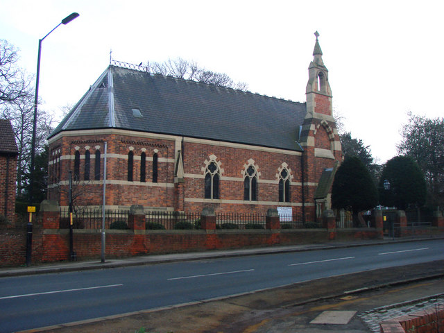
Ss Mary and Romuald, Yarm

St Mary and St Romuald is a Catholic parish church in Yarm, North Yorkshire, England. Administratively, it is part of the Diocese of Middlesbrough. �...

Yarm Methodist Church

Yarm Methodist Church is a Methodist church in the town of Yarm in the borough of Stockton-on-Tees, England. It is octagonal in shape. Built in 1763, John...
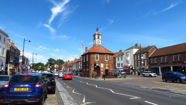
Yarm Town Hall

Yarm Town Hall is a municipal building in the High Street in Yarm, North Yorkshire, England. The structure, which is the meeting place of Yarm Town Council...
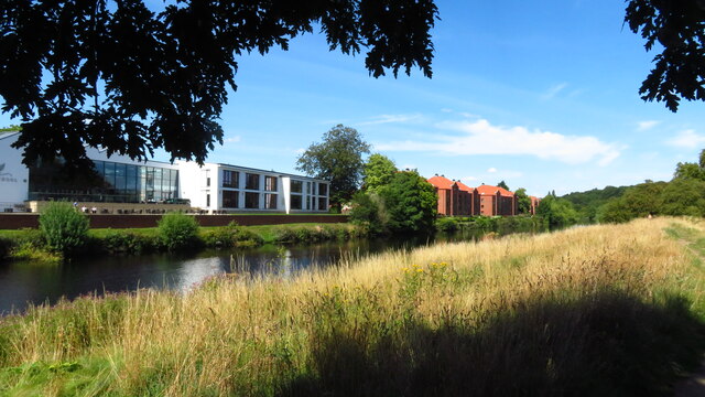
Yarm School

Yarm School is a co-educational independent day school in Yarm, North Yorkshire in the North East of England. The school accepts pupils aged 3–18 years...

Egglescliffe School

Egglescliffe School & Sixth Form College is a large Coeducational secondary school and sixth form located between Egglescliffe and Urlay Nook in the Borough...
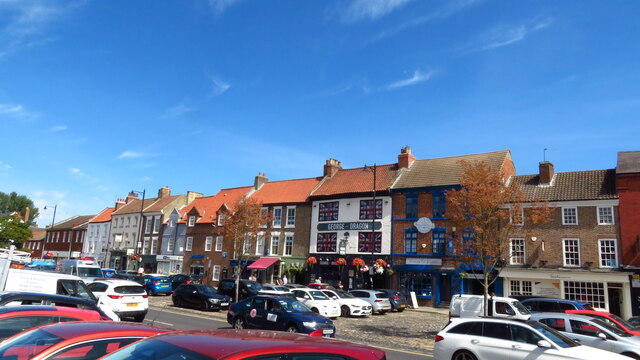
Yarm

Yarm, also referred to as Yarm-on-Tees, is a market town and civil parish in the Borough of Stockton-on-Tees, North Yorkshire, England. It is in Teesdale...

Nearby Amenities

Located within 500m of 54.50461,-1.3737368
Power: tower
Source: Bing
Lat/Long: 54.5044455/-1.371831
Power: tower
Source: Bing
Lat/Long: 54.5077344/-1.3727891
Power: tower
Source: Bing
Lat/Long: 54.5024396/-1.3721327
Aislaby
Place: village
Population: 201
Wikidata: Q2828778
Wikipedia: en:Aislaby, County Durham
Lat/Long: 54.5052411/-1.3752431
The data included in this document is from www.openstreetmap.org. The data is made available under ODbL.

Have you been to Holmhouse Wood?

Leave your review of Holmhouse Wood below (or comments, questions and feedback).