Asfordby

Settlement in Leicestershire Melton

England

Asfordby

Coal stacks, Holwell Works
Coal stacks, Holwell Works Credit: Jonathan Thacker

Asfordby is a small village located in Leicestershire, England. Situated approximately 5 miles northeast of Melton Mowbray, it is nestled in the picturesque countryside of the East Midlands region. The village is home to a population of around 3,000 residents.

Asfordby boasts a rich history, with evidence of human settlement dating back to Roman times. The village's name is derived from the Old Norse words "Áss" and "fjǫrðr," meaning "a river crossing of the gods." This suggests that Asfordby was an important crossing point over the River Wreake in ancient times, contributing to its development as a settlement.

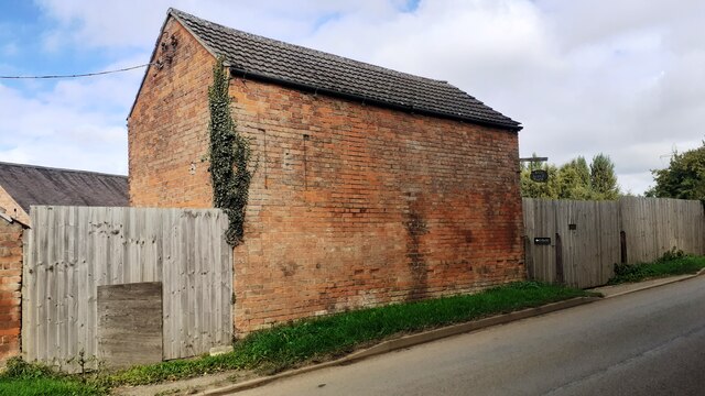
Today, Asfordby retains its rural charm and offers a peaceful and idyllic lifestyle. The village is characterized by its charming cottages, picturesque countryside views, and a strong sense of community. It provides a range of amenities, including a primary school, a village hall, a pub, and a local shop, catering to the needs of its residents.

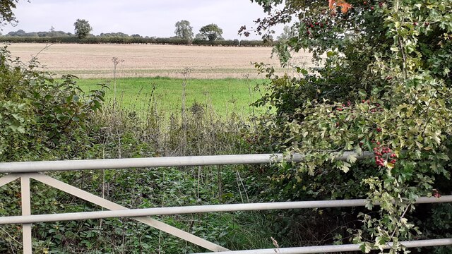
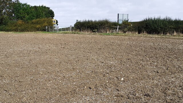
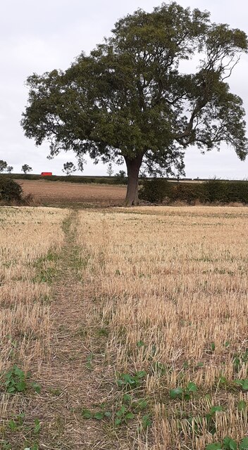
For outdoor enthusiasts, Asfordby offers ample opportunities to explore the beautiful surrounding countryside. The village is surrounded by rolling hills, woodland areas, and scenic walking trails, providing the perfect backdrop for leisurely strolls and outdoor activities.

Overall, Asfordby is a quintessential English village, known for its historical significance, natural beauty, and close-knit community. With its tranquil ambiance and access to the countryside, it offers an appealing lifestyle for those seeking a peaceful retreat in the heart of Leicestershire.

If you have any feedback on the listing, please let us know in the comments section below.
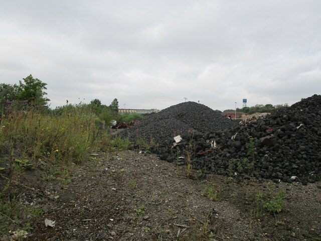
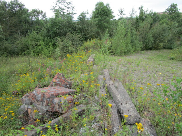
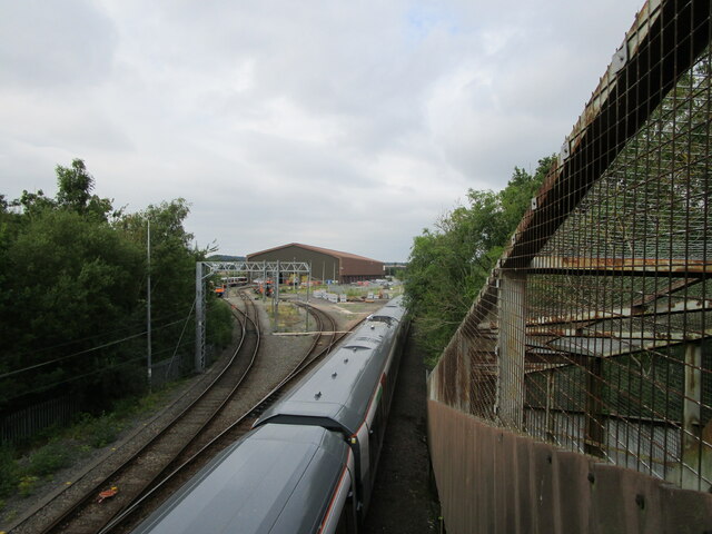
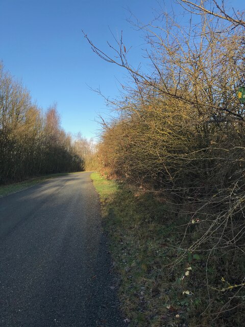
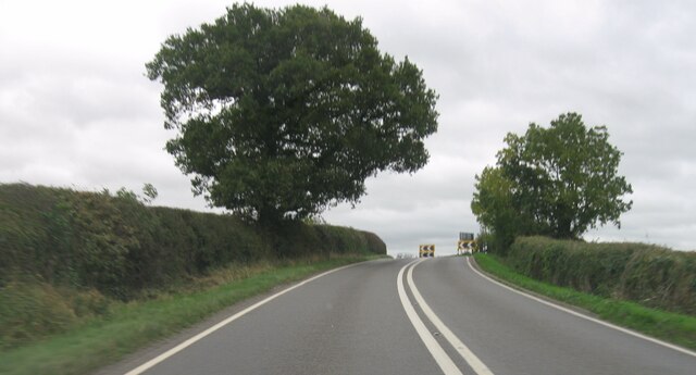
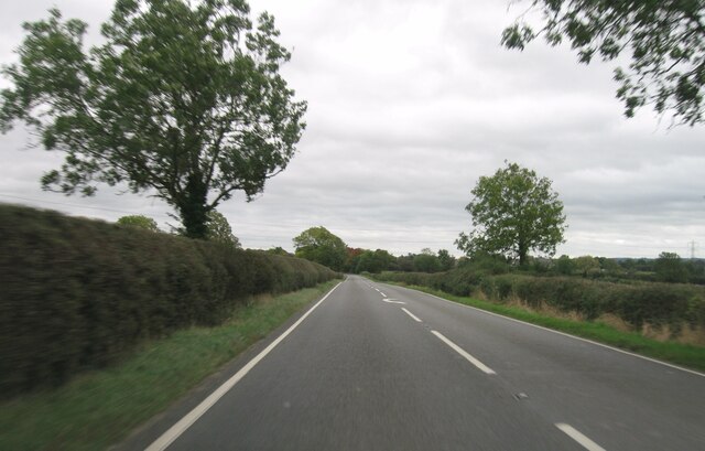
Asfordby Images

Images are sourced within 2km of 52.764172/-0.951402 or Grid Reference SK7019. Thanks to Geograph Open Source API. All images are credited.

Coal stacks, Holwell Works
Remains at former industrial site
Melton Rail Innovation and Development Centre
Road towards Welby
Road towards Welby
A6006 eastbound
A6006 eastbound
Loughborough Road
Loughborough Road
SW parapet of bridge taking A6006 (Loughborough Road) over stream near Grimston Gap Ordnance Survey records indicate that a benchmark levelled at 77.636m above Newlyn Datum was verified in 1962 on the parapet over the centre of the stream
SW parapet of bridge taking A6006 (Loughborough Road) over stream near Grimston Gap
Ordnance Survey records indicate that a benchmark levelled at 77.636m above Newlyn Datum was verified in 1962 on the parapet over the centre of the stream
Stile on footpath from Grimston Gap to Hoby Road west of Asfordby
St Thomas of Canterbury Church and graveyard There is an Ordnance Survey benchmark <a href="https://www.geograph.org.uk/photo/3977389">SK6917 : Benchmark on St Thomas of Canterbury Church</a> on the buttress on the right hand corner of the tower: the mark levelled at 70.409m above Newlyn Datum was verified in 1962
St Thomas of Canterbury Church and graveyard
There is an Ordnance Survey benchmark SK6917 : Benchmark on St Thomas of Canterbury Church on the buttress on the right hand corner of the tower: the mark levelled at 70.409m above Newlyn Datum was verified in 1962
Badger latrine beside footpath through field west of Asfordby
Gateway for footpath on north side of A6006 east of Shoby Lodge
Footpath from field through woodland strip to A6006 east of Shoby Lodge
Pond beside footpath at Asfordby Carp Pools
Ploughed footpath heading for A6006 at Grimston Gap
Footpath heading for Loughborough Road from Hoby Road
Benchmark on outbuilding at Red Lodge Farm on NW side of Hoby Road Ordnance Survey cut mark benchmark levelled at 69.065m above Newlyn Datum verified 1962
Benchmark on outbuilding at Red Lodge Farm on NW side of Hoby Road
Ordnance Survey cut mark benchmark levelled at 69.065m above Newlyn Datum verified 1962
Red Lodge Farm outbuilding on NW side of Hoby Road There is an Ordnance Survey benchmark <a href="https://www.geograph.org.uk/photo/7314361">SK6918 : Benchmark on outbuilding at Red Lodge Farm on NW side of Hoby Road</a> on the near corner, road face, of the building
Red Lodge Farm outbuilding on NW side of Hoby Road
There is an Ordnance Survey benchmark SK6918 : Benchmark on outbuilding at Red Lodge Farm on NW side of Hoby Road on the near corner, road face, of the building
Red Lodge and farm outbuilding at NW side of Hoby Road
Show me another place!

Asfordby is located at Grid Ref: SK7019 (Lat: 52.764172, Lng: -0.951402)

Administrative County: Leicestershire

District: Melton

Police Authority: Leicestershire

What 3 Words

///croaking.claim.unwell. Near Asfordby, Leicestershire

Nearby Locations

Asfordby

Related Wikis

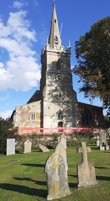
All Saints' Church, Asfordby

All Saints' Church is a church in Asfordby, Leicestershire, England. It is a Grade I listed building. == History == The church is made up of a nave, tower...
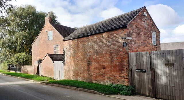
Old Hall, Asfordby

The Old Hall is a Jacobean former manor house in the village of Asfordby, Leicestershire. Built of brick c. 1620, it has three gables. It is a Grade II...

Asfordby

Asfordby is a village and civil parish in the Melton district of Leicestershire, to the west of Melton Mowbray on the A6006 road. The village is north...

Asfordby railway station

Asfordby railway station was a station serving the villages of Asfordby and Kirby Bellars in Leicestershire. The station was situated at a level crossing...

Kirby Bellars Priory

Kirby Bellars Priory was a small priory of Canons Regular of Saint Augustine in Leicestershire, England. It is now the Church of England Parish Church...

Asfordby F.C.

Asfordby Football Club is a football club based in Asfordby, England. They are currently members of the United Counties League Division One and play at...

Frisby and Kirby

Frisby and Kirby, formerly just Frisby is a former civil parish in the Melton district, in the county of Leicestershire, England. Its principal settlements...

Asfordby Hill

Asfordby Hill is a hamlet on the A6006 road, in the parish of Asfordby, in the Melton district, in the English county of Leicestershire. == Amenities... ==

Nearby Amenities

Located within 500m of 52.764172,-0.951402
Mini Roundabout
Direction: clockwise
Lat/Long: 52.76423/-0.9514129
Bus Stop
Parish Hall
Alt Name: Asfordby - Parish Hall
Bus: yes
Naptan AltCommonName: Asfordby - Parish Hall
Naptan AtcoCode: 260000001
Naptan Bearing: W
Naptan CommonName: Parish Hall
Naptan Indicator: opposite
Naptan Landmark: Parish Hall
Naptan NaptanCode: leidmpwd
Naptan Notes: Hourly - County
Naptan Street: Main Street
Naptan Verified: no
Public Transport: platform
Source: naptan_import
Lat/Long: 52.7644018/-0.9451817
Bus Stop
Parish Hall
Alt Name: Asfordby - Parish Hall
Bus: yes
Naptan AltCommonName: Asfordby - Parish Hall
Naptan AtcoCode: 260000002
Naptan Bearing: E
Naptan CommonName: Parish Hall
Naptan Indicator: outside
Naptan Landmark: Parish Hall
Naptan NaptanCode: leidmpwg
Naptan Notes: Hourly - County
Naptan Street: Main Street
Naptan Verified: no
Public Transport: platform
Source: naptan_import
Lat/Long: 52.764505/-0.9456683
Bus Stop
Jubilee Avenue
Alt Name: Asfordby - New Street
Bus: yes
Naptan AltCommonName: Asfordby - New Street
Naptan AtcoCode: 260000003
Naptan Bearing: E
Naptan CommonName: Jubilee Avenue
Naptan Indicator: outside
Naptan Landmark: 48 Main Street
Naptan NaptanCode: leidmpwj
Naptan Notes: Hourly - County
Naptan Street: Main Street
Naptan Verified: no
Public Transport: platform
Source: naptan_import
Lat/Long: 52.764453/-0.9479075
Bus Stop
All Saints Close
Alt Name: Asfordby - Bradgate Lane
Bus: yes
Naptan AltCommonName: Asfordby - Bradgate Lane
Naptan AtcoCode: 260000005
Naptan Bearing: E
Naptan CommonName: All Saints Close
Naptan Indicator: opposite
Naptan Landmark: All Saints Close
Naptan NaptanCode: leidmpwp
Naptan Notes: Hourly - County
Naptan Street: Main Street
Naptan Verified: no
Public Transport: platform
Source: naptan_import
Lat/Long: 52.7642357/-0.9517958
Bus Stop
Blue Bell PH
Alt Name: Asfordby - Mill Lane
Bus: yes
Naptan AltCommonName: Asfordby - Mill Lane
Naptan AtcoCode: 260000006
Naptan Bearing: W
Naptan CommonName: Blue Bell PH
Naptan Indicator: opposite
Naptan Landmark: Blue Bell
Naptan NaptanCode: leidmpwt
Naptan Notes: Hourly - County
Naptan Street: Main Street
Naptan Verified: no
Public Transport: platform
Source: naptan_import
Lat/Long: 52.7634868/-0.9555634
Bus Stop
Hazelwood Crescent
Alt Name: Asfordby - Saxelbye Road
Bus: yes
Naptan AltCommonName: Asfordby - Saxelbye Road
Naptan AtcoCode: 260000007
Naptan Bearing: SE
Naptan CommonName: Hazelwood Crescent
Naptan Indicator: opposite
Naptan Landmark: 1-3 Loughborough Road
Naptan NaptanCode: leidmtad
Naptan Notes: Hourly - County
Naptan Street: Loughborough Road
Naptan Verified: no
Public Transport: platform
Source: naptan_import
Lat/Long: 52.7644847/-0.9586371
Bus Stop
Telephone Exhange
Alt Name: Asfordby - Post Office
Bus: yes
Naptan AltCommonName: Asfordby - Post Office
Naptan AtcoCode: 260000014
Naptan Bearing: S
Naptan CommonName: Telephone Exhange
Naptan Indicator: opposite
Naptan Landmark: Telephone Exhange
Naptan NaptanCode: leidmtda
Naptan Notes: Non-Hourly - County
Naptan Street: Bradgate Lane
Naptan Verified: no
Public Transport: platform
Source: naptan_import
Lat/Long: 52.7647989/-0.9514414
Bus Stop
Blue Bell PH
Alt Name: Asfordby - Mill Lane
Bus: yes
Naptan AltCommonName: Asfordby - Mill Lane
Naptan AtcoCode: 260000015
Naptan Bearing: E
Naptan CommonName: Blue Bell PH
Naptan Indicator: outside
Naptan Landmark: Blue Bell
Naptan NaptanCode: leidmtdg
Naptan Notes: Hourly - County
Naptan Street: Main Street
Naptan Verified: no
Public Transport: platform
Source: naptan_import
Lat/Long: 52.7636327/-0.9557971
Bus Stop
Jubilee Avenue
Alt Name: Asfordby - New Street
Bus: yes
Naptan AltCommonName: Asfordby - New Street
Naptan AtcoCode: 260000016
Naptan Bearing: W
Naptan CommonName: Jubilee Avenue
Naptan Indicator: adj
Naptan Landmark: 39 Main Street
Naptan NaptanCode: leidmtdj
Naptan Notes: Hourly - County
Naptan Street: Main Street
Naptan Verified: no
Public Transport: platform
Source: naptan_import
Lat/Long: 52.7643203/-0.9481478
Bus Stop
All Saints Close
Bus: yes
Naptan AtcoCode: 260000017
Naptan Bearing: W
Naptan CommonName: All Saints Close
Naptan Indicator: adjacent
Naptan Landmark: All Saints Close
Naptan NaptanCode: leidmtdm
Naptan Notes: Hourly - County
Naptan Street: Main Street
Naptan Verified: no
Public Transport: platform
Source: naptan_import
Lat/Long: 52.7637296/-0.9545498
Bus Stop
Station Lane
Bus: yes
Naptan AtcoCode: 260000020
Naptan Bearing: S
Naptan CommonName: Station Lane
Naptan Indicator: opposite
Naptan Landmark: 8 Station Lane
Naptan NaptanCode: leidmtdp
Naptan Notes: Hourly - County
Naptan Street: Station Lane
Naptan Verified: no
Public Transport: platform
Source: naptan_import
Lat/Long: 52.7632583/-0.9582069
Londis
Addr City: Melton Mowbray
Addr Country: GB
Addr Housenumber: 3
Addr Postcode: LE14 3YG
Addr Street: Charnwood Avenue
Addr Village: Asfordby
Branch: Northfield Stores
Brand: Londis
Brand Wikidata: Q21008564
Brand Wikipedia: en:Londis (United Kingdom)
Fhrs Authority: Melton
Fhrs Id: 5224
Fhrs Local Authority Id: 01650/0003/0/000
Shop: convenience
Lat/Long: 52.7659847/-0.9545475
Post Box
Lat/Long: 52.7663027/-0.9547459
Post Box
Lat/Long: 52.7646077/-0.9516642
Fast Food
kings Take away
Lat/Long: 52.764512/-0.9516079
Restaurant
Empress Of India
Addr City: Melton Mowbray
Addr Country: GB
Addr Housenumber: 97
Addr Postcode: LE14 3RZ
Addr Street: Main Street
Addr Village: Asfordby
Fhrs Authority: Melton
Fhrs Id: 32965
Fhrs Local Authority Id: 10/00016/COMM
Lat/Long: 52.7641123/-0.9517224
Fast Food
Paul's Plaice
Addr City: Melton Mowbray
Addr Country: GB
Addr Housenumber: 4
Addr Postcode: LE14 3YD
Addr Street: Bradgate Lane
Addr Village: Asfordby
Fhrs Authority: Melton
Fhrs Id: 980287
Fhrs Local Authority Id: 17/00027/COMM
Lat/Long: 52.7644129/-0.9512968
Pharmacy
Boots
Addr City: Melton Mowbray
Addr Country: GB
Addr Housenumber: 5
Addr Postcode: LE14 3YD
Addr Street: Bradgate Lane
Addr Village: Asfordby
Brand: Boots
Brand Wikidata: Q6123139
Brand Wikipedia: en:Boots (company)
Fhrs Authority: Melton
Fhrs Id: 2390
Fhrs Local Authority Id: 00890/0005/0/000
Healthcare: pharmacy
Website: https://www.boots.com/stores/5091-asfordby-bradgte-lane-le14-3yd
Lat/Long: 52.7644584/-0.9515757
Parking
Lat/Long: 52.764757/-0.9518788
Pub
The Horse Shoes
Addr City: Melton Mowbray
Addr Country: GB
Addr Housenumber: 128
Addr Postcode: LE14 3SA
Addr Street: Main Street
Addr Village: Asfordby
Fhrs Authority: Melton
Fhrs Id: 16762
Fhrs Local Authority Id: 05270/0128/2/000
Lat/Long: 52.7642117/-0.9521899
Pub
The Blue Bell
Lat/Long: 52.7635885/-0.9560952
Pub
The Crown
Addr City: Melton Mowbray
Addr Country: GB
Addr Housenumber: 106
Addr Postcode: LE14 3SA
Addr Street: Main Street
Addr Village: Asfordby
Fhrs Authority: Melton
Fhrs Id: 16761
Fhrs Local Authority Id: 05270/0106/0/000
Source Addr: FHRS Open Data
Lat/Long: 52.764387/-0.950645
The Co-operative Food
Addr City: Melton Mowbray
Addr Country: GB
Addr Housenumber: 1a
Addr Postcode: LE14 3YD
Addr Street: Bradgate Lane
Addr Village: Asfordby
Brand: The Co-operative Food
Brand Wikidata: Q107617274
Fhrs Authority: Melton
Fhrs Id: 2387
Fhrs Local Authority Id: 00890/0001/A/000
Operator: Central England Co-operative
Operator Wikidata: Q16986583
Shop: supermarket
Website: https://stores.centralengland.coop/leicestershire/melton-mowbray/1a-bradgate-lane
Lat/Long: 52.7642831/-0.9516213
Asfordby
Place: village
Lat/Long: 52.7644508/-0.9541789
Traffic Calming: table
Lat/Long: 52.7634023/-0.9510116
Generator Method: photovoltaic
Generator Output Electricity: yes
Generator Source: solar
Generator Type: solar_photovoltaic_panel
Location: roof
Power: generator
Lat/Long: 52.7653315/-0.9574646
Generator Method: photovoltaic
Generator Output Electricity: yes
Generator Source: solar
Generator Type: solar_photovoltaic_panel
Location: roof
Power: generator
Lat/Long: 52.7642912/-0.9556031
Generator Method: photovoltaic
Generator Output Electricity: yes
Generator Source: solar
Generator Type: solar_photovoltaic_panel
Location: roof
Power: generator
Lat/Long: 52.7652553/-0.9534198
Generator Method: photovoltaic
Generator Output Electricity: yes
Generator Source: solar
Generator Type: solar_photovoltaic_panel
Location: roof
Power: generator
Lat/Long: 52.7650264/-0.9531972
Generator Method: photovoltaic
Generator Output Electricity: yes
Generator Source: solar
Generator Type: solar_photovoltaic_panel
Location: roof
Power: generator
Lat/Long: 52.7649128/-0.9532669
Generator Method: photovoltaic
Generator Output Electricity: yes
Generator Source: solar
Generator Type: solar_photovoltaic_panel
Location: roof
Power: generator
Lat/Long: 52.7647781/-0.9530094
Generator Method: photovoltaic
Generator Output Electricity: yes
Generator Source: solar
Generator Type: solar_photovoltaic_panel
Location: roof
Power: generator
Lat/Long: 52.7651352/-0.9527868
Generator Method: photovoltaic
Generator Output Electricity: yes
Generator Source: solar
Generator Type: solar_photovoltaic_panel
Location: roof
Power: generator
Lat/Long: 52.7646158/-0.952481
Generator Method: photovoltaic
Generator Output Electricity: yes
Generator Source: solar
Generator Type: solar_photovoltaic_panel
Location: roof
Power: generator
Lat/Long: 52.7644811/-0.9528833
Generator Method: photovoltaic
Generator Output Electricity: yes
Generator Source: solar
Generator Type: solar_photovoltaic_panel
Location: roof
Power: generator
Lat/Long: 52.7660635/-0.9521216
Generator Method: photovoltaic
Generator Output Electricity: yes
Generator Source: solar
Generator Type: solar_photovoltaic_panel
Location: roof
Power: generator
Lat/Long: 52.7666396/-0.9519017
Generator Method: photovoltaic
Generator Output Electricity: yes
Generator Source: solar
Generator Type: solar_photovoltaic_panel
Location: roof
Power: generator
Lat/Long: 52.7666315/-0.9517488
Generator Method: photovoltaic
Generator Output Electricity: yes
Generator Source: solar
Generator Type: solar_photovoltaic_panel
Location: roof
Power: generator
Lat/Long: 52.76675/-0.9506866
Generator Method: photovoltaic
Generator Output Electricity: yes
Generator Source: solar
Generator Type: solar_photovoltaic_panel
Location: roof
Power: generator
Lat/Long: 52.7662631/-0.9504425
Generator Method: photovoltaic
Generator Output Electricity: yes
Generator Source: solar
Generator Type: solar_photovoltaic_panel
Location: roof
Power: generator
Lat/Long: 52.7663021/-0.9510434
Generator Method: photovoltaic
Generator Output Electricity: yes
Generator Source: solar
Generator Type: solar_photovoltaic_panel
Location: roof
Power: generator
Lat/Long: 52.7662647/-0.9503165
Generator Method: photovoltaic
Generator Output Electricity: yes
Generator Source: solar
Generator Type: solar_photovoltaic_panel
Location: roof
Power: generator
Lat/Long: 52.7653948/-0.9481144
Generator Method: photovoltaic
Generator Output Electricity: yes
Generator Source: solar
Generator Type: solar_photovoltaic_panel
Location: roof
Power: generator
Lat/Long: 52.7653884/-0.9468055
Generator Method: photovoltaic
Generator Output Electricity: yes
Generator Source: solar
Generator Type: solar_photovoltaic_panel
Location: roof
Power: generator
Lat/Long: 52.7646093/-0.9517059
Generator Method: photovoltaic
Generator Output Electricity: yes
Generator Source: solar
Generator Type: solar_photovoltaic_panel
Location: roof
Power: generator
Lat/Long: 52.7620969/-0.9562254
Generator Method: photovoltaic
Generator Output Electricity: yes
Generator Source: solar
Generator Type: solar_photovoltaic_panel
Location: roof
Power: generator
Lat/Long: 52.7620628/-0.9567484
Generator Method: photovoltaic
Generator Output Electricity: yes
Generator Source: solar
Generator Type: solar_photovoltaic_panel
Location: roof
Power: generator
Lat/Long: 52.7619573/-0.957419
Generator Method: photovoltaic
Generator Output Electricity: yes
Generator Source: solar
Generator Type: solar_photovoltaic_panel
Location: roof
Power: generator
Lat/Long: 52.7619459/-0.9575262
Generator Method: photovoltaic
Generator Output Electricity: yes
Generator Source: solar
Generator Type: solar_photovoltaic_panel
Location: roof
Power: generator
Lat/Long: 52.7633726/-0.9586984
Generator Method: photovoltaic
Generator Output Electricity: yes
Generator Source: solar
Generator Type: solar_photovoltaic_panel
Location: roof
Power: generator
Lat/Long: 52.7665195/-0.9553724
Generator Method: photovoltaic
Generator Output Electricity: yes
Generator Source: solar
Generator Type: solar_photovoltaic_panel
Location: roof
Power: generator
Lat/Long: 52.766156/-0.9541815
Generator Method: photovoltaic
Generator Output Electricity: yes
Generator Source: solar
Generator Type: solar_photovoltaic_panel
Location: roof
Power: generator
Lat/Long: 52.7661609/-0.9540528
Generator Method: photovoltaic
Generator Output Electricity: yes
Generator Source: solar
Generator Type: solar_photovoltaic_panel
Location: roof
Power: generator
Lat/Long: 52.766182/-0.953393
Generator Method: photovoltaic
Generator Output Electricity: yes
Generator Source: solar
Generator Type: solar_photovoltaic_panel
Location: roof
Power: generator
Lat/Long: 52.7659548/-0.9505606
Generator Method: photovoltaic
Generator Output Electricity: yes
Generator Source: solar
Generator Type: solar_photovoltaic_panel
Location: roof
Power: generator
Lat/Long: 52.7632769/-0.9459251
Cafe
Dove Cottage Day Hospice Shop & Tearoom
Addr City: Melton Mowbray
Addr Country: GB
Addr Housenumber: 9-11
Addr Postcode: LE14 3YD
Addr Street: Bradgate Lane
Addr Village: Asfordby
Fhrs Authority: Melton
Fhrs Id: 1112801
Fhrs Local Authority Id: 19/00013/COMM
Shop: charity
Lat/Long: 52.7645878/-0.9515914
Asfordby News
Addr City: Melton Mowbray
Addr Country: GB
Addr Housenumber: 3
Addr Postcode: LE14 3YD
Addr Street: Bradgate Lane
Addr Village: Asfordby
Fhrs Authority: Melton
Fhrs Id: 2389
Fhrs Local Authority Id: 00890/0003/2/000
Shop: newsagent
Lat/Long: 52.7644174/-0.9515619
Vinny's Of Asfordby
Addr City: Melton Mowbray
Addr Country: GB
Addr Housenumber: 82
Addr Postcode: LE14 3RZ
Addr Street: Main Street
Addr Village: Asfordby
Fhrs Authority: Melton
Fhrs Id: 16760
Fhrs Local Authority Id: 05270/0082/0/000
Shop: butcher
Lat/Long: 52.7644433/-0.9496897
Barrier: bollard
Lat/Long: 52.765703/-0.9539592
Crossing
Lat/Long: 52.7673214/-0.9502315
Traffic Calming: table
Lat/Long: 52.7639398/-0.9511124
Turning Circle
Lat/Long: 52.7664461/-0.9494926
Advertising: board
Lat/Long: 52.7642189/-0.9577197
The data included in this document is from www.openstreetmap.org. The data is made available under ODbL.

Have you been to Asfordby?

Leave your review of Asfordby below (or comments, questions and feedback).