Dores Copse

Wood, Forest in Hampshire Winchester

England

Dores Copse

Track to Gudge Copse A farm track off Dores Lane. It is not a public footpath.
Track to Gudge Copse Credit: Bill Boaden

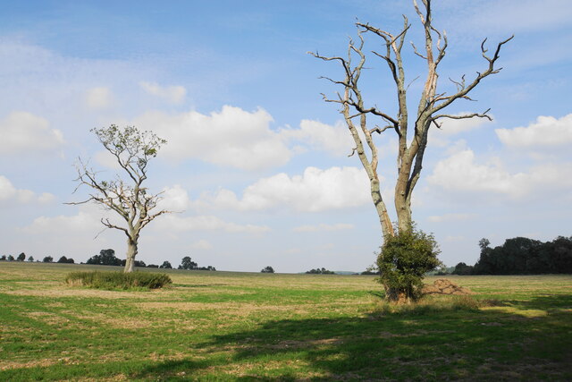
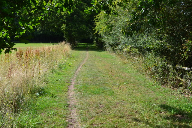
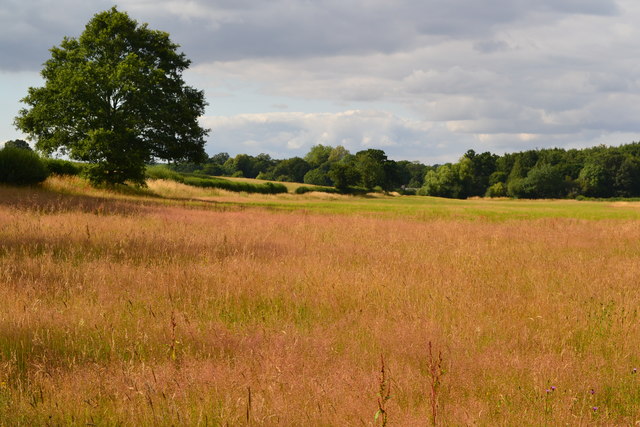
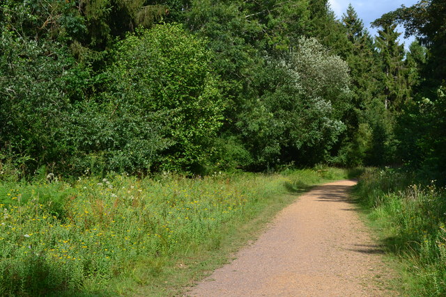
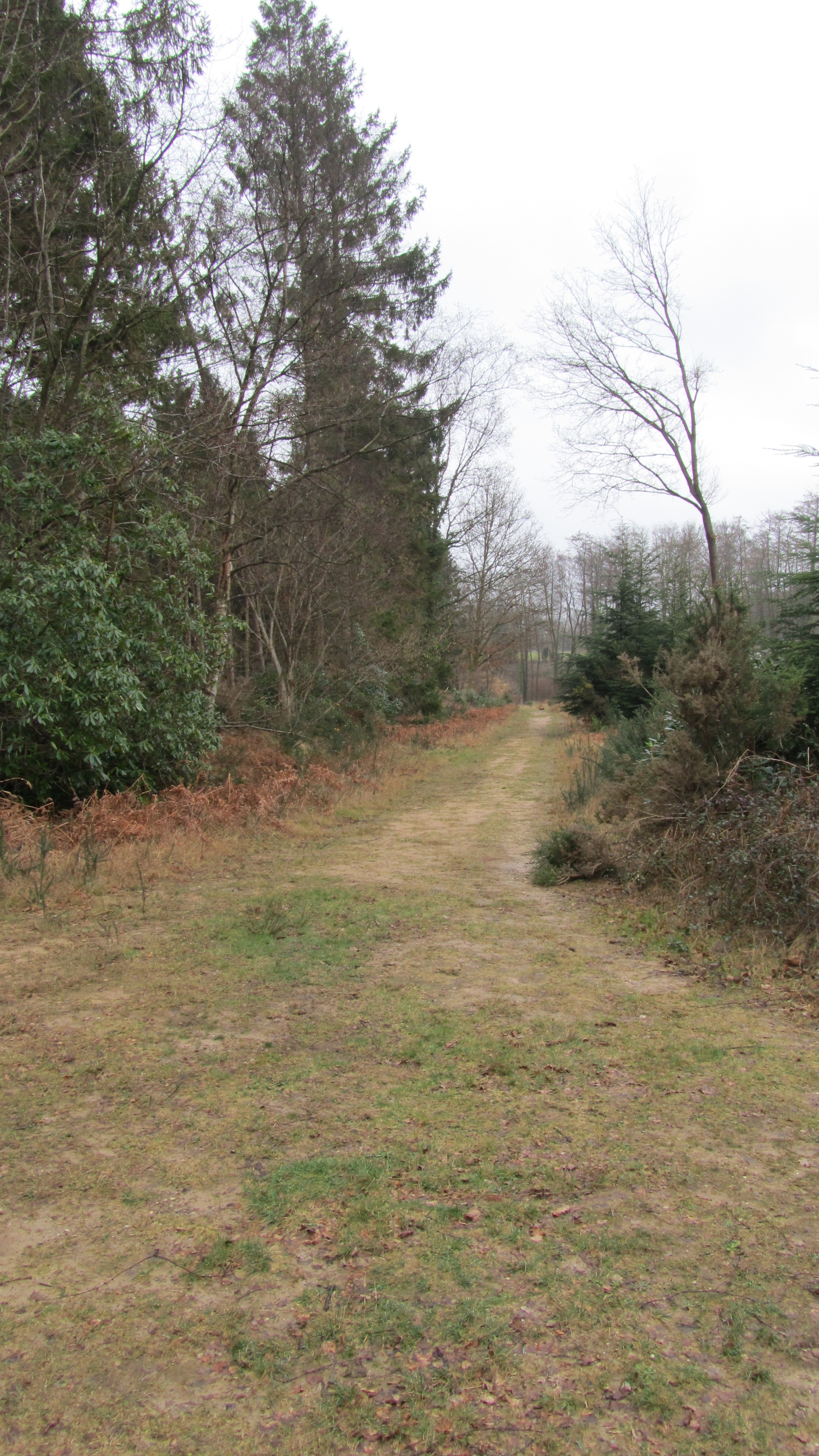
Dores Copse is a picturesque woodland located in Hampshire, England. Covering an area of approximately 50 acres, this enchanting forest is known for its diverse range of flora and fauna, making it a popular destination for nature enthusiasts and hikers alike.

The copse is predominantly composed of deciduous trees, including oak, beech, and ash, which create a dense canopy that filters sunlight, casting a tranquil and serene atmosphere over the woodland floor. This creates the ideal habitat for an array of wildlife. Visitors may spot a variety of bird species, such as woodpeckers, nuthatches, and owls, as well as small mammals like foxes, badgers, and squirrels.

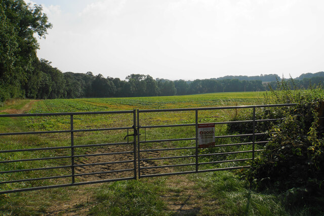
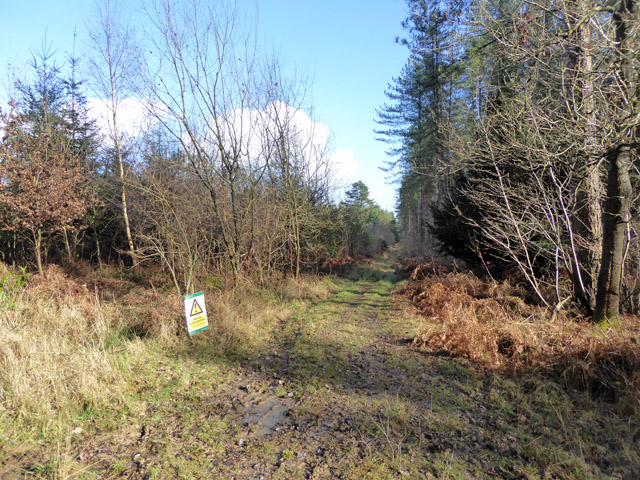
Tranquil walking paths wind their way through the copse, allowing visitors to explore the natural beauty at their own pace. These well-maintained trails offer stunning views of the surrounding countryside and provide an opportunity to immerse oneself in the peaceful ambiance of the forest.

Dores Copse is also home to an impressive array of wildflowers and plants. In the spring and summer months, the forest floor is adorned with vibrant bluebells, primroses, and wood anemones, creating a breathtaking natural carpet of colors.

Whether you are seeking a peaceful retreat, a chance to reconnect with nature, or a place to indulge in outdoor activities, Dores Copse offers a truly captivating experience. Its idyllic setting, flourishing wildlife, and stunning scenery make it a must-visit destination for nature lovers and explorers of all ages.

If you have any feedback on the listing, please let us know in the comments section below.

Dores Copse Images

Images are sourced within 2km of 51.029358/-1.4247652 or Grid Reference SU4025. Thanks to Geograph Open Source API. All images are credited.

Track to Gudge Copse A farm track off Dores Lane. It is not a public footpath.
Track to Gudge Copse
A farm track off Dores Lane. It is not a public footpath.
Skeletal trees on Berry Down These have presumably succumbed to a fungal infection, but there are signs of life clinging on.
Skeletal trees on Berry Down
These have presumably succumbed to a fungal infection, but there are signs of life clinging on.
Field above Miller's Copse A crop is emerging but I cannot tell what it is from this distance.
Field above Miller's Copse
A crop is emerging but I cannot tell what it is from this distance.
Open field above Berry Down The aspect from St John's Church, Farley Chamberlayne.
Open field above Berry Down
The aspect from St John's Church, Farley Chamberlayne.
Churchyard of St John's, Farley Chamberlayne A peaceful spot behind the church.
Churchyard of St John's, Farley Chamberlayne
A peaceful spot behind the church.
Forestry track, Ampfield Wood Forestry Commission woodland.
Forestry track, Ampfield Wood
Forestry Commission woodland.
Farley Chamberlayne - St John's Church
Old Direction Sign - Signpost by Dores Lane, Hursley Parish No finial - 4 arms; by the UC road, in parish of Hursley (Winchester District), junction of Dores Lane and Merdon Castle Lane.

To be surveyed

Milestone Society National ID: HA_SU3926
Old Direction Sign - Signpost by Dores Lane, Hursley Parish
No finial - 4 arms; by the UC road, in parish of Hursley (Winchester District), junction of Dores Lane and Merdon Castle Lane. To be surveyed Milestone Society National ID: HA_SU3926
Old Direction Sign - Signpost by Lower Slackstead No finial - 3 arms; by the UC road, in parish of Hursley (Winchester District), Lower Slackstead, junction of Dores Lane with road to Upper Slackstead.

To be surveyed

Milestone Society National ID: HA_SU3925
Old Direction Sign - Signpost by Lower Slackstead
No finial - 3 arms; by the UC road, in parish of Hursley (Winchester District), Lower Slackstead, junction of Dores Lane with road to Upper Slackstead. To be surveyed Milestone Society National ID: HA_SU3925
St John's Church, Farley Chamberlayne Brass plaque in memory of Church Verger Edith Windibank inside St John's Church, Farley Chamberlayne, Hampshire.
St John's Church, Farley Chamberlayne
Brass plaque in memory of Church Verger Edith Windibank inside St John's Church, Farley Chamberlayne, Hampshire.
Path from Ampfield Wood to Lower Slackstead
Field north of Red Gate
Path in Ampfield Wood
Farley Chamberlayne
Farley Chamberlayne
Post Box, Oakfield
Post Box, Oakfield
St John's Church, Farley Chamberlayne Donation box in the church
St John's Church, Farley Chamberlayne
Donation box in the church
Farley Chamberlayne War Memorial Located in the porch of St John's Church
Farley Chamberlayne War Memorial
Located in the porch of St John's Church
Direction Sign – Signpost Located on the southeast side of the junction of Dores Lane and Merdon Castle Lane in Hursley parish. 4 arms and missing annulus finial. An updated photo of <a title="https://www.geograph.org.uk/photo/6045056" href="https://www.geograph.org.uk/photo/6045056">Link</a>.

Milestone Society National ID: HA_SU3926
Direction Sign – Signpost
Located on the southeast side of the junction of Dores Lane and Merdon Castle Lane in Hursley parish. 4 arms and missing annulus finial. An updated photo of Link. Milestone Society National ID: HA_SU3926
Show me another place!

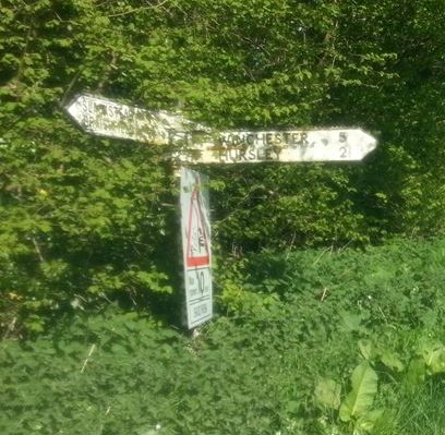
Dores Copse is located at Grid Ref: SU4025 (Lat: 51.029358, Lng: -1.4247652)

Administrative County: Hampshire

District: Winchester

Police Authority: Hampshire

What 3 Words

///aviators.barmaid.stuck. Near North Baddesley, Hampshire

Nearby Locations

Dores Copse Dell Copse

Related Wikis

IBM Hursley

IBM Hursley is a research and development laboratory belonging to International Business Machines in the village of Hursley, Hampshire, England. Established...

Hursley House

Hursley House is an 18th-century Queen Anne style mansion in Hursley, near Winchester in the English county of Hampshire. The building is Grade II* listed...

The Quarters, Hursley Park

The Quarters is a cricket ground located off Hursley Park Road in the grounds of the former Hursley Park Estate at Hursley, Hampshire, England. Set in...

Ampfield

Ampfield is a village and civil parish in the Borough of Test Valley in Hampshire, England, between Romsey, Eastleigh, and Winchester. It had a population...

Ratlake Meadows

Ratlake Meadows is a 4.2-hectare (10-acre) biological Site of Special Scientific Interest north of Chandler's Ford in Hampshire.These unimproved meadows...

Hursley

Hursley is a village and civil parish in Hampshire, England with a population of around 900 in 2011. It is located roughly midway between Romsey and Winchester...

Braishfield

Braishfield is a village and civil parish north of Romsey in Hampshire, England. The name is thought to be derived from the Old English bræsc + feld,...

Farley Mount

Farley Mount is one of the highest points in Hampshire at 174 metres ASL (571ft). It is in Farley Mount Country Park, about four miles west of the historic...

Nearby Amenities

Located within 500m of 51.029358,-1.4247652
Power: pole
Lat/Long: 51.0266251/-1.4293223
Power: pole
Lat/Long: 51.0265581/-1.4272646
Power: pole
Lat/Long: 51.0255352/-1.4225506
Power: pole
Lat/Long: 51.0252878/-1.4219163
Hunting Stand
Lat/Long: 51.0253242/-1.4260021
Hunting Stand
Lat/Long: 51.0262149/-1.4239677
Hunting Stand
Lat/Long: 51.0286729/-1.4254757
Dell Copse
Place: locality
Lat/Long: 51.0256272/-1.4284375
Power: pole
Lat/Long: 51.0264258/-1.424893
Hunting Stand
Access: private
Lockable: no
Lat/Long: 51.0272507/-1.4277327
Hatchet Gate
Place: locality
Lat/Long: 51.0262793/-1.4233302
Hunting Stand
Lat/Long: 51.0258936/-1.4224361
The data included in this document is from www.openstreetmap.org. The data is made available under ODbL.

Have you been to Dores Copse?

Leave your review of Dores Copse below (or comments, questions and feedback).