Donington

Settlement in Shropshire

England

Donington

Patshull Road near Albrighton
Patshull Road near Albrighton Credit: Alex McGregor

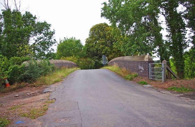
Donington is a small village located in the county of Shropshire, England. Situated approximately 10 miles south of the county town of Shrewsbury, it falls within the civil parish of Wroxeter and Uppington. Donington is nestled in the picturesque countryside, surrounded by rolling hills and lush green fields.

The village itself is home to a close-knit community, with a population of around 200 residents. The houses in Donington are predominantly traditional in style, reflecting its rich history and rural charm. The village boasts a quaint church, St. Cuthbert's, which dates back to the 12th century and stands as a testament to its long-standing presence.

Despite its small size, Donington has a vibrant social scene and offers various amenities for its residents. The village has a well-regarded primary school, providing education for local children, and a village hall that serves as a hub for community activities and events. Additionally, there is a local pub, The Donington Arms, where residents can gather and socialize.

The surrounding countryside offers numerous opportunities for outdoor activities, such as hiking and cycling, with several scenic footpaths and trails passing through the area. Donington also benefits from its proximity to other notable attractions, including the historic Roman city of Wroxeter, which is just a short distance away.

In conclusion, Donington is a charming village in Shropshire, offering a peaceful and idyllic rural lifestyle. Its strong sense of community, picturesque surroundings, and historical landmarks make it an attractive place to live or visit.

If you have any feedback on the listing, please let us know in the comments section below.

Donington Images

Images are sourced within 2km of 52.633415/-2.2821702 or Grid Reference SJ8104. Thanks to Geograph Open Source API. All images are credited.

Patshull Road near Albrighton
Grass-covered hangar The North-Western corner of one of the grass-covered hangars on Cosford airfield, showing the distinctive curved roof-structure. The doors of another hangar may be glimpsed behind. This view was taken whilst accompanying a friend who was at the airfield for a glider flight.
Grass-covered hangar
The North-Western corner of one of the grass-covered hangars on Cosford airfield, showing the distinctive curved roof-structure. The doors of another hangar may be glimpsed behind. This view was taken whilst accompanying a friend who was at the airfield for a glider flight.
Wolverhampton to Shrewsbury railway line near Donington Looking in the direction of Wolverhampton and photographed from the bridge in Rectory Road.
Wolverhampton to Shrewsbury railway line near Donington
Looking in the direction of Wolverhampton and photographed from the bridge in Rectory Road.
Wolverhampton to Shrewsbury railway line near Donington Looking in the direction of Shrewsbury and photographed from the bridge in Rectory Road.
Wolverhampton to Shrewsbury railway line near Donington
Looking in the direction of Shrewsbury and photographed from the bridge in Rectory Road.
Railway bridge in Rectory Road, near Donington The bridge takes Rectory Road across the Wolverhampton to Shrewsbury railway line.
Railway bridge in Rectory Road, near Donington
The bridge takes Rectory Road across the Wolverhampton to Shrewsbury railway line.
Rectory Road approaching the junction with the A41 road, near Donington The A41 is just past the road sign on the right.
Rectory Road approaching the junction with the A41 road, near Donington
The A41 is just past the road sign on the right.
Rectory Road, Donington At the edge of the village near the railway bridge.
Rectory Road, Donington
At the edge of the village near the railway bridge.
Sandy Lane, near Donington Photographed from its junction with Rectory Road. Sandy Lane is an access road and is not very long. It also forms a junction with Newport Road.
Sandy Lane, near Donington
Photographed from its junction with Rectory Road. Sandy Lane is an access road and is not very long. It also forms a junction with Newport Road.
Bowling Green Lane near Whiston Cross A minor road which has come from Albrighton and will shortly join the A464 road.
Bowling Green Lane near Whiston Cross
A minor road which has come from Albrighton and will shortly join the A464 road.
Bowling Green Lane near Albrighton A minor road going to Albrighton and passing near to RAF Cosford, on the left.
Bowling Green Lane near Albrighton
A minor road going to Albrighton and passing near to RAF Cosford, on the left.
Hangar no. 7, RAF Cosford, near Albrighton RAF Cosford opened in 1938 and today the majority of work carried out there is on various training courses. This hangar is one of several which are grass covered. Whether it is still used for storage of planes or other purposes I don't know. The base has its own website which explains in some detail what they do. Photographed from Bowling Green Lane.

<a href="https://www.geograph.org.uk/photo/2763516">SJ7904 : Two hangars at RAF Cosford, near Albrighton</a>.
Hangar no. 7, RAF Cosford, near Albrighton
RAF Cosford opened in 1938 and today the majority of work carried out there is on various training courses. This hangar is one of several which are grass covered. Whether it is still used for storage of planes or other purposes I don't know. The base has its own website which explains in some detail what they do. Photographed from Bowling Green Lane. SJ7904 : Two hangars at RAF Cosford, near Albrighton.
Two hangars at RAF Cosford, near Albrighton Two of the grass covered hangars at this RAF base. The land in the foreground appears to be in agricultural use. Photographed from Bowling Green Lane.

<a href="https://www.geograph.org.uk/photo/2763485">SJ7904 : Hangar no. 7, RAF Cosford, near Albrighton</a>.
Two hangars at RAF Cosford, near Albrighton
Two of the grass covered hangars at this RAF base. The land in the foreground appears to be in agricultural use. Photographed from Bowling Green Lane. SJ7904 : Hangar no. 7, RAF Cosford, near Albrighton.
St. Cuthbert's Church (1), Rectory Road, Donington The Parish church for the village of Donington. It was founded in 1085 by Roger de Montgomery, at a time when King William I (William the Conqueror) was still on the throne of England. The present structure seems to be rather later than that, with parts from the 14th & possibly 13th centuries, with much later work and heavily restored in 1878/79.

<a href="https://www.geograph.org.uk/photo/2765980">SJ8004 : St. Cuthbert's Church (2) - lychgate, Rectory Road, Donington</a>.
<a href="https://www.geograph.org.uk/photo/2765992">SJ8004 : St. Cuthbert's Church (3) - porch, Rectory Road, Donington</a>.
<a href="https://www.geograph.org.uk/photo/2766011">SJ8004 : St. Cuthbert's Church (4) - looking towards the lychgate, Rectory Road, Donington</a>.
<a href="https://www.geograph.org.uk/photo/2766031">SJ8004 : St. Cuthbert's Church (5) - remains of old cross, Rectory Road, Donington</a>.
<a href="https://www.geograph.org.uk/photo/2766045">SJ8004 : St. Cuthbert's Church (6) - carved head on remains of old cross, Rectory Road, Donington</a>.
St. Cuthbert's Church (1), Rectory Road, Donington
The Parish church for the village of Donington. It was founded in 1085 by Roger de Montgomery, at a time when King William I (William the Conqueror) was still on the throne of England. The present structure seems to be rather later than that, with parts from the 14th & possibly 13th centuries, with much later work and heavily restored in 1878/79. SJ8004 : St. Cuthbert's Church (2) - lychgate, Rectory Road, Donington. SJ8004 : St. Cuthbert's Church (3) - porch, Rectory Road, Donington. SJ8004 : St. Cuthbert's Church (4) - looking towards the lychgate, Rectory Road, Donington. SJ8004 : St. Cuthbert's Church (5) - remains of old cross, Rectory Road, Donington. SJ8004 : St. Cuthbert's Church (6) - carved head on remains of old cross, Rectory Road, Donington.
St. Cuthbert's Church (2) - lychgate, Rectory Road, Donington The lychgate may well date from the time of the major restoration of the church in 1878/79.

Other photos:- <a href="https://www.geograph.org.uk/photo/2765934">SJ8004 : St. Cuthbert's Church (1), Rectory Road, Donington</a>.
St. Cuthbert's Church (2) - lychgate, Rectory Road, Donington
The lychgate may well date from the time of the major restoration of the church in 1878/79. Other photos:- SJ8004 : St. Cuthbert's Church (1), Rectory Road, Donington.
St. Cuthbert's Church (3) - porch, Rectory Road, Donington The porch is on the south side of the church.

Other photos:- <a href="https://www.geograph.org.uk/photo/2765934">SJ8004 : St. Cuthbert's Church (1), Rectory Road, Donington</a>.
St. Cuthbert's Church (3) - porch, Rectory Road, Donington
The porch is on the south side of the church. Other photos:- SJ8004 : St. Cuthbert's Church (1), Rectory Road, Donington.
St. Cuthbert's Church (4) - looking towards the lychgate, Rectory Road, Donington Looking from outside the church tower, across part of the church grounds, towards the lychgate.

Other photos:- <a href="https://www.geograph.org.uk/photo/2765934">SJ8004 : St. Cuthbert's Church (1), Rectory Road, Donington</a>.
St. Cuthbert's Church (4) - looking towards the lychgate, Rectory Road, Donington
Looking from outside the church tower, across part of the church grounds, towards the lychgate. Other photos:- SJ8004 : St. Cuthbert's Church (1), Rectory Road, Donington.
St. Cuthbert's Church (5) - remains of old cross, Rectory Road, Donington In the church grounds are the remains of this late medieval cross, consisting of the square base and the stump of the shaft. On the corners of the base are carved heads, but unfortunately these are badly weathered through the passage of time.

Other photos:- <a href="https://www.geograph.org.uk/photo/2765934">SJ8004 : St. Cuthbert's Church (1), Rectory Road, Donington</a>.
St. Cuthbert's Church (5) - remains of old cross, Rectory Road, Donington
In the church grounds are the remains of this late medieval cross, consisting of the square base and the stump of the shaft. On the corners of the base are carved heads, but unfortunately these are badly weathered through the passage of time. Other photos:- SJ8004 : St. Cuthbert's Church (1), Rectory Road, Donington.
Show me another place!

Donington is located at Grid Ref: SJ8104 (Lat: 52.633415, Lng: -2.2821702)

Unitary Authority: Shropshire

Police Authority: West Mercia

What 3 Words

///bumpy.readily.debut. Near Albrighton, Shropshire

Nearby Locations

Donington Albrighton

Related Wikis

Albrighton, east Shropshire

Albrighton is a large village and civil parish in Shropshire, England, 8 miles (13 km) northwest of Wolverhampton and 11 miles (18 km) northeast of Bridgnorth...

Donington and Albrighton

Donington and Albrighton is a local nature reserve being a valuable site for wildlife and recreation in Shropshire, it has a historical reference as it...

Albrighton railway station

Albrighton railway station is a railway station which serves the village of Albrighton in Shropshire, England. The former up goods yard is now occupied...

Donington, Shropshire

Donington is a hamlet and civil parish in Shropshire, England. It shares a parish council with the neighbouring parish of Boscobel, due to the latter's...

Boningale

Boningale is a village and civil parish in Shropshire, England. The village lies just south of Albrighton, and just west of the county border with Staffordshire...

Cosford railway station

Cosford railway station is a railway station which serves the village of Cosford in Shropshire, England. It also serves RAF Cosford which is also home...

RAF Hospital Cosford

RAF Hospital Cosford was a Royal Air Force staffed military hospital at RAF Cosford, Shropshire, England. The hospital opened in 1940, and was one of a...

RAF Cosford

Royal Air Force Cosford or RAF Cosford (formerly DCAE Cosford) (ICAO: EGWC) is a Royal Air Force station in Cosford, Shropshire, England just to the northwest...

Nearby Amenities

Located within 500m of 52.633415,-2.2821702
Albrighton
Is In: Shropshire
Place: village
Wikidata: Q728994
Lat/Long: 52.6353685/-2.27814
Mini Roundabout
Source: bing
Lat/Long: 52.6309296/-2.286861
Mini Roundabout
Lat/Long: 52.6324856/-2.2824437
Pub
The Crown
Addr City: Albrighton
Addr Country: GB
Addr Postcode: WV7 3JA
Addr Street: High Street
Fhrs Authority: Shropshire
Fhrs Id: 1535621
Fhrs Local Authority Id: 22/00593/COMM
Lat/Long: 52.6348934/-2.2779629
Pub
The Harp
Addr City: Albrighton
Addr Country: GB
Addr Postcode: WV7 3JF
Addr Street: High Street
Fhrs Authority: Shropshire
Fhrs Id: 1390966
Fhrs Local Authority Id: 21/00535/COMM
Lat/Long: 52.6336229/-2.27492
Post Office
Albrighton Post Office
Addr Postcode: WV7 3JA
Brand: Post Office
Brand Wikidata: Q1783168
Ref Pol Id: 139939
Source: OSM Note
Lat/Long: 52.6341357/-2.276084
Mini Roundabout
Source: bing
Lat/Long: 52.6342905/-2.2792974
Turning Circle
Lat/Long: 52.6347999/-2.2813323
Turning Circle
Turning Circle: hammer
Lat/Long: 52.6358428/-2.2869824
Turning Circle
Turning Circle: circle
Lat/Long: 52.6373228/-2.2855879
Generator Method: photovoltaic
Generator Output Electricity: yes
Generator Source: solar
Generator Type: solar_photovoltaic_panel
Location: roof
Power: generator
Lat/Long: 52.6344645/-2.2837776
Generator Method: photovoltaic
Generator Output Electricity: yes
Generator Source: solar
Generator Type: solar_photovoltaic_panel
Location: roof
Power: generator
Lat/Long: 52.6325957/-2.2836837
Generator Method: photovoltaic
Generator Output Electricity: yes
Generator Source: solar
Generator Type: solar_photovoltaic_panel
Location: roof
Power: generator
Lat/Long: 52.6327438/-2.2834235
Generator Method: photovoltaic
Generator Output Electricity: yes
Generator Source: solar
Generator Type: solar_photovoltaic_panel
Location: roof
Power: generator
Lat/Long: 52.6325753/-2.2791467
Generator Method: photovoltaic
Generator Output Electricity: yes
Generator Source: solar
Generator Type: solar_photovoltaic_panel
Location: roof
Power: generator
Lat/Long: 52.6337547/-2.2760421
Generator Method: photovoltaic
Generator Output Electricity: yes
Generator Source: solar
Generator Type: solar_photovoltaic_panel
Location: roof
Power: generator
Lat/Long: 52.6323889/-2.2857624
Generator Method: photovoltaic
Generator Output Electricity: yes
Generator Source: solar
Generator Type: solar_photovoltaic_panel
Location: roof
Power: generator
Lat/Long: 52.6368736/-2.2860521
Generator Method: photovoltaic
Generator Output Electricity: yes
Generator Source: solar
Generator Type: solar_photovoltaic_panel
Location: roof
Power: generator
Lat/Long: 52.6369208/-2.2815487
Generator Method: photovoltaic
Generator Output Electricity: yes
Generator Source: solar
Generator Type: solar_photovoltaic_panel
Location: roof
Power: generator
Lat/Long: 52.6368736/-2.2804061
Generator Method: photovoltaic
Generator Output Electricity: yes
Generator Source: solar
Generator Type: solar_photovoltaic_panel
Location: roof
Power: generator
Lat/Long: 52.6367027/-2.2805697
Crossing
Crossing: uncontrolled
Crossing Island: no
Crossing Markings: zebra
Crossing Ref: zebra
Source: bing
Tactile Paving: yes
Lat/Long: 52.6329031/-2.2815681
Bus Stop
Shrewsbury Arms
Naptan AtcoCode: 3500B220201
Naptan NaptanCode: shratdmt
Naptan Verified: no
Public Transport: platform
Source: naptan
Lat/Long: 52.6360875/-2.2817146
Bus Stop
Crown Inn
Bench: no
Bus: yes
Naptan AtcoCode: 3500B220203
Naptan NaptanCode: shratdpa
Naptan Verified: no
Public Transport: platform
Shelter: no
Source: naptan
Lat/Long: 52.634622/-2.2779964
Bus Stop
Crown Inn
Bus: yes
Naptan AtcoCode: 3500B220202
Naptan NaptanCode: shratdmw
Naptan Verified: no
Public Transport: platform
Shelter: yes
Source: naptan
Lat/Long: 52.6347749/-2.2779826
Bus Stop
Shrewsbury Arms
Bench: no
Naptan AtcoCode: 3500B220200
Naptan NaptanCode: shratdmp
Naptan Verified: no
Public Transport: platform
Shelter: yes
Source: naptan
Lat/Long: 52.636669/-2.28293
Bicycle Parking
Bicycle Parking: stands
Capacity: 6
Covered: no
Fee: no
Lat/Long: 52.6351135/-2.2782319
Bicycle Parking
Bicycle Parking: stands
Capacity: 2
Covered: no
Fee: no
Lat/Long: 52.6340912/-2.276873
Social Facility
Albrighton Foodbank
Addr City: Albrighton
Addr Housename: The Parish Office St Mary's Church Centre
Addr Postcode: WV7 3EQ
Addr Street: Vicarage Fields
Email: revmarythomas@gmail.com
Network: IFAN
Parliamentary Constituency: The Wrekin
Phone: 01902373415
Social Facility: food_bank
Social Facility For: underprivileged
Source: give_food
Url: https://www.givefood.org.uk/needs/at/albrighton/
Lat/Long: 52.6371812/-2.2825062
Pub
The Shrewsbury Arms
Addr City: Albrighton
Addr Country: GB
Addr Postcode: WV7 3LA
Addr Street: High Street
Fhrs Authority: Shropshire
Fhrs Id: 582286
Fhrs Local Authority Id: 201787
Website: https://theshrewsburyarms.com/
Lat/Long: 52.6367172/-2.2835893
Turning Circle
Turning Circle: circle
Lat/Long: 52.6367004/-2.2866487
Give Way
Direction: forward
Lat/Long: 52.6328272/-2.281609
Give Way
Direction: forward
Lat/Long: 52.6329716/-2.2815283
Crossing
Crossing: unmarked
Crossing Island: no
Crossing Markings: no
Tactile Paving: yes
Lat/Long: 52.6333834/-2.2810082
Give Way
Direction: forward
Lat/Long: 52.6333533/-2.2809581
Entrance: yes
Lat/Long: 52.6371763/-2.2832095
Turning Circle
Turning Circle: y-head
Lat/Long: 52.633451/-2.2786585
Defibrillator
Emergency: defibrillator
Ref GB The Circuit: 9900BAF6-F5BB-4893-AD94-ACAE00B6464C
Source: bing_streetside
Survey Date: 2020-06-23
Lat/Long: 52.6351247/-2.2782681
B&Bs Barbers
Shop: hairdresser
Lat/Long: 52.6359946/-2.2806796
The Tanning Lounge
Shop: beauty
Lat/Long: 52.6357846/-2.2806273
Nieve-Ella's Hair and Beauty
Shop: hairdresser
Lat/Long: 52.6358115/-2.2807051
Restaurant
Albrighton Balti Bazaar
Addr City: Albrighton
Addr Country: GB
Addr Housenumber: 5-6
Addr Postcode: WV7 3JX
Addr Street: High Street
Fhrs Authority: Shropshire
Fhrs Id: 212630
Fhrs Local Authority Id: 199729
Lat/Long: 52.6358579/-2.2808795
Albrighton News
Addr City: Albrighton
Addr Country: GB
Addr Housenumber: 2-3
Addr Postcode: WV7 3JX
Addr Street: High Street
Fhrs Authority: Shropshire
Fhrs Id: 834076
Fhrs Local Authority Id: 15/00448/COMM
Shop: newsagent
Lat/Long: 52.6359002/-2.281023
Restaurant
Osiria
Addr City: Albrighton
Addr Country: GB
Addr Housenumber: 2a-2b
Addr Postcode: WV7 3JX
Addr Street: High Street
Fhrs Authority: Shropshire
Fhrs Id: 1211034
Fhrs Local Authority Id: 19/00077/COMM
Lat/Long: 52.6359295/-2.281145
Londis Albrighton
Addr City: Albrighton
Addr Country: GB
Addr Housenumber: 31-33
Addr Postcode: WV7 3QH
Addr Street: Station Road
Fhrs Authority: Shropshire
Fhrs Id: 1513543
Fhrs Local Authority Id: 22/00434/COMM
Shop: convenience
Lat/Long: 52.6361476/-2.276368
Bar
Next Door Bar
Addr City: Albrighton
Addr Country: GB
Addr Housenumber: 11
Addr Postcode: WV7 3QH
Addr Street: Station Road
Fhrs Authority: Shropshire
Fhrs Id: 81446
Fhrs Local Authority Id: 198779
Lat/Long: 52.6353533/-2.2776943
The Village Butcher
Addr City: Albrighton
Addr Country: GB
Addr Housenumber: 9
Addr Postcode: WV7 3QH
Addr Street: Station Road
Fhrs Authority: Shropshire
Fhrs Id: 1607894
Fhrs Local Authority Id: 23/00174/COMM
Shop: butcher
Lat/Long: 52.635258/-2.2778311
Number 7
Shop: clothes
Lat/Long: 52.63521/-2.2779183
Taxi
Albrighton Taxis
Lat/Long: 52.6351775/-2.2780323
Studio B
Shop: hairdresser
Lat/Long: 52.6351416/-2.2781235
Lifestyle Express
Addr City: Albrighton
Addr Country: GB
Addr Housenumber: 22
Addr Postcode: WV7 3LB
Addr Street: Church Road
Fhrs Authority: Shropshire
Fhrs Id: 1429718
Fhrs Local Authority Id: 21/01205/COMM
Shop: convenience
Lat/Long: 52.6355128/-2.2855935
T A Rhodes
Shop: chemist
Lat/Long: 52.6341055/-2.2762366
Spar
Addr City: Albrighton
Addr Country: GB
Addr Housenumber: 78
Addr Postcode: WV7 3JA
Addr Street: High Street
Fhrs Authority: Shropshire
Fhrs Id: 737760
Fhrs Local Authority Id: 30188
Shop: convenience
Lat/Long: 52.6341601/-2.2764444
Fast Food
Rumbles Fish & Chips
Addr City: Albrighton
Addr Country: GB
Addr Housenumber: 25
Addr Postcode: WV7 3JF
Addr Street: High Street
Fhrs Authority: Shropshire
Fhrs Id: 698818
Fhrs Local Authority Id: 14/00066/COMM
Lat/Long: 52.6340608/-2.2768535
Cafe
Twelve Thirty Two
Addr City: Albrighton
Addr Country: GB
Addr Housenumber: 79-81
Addr Postcode: WV7 3JA
Addr Street: High Street
Fhrs Authority: Shropshire
Fhrs Id: 1093366
Fhrs Local Authority Id: 18/00447/COMM
Lat/Long: 52.6342789/-2.2765222
Place Of Worship
Albrighton Methodist Church
Religion: christian
Lat/Long: 52.6343245/-2.2768468
Cafe
Peckish
Addr City: Albrighton
Addr Country: GB
Addr Housenumber: 82
Addr Postcode: WV7 3JA
Addr Street: High Street
Fhrs Authority: Shropshire
Fhrs Id: 631255
Fhrs Local Authority Id: 202291
Lat/Long: 52.6343424/-2.2769782
Indulgence
Shop: beauty
Lat/Long: 52.6344181/-2.2771324
Restaurant
Aroma Restaurant
Addr City: Albrighton
Addr Country: GB
Addr Housenumber: 83a
Addr Postcode: WV7 3JA
Addr Street: High Street
Fhrs Authority: Shropshire
Fhrs Id: 123252
Fhrs Local Authority Id: 51719
Lat/Long: 52.634532/-2.2773577
The Cooperative Food
Addr City: Albrighton
Addr Country: GB
Addr Housenumber: 83
Addr Postcode: WV7 3JA
Addr Street: High Street
Fhrs Authority: Shropshire
Fhrs Id: 737751
Fhrs Local Authority Id: 1979
Shop: supermarket
Lat/Long: 52.6345052/-2.2773322
Mogul Diamonds
Shop: books
Lat/Long: 52.6349544/-2.2785942
Bar
Al Sorriso
Lat/Long: 52.6349992/-2.2786975
Pub
The Old Bush
Addr City: Albrighton
Addr Country: GB
Addr Housenumber: 85
Addr Postcode: WV7 3JT
Addr Street: High Street
Fhrs Authority: Shropshire
Fhrs Id: 1616093
Fhrs Local Authority Id: 23/00244/COMM
Operator: Bank's
Lat/Long: 52.6354884/-2.2792675
Cartwrights
Shop: florist
Lat/Long: 52.6354509/-2.2796242
Fast Food
Albrighton Fish And Chips
Addr City: Albrighton
Addr Country: GB
Addr Housenumber: 13
Addr Postcode: WV7 3JX
Addr Street: High Street
Fhrs Authority: Shropshire
Fhrs Id: 97410
Fhrs Local Authority Id: 30207
Lat/Long: 52.6354721/-2.2796752
Just Gents
Shop: hairdresser
Lat/Long: 52.6355046/-2.2797811
Treat Them
Shop: pet
Lat/Long: 52.6355209/-2.2798227
Blakeways Unique Gifts
Shop: gift
Lat/Long: 52.6355405/-2.2798723
Village Wines
Shop: wine
Lat/Long: 52.6356837/-2.2798012
The Bike Shop
Shop: bicycle
Lat/Long: 52.6357146/-2.2798562
The Hide Away
Shop: hairdresser
Lat/Long: 52.6357317/-2.2799152
The Little Barber
Shop: hairdresser
Lat/Long: 52.6357561/-2.2799608
Albrighton Garage
Shop: car_repair
Lat/Long: 52.6358351/-2.2800869
The data included in this document is from www.openstreetmap.org. The data is made available under ODbL.

Have you been to Donington?

Leave your review of Donington below (or comments, questions and feedback).