Doncaster
Settlement in Yorkshire
England
Doncaster

Doncaster is a historic town located in the county of South Yorkshire, England. It lies on the River Don and is approximately 20 miles east of Sheffield. With a population of around 109,000 people, it is one of the largest towns in Yorkshire.
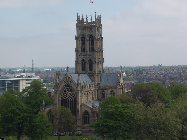
Doncaster has a rich history dating back to Roman times, with evidence of settlements and fortifications found in the area. The town grew significantly during the medieval period and became an important market town. Today, remnants of its past can be seen in the form of the Doncaster Minster, a majestic Gothic church that dates back to the 12th century.
The town's economy is diverse, with various industries contributing to its prosperity. Doncaster is known for its horse racing heritage, hosting the prestigious St. Leger Stakes, one of the oldest and most renowned horse races in the world. The racing industry continues to play a significant role in the local economy, with the town being home to the renowned Doncaster Racecourse.
Doncaster also has a strong manufacturing sector, particularly in rail engineering and locomotive production. Several major companies have operations in the area, contributing to employment opportunities and economic growth. The town is also a transportation hub, with excellent rail and road connections, including the Doncaster Sheffield Airport.
In terms of culture and entertainment, Doncaster offers a range of attractions. The town center has a vibrant shopping district, featuring both high street stores and independent boutiques. Doncaster is also home to numerous parks and green spaces, providing recreational areas for residents and visitors alike.
Overall, Doncaster is a bustling town with a rich history, diverse economy, and a range of cultural and entertainment offerings.
If you have any feedback on the listing, please let us know in the comments section below.
Doncaster Images
Images are sourced within 2km of 53.522713/-1.13234 or Grid Reference SE5703. Thanks to Geograph Open Source API. All images are credited.


Doncaster is located at Grid Ref: SE5703 (Lat: 53.522713, Lng: -1.13234)
Division: West Riding
Unitary Authority: Doncaster
Police Authority: South Yorkshire
What 3 Words
///ritual.poet.rail. Near Doncaster, South Yorkshire
Nearby Locations
Related Wikis

Doncaster
Doncaster ( DONK-ə-stər, DONK-ast-ər) is a city in South Yorkshire, England. Named after the River Don, it is the administrative centre of the larger City...

Town (Doncaster ward)
Town—consisting of central Doncaster, Hyde Park, Belle Vue and Wheatley—is one of 21 electoral wards in the Metropolitan Borough of Doncaster, South Yorkshire...

Mansion House, Doncaster
Doncaster Mansion House is a Grade I listed building in Doncaster, South Yorkshire, England. It is owned and managed by Doncaster Council. The Mansion...
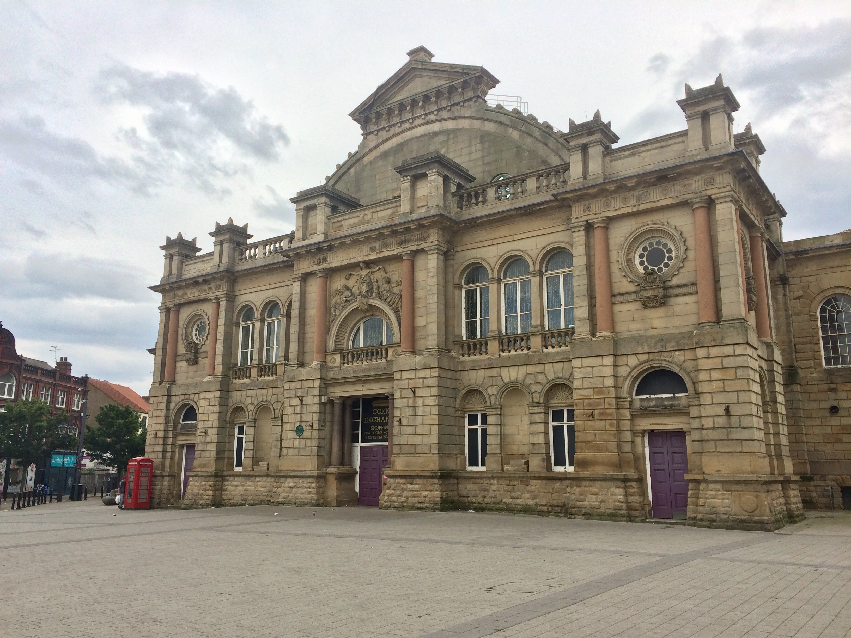
Doncaster Corn Exchange
The Corn Exchange is a trading space and events venue in Doncaster, South Yorkshire, England. The structure, which was commissioned as a corn exchange...
Doncaster Rural District
Doncaster was a rural district in the West Riding of Yorkshire, England from 1894 to 1974. The rural district was created by the Local Government Act...
City of Doncaster
The City of Doncaster is a metropolitan borough with city status in South Yorkshire, England. It is named after its principal settlement, Doncaster, and...
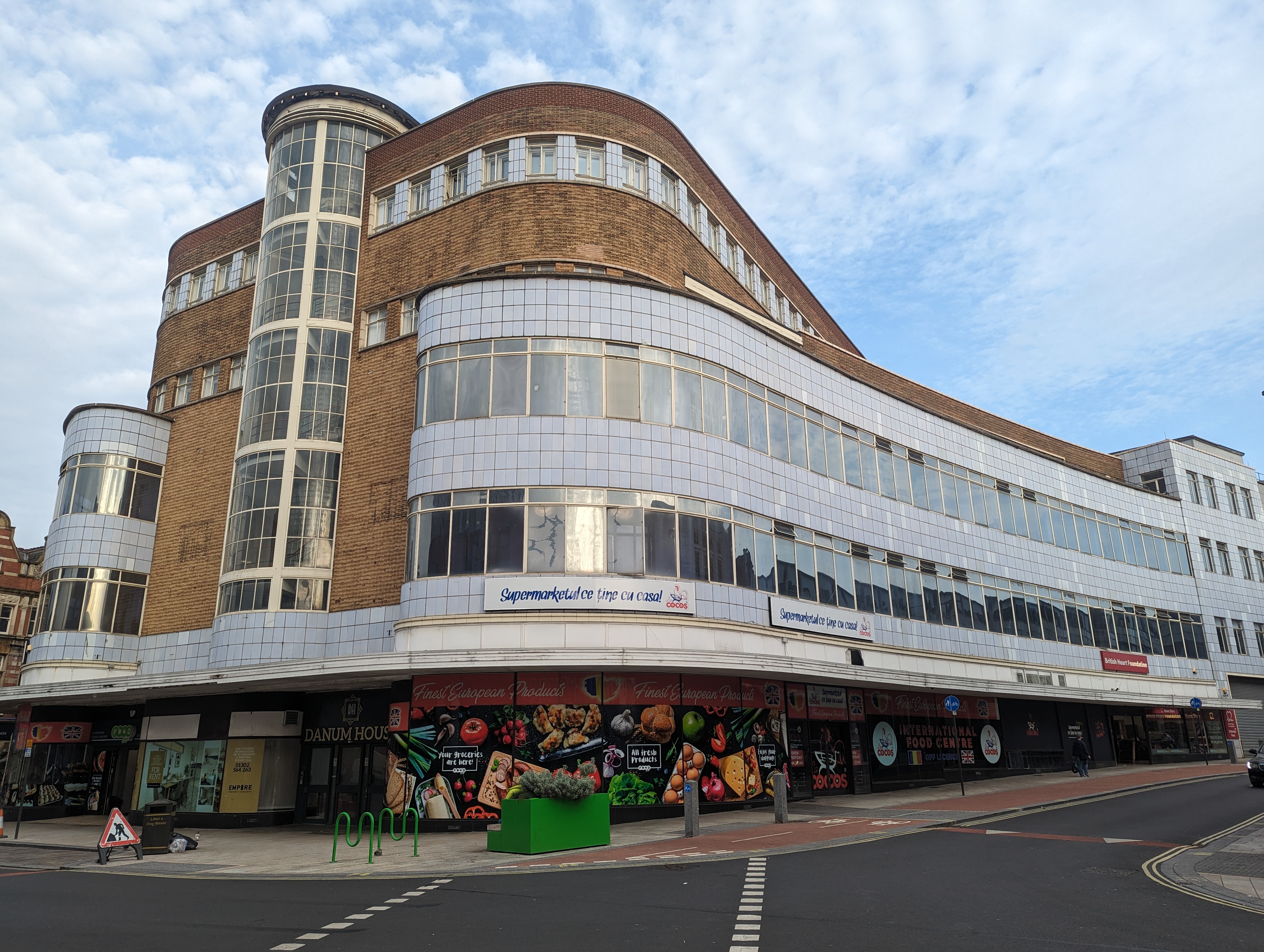
Danum House
Danum House is a commercial building in Doncaster, in England. == History == The Doncaster Co-operative Society operated a department store on St Sepulchre...
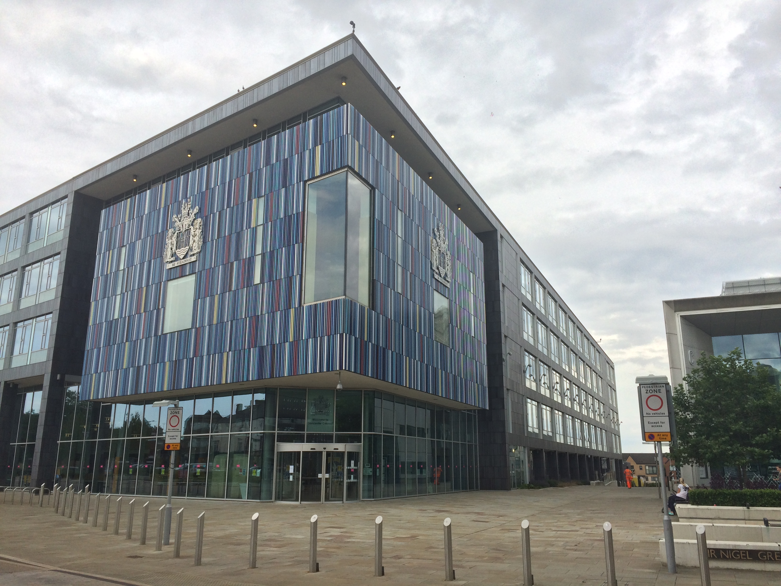
Doncaster Civic Office
Doncaster Civic Office is a municipal building in Waterdale, Doncaster, South Yorkshire, England. The structure is the meeting place of Doncaster Metropolitan...
Nearby Amenities
Located within 500m of 53.522713,-1.13234Have you been to Doncaster?
Leave your review of Doncaster below (or comments, questions and feedback).