Bunkerdale Wood

Wood, Forest in Durham

England

Bunkerdale Wood

Field near Sloshmire Gate
Field near Sloshmire Gate Credit: David Brown

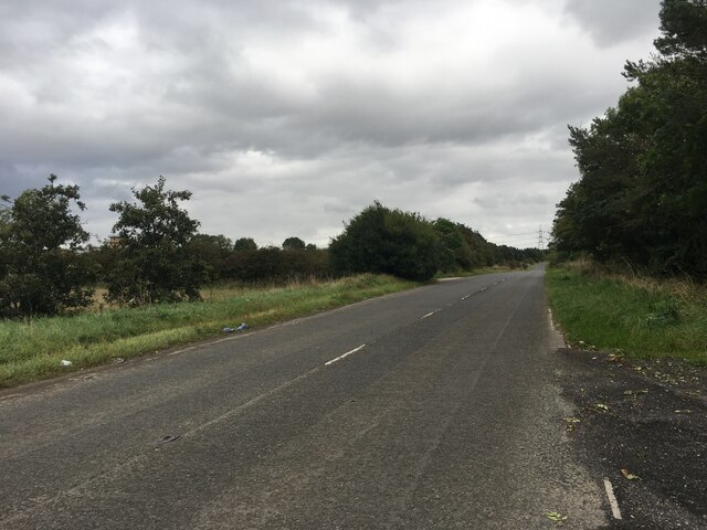
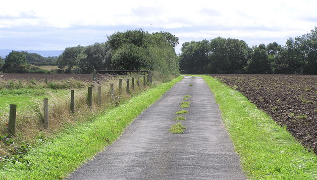
Bunkerdale Wood is a picturesque forest located in Durham, England. Spanning over a vast area, it is a haven for nature enthusiasts and those seeking tranquility amidst the bustling city life. The wood is nestled within the stunning North Pennines Area of Outstanding Natural Beauty, a designated protected landscape, which further enhances its appeal.

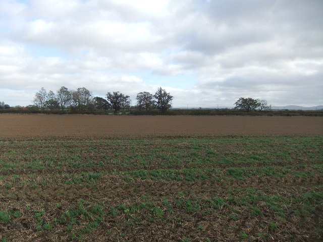
The wood boasts a diverse range of flora and fauna, providing a habitat for various species of plants and animals. Towering, old-growth trees, such as oak, beech, and birch, dominate the landscape, creating a dense canopy that filters sunlight and casts a soothing shade over the forest floor. These majestic trees have stood the test of time, some dating back centuries, and their presence adds a sense of mystery and wonder to the wood.

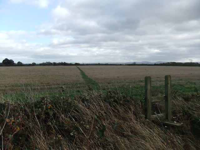
A network of well-maintained trails winds through Bunkerdale Wood, inviting visitors to explore its natural wonders. Whether it's a leisurely stroll or a more challenging hike, there is something for everyone. Along the way, visitors may encounter enchanting wildflowers, vibrant fungi, and the occasional glimpse of elusive wildlife, such as deer, foxes, and various bird species.

Bunkerdale Wood also holds historical significance, with remnants of old charcoal pits and iron ore mines dating back to the industrial era. These relics provide a glimpse into the region's past and add an extra layer of intrigue to the woodland experience.

Overall, Bunkerdale Wood is a captivating destination that appeals to nature lovers, history enthusiasts, and those simply seeking solace in the beauty of the natural world. Its rich biodiversity, breathtaking scenery, and tranquil atmosphere make it a must-visit location for anyone exploring the Durham area.

If you have any feedback on the listing, please let us know in the comments section below.

Bunkerdale Wood Images

Images are sourced within 2km of 54.51318/-1.3834912 or Grid Reference NZ4013. Thanks to Geograph Open Source API. All images are credited.
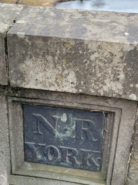
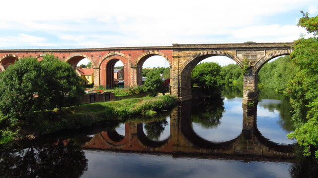
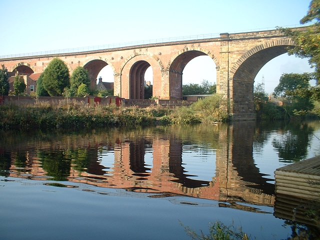
Field near Sloshmire Gate
"Footpath" near West Moor
Carter’s Lane
Carter’s Lane
Old Boundary Marker on the A67, Yarm Bridge, Egglescliffe parish County Boundary Marker on the north side of a lamp post in a refuge on the east side of Yarm Bridge on the A67 Yarm Road and High Street. See also YN_YARM01cb. Egglescliffe parish. 

Milestone Society National ID: DU_EGGLES01cb
Old Boundary Marker on the A67, Yarm Bridge, Egglescliffe parish
County Boundary Marker on the north side of a lamp post in a refuge on the east side of Yarm Bridge on the A67 Yarm Road and High Street. See also YN_YARM01cb. Egglescliffe parish. Milestone Society National ID: DU_EGGLES01cb
Old Boundary Marker on the A67, Yarm Bridge, Yarm parish County Boundary Marker on the south side of a lamp post in a refuge on the east side of Yarm Bridge on the A67 Yarm Road and High Street. See also DU_EGGLES01cb. Yarm parish. 

Milestone Society National ID: YN_YARM01cb
Old Boundary Marker on the A67, Yarm Bridge, Yarm parish
County Boundary Marker on the south side of a lamp post in a refuge on the east side of Yarm Bridge on the A67 Yarm Road and High Street. See also DU_EGGLES01cb. Yarm parish. Milestone Society National ID: YN_YARM01cb
Yarm Railway Viaduct over the R Tees The viaduct extends for over 2,280 feet in a north/south direction over the town of Yarm and across the River Tees. It consists of 43 arches; 41 of them are 40 feet span and are constructed of 7.5 million red bricks. The other two arches are constructed from stone and are 67 feet across with one pier standing in the river. The two spans across the river are composed of 139,000 cubic feet of stone and are skewed across the river by 20 degrees. On the downstream side of the viaduct (eastern side) is a large plaque set into the stone section of where the bridge spans the river. This commemorates the engineers and contractors on the project.
Yarm Railway Viaduct over the R Tees
The viaduct extends for over 2,280 feet in a north/south direction over the town of Yarm and across the River Tees. It consists of 43 arches; 41 of them are 40 feet span and are constructed of 7.5 million red bricks. The other two arches are constructed from stone and are 67 feet across with one pier standing in the river. The two spans across the river are composed of 139,000 cubic feet of stone and are skewed across the river by 20 degrees. On the downstream side of the viaduct (eastern side) is a large plaque set into the stone section of where the bridge spans the river. This commemorates the engineers and contractors on the project.
Yarm, Town Hall & High St
George & Dragon PH, Yarm High St The George and Dragon on Yarm High Street was the location of the promoters meeting of the Stockton and Darlington Railway on 12th February 1820. Meynell laid the first rail on 23rd May 1822 and went on to be chairman of the railway.
George & Dragon PH, Yarm High St
The George and Dragon on Yarm High Street was the location of the promoters meeting of the Stockton and Darlington Railway on 12th February 1820. Meynell laid the first rail on 23rd May 1822 and went on to be chairman of the railway.
Butts Lane meets Yarm Road Looking across Yarm Road from Butts Lane towards South View.
Butts Lane meets Yarm Road
Looking across Yarm Road from Butts Lane towards South View.
Queueing traffic on Yarm Road The traffic is clogged up all the way into and through Yarm. Ahead is the junction with Urlay Nook Road.
Queueing traffic on Yarm Road
The traffic is clogged up all the way into and through Yarm. Ahead is the junction with Urlay Nook Road.
River Tees in Yarm Looking downstream from Yarm Road bridge.
River Tees in Yarm
Looking downstream from Yarm Road bridge.
Railway viaduct over the River Tees Looking upstream along the river from Yarm Road bridge. The railway bridge carries the Northallerton to Stockton lines. The centre of the bridge reads "Engineers: Thomas Grainger & John Bourne. Superintendent: Joseph Dixon. Contractors: [illegible due to plant growth]".
Railway viaduct over the River Tees
Looking upstream along the river from Yarm Road bridge. The railway bridge carries the Northallerton to Stockton lines. The centre of the bridge reads "Engineers: Thomas Grainger & John Bourne. Superintendent: Joseph Dixon. Contractors: [illegible due to plant growth]".
Railway viaduct and Yarm Road bridge Two structures crossing the River Tees.
Railway viaduct and Yarm Road bridge
Two structures crossing the River Tees.
Twinning sign in Yarm The town is twinned with Vernouillet sur Seine in France and Schwalbach am Taunus in Germany.
Twinning sign in Yarm
The town is twinned with Vernouillet sur Seine in France and Schwalbach am Taunus in Germany.
A67 towards Egglescliffe
Elementis Chemical Works, Urlay Nook
Level Crossing On the Darlington to Stockton Line between Teesside Airport and Urlay Nook Crossing. Looking south with access to East Brocks and White House Farms on Carter's Lane.
Level Crossing
On the Darlington to Stockton Line between Teesside Airport and Urlay Nook Crossing. Looking south with access to East Brocks and White House Farms on Carter's Lane.
Lane to Aislaby Grange This lane passes Aislaby Wood and on to Aislaby Grange Farm and Cottage. On the North bank of the River Tees.
Lane to Aislaby Grange
This lane passes Aislaby Wood and on to Aislaby Grange Farm and Cottage. On the North bank of the River Tees.
Show me another place!

Bunkerdale Wood is located at Grid Ref: NZ4013 (Lat: 54.51318, Lng: -1.3834912)

Unitary Authority: Stockton-on-Tees

Police Authority: Cleveland

What 3 Words

///trappings.luring.explored. Near Yarm, Co. Durham

Nearby Locations

Bunkerdale Wood Bunkerdale

Related Wikis

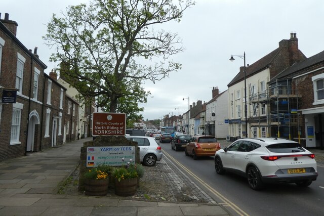
Aislaby, County Durham

Aislaby ( AYZ-əl-bi) is a small village and civil parish on the north bank of the River Tees within the borough of Stockton-on-Tees and the ceremonial...

Urlay Nook

Urlay Nook is a village in the County Durham, England. It is part of the Egglescliffe parish in the borough of Stockton-on-Tees. The village is dominated...

Egglescliffe School

Egglescliffe School & Sixth Form College is a large Coeducational secondary school and sixth form located between Egglescliffe and Urlay Nook in the Borough...

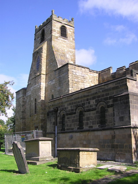
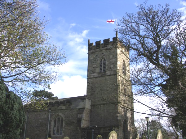
St Mary Magdalene, Yarm

St Mary Magdalene is a Church of England parish church in the town of Yarm, in the Borough of Stockton-on-Tees, North Yorkshire, England, which is dedicated...
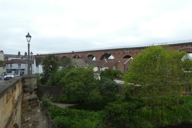
Yarm Viaduct

Yarm Viaduct is a railway viaduct carrying the railways above the town of Yarm in North Yorkshire, England. It crosses the River Tees which forms the boundary...

Allens West railway station

Allens West is a railway station on the Tees Valley Line, which runs between Bishop Auckland and Saltburn via Darlington. The station, situated 8 miles...
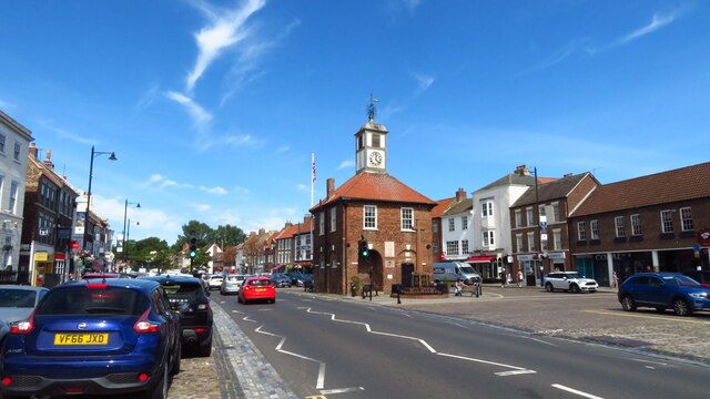
Yarm Town Hall

Yarm Town Hall is a municipal building in the High Street in Yarm, North Yorkshire, England. The structure, which is the meeting place of Yarm Town Council...

St John the Baptist, Egglescliffe

The parish church of St John the Baptist, Egglescliffe is an Anglican church in the village of Egglescliffe, Stockton-on-Tees. It is a perpendicular church...

Nearby Amenities

Located within 500m of 54.51318,-1.3834912
Power: tower
Lat/Long: 54.5125975/-1.3768426
Power: tower
Lat/Long: 54.515625/-1.3793663
The data included in this document is from www.openstreetmap.org. The data is made available under ODbL.

Have you been to Bunkerdale Wood?

Leave your review of Bunkerdale Wood below (or comments, questions and feedback).