Dol-y-maen

Settlement in Montgomeryshire

Wales

Dol-y-maen

Lay-by on the A458 east of Foel
Lay-by on the A458 east of Foel Credit: Steven Brown

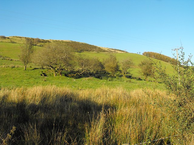
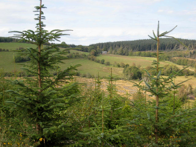
Dol-y-maen is a small rural village located in the historic county of Montgomeryshire in Wales. Situated in the picturesque countryside, the village is surrounded by rolling hills and lush green fields, making it an idyllic setting for those seeking a peaceful retreat.

The village is home to a small population of around 200 residents, who primarily work in agriculture and other rural industries. The community is close-knit, with a strong sense of pride in their heritage and traditions.

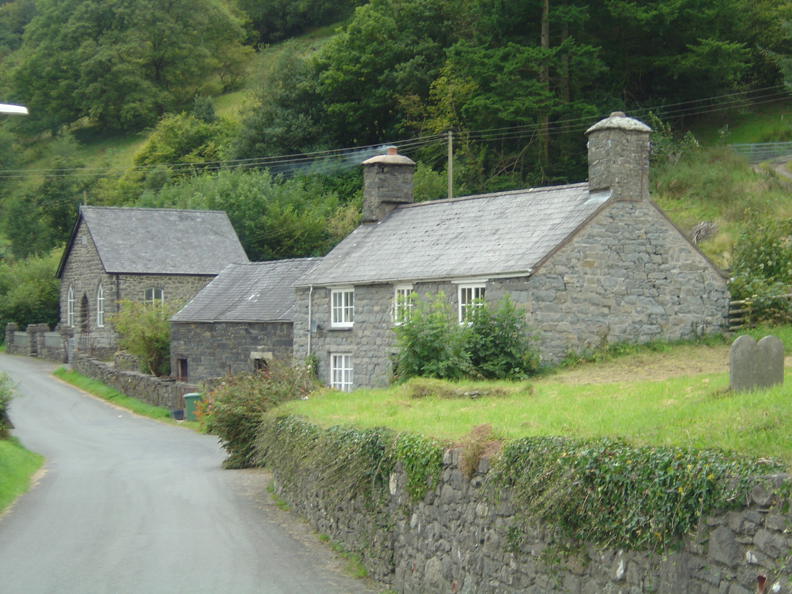
Dol-y-maen is known for its charming stone cottages and traditional Welsh architecture, giving it a quaint and timeless feel. The village also boasts a number of historic buildings, including a medieval church and a manor house dating back to the 17th century.

Despite its small size, Dol-y-maen has a lively community spirit, with a village hall hosting regular events and gatherings for residents to socialize and connect. The surrounding countryside offers ample opportunities for outdoor activities such as hiking, cycling, and horseback riding, making Dol-y-maen a popular destination for nature lovers and outdoor enthusiasts.

If you have any feedback on the listing, please let us know in the comments section below.

Dol-y-maen Images

Images are sourced within 2km of 52.709266/-3.563793 or Grid Reference SH9413. Thanks to Geograph Open Source API. All images are credited.

Lay-by on the A458 east of Foel
Afon Dugoed The headwaters of the Afon Dugoed.
Afon Dugoed
The headwaters of the Afon Dugoed.
Lay-by on the A458
Lay-by on the A458
A458 towards Foel
A458 towards Foel
Layby on the A458 Looking east along the road between Mallwyd and Foel.
Layby on the A458
Looking east along the road between Mallwyd and Foel.
West along the A458 Looking west along the road between Mallwyd and Foel from a layby.
West along the A458
Looking west along the road between Mallwyd and Foel from a layby.
Moorland north of the A458 Looking across moorland from a layby along the road.
Moorland north of the A458
Looking across moorland from a layby along the road.
North of the A458 Looking across moorland from a layby along the road.
North of the A458
Looking across moorland from a layby along the road.
Track off A458 towards Foel-fach
Old Milestone by the A458, Foel-fach, Banwy Parish Machynlleth Chamfer by the A458, in parish of Banwy (Powys District), Foel-fach; 1km east of Dol-y-maen, North West of Gesail-Ddu, on verge between road markers.

Inscription reads:-
MACHYNLLETH
18 MILES
MALLWYDD 6½
CAN OFFICE 5½
POOL 20 

Grade II listed by Cadw. Reference Number: 80792
<span class="nowrap"><a title="https://cadwpublic-api.azurewebsites.net/reports/listedbuilding/FullReport?lang=&id=80792" rel="nofollow ugc noopener" href="https://cadwpublic-api.azurewebsites.net/reports/listedbuilding/FullReport?lang=&id=80792">Link</a><img style="margin-left:2px;" alt="External link" title="External link - shift click to open in new window" src="https://s1.geograph.org.uk/img/external.png" width="10" height="10"/></span>

Surveyed

Milestone Society National ID: MOT_MCWP18
Old Milestone by the A458, Foel-fach, Banwy Parish
Machynlleth Chamfer by the A458, in parish of Banwy (Powys District), Foel-fach; 1km east of Dol-y-maen, North West of Gesail-Ddu, on verge between road markers. Inscription reads:- MACHYNLLETH 18 MILES MALLWYDD 6½ CAN OFFICE 5½ POOL 20 Grade II listed by Cadw. Reference Number: 80792 LinkExternal link Surveyed Milestone Society National ID: MOT_MCWP18
Old Milestone by the A458. Bwlch-y-Fedwen Machynlleth Chamfer by the A458, in parish of Banwy (Powys District), Bwlch-y-Fedwen; Tal Cefn, on verge. Photo from 2016 <span class="nowrap"><a title="https://img.geocaching.com/track/log/large/9b14bd4d-9583-4b87-a5a3-82ba680442a2.jpg" rel="nofollow ugc noopener" href="https://img.geocaching.com/track/log/large/9b14bd4d-9583-4b87-a5a3-82ba680442a2.jpg">Link</a><img style="margin-left:2px;" alt="External link" title="External link - shift click to open in new window" src="https://s1.geograph.org.uk/img/external.png" width="10" height="10"/></span>

Inscription reads:-
MACHYNLLETH
17 MILES
MALLWYD 5½
CANOFFICE 6½
POOL 21

Grade II listed by CADW.
Reference Number: 80790 <span class="nowrap"><a title="https://cadwpublic-api.azurewebsites.net/reports/listedbuilding/FullReport?lang=&id=80790" rel="nofollow ugc noopener" href="https://cadwpublic-api.azurewebsites.net/reports/listedbuilding/FullReport?lang=&id=80790">Link</a><img style="margin-left:2px;" alt="External link" title="External link - shift click to open in new window" src="https://s1.geograph.org.uk/img/external.png" width="10" height="10"/></span>

Surveyed

Milestone Society National ID: MOT_MCWP17
Old Milestone by the A458. Bwlch-y-Fedwen
Machynlleth Chamfer by the A458, in parish of Banwy (Powys District), Bwlch-y-Fedwen; Tal Cefn, on verge. Photo from 2016 LinkExternal link Inscription reads:- MACHYNLLETH 17 MILES MALLWYD 5½ CANOFFICE 6½ POOL 21 Grade II listed by CADW. Reference Number: 80790 LinkExternal link Surveyed Milestone Society National ID: MOT_MCWP17
View of the hillside above Bwlch y Fedwen Taken from the A458 which runs through the pass.
View of the hillside above Bwlch y Fedwen
Taken from the A458 which runs through the pass.
Evening light near the top of the pass This is near the watershed between east and west-flowing rivers though this area is still west-flowing.
Evening light near the top of the pass
This is near the watershed between east and west-flowing rivers though this area is still west-flowing.
Evening light near Bwlch y Fedwen Looking towards the head of the pass.
Evening light near Bwlch y Fedwen
Looking towards the head of the pass.
Forestry track at the head of Cwm Dugoed There is a very large forested area just over the ridge.
Forestry track at the head of Cwm Dugoed
There is a very large forested area just over the ridge.
Dol-y-Maen Welsh hillside farm.
Dol-y-Maen
Welsh hillside farm.
Group of old hawthorns on slopes of Moel y Llyn A curious group beside the A458. Some of the trees are growing in hollows, others look like overgrown laid hedging.
See also <a href="https://www.geograph.org.uk/photo/2644093">SH9313 : Closer view of hawthorn in hollow</a> and <a href="https://www.geograph.org.uk/photo/2644095">SH9313 : Overgrown hedge by the A458</a>.
Group of old hawthorns on slopes of Moel y Llyn
A curious group beside the A458. Some of the trees are growing in hollows, others look like overgrown laid hedging. See also SH9313 : Closer view of hawthorn in hollow and SH9313 : Overgrown hedge by the A458.
Show me another place!

Dol-y-maen is located at Grid Ref: SH9413 (Lat: 52.709266, Lng: -3.563793)

Unitary Authority: Powys

Police Authority: Dyfed Powys

What 3 Words

///squares.departure.amphibian. Near Llangadfan, Powys

Nearby Locations

Dol-y-maen

Related Wikis

Dyfnant Forest

Dyfnant Forest is a remote forest in northeastern-central Powys, Wales. == Location == Dyfnant Forest lies to the west of the B4395 road, a road which...

Llanymawddwy

Llanymawddwy () is a village in the community of Mawddwy in south-east Gwynedd, Wales, which is to the north of the larger village of Dinas Mawddwy, on...

Llangadfan

Llangadfan is a small village in Powys, Wales, based in the community of Banwy. The village lies on the A458 between Foel and Llanerfyl, 12 kilometres...

Cywarch

Cywarch (also known as Aber-Cywarch or Aber Cywarch) is a location at the head of Cwm Cywarch in the Snowdonia National Park, in Gwynedd, Wales. Several...

Nearby Amenities

Located within 500m of 52.709266,-3.563793
Place: farm
Lat/Long: 52.710047/-3.5663714
Foel-fach
Ele: 288
Natural: peak
Lat/Long: 52.705405/-3.561931
The data included in this document is from www.openstreetmap.org. The data is made available under ODbL.

Have you been to Dol-y-maen?

Leave your review of Dol-y-maen below (or comments, questions and feedback).